
The Mounth is a huge area. The A83 from
Braemar south to Blairgowrie neatly slices
the bulk of the range in two. To the west of this road are several
distinct groups of hills; Beinn Dearg and Carn Liath north of Glen
Tilt, the Beinn a Ghlo massif south and east of this same glen, the
lonely Corbetts of the Gaick Forest, An Sgarsoch and its neighbours by
the Tarf glen, The Beinn Iutharn / An Socach group nestling around the
upper Dee, and the Cairnwell group hard by the A83.
Glen Tilt provides a superb through-route for hardy walkers, while Glen
Bruar, Glen Lochsie and other lonely valleys also offer routes into the
hills for the walker and the mountain biker.
The
mountains east of the A83 are concentrated largely into two groups -
the Glas
Maol plateau immediately east of the Glenshee ski grounds, and the
Lochnagar
massif south of Balmoral. A number of picturesque glens lead into these
hills,
among them Glen Esk, Glen Clova and Glen Isla from the Angus (south)
side,
and Glen Callater, Glen Muick and Glen Tanar from the Aberdeenshire
(north)
side. Linking these glens are the so-called Mounth roads, ancient drove
roads and rights of way that still exist as tracks and offer fine
through-routes
as well as excellent access to mountain country.
 |
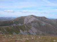
Glas Maol group, June 2000 |
 |
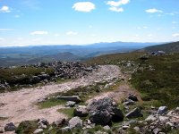
Carn Liath,
June 2005 |
 |
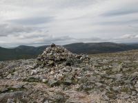
Carn a'
Chlamain, June 2005 |
 |
The Glenshee
Munros, July 2006 |
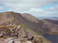 |
Lochnagar,
July 2006 |
 |
Morrone,
July 2006 |
 |
Beinn a'Ghlo,
May 2008 |
 |
Meall Chuaich, May 2008 |
Back to Scottish Highlands index page
This page last updated 17th December 2008
![]()