
|
The
taxi dropped me off at Spittal of Glen Muick's meagre visitor centre
not long after 10am. I set off straight away, the initial route laying
across the floodplain of the Muick below the loch, on a vehicle track
heading for the cottage of Allt-na-Guibhsaich. Beyond the cottage was a
short, rocky and rather tentative section through a patch of woodland
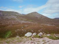
after which the track rose up the right hand side of the valley of the
Allt na Guibhsaich, seen here.
|
|
The
track takes a side valley heading towards a col to the south west of
the Corbett of Conachraig, which looks like an easy ascent and which I
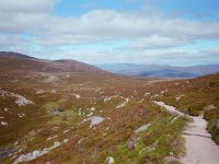
pencilled in for a future expedition. From here the Lochnagar path is
clearly seen heading west towards the col south of Meikle Pap, which
was to be my first summit of the day.
|
|
.The
track itself continues to the col and then heads northwestwards for the
valley of the Allt Ghlas Choire and the Balmoral estate. There's a view
towards the high Cairngorms from here.
|

|
The
Lochnagar path leaves to the west, passing a feature called Ptarmigan
Butts. I've climbed to about 2300 ft here and Meilke Pap is looming
large in the view ahead.
|

|
Not
much over twenty minutes later I reached the col between Meikle Pap and
Lochnagar proper, and got my first view of the dramatic cliffs forming
the north rim of Lochnagar's summit plateau.
|

|
That's the route up to the Lochnagar plateau, a path apparently known as the Ladder.
|

|
First,
though, I turned right and ascended an obvious path to Meikle Pap, a
Murdo. The 200ft ascent from the col took just ten minutes and rewarded
me with this magnificent view of Lochnagar, with the loch itself in the
hollow at the foot of the cliffs. the summit, Cac Carn Beag, is the
pimple in shadow to the far right of the cliffs.
|

|
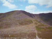
The summit of Meikle Pap.
|
|
Back at the col, and I'm now about to tackle the Ladder.
|

|
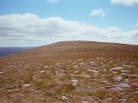
The view back from the Ladder to Meikle Pap. That path isn't even shown on the maps.
|
|
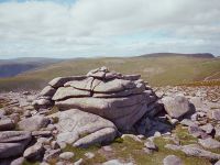
The
Ladder, although very stony, proved to be a superb piece of path
engineering and I was up it in twenty minutes almost without realising.
Balmoral's footpath repair gangs are to be commended for a first class
piece of work, which is unobtrusive and looks as near natural as it
can. Here I've reached the top and I'm ooking out across the plateau to
Cuidhe Crom, another Murdo and Munro Top. The terrain looked inviting
so I set off for the summit cairn.
|
|
Twelve
minutes later I'd reached the summit cairn of Cuidhe Crom, almost
without effort. The summit plateau of Lochnagar is typical of the
Mounth and Cairngorms in that it provides superb, easy walking terrain,
surely the best in the UK at this altitude. There are paths but they
are largely unneccessary; you can, for the most part, just wander at
will without undue effort.
|

|
The
view south from Cuidhe Crom, across the dips of the Glas Allt and the
Allt an Dubh Loch, towards Carn Bannoch and Broad Cairn.
|

|
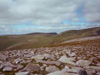
I made my way back across the plateau towards Lochnagar proper.
|
|
A view westwards towards the gentle rise of Carn a' Choire Bhaideach, a remoter Munro beyond Lochnagar.
|

|
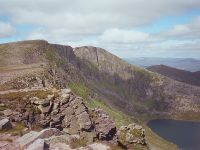
I
arrived at the cliff edge at the minor col between Cuidhe Crom and
Lochnagar, at the top of a gully called Red Spout. There's a dramatic
view of Loch Nagar.
|
|
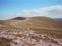
From the same spot, a view along the cliff edge to Lochnagar's summit.
|
|
There's
a choice of routes beyond Red Spout; you can choose to keep to the
cliff edge for the dramatic views or you can take a more straighforward
line directly for the summit, which joins a path coming up the valley
of the Glas Allt from the top end of Loch Muick. This is the
retrospective view from the main route.
|

|
A little further along the path, and another look back.
|
|
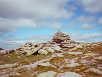
Not
much over ten minutes later I arrived at the cairn of Cac Carn Mor,
once considered a "top" of Lochnagar but now considered too minor to be
listed seperately. This is a major route junction
|
|
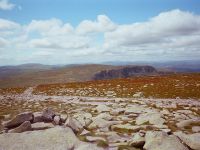
That's the view to the southwest, where I'll be heading after lunch; the gentle dome of Carn a' Choire Bhaideach |
|
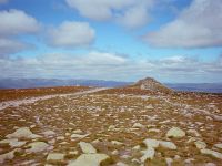
But now there's a simple stroll of just 600 metres to Cac Carn Beag, the summit of Lochnagar.
|

|
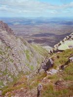
There's
some interesting cliff scenery on the way, however. This nameless yet
spectacular gully lies between the Pinnacle and the West Buttress.
|
|
The
gully plunges straight down to the hollow of Loch Nagar (not seen). The
Balmoral estate lays beyond; Balmoral Castle is out there somewhere.
|

|
Another view of the gully.
|

|
I've
arrived at the summit of Lochnagar, the highest point of the Mounth;
and at 3789 ft the 21st highest mountain in Britain. And my 29th Munro.
|
|
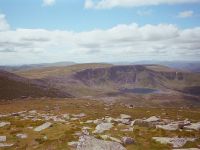
Out there is what I hope will be Munro no.30; Carn
a' Choire Bhaideach, the White Mounth. It mirrors Lochnagar in having
its own line of north-facing crags, with the pretty Loch nan Eun
situated below.
|
|
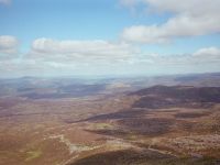
The Balmoral estate and the Dee valley to the north.
|

|
Lochnagar's summit tor. Curiously, the trig pillar is situated on the lower of the two principal summit boulders.
|
|
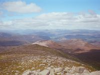
The
view to the northwest, Invercauld is in view, and the high Cairngorms
form the skyline. The ridge with the line of snow is Beinn a' Bhuiridh.
|

|
I
ate my lunch in the lee of the summit cairn. The day was pleasantly
warm yet there was just enough breeze to make a light pullover
desirable. After I'd finished eating I set off to the south west. Yet
again the terrain was almost totally benign and I ignored the path for
most of the way. Forty five minutes later I arrived at Carn
a' Choire Bhaideach, or the White Mounth; 3642 ft, the 42nd highest
summit in Britain, and my 30th Munro. There had been a fair number of
walkers on Lochnagar but I had Carn a' Choire Bhaideach all to myself.
|
|
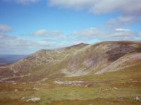
This is the view back towards Lochnagar.
With the time now past 2.30 I considered my options and decided against
pushing on further; the full round of the Dubh Loch was a considerable
undertaking and I thought it wise to call it a day here. But to avoid
retracing my steps I came up with the idea of following the path
alongside the Glas Allt, to the east, down to Loch Muick. To get there
I decided on a bit of pathless free-ranging. I strolled back to the
White Mounth / Lochnagar col but instead of reascending the hill I
countoured round to the right. It was a straightforward expedition and
took just fifteen minutes; others had obviously had the same idea as I
came across scraps off path here and there. Before long I found myself
on the upper reaches of the Glas Allt path, and turned right for the
descent.
|

|
It's
a long way, the Glas Allt route; some three miles back to the loch,
involving some 2500 ft of descent. I don't think I'd fancy coming up
this way. The path itself was absolutely first class, however, and once
again I saluted the skills of the Balmoral estate's footpath
maintaiance gangs.
|
|
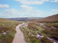
Getting
on for three quarters of hour later, I've got about half way down the
path. The trench of Glen Muick is beginning to reveal itself ahead.
|
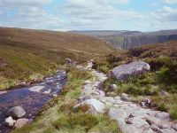
|
The path switches to the south side of the Glas Allt about five hundred metres before reaching the steepest part of the descent.
|

|
There's
little warning from above but the path ducks out of sight of the stream
for a couple of minutes as it tackles a steep section. There's a
roaring noise to your left. And suddenly they are revealed; the Falls
of Glas Allt.
|

|
From
here the path zigzags down through the heather (midge hell on a dank,
overcast day no doubt) to reach the top end of Loch Muick.
From there it's a long walk along the northwest side of the loch, and
then across the foot of the loch to the main vehicle track back to
Spittal of Glen Muick. I was back shortly before 6pm, eight hours after
setting out. There's a phone at the visitor centre, which was lucky as
there was no mobile phone signal; I called the taxi but had to wait
almost an hour before he arrived. No matter, for it had been a superb
mountain day. I measured the route on the laptop once I was ack at the
hotel; it came to just under 16 miles and involved over 3700ft of
ascent. No wonder I felt tired. But it was well worth it.
|
![]()