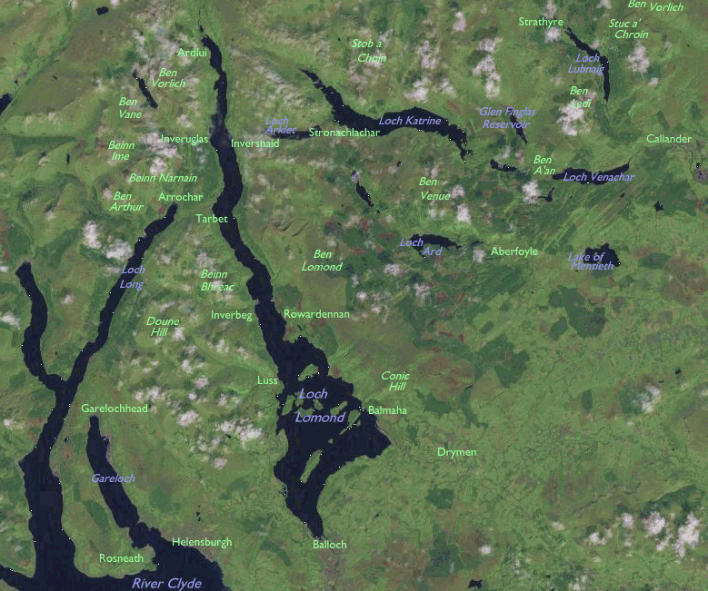

Loch Lomond is Britain's largest freshwater lake, some 22 miles long from south to north and perhaps a couple of miles wide at its southern end. The Highland Boundary Fault - a distinct geographical feature that divides the Scottish Highlands from the central Lowlands - crosses the loch about a third of the way along. Ben Lomond, Scotland's most southerly Munro (mountan over 3000 feet high) dominates the eastern side. The West Highland Way runs along the eastern shore of the lake, while the West Highland Railway and the A82 trunk road follow the west shore. There are several villages on the west bank, notably Luss, Tarbet, Inveruglas and Ardlui. Just west of Tarbet is Arrochar, a village overlooked by the famous group of mountains known as the Arrochar Alps. These comprise the Munros of Ben Narnain, Ben Ime, Ben Vane and Ben Vorlich as well as their lesser but craggier companion, Ben Arthur (a.k.a. "The Cobbler"). The National Park extends some way west and south of here, along Loch Long and the Cowal peninsula to include the area around Loch Goll and Loch Eck,
The "Trossachs" is the area immediately to the east of Loch Lomond. The name is said to mean "bristly country" and the area is often referred to as the "Highlands in Miniature". Romanticised as the land of Rob Roy Macgregor, it's a land of lakes and reservoirs interspersed with hills around 2000ft high, many of whose slopes are covered with pine forests. It is centred on Loch Katrine, noted for its pleasure cruises. There are no towns as such in the area but it encompasses several significant settlements such as Aberfoyle, Balquhidder, Lochearnhead and Strathyre. The town of Callander, often called the "gateway to the Highlands", lays just to the east of the Trossachs adjacent to the 2883ft summit of Ben Ledi. Finally, in the far east, the park extends to the Stirlingshire - Perthshire boundary to include Loch Earn and the Munros of Stuc a Chroin and the other Ben Vorlich.
In
summary, this part of the National Park encompasses a magnificent sweep
of country
containing
some superb loch, mountain and forest scenery. Its reputation as
Glasgow's
playground can easily be appreciated.
 |
West Highland Way (Conic Hill to Rowardennan) |
 |
West Highland Way (Rowardennan to Ardleish) |
 |
Ben Narnain, May 2000 |
 |
Ben Ledi, May 2002 |
 |
Stuc a' Chroin, May 2002 |
 |
Ben Lomond, June 2006 |
Back to Scottish Highlands index page
This page last updated 31st July 2006