|
It's about seven miles from
Callander to
the summit of Stuc a' Chroin, and a third of this distance lays along
an
unclassified motor road running north from the town to a couple of
isolated
farms. The road passes the golf course north of the town, and then
climbs
steeply through woods. It's ascending the Highland Boundary Fault, of
course.
Not everyone is the same, but I find that a steep ascent early in the
walk
is a real stamina sapper and will leave me less able to tackle the
legwork
later on. If you have a car you can save yourself some appreciable
early
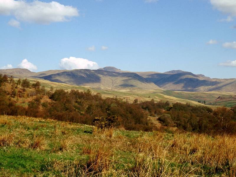
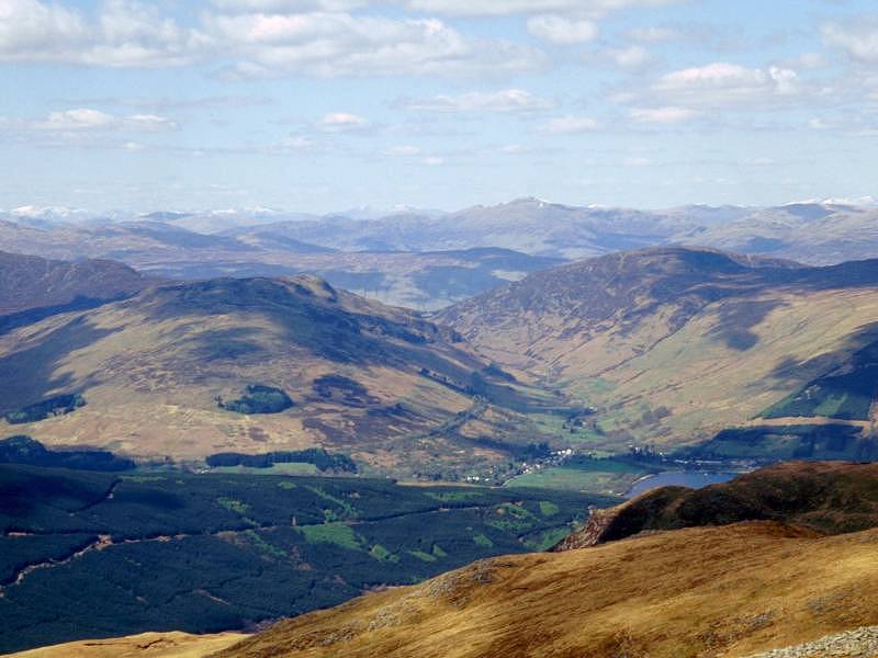
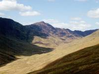
effort by driving to the end of the road. In this shot I'm clear of the
woods about an hour after starting out. Stuc a Chroin is the summit
just
left of centre, while the Perthshire Ben Vorlich lies to the right. |
 |
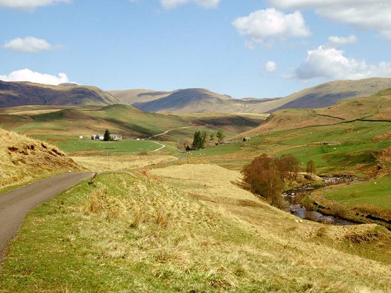
The road is following the valley of
the Kelfie
water, seen down to the right. |
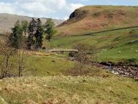 |
A bridge over the Kelfie. You come
to the
first of two car parks here, from where a footpath crosses the Kelfie
to
lead down the riverbank towards the Bracklinn falls. The woodlands
further
down the valley featured in the film, "Monty Python and the Holy
Grail",
so if you venture down this way be on the lookout for the Knights of
Ni.
And remember to have a shrubbery handy. |
 |
The road is gated at the first car
park,
so drivers must stop to open the gate (and close it again behind them!)
before stopping at the second car park half a mile further on. You walk
through the yard of Braeleny Farm after the second car park, where
tarmac
gives way to a rich brew of mud and slurry. Cattle graze the pastures
beyond
the farm. The route now lays along a vehicle track through a lonely
tract
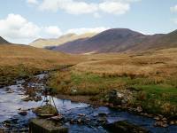
of moorland, heading for the junction of two burns (Allt Breac-nic and
Allt a Chroin). The map is ambiguous about the presence of a bridge
here
but you need not worry. From the bridge you can see the remains of a
ford
and an old wire footbridge (seen in the picture). |
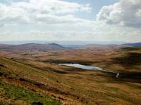 |
Half a mile north of the bridge is
the cottage
of Arivurichardich, presumably an old shepherds cottage but now being
refurbished
as a private bothy. The vehicle track gives out and you progress now on
a simple path, gradually climbing the eastern slopes of the Gleann a'
Chroin.
The glen holds a small reservoir, seen here in retrospect. Watch for
the
path junction one field beyond the cottage; the path leading straight
on
runs into the glen and peters out so be sure to tackle the (apparently
lesser) path heading up to the right. This is where the terrain gets
trying,
for like so many Scottish moorlands slopes this area is rent with
streams
and patches of bog. Progress is slow and tiring and you just know that
it will be even worse on the descent. |
|
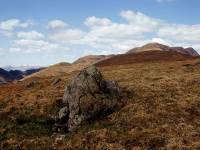
After yesterday's climb of Ben Ledi
and this
morning's exertions on the road section I was feeling the effort badly
and wondered if it was wise to go on. In these situations your ultimate
goal seems impossible so you divide the task down into manageable
chunks
and tackle them one at a time. "I'll just get to that rock a couple of
hundred yards ahead and see how I feel," I kept telling myself. "I'm
not
in the Marines, I'm doing this for fun. If I don't make the summit, so
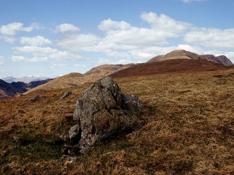
what? I'm still having a nice walk." And it was rewarding already, with
scenes like this - a view across the glen to the Corbett of Beinn
Each. |
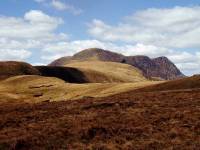
|
So in this manner I just got to the
col,
then I thought I'd just tackle the steep 300ft rise to the main ridge.
It took me half an hour to get up that slope but beyond it was this
reward
- a relatively gentle, grassy ridge walk most of the way to the summit
dome. |
|
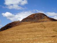
Suddenly I'm flying. This is what
it's all
about - the great outdoors, empty country, big skies, glorious views.
So
refreshing. The summit dome of Stuc a' Chroin is a mile and a half
ahead
and doesn't look quite so unattainable now. |

|
Plenty of sunshine and the day is
warm, even
at 2500ft. Half a mile of ridge walk glides by. |
|
It's starting to get steep again.
Since it's
well past 1pm I decided to stop here and declare lunch. |

|
A look back at the ridge walk from
the foot
of the summit dome. |

|
It took getting on for an hour to
climb the
summit dome. I rested more than I climbed. I was very fatigued and it
didn't
help that I'd just had lunch. But with rewards like this view to
sustain
me, it was worth the effort. |

|
The top! Still patches of snow here. |
|
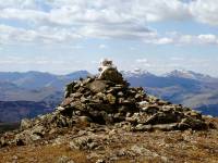
Stuc a' Chroin has two summit
cairns. This
is the western cairn, with a view of Ben More and Stobinian behind. |

|
A view to the northwest from the
cairn. Lochearnhead
and the western end of Loch Earn are in view. Some of the Glen
Lyon
and Rannoch Munros are seen. Can't put a name to any of them I'm afraid. |

|
Looking to the northeast here from
the main
cairn. Ben Lawers is to the left, and that's probably the Mounth or the
Cairngorms to the right, a good fifty or sixty miles away. |

|
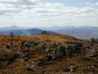
Looking west. Beinn Each is in
shadow across
the glen, while Ben Ledi is in sunlight five miles away. We can see Ben
Lomond on the skyline to the right. |

|
Ben Lawers seen from the main
cairn, looking
north. |
|
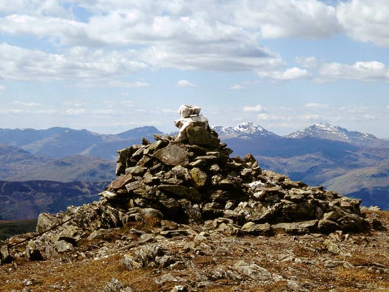
The west cairn from the main cairn
- and
a magical skyline of peaks including Ben Lomond and the Arrochar Alps. |

|
A final summit view; Ben More and
Stobinian
again. |