 |
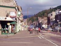
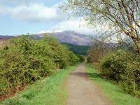
Callander's main street around 9am
on the
Saturday morning. Ben Ledi, its top in cloud at the moment, can be seen
directly in line with the street to the west. |
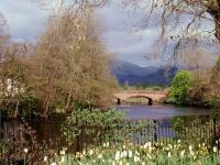 |
One of the town's bridges over the
river
Teith from a stretch of adjacent parkland. |
 |
The parkland between Callander's
town centre
and the riverbank. |
 |
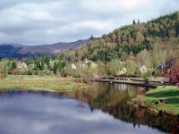
Callander, from the riverbank. |
 |
I'm starting my walk to Ben Ledi
from the
park. |

|
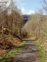
The walk proper starts here, as I
join a
cycle track routed along the bed of the old Stirling to Oban railway
line.
One of the signals is still in place, nearly forty years after the line
closed. |
|
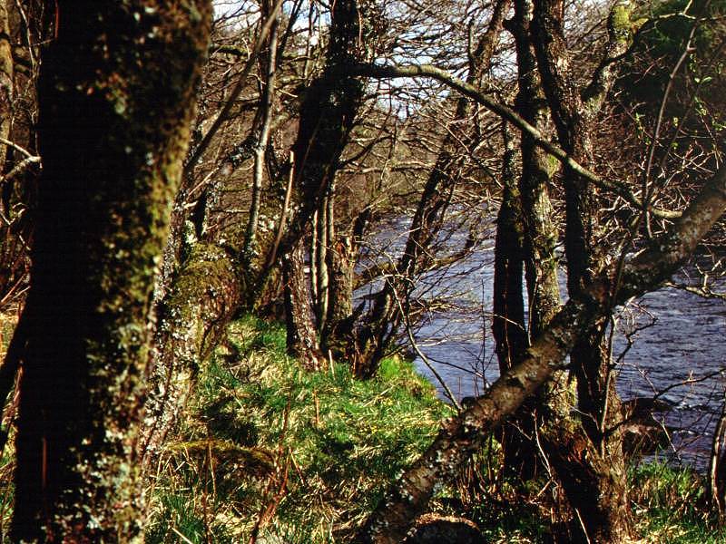
The old railway track runs out
through river
meadows west of the town. The cloud is beginning to lift from the
summit
of Ben Ledi and a fine day is in prospect. |
|
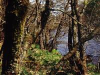
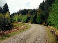
A pleasant stretch of open woodland
is reached
after the A821 road crossing. |

|
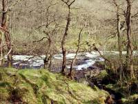
The old railway arrives at the
Falls of Leny,
a series of rapids formed as the Garbh Uisge (which is Gaelic for
"Rough
Water") runs through a narrow gap in the hills. We're more or less at
the
Highland Boundary Fault here. |
|
Another view of the Falls of Leny. |

|
The falls again, backlit. |
|
The scenery just short of the car
park from
where the path to Ben Ledi climbs through the woods. |
|
A problem. The Forestry Commission
are felling
trees and have closed the main path to Ben Ledi. They have requested
walkers
to follow an alternative path to the summit and have signposted the new
access point from the cycle track, but have not seen fit to post a map
and helpfully state that there is "no waymarking on the hill". My map
shows
no other track. I'm in a maze of forest rides and logging tracks. What
to do? |
|
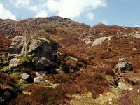
The paths lead into the corrie of
Stank Burn,
northwest of Ben Ledi. I've decided to follow the path as far as I am
able
but it's petering out and the terrain is becoming rough and boggy. |
|
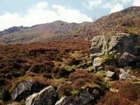
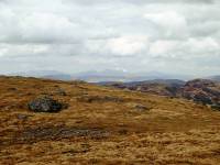
Looking up at the ridge. I've
spotted a grassy
rake ahead (not seen in this photo) that looks as though it might give
me relatively trouble free access to the ridge, but the terrain is
becoming
steep and tiring. This is my first proper climb for a year and I'm
hopelessly
unfit and feeling the effort quite badly. |
|
More walkers come up behind me but
pass below,
and it becomes obvious I've missed the main route and am now on a
trackless
slope. I take my time and make my way towards what appears to be a
reasonably
defined path, not shown on any of the maps. As I reach the col, a
magnificent
view is seen to the northwest. |
|
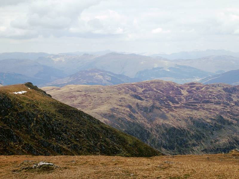
A view to the north, along the gap
of Strathyre,
and I believe I'm looking at the 3983ft summit of Ben Lawers, still
snow-capped
in early May. |

|
From the col I'm labouring up the
ridge line
towards Ben Ledi's northwest top. |
|
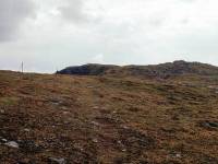
A simpler and less arduous walk
from the
northwest top to the main summit. I can see people by the trig pillar. |
|
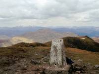
Arrival at the main summit, at just
after
1pm. |
|
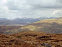
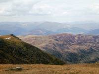
Summit panorama 1, looking out
across the
northwest top towards the Glen Lyon hills. |

|
Summit panorama 2, looking north.
The Stank
Glen is in the foreground. Ben Lawers in the distance. |

|
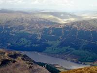
Summit panorama 3, the northeast
view across
Loch Lunbaig to Beinn Each. Stuc a Chroin is beyond and to the right. |
|
Summit panorama 4, east northeast
across
the col south of Beinn Each to an unknown valley beyond. |

|
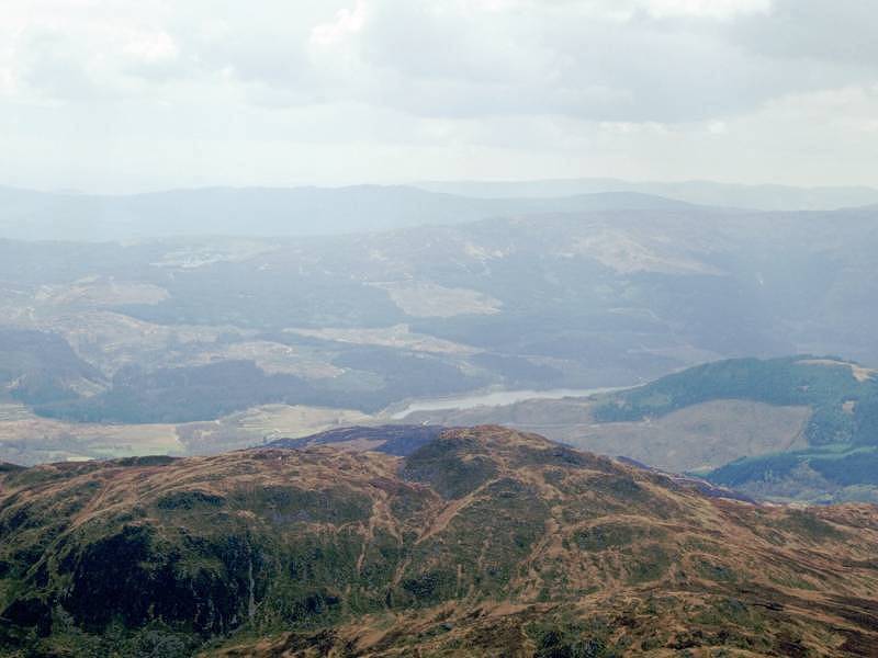
Summit panorama 5, eastwards across
the Highland
Boundary Fault. The Ochils are on the skyline to the right. |
|
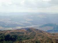
Summit panorama 6, east southeast.
Callander
is directly in view, and the old railway line is clearly seen. Doune
Castle
(immortalized as Castle Anthrax in "Monty Python and the Holy Grail")
lies
a few miles beyond. The Ochils fill the skyline and, hard to the right
of them, you can see the two dark hillocks on which stand the Wallace
Monument
and Stirling Castle. If the day were clearer, we would be able to see
Arthur's
Seat in Edinburgh. |

|
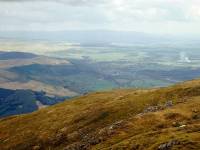
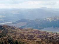
Summit panorama 7, looking
southeast into
the central lowlands of Scotland. Stirling Castle is right on the edge
of shot to the left, with the glint of the Firth of Forth beyond. The
Grangemouth
oil refinery is pretty much in the middle, with Falkirk just to its
right. |
|
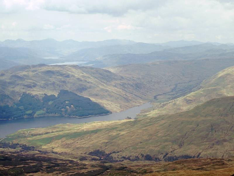
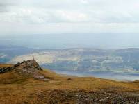
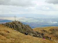
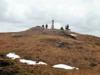
Summit panorama 8, looking SSW. The
cross
is a memorial to a hillwalker, the lake is Loch Venachar. |

|
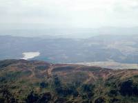
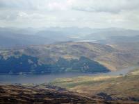
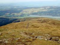
Summit panorama 9. Looking south,
at the
west end of Loch Venachar and the eastern shore of (I kid you not) Loch
Drunkie. |
|
Summit panorama 10. SSW into
the Trossachs.
Loch Drunkie is to the left. |
|
Summit panorama 11, looking SW
across to
Loch Achray. |
|
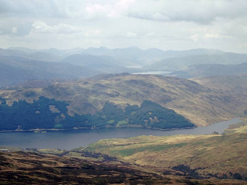
Summit panorama 12. looking WSW.
Ben Lomond
appears on the skyline to the right of shot, and the Glen Finglas
reservoir
is coming into view at bottom right. Loch Achray is to the left. |
|
Summit panorama 13, looking west.
Loch Katrine
is in view now, just to the right of centre. Ben Narnain is on the
skyline
directly above it, with the Cobbler just to its left, Ben Ime to its
right
and the Argyll Ben Vorlich to the right again. |

|
Summit panorama 14. Looking NNW
across the
Ben Kinglas reservoir in the direction of Ben Vorlich. |

|
Summit panorama 15. We're looking
northwestwards
to the Glen Falloch Munros. |

|
Summit panorama 16. Ben More and
Stobinian
are the principal hills in view in NNW direction. |

|
Summit panorama 17. More or less
back where
we started, looking across the northwest top towards the hills fringing
Glen Lyon in Perthshire. |
|
Time to go back to Callander.
Despite the
Forestry Commission's closure of the path I've decided to ignore their
advice and stick to the main route. The "back door" to Ben Ledi is
tiring
and the terrain would be hell to descend. |
|
A last look at the summit... |
|
A swift descent along the south
east ridge
over grass... |

|
...and then a left turn onto the
path back
through the forest to the foot of Loch Lubnaig. The descent through the
cleared area was a little tricky but nothing like as bad as the trek
back
through the Stank Glen would have been. I was back in the hotel room
just
after 5pm. |