The Central Fells, Langstrath and
Thirlmere
Sketch map will appear here
Behind the Langdale Pikes a long ridge sweeps away to the north,
taking
in all the high country between Borrowdale and Thirlmere. This ridge
pretty
much occupies the geographical centre of Lakeland and it might be
expected,
in the general scheme of things, to contain the highest fells, the best
scenery and the most exciting walking country.
Unfortunately this doesn't hold true. The ridge of the Central Fells
is actually the lowest in Lakeland, save for a couple of groups of
fells
on the periphery. It's also a flat, plateau-like area. In consequence
it
drains badly. The Central Fells ridge actually has more in common with
the Pennines than the rest of Lakeland.
If we count High Raise as the parent fell of the Langdale Pikes then
the principal summit of the Central Fells is its immediate neighbour to
the north, Ullscarf. Ullscarf is a sprawling brute of a hill, a vast
moorland
plateau of indeterminate topography with a number of minor tops. Some
of
these tops have the appearance of prominent, shapely hills when seen
from
the valleys to either side; Armboth Fell, for instance, is regarded as
a separate mountain by Wainwright though few others would bother to
classify
it as such. The flat, peaty ridge continues north over High Tove and
High
Seat to Bleaberry Fell, a superb viewpoint overlooking Keswick and
lower
Borrowdale.
If the ridge itself is dull, its flanks are fortunately full of
interest
and scenic beauty. To the west, on the Borrowdale side, there is a
complex
of lateral ridges interspersed with side valleys, of which the most
celebrated
is the little gill rising southeast of Ashness that leads up to the
isolated
village of Watendlath. Another valley, Greenup, carries the route of
the
Coast-to-Coast Walk from Grasmere over the ridge into lower Langstrath.
Eagle Crag and Sergeant's Crag, technically just "tops" of High Raise,
are a splendid sight from Stonethwaite and Langstrath and are also
regarded
by Wainwright as separate fells. Grange Fell and Great Crag are complex
little hill systems in their own right and contain within their bounds
far more than their fair share of picturesque tarns and extensive pine
and birch woodlands. Langstrath itself, which delineates the High Raise
/ Ullscarf system to the west and runs northwards to join Borrowdale at
Stonethwaite, is surely one of Lakeland's finest valleys.
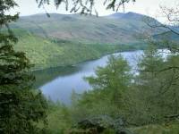
The area I've described as the central fells also includes Thirlmere
itself, a feature that is arguably Lakeland's most central body of
water.
It languishes in obscurity, however, because there is no habitation on
its shores. Thirlmere is reserved as a reservoir for Manchester's water
supply; there are no visitor facilities, no watersports, and few
roadside
viewpoints. The best view of Thirlmere is seen from Raven Crag, a
northeastern
limb of High Tove and quite a giddy climb. The area finally includes
High
Rigg, an area of hill country east of the main Keswick-Ambleside road
but
west of St John's in the Vale, and therefore topographically an
offshoot
of High Tove.
Gallery Index
Back to Lake District index page
This page last updated 6th April 2006


