
| Bridge of Orchy to Kingshouse | Back to West Highland Way index | Kinlochleven to Fort William |

| Bridge of Orchy to Kingshouse | Back to West Highland Way index | Kinlochleven to Fort William |
Today's route follows the old Glencoe road for three miles, running parallel with the A82 as far as Altnafeadh, after which it leaves Glencoe and strikes north, climbing the aforementioned Devil's Staircase to the col. The long, gentle descent to Kinlochleven runs along the edge of some wild moorland scenery stretching out to the Blackwater reservoir (why not Lochan Uisge-Dubh?) to the east, looping across the shallow valleys of Choire Odhar Beag and Choire Odhar Mhor before coming alongside the service track to the reservoir. This track takes a languorous dogleg through the forested Coire Mhoraire before dropping down to cross the river Leven just behind the aluminium works at Kinlochleven. The West Highland Way takes a short detour through the Kinlochmore housing estate before arriving in the heart of the little town at the head of Loch Leven.
|
|
|
| Length: | 8.86 miles / 14.3 km |
| Total ascent: | 1471 ft / 448 m |
| Total descent: | 2241 ft / 683 m |
| Estimated time: | 3 hrs 18 mins |
Map: OS 1:25000 Explorers 384 (Glencoe) and 392 (Ben Nevis)
The route from Kingshouse begins to the rear of the hotel. Cross the infant river Etive and take the track for some 300 yards north, past the hotel's camping enclosure. You join the minor road to Black Corries, out to the east. Turn left (west) and walk down the tarmac in the direction of Buachaille Etive Mor.
Kingshouse and Creise; Buachaille Etive Mor; West Highland Way at Kingshouse
After some 900 yards of road walking the old Glencoe road (just a rough vehicle track now) diverges off to the right. Follow this track. It winds uphill a little, across the flanks of Beinn a Chrulaiste, and runs parallel with the main road about 500 yards away.
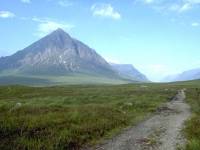
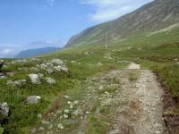
The old military road runs for about 2½ miles, into the eastern jaws of Glencoe. The Buachaille Etive Mor cannot fail to command your attention. The Great Shepherd is actually a long and quite complex ridge; what you see from the West Highland Way is actually the steep butt-end of its northern summit, Stob Dearg (Red Point), 3350ft high. As you progress the dramatic coombe of Coire na Tulaich comes into view immediately to the right of the summit, while the neighbouring saddle-shaped Little Shepherd (Buachaille Etive Beag) begins to appear beyond.
Buachaille Etive Mor; Buachaille Etive Beag; The WHW and the Buachailles
The path converges with the main road again and, about 800 yards short of Altnafeadh (which stands at the foot of the group of trees seen ahead) the old and new roads merge. The West Highland Way is carried on a footpath separated from the main road by a wide grass verge. A tantalizing glimpse - no more - of the majesty of Glencoe presents itself directly ahead.
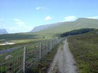


At Altnafeadh, a cottage below the stand of trees north of a wide curve in the road, several footpaths diverge. There is a pretty substantial car park here. You might take a few minutes to wander off the road to the south and gaze into Gleann Coupall, the valley between the two Buachailles. The main path wandering off from here is heading into the fastnesses of Coire na Tulaich, a tricky ascent route of Stob Dearg and not really recommended for the ordinary walker. Our route, however, leads off from the rear of Altnafeadh, along an old road accompanying the Allt a Mhain to the left of the trees. This is the six-mile long footpath to Kinlochleven which nowadays forms a key part of the West Highland Way. The ascent of just over 800ft to the col is known as the Devil's Staircase.
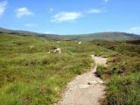
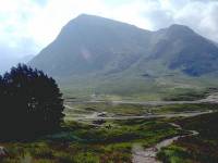
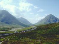
The Allt a Mhain path; Buachaille Etive Mor above Altnafeadh; Gleann Coupall
The origins of the name "Devil's Staircase" is unknown (at least to me), and the name itself is a gross overreaction to an ascent route that would be entirely unremarkable in most other settings. It requires less effort than the ascent of Conic Hill back on day 2, and is an order of magnitude easier than most Lakeland col ascents. It is a rewarding climb, however, for the views it affords back over this eastern end of Glencoe. The backlit Blackmount peaks and the Buachailles are an arresting scene, particularly with the Allt a Mhain and the Altnafeadh plantation in the foreground.
Footbridge; the track above Altnafeadh; the Devil's Staircase
The Devil's Staircase
The gradient flattens out to an easy stroll on firm gravel as the col is approached. The col is quite broad and the view ahead opens out gradually. But what a view! The magnificent Mamores are spread out before you, with Ben Nevis, Carn Mor Dearg and the Aonachs just behind them towards the left of the scene. The main peaks in view are Am Bodach, An Garbhanaich, Binnein Mor and Sgurr Eilde Mor.
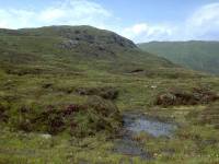
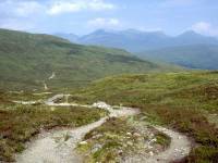
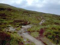
The long descent to Kinlochleven begins here. While the hills in the distance are a magnificent sight, the terrain closer at hand is on the drab side. The Blackwater Reservoir, an artificial lake, stands a couple of miles eastwards in an area pretty much devoid of scenic merit. A lochan or two stand just beyond the col in a small hanging valley, but beyond there is little but heather and rough moorland grasses. The path swings down in two loops through a pair of shallow valleys, the Coire Odhair Beag and its bigger brother, the Coire Odhair Mhor. The footbridge over the Allt Coire Odhair Mhor is a picturesque spot, graced by a rocky water cascade and a couple of trees, and the bank of the stream is an obvious refreshment stop.
Sron a Choire Odhar Bheag; the Allt Choire Odhar Mor; Strath Leven
Not far from the confluence of the West Highland Way with the Blackwater access track, the latter now swings south to describe a wide zigzag around the slopes of the Coire Mhoraire, a picturesque and well-forested valley falling from the Munro of Am Bodach, away to the southwest. The descent is surprisingly steep in places. Beware of cyclists zooming past you at high speed. The occasional land-rover that comes this way will almost certainly be moving at a more sedate pace.
Just after the dogleg back to the northwest, a small body of water may be glimpsed through the trees to the left. This is another reservoir, a mere pond compared to the Blackwater but far prettier. A couple of indistinct paths lead to the reservoir through the tree cover, revealing a group of small clearings nearby. The charred patches of ground in these clearing suggest that they are used as wild campsites. I'm of the opinion that this is an unsuitable place for a wild camp. If you must erect a tent here be more respectful than those who litter the place with charred logs. Use a proper stove and leave no trace of your stay.
The track now swings north along the other side of the Coire Mhoraire descending gradually to the pipeline again, which it runs alongside for the last eight hundred yards to the rear of the aluminium works.
Kinlochleven has a reputation for being a backwater - not surprising given that it stands at the head of Loch Leven, a 10-mile long sea loch indenting the coast of Loch Linnhe. One road runs out to Kinlochleven along the south side of the loch from Ballachulish, diverging from the A82 at Glencoe village; another runs back along the north side to Onich. Traffic between Glasgow and Fort William is spared the twenty mile detour via Kinlochleven thanks to the Ballachulish bridge; before the bridge was opened there was a ferry that performed the same function. Kinlochleven sees little through traffic, then, and few come here save those who live or work in the town, the odd curious visitor, and of course those of us walking the West Highland Way or climbing the Mamores.
Kinlochleven was a drab, utilitarian town a generation ago but it has smartened up and possesses a degree of charm now. British Alcan have even opened a visitor centre. There are a handful of shops, inns, a cafe or two and a smattering of guest houses and B&Bs. Otherwise, those searching out a night's lodging will board the bus to whisk them off to Ballachulish or Fort William.
![]() Ft William
- Kinlochleven timetable not available, sorry, but bus runs roughly
every
2 hrs until late evening Mon - Sat.
Ft William
- Kinlochleven timetable not available, sorry, but bus runs roughly
every
2 hrs until late evening Mon - Sat.
![]() Citylink
bus connections at Ballachulish: Glasgow-Ft
William,Oban-Ft
William-Inverness (.pdf documents).
Citylink
bus connections at Ballachulish: Glasgow-Ft
William,Oban-Ft
William-Inverness (.pdf documents).
| Bridge of Orchy to Kingshouse | Back to West Highland Way index | Kinlochleven to Fort William |
This page last updated 8th February 2005
![]()