
| Tyndrum to Bridge of Orchy | Back to West Highland Way index | Kingshouse to Kimlochleven |
| Tyndrum to Bridge of Orchy | Back to West Highland Way index | Kingshouse to Kimlochleven |
|
|
|
| Length: | 12 miles / 19.3 km |
| Total ascent: | 1699 ft / 518 m |
| Total descent: | 1436 ft / 438 m |
| Estimated time: | 4 hrs 20 mins |
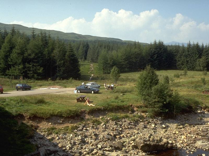

Bridge of Orchy campground; The bridge and hotel with Beinn Dorain behind
![]() Train
times to Bridge of Orchy (.pdf document)
Train
times to Bridge of Orchy (.pdf document)
![]() Citylink
bus times to/from Bridge of Orchy: Glasgow-Ft
William (.pdf document).
Citylink
bus times to/from Bridge of Orchy: Glasgow-Ft
William (.pdf document).
Having paid your hotel bill, or repacked your tent, or arrived at Bridge of Orchy by train or Citylink coach, begin the day's walk by finding the forest track leading northwestwards away from the minor road on the west side of the bridge.


Bridge of Orchy


The path climbs for nearly a mile through the nameless forest plantation to emerge on the bald height of Mam Carraigh. Although of modest elevation it does command a splendid view northeastwards across Loch Tulla to the stark emptiness of Rannoch Moor beyond. Near at hand, Inveroran and Forest Lodge are seen at the western end of the loch, among scattered stands of trees and small conifer plantations. The Abhainn Shira disappears into the mountain fastnesses to the west, while the massive and shapely bulk of Stob Gabhar and its neighbours dominate the scene to the northwest.

The path descends, first to the northwest, then to the west, to rejoin the motor road just short of the Inveroran Hotel.


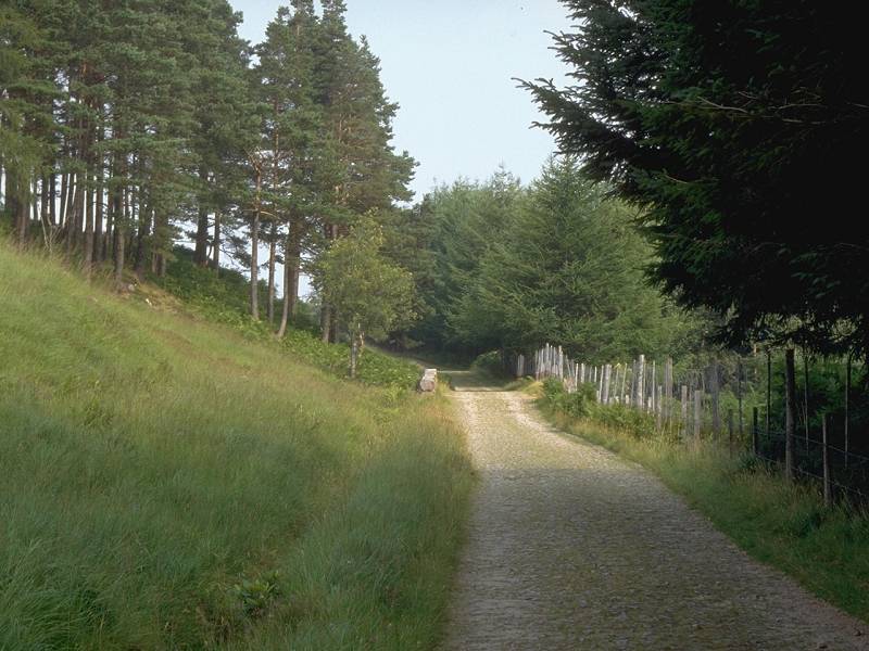
The forest section of the Glencoe drove road
The trees to the left clear first, though the only view offered on this stretch is one of bare moorland, the lower flanks of Beinn Toaig. Sightings of Loch Tulla to the right, and the so-called Wall of Rannoch beyond, are very elusive. Eventually, after about a mile and a half, the trees clear to the right. Welcome to the Blackmount.

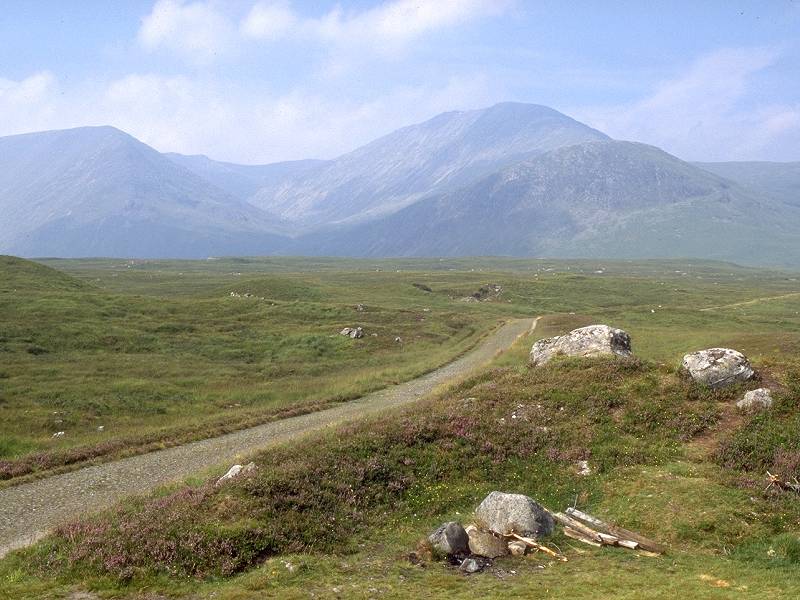
The Glencoe drove road climbing past the last forest plantation


It is the view to the west, however, that arrests the mind. Once you pass the first of the isolated conifer plantations you draw away from Stob Gabhar, Stob a Choire Odhair and Beinn Toag. Their northern neighbours (Clach Leathad and Meall a Bhuiridh) come into view. The two mountain groups form a horseshoe around the magificent green bowl of Coireach a Ba (the Hollow of the Cattle), surely one of Scotland's most beautiful mountain valleys. Clach Leathad was once a Munro (a mountain over 3000ft high) but it is now recognised only as a minor top. Sron na Creise, the highest summit of its northern ridge, has a greater elevation than its nominal parent; unfortunately it lies out of sight from here. Its eastern neighbour, Meall a Bhuiridh, is 3635 ft high and is Scotland's 45th highest peak. It is easily climbed; the Glencoe chirlift rises over its northern slopes.


Two views of the Clach Leathad group; a burn near the second plantation
The scenery improves still more as water enters the equation; a pair of tarns grace the scene north of the second conifer plantation. The southern tarn is named Lochan Mhic Pheadair Ruiadhe; the second is nameless. It was on the shore of the first lochan that I stopped for lunch on that beautiful August day in 1995 when I first walked this section.
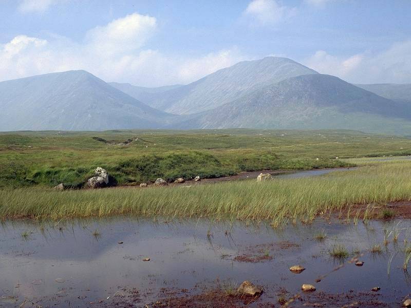

The Clach Leathad hills from the Lochan Mhic Pheadair Ruaidhe; the Stob Gabhar group
The next thousand yards are known as the Moss; a boggy area, spatered with innumerable tiny lochans lies just to the west but the path rolls on, resolute and straight, towards the bridge over the river Ba ahead.


The Moss; Clach Leathad and Meall a Bhuiridh; approaching the Ba gorge


A Ba Bridge photo album
Ba Bridge is, I have no doubt, an immensely popular wild campsite. Beware the midges, however. And please, if you do camp here, respect its beauty. Leave it as you found it. This spot is a little bit of heaven on earth, and it's up to us all to ensure that it stays that way.


The Ba below Clach Leathad; the Drochaid an t-Saighdeir plantation
Once you can tear yourself away from the Ba gorge, continue past the Drochaid an t-Saighdeir conifer plantaion. The path now climbs away from the Ba, towards a low col a couple of miles ahead. Just past the plantation you may well be surprised to see a cottage standing back off the track. Ba Cottage is presumably a property of the Forest Lodge estate and, as far as I know, is not inhabited. If they ever want to sell it off, maybe they'd like to contact me first?
One can dream.


The col at the north end of the Blackmount section doesn't appear to have a name. Gualainn Laith Guibhais is the nearst named locality on the map, presumably the northeastern shoulder of Meall a Bhuiridh, now rising directly to your left. As you cross the col the sheer emptiness of Rannoch Moor lies before you and to the right. The A82 trunk road reappears in the scene, crossing the western apex of the moor two kilometers to the north. A low, fairly nondescrpit ridge of hills fringes Rannoch Moor to the north; this area is known as Black Corries and contains one solitary cottage. Nearer to, and immediately to your right, is the locality of White Corries; it consists of a tiny handful of cottages, the base station of the Glencoe chairlift, and the Kingshouse hotel and its outhouses and staff cottages.


The track wanders down towards White Corries now, and some two miles beyond the col it merges with the service road to the chailift at a cottage belonging to a ladies' mountaineering club. The scene to the west is dramatic; you are looking into the maw of Glencoe, a valley famed for its savage rock scenery and etched in history as the scene of one of Scotland's nastiest atrocities. Most prominent in the scene is the Buachaille Etive Mor (Great Shepherd of Etive), a conical peak regarded as one of Scotland's finest mountains. Sron na Creise (commonly known simply as Criese) stands eastwards of it, the two mountains standing either side of the entrance to the elusive Glen Etive.


The track from the chairlift to the A82; the West Highland Way approaching Kingshouse
The West Highland Way follows the chairlift service road north now, to emerge on the A82. It's a rude shock, encountering so much heavy, fast-moving traffic after the wild, silent country of the Blackmount. Cross the road carefully. Another vehicle track leads off northwest, running roughly parallel to the main road. This was (until about 1930) the original motor road and was one of the Military Roads first driven through the Highlands in the late 18th century following the Jacobite uprising. After a mile you come to the Kingshouse hotel, reputedly Scotland's oldest inn.
Relax here, have yourself a drink, partake of a bar meal perhaps, lose yourself in the conversation of walkers and hikers and cyclists and mountaineers. The hotel allows camping nearby, or of course you could book a room there; alternatively (having checked the timetable) walk out along the main driveway and signal the Citylink coach to stop for you as it speeds past on its way to Glasgow or Fort William.
Go on, admit it. You've had a perfect day.
![]() Citylink
bus times to/from Kingshouse (times are as shown at "White Corries"): Glasgow-Ft
William (.pdf document).
Citylink
bus times to/from Kingshouse (times are as shown at "White Corries"): Glasgow-Ft
William (.pdf document).
| Tyndrum to Bridge of Orchy | Back to West Highland Way index | Kingshouse to Kimlochleven |
This page last updated 20th November 2004
![]()