A sketchmap of the route will appear here
| Jedfoot Bridge to St Boswells | Back to South of Scotland Way index | Melrose to Galashiels |
| Jedfoot Bridge to St Boswells | Back to South of Scotland Way index | Melrose to Galashiels |
The Eildons consist of a single isolated massif, volcanic in origin, with three distinct summits of which the highest is just under 1400ft above sea level. There is the option of visiting any, all or none of the three summits, depending on your whim. The Eildons first came into view on the penultimate day of the Pennine Way, five days and fifty three miles ago, on Raven's Knowe in the Cheviots. The Roman road of Dere Street has been heading more or less straight for them, and there was known to be a Roman signal station on the eastern top. The Eildons also have their place among the extensive legends surrounding the mythical King Arthur, though not nearly so much as at Glastonbury in Somerset. I've already said enough about Arthur on the page covering Glastonbury (Street - Wells, Somerset Way walk 6) so I'll mention him no more here. The area is, however, also associated with a much more solid figure - the novelist Sir Walter Scott, who lived near Melrose and who set many a tale among these hills.
Our walk ends in Melrose, beyond and just below the Eildons, at the
handsome ruin of Melrose Abbey. This is also the end of St Cuthbert's
Way.
From there on we will follow the Southern Upland Way, to Galashiels and
then to Innerleithen. As today's walk is relatively short it might well
be combined with the previous section (from Jedfoot Bridge to St
Boswells)
or the following section (from Melrose to Galashiels). St Boswells and
Melrose are both well served by buses from Galashiels and Edinburgh.
|
|
|
| Length: | 6.22 miles / 10 km |
| Total ascent: | 1032 ft / 315 m |
| Total descent: | 1021 ft / 311 m |
| Estimated time: | 2 hrs 19 mins |
Map: OS 1:25000 Explorer 338 (Melrose & Galashiels)
Click
on
any thumbnail image in this gallery to display the corresponding full
size
image. The images are access protected through a cgi script to prevent
hotlinking. If you encounter problems while trying to view the full
size
images, please read the access advice
page.

Returning to the Tweed
Your first task is to locate the continuation of St Cuthbert's Way along the south bank of the Tweed, west of the town. This looks perfectly straightforward on the map but is rather less so on the ground, involving a confusing series of lanes and paths off the main road to the north just outside the town centre. Trust the waymarks, even if you are under the impression that you are heading the wrong way.


St Cuthbert's Way alongside the Tweed
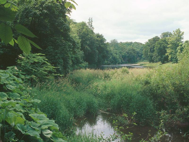
Once you do hit the Tweed, the next mile of path is utterly charming. St Cuthbert's Way hogs the riverbank through a lazy S-shaped meander. There is a ribbon of tree cover on our side, while opposite there is an area of parkland punctuated by a number of comely and impressive buildings that comprise the locality of Dryburgh - an abbey (Sir Walter Scott is buried here) and a hotel among them. This stretch of the Tweed is remarkably similar to the Oxfordshire reaches of the Thames in appearance.


The Tweed opposite Dryburgh
As you come out of the second (left-hand) bend of the S-shaped meander, you pass a handsome suspension bridge giving access to Dryburgh Mains. About 250m past the bridge turn left, away from the river, for a path through a ribbon of trees heading for Newtown St Boswells.


Path from River Tweed to Newtown; Newtown St Boswells; lane to Bowden
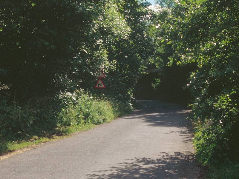
Newtown St Boswells is reached quickly enough - you're only about half a kilometre away from the riverbank when you reach the underpass beneath the main A68 bypassing the village, and just another 300m or so along a back lane brings you to the centre of the village. There is not much here. The viaduct and embankments of the former Kelso - Galashiels railway dominate the village, which is further dwarfed by the headquarters of the Borders regional council standing just to the north. A village shop is very handy for provisions (it was a hot day when I did this walk in July '99 and I treated myself to fruit juices and an ice cream here), though a cafe or coffee shop would also be very useful. The continuation of St Cuthbert's Way is not along the B6398 road to Bowden, although you could take this route if you wished, but rather along a minor road to Whitelee Farm that runs parallel about a quarter of a mile to the south. Go south for a short distance along the main road through the village then hard right at the road junction to pass underneath the old railway line.


At Whitelee Farm the motor road turns off left for Camieston. Our route now lays along a track heading straight on, close to the southern bank of Bowden Burn.


The footpath from Whitelee Farm to Bowden
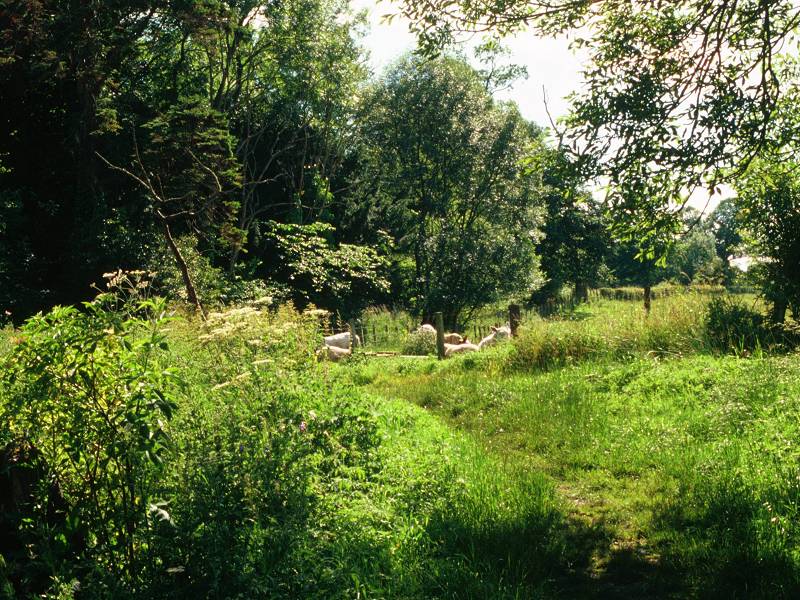
The path from Whitelee Farm to Bowden is a delightful pastoral interlude, of about a mile in length. It's arguable that we've not traversed a proper country footpath like this, among farms and villages in a river valley setting, since the more pastoral parts of the Pennine Way back in Yorkshire. The path initially runs beside the Bowden Burn then crosses it via a rustic footbridge to run alongside pastures with tree cover to the left. The route of St Cuthbert's Way follows this path out to a minor road running from Bowden out to the A699 at Woodlea, though I followed an alternative route making use of a path to the right, into the eastern end of Bowden village, about 400m short of the road.

There's little to say about Bowden village. It's compact, it's neat, it's quite charming, but apart from a small post office it has no amenities. In the village centre, where there's a bit of a green, turn right along a residential road.


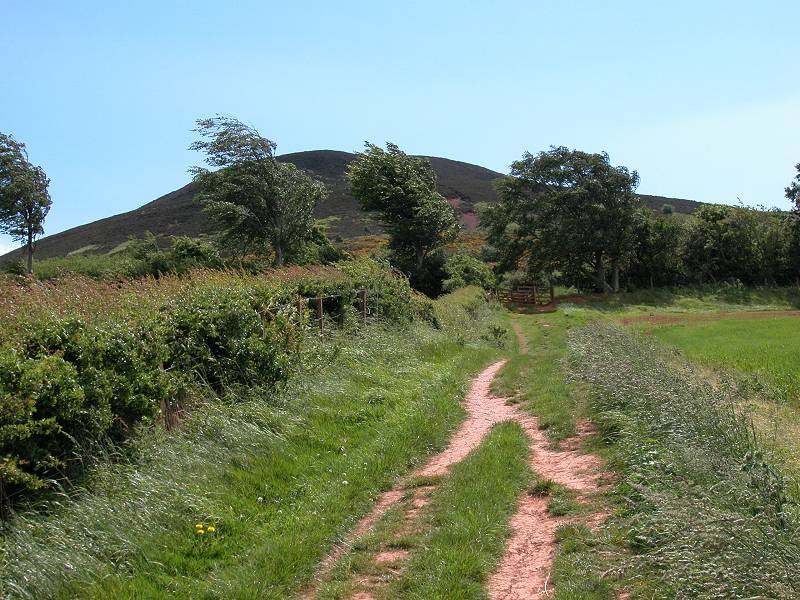
The road soon becomes a lane, heading out to Bowden common. Eildon Mid Hill is almost directly in front of you and is now looming large. The track turns left for the common but very shortly afterwards you turn right, at a small stand of trees, for a right of way across Glenburnie burn. About 200m after the turnoff you reach the trees of Greenside plantation. Turn right here and follow the track, which leads through the wood and up onto the Eildons massif.


Your track runs around the south, and then the east, sides of Greenside plantation before diving into the natural tree cover of Broad Wood. You're climbing fairly smartly now and if the day is hot (a rarity in Scotland but it does happen) then the trees will give welcome shade while you ascend. You break out of the trees only about 250m of distance and about 50m of ascent short of the col, which stands at 315m above sea level.


St Boswells from the col; The Eildons col; Melrose from the col
The view from the col is glorious - the view from either of the summits is even better, and you are encouraged to climb either or both the main summits if you can spare the time and effort. The Eildons are hills of rough pasture and heather. Eildon North Hill lies to the northeast of the col; it's the lower of the two main summits at 404m but is also the broader, and was the site of the Roman signal station. Eildon Mid Hill is the nearer and higher of the two summits, and the ascent route leaves the col to the west to ascend the hill's northern flanks.


Eildon North Hill; The summit of Eildon Mid Hill; the path up from the col


Leaving Eildon Mid Hill for Melrose


Descending from the Eildons
There are two ways down from the col to Melrose but the more satisfying - omitting half a mile of road walking within Melrose itself - is to follow the main track northwards from the col, descending the flanks of the North Hill and apparently veering away from Melrose to the east. Fear not, at the foot of the heather slopes the path turns half left to cross pastures heading directly for the town.


St Cuthberts Way approaching Melrose


Descending steps; Path beside garden

Logistically the day's walk ends once you reach Melrose's handsome market square (actually a triangle) in the town centre, but St Cuthbert's Way officially continues the 150m up a side road to Melrose Abbey and, unless it's late in the day, few will want to take leave of the town without taking a look at it. You don't need to be a fan of ecclesiastical architecture to appreciate its beauty. I don't have very much information on its history, save that it was built for an order of Cistercian monks in about 1136, subsequently suffered during the interminable border wars with England, and was finally abandoned in its present ruined state in 1544. The heart of Robert the Bruce is said to be buried here.


Melrose; Melrose Abbey; abbey gardens

Melrose market square
![]() Buses
to Galashiels, Peebles, Edinburgh, Jedburgh and Kelso leave from the
market
square.
Buses
to Galashiels, Peebles, Edinburgh, Jedburgh and Kelso leave from the
market
square.
|
£3.50
inclusive
of postage / packing. |
| Jedfoot Bridge to St Boswells | Back to South of Scotland Way index | Melrose to Galashiels |
This page last updated 17th March 2006
![]()