
A sketchmap of the route will appear here
| Morebattle to Jedfoot Bridge | Back to South of Scotland Way index | St Boswells to Melrose |
| Morebattle to Jedfoot Bridge | Back to South of Scotland Way index | St Boswells to Melrose |
|
|
|
| Length: | 10.1 miles / 16.3 km |
| Total ascent: | 816 ft / 249 m |
| Total descent: | 712 ft / 217 m |
| Estimated time: | 3 hrs 20 mins |
Maps: OS 1:25000 Outdoor Leisure 16 (The Cheviots); Explorer 338 (Melrose & Galashiels)
Click
on
any thumbnail image in this gallery to display the corresponding full
size
image. The images are access protected through a cgi script to prevent
hotlinking. If you encounter problems while trying to view the full
size
images, please read the access advice
page.


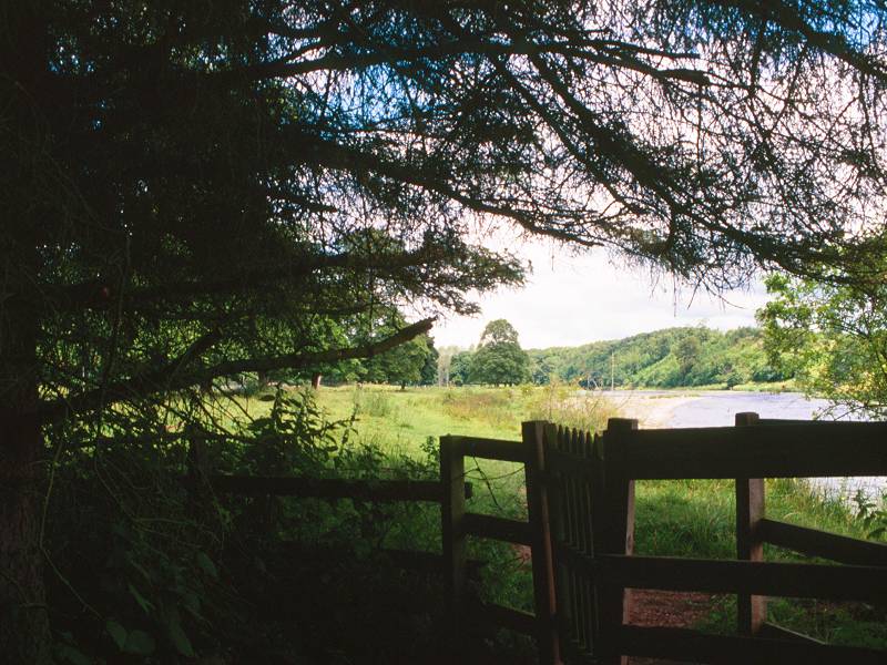
The path along the banks of Jed Water
Jedfoot Bridge is a couple of miles north of the town of Jedburgh. Bonjedward junction, two hundred yards to the east, can be reached by buses between Jedburgh and Kelso, Jedburgh and Galashiels, or Galashiels and Kelso. You can descend to the track on the left (west) bank of the Jed Water via a flight of steps from the bridge, or you might find it preferable to use an access track to a couple of cottages on the north side of the road from which a local path gives access to the riverbank track a hundred yards or so to the north.
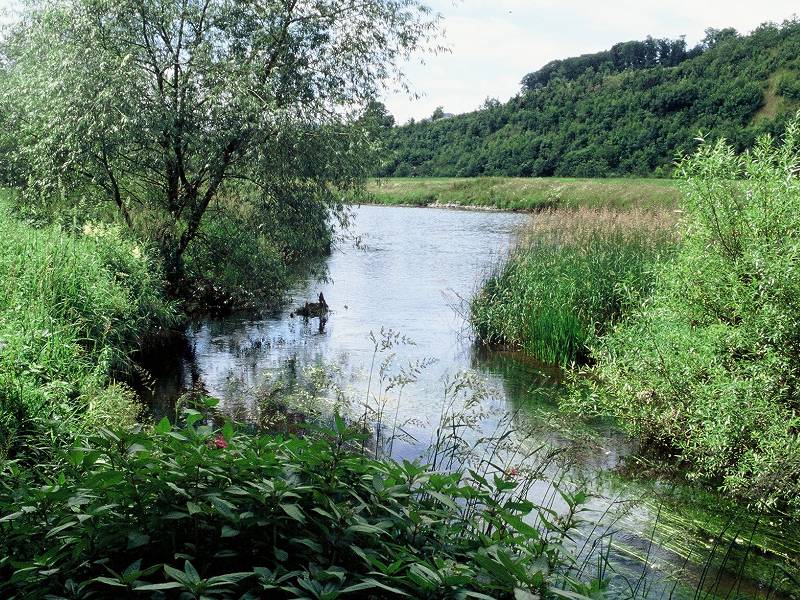
Six hundred meters north of Jedfoot Bridge the Jed reaches the confluence with the river Teviot. Turn left and follow the track along its southern bank, which runs for a kilometre westwards to a suspension bridge across the river.


The suspension bridge across the Teviot
The bridge gives access to the grounds of Monteviot House. Once you're across the bridge it's necessary to backtrack along the north bank for 400m, then turn sharp left for a track on rising ground which then curves further left to run through a pleasant ribbon of woodland. The woodland track is running parallel to the unseen B6400 road that borders the wood to the north. The track crosses Monteviot House's main access drive and then continues for another 400m before turning right. Cross the road and take another woodland track, still on rising ground, which twists and turns somewhat over slightly knobbly ground before curving left to resume the (temporarily lost) course of Dere Street. The track now runs dead straight for a full 5km, or 3 miles; except for a section of road walking in Caithness on the last day it's the longest straight stretch of the entire End-to-End walk.
Hamish Brown's book of 1992 indicates that this section of Dere Street was unwalkable at that time - "the authorities," he tells us, "are working on it." The authorities have done well. The path emerges from the Monteviot woods at an unclassified road and continues, typically between twin rows of hedgerow or tree cover and sometimes as a field edge path. The height of Peniel Heugh, which carries the stone obelisk that is the Waterloo Monument (first glimpsed back at Cessford Moor yesterday) has been obscured by the Monteviot plantations but now reappears behind and the the right. Dere Street runs onwards towards the locality of Harrietsfield.


Dere Street near Harrietsfield
There's no change in the nature of the route as it runs through Harrietsfield; it just runs, straight as an arrow, through pasture country fringed by one, or sometimes two, rows of vegetation. The hill of Down Law rises to the right.


Views of Dere Street near Harrietsfield


Path and footbridge near Lilliard's Edge
A mile further on and the name changes, but the scenery stays much the same. The main A68 trunk road can be seen gradually getting closer to the left, and Dere Street temporarily ducks into tree cover on the edge of Whinny Plantation.


Scenes along Dere Street near Lilliard's Edge


Dere Street approaching Hiltonshill
There are patches of woodland here and there, but occasionally the landscape opens up enough to show you a good half mile or so of Dere Street stretching ahead of you, and the effect is unnerving. You're looking at a scene that was conceived two thousand years ago by a Roman surveyor and brought into being by military commanders of astonishing single mindedness and tenacity. It's almost frightening to try to imagine what kind of people the Romans were - a people who not only thought in perfectly straight lines fifty or a hundred miles long but actually constructed them across virgin countryside, almost two thousand years before the age of mechanization.


Dere Street near Morridgehall wood
The A68 now converges rapidly with the route of Dere Street from the left and runs almost alongside for the 500 meters short of Hiltonshill junction, though fortunately a strip of woodland isolates the road to some extent.

The track at Hiltonshill Tollhouse
Having passed the site of a sawmill, the Dere Street track hits the minor crossroads of Hiltonshill. Beyond here the A68 follows the route of Dere Street and St Cuthbert's Way forsakes it for quieter country, turning right along the unclassified lane to Maxton.

Maxton lane


It's about a mile along the lane to Maxton, during which the road doglegs left then right to cross the bed of an abandoned railway line. The railway was a loop of the North British that followed the Tweed valley from Berwick to Peebles and then ran northward to Edinburgh. It was likely one of the lines axed by the Beeching report of 1963.
Our back lane emerges onto the A699 road at a junction some 300m southwest of Maxton. Follow the road into the village; it's a pleasant enough place though there is little here. Pulses should quicken a little, however, for we are about to encounter the principal river of southern Scotland - the Tweed.


The route through the woods between Maxton and Benrig
There's a bit of a cat and mouse game first, however. Follow a footpath from Maxton northwest towards the riverbank. You get within 200m of the river before the path swings left by Glebe House, entering a stretch of picturesque woodland. It's almost a parkland setting, with a fairly dense cover of varied tree species and a couple of streams crossed by rustic wooden footbridges.

The first sighting of the Tweed at Benrig
Then, suddenly, the trees thin to your right and you're standing on the banks of the Tweed. This fine river rises at Tweeds Well in the lonely hill country north of Moffat, and flows northeast to Peebles and then generally eastwards through Galashiels, Melrose, Roxburgh and Coldstream before entering the sea at Berwick. For most of its length eastwards of Coldstream it defines the England - Scotland border.
Here, at Benrig, it's a good 200 meters wide and is in the process of describing a massive S-shaped meander. St Cuthbert's Way follows the south bank of the river around the upper loop of the "S", all the way into St Boswells (which is actually less than a mile away directly, but more than two miles by our route).


The Tweed north of Benrig; Mertoun Bridge; the Tweed from the bridge
St Cuthbert's Way follows the bank of the river around a long right-hand curve, through typical river meadow scenery dotted with occasional clumps and ribbons of trees. It's a semi-parkland setting in part, and you will no doubt encounter fishermen and locals exercising their dogs. There are even a couple of bench seats if I remember correctly. The curve straightens out (this being the central part of the "S") and then swings lazily to the left, curving round to the north and then the northwest, where the Tweed is crossed by Mertoun Bridge. The bridge carries the B6404 road from St Boswells to Kelso.

Riverside track west of Mertoun bridge
Beyond the bridge the river, with our route faithfully following its south bank, curves right around to the southwest to run the final mile and a bit into St Boswells.


Riverside scenes on the approach to St Boswells
The riverbank emerges from its "S"-shaped meander to run along a fairly straight stretch, the bank of which is marked as Great Stenhouse on the map. The river meadow theme continues at first but soon gives way to an extensive golf course, which our route skirts some 100m away from the river bank.


Lanes behind Lessenden House
The route runs pretty much all the way along the side of the golf course, eventually turning left to run southeastwards close to Lessenden House, presumably the clubhouse of the golf course, towards the eastern end of St Boswells proper. The path gets well hemmed in by hedges. A glance at the map shows that there are a number of alternative routes by various back lanes, and there is also a riverbank option though I have found this remarkably difficult to follow.


Make your way, by whichever route you chose, into the centre of St Boswells. It's a very compact little town, really not much more than an enlarged village with a row of shops, but it's our official destination for the day. Walk west beyond the town centre where you will find an elongated triangular green; this is where the buses stop, and at the foot of the green is the main A68.
If you feel like pushing on further, Newtown St Boswells is less than two miles distant while Melrose is seven walking miles away, though be warned that the climb of the Eildons must be tackled first.
| Morebattle to Jedfoot Bridge | Back to South of Scotland Way index | St Boswells to Melrose |
This page last updated 25th February 2006
![]()