A sketchmap will appear here shortly
| St Boswells to Melrose | Back to South of Scotland Way index | Galashiels to Innerleithen |
| St Boswells to Melrose | Back to South of Scotland Way index | Galashiels to Innerleithen |
Today's route is just five and a half
miles
in length. It plays a curious cat and mouse game by first running into
the eastern outskirts of Galashiels, then taking a detour by the Tweed
and over the slopes of Gala Hill before approaching the town a second
time,
this time from the south. It would suit a half day expedition, or could
even be split into two evening strolls for those staying in the
vicinity.
|
|
|
| Length: | 5.1 miles / 8.2 km |
| Total ascent: | 588 ft / 179 m |
| Total descent: | 468 ft / 143 m |
| Estimated time: | 1 hr 46 mins |
Map: OS 1:25000 Explorer 338 (Galashiels, Selkirk & Melrose)
Click
on
any thumbnail image in this gallery to display the corresponding full
size
image. The images are access protected through a cgi script to prevent
hotlinking. If you encounter problems while trying to view the full
size
images, please read the access advice
page.
Approaching the Tweed north of Melrose
The Southern Upland Way north of Melrose
The Southern Upland Way pretty much hugs the riverbank for the next mile or more. At first the route is crowded into a series of paths and lanes squeezed between the river and the houses on the edge of Melrose, though there are also a couple of open areas, on one of which stands a SUW information board. A number of paths and lanes lead into Melrose off to the left and almost beg to be explored. Eventually the route emerges from the edge of town at a right hand curve in the river.
Southern Upland Way by the Tweed at Melrose
From here the Way wanders pleasantly along the bank of the river, among a series of meadows. The river curves gradually around to the left again. Over to your left is the locality of Darnick, and the grounds of the Waverley Castle Hotel.
The banks of the Tweed
At one point ypu come out onto a bend in a road; follow the road around the bend for just a few paces to find a gap in the fence that allows you access to another series of river meadows. You approach a sharper bend to the right, and approach the road bridge over the Tweed.
Riverbank path
Before you reach the bridge, the route climbs up left away from the riverbank to reach the B6374 road. Head across the road and take a tarmac drive (third image above) running past a small industrial area. In about 200m you merge with a long, straight ribbon of tarmac. This is the course of the former North British railway line from Edinburgh to Berwick on Tweed via Galashiels, here turned into a footpath and cycle way.
The SUW leaving the riverbank to join the old railway track
The old railway track at Tweedbank
Continue for another 200m until you come out on the main road. Turn left and walk along the road, which runs through the eastern fringes of Galashiels. This is pretty much an industrial area and you will pass a sewage works on your left and a gasworks on your right. Once the road crosses the Gala Water look out for the SUW fingerpost pointing down a pathway to your left.
turning left onto the road at Galashiels; A609 viaduct; woodland path
The path runs initially past a small industrial site before emerging into a small car park. Beyond the car park is large river meadow, dominated by the viaduct carrying the main road into Galashiels from the east, the A609. The route slides under the viaduct along the western side of the river meadow, after which it enters a ribbon of woodland. The Tweed slides alongside.
Riverside path
The woodland / riverside section, which is about 700m long, is the undoubted highlight of the day's walk. Towards the far end, look out for the path gradually climbing the bank alongside to come out onto the road. Before long you will spot a SUW fingerpost pointing up to the right - follow the route along a lane to Netherbarns.
The route through Netherbarns is a little intricate. The lane winds round several bends, mainly alongside a pasture with grazing cattle. Netherbarns is an open residential area with the character of a country village, though you get a rude shock when, having followed the lane past several desirable cottages that might well be in the middle of the country, you suddenly find yourself standing on the A7, one of the principal road arteries of southern Scotland. Cross with care and find the continuation of the SUW, almost opposite. You're now following a land that runs above the A7 around the lower slopes of Gala Hill, but after 150m you should turn left onto a lane heading just south of west, going diagonally up the hill.
The Southern Upland Way through Netherbarns


Scenes on the slopes of Gala Hill
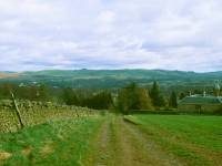
The route quickly becomes a farm track and heads smartly uphill into open country, giving some rewarding views into the Tweed valley and across the eastern end of Galashiels. Melrose and the Eildons are well seen. After 500m of the farm track you reach the corner of four fields. Turn right here for another farm track, heading just west of north.
Eildon Hills; the Gala Hill track
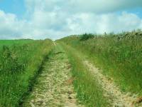
Your track climbs steadily alongside a stone wall. The surrounding pastures are grazed by sheep. Gala Hill rises to your left, cloaked by trees, but the track rises across its eastern slopes. Galashiels is initially hidden by the shoulder of the hill though you get good views of the hills to the north of the town, such as Buckholm Hill and Blaikie's Hill. Eventually the track levels out and then gradually begins to fall again. A few hundred meters beyond the summit of the track you find yourself looking down on Galashiels.
The Southern Upland Way crossing Gala Hill


First view of Galashiels; the Southern Upland Way above the town
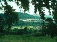
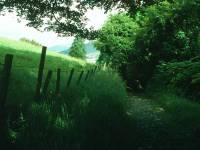
The path kinks slightly to the left now, and runs along a terrace, fringed by a ribbon of trees and hedges, running above the town on its southwest side. You get a good idea of the extent of the town from here and its situation on the junction of the Tweed and the Gala Water. The main part of the town, on which you're looking down, forms a broad ribbon of development for quite some distance along the valley of the Gala Water.
The route along the south-western fringes of Galashiels
As you progress the track becomes a lane, and then the lane becomes a residential road, and suddenly you find yourself in a smart suburban street high above the town down to your right. After some 800m of residential road you come out onto the main road rising across Gala Hill to the southwest. It only remains now to turn right onto this road and follow it downhill into the centre of town. After only about 200m a signboard points to the left, where the Southern Upland Way heads off though school grounds and parkland before beginning its long journey across the northern shoulder of Gala Hill for Yair, Three Brethren, Minchmoor, Traquair and Innerleithen. But that's for tomorrow. For now, stroll down into town.
The southern heights of Galashiels
| St Boswells to Melrose | Back to South of Scotland Way index | Galashiels to Innerleithen |
This page last updated 17th March 2006
![]()