
| Bicknoller to Taunton | Back to Somerset Way index | Langport to Street |
| Bicknoller to Taunton | Back to Somerset Way index | Langport to Street |
The walk breaks down into two main phases. First we follow the towpath of the Bridgewater canal to Creech St Michael, and then the banks of the River Tone to Ham. From Ham onwards we rely on a series of "green lanes", typically farm vehicle tracks, to get ourselves around the southern side of the low lying fen of West Sedge Moor. It's unfortunate that some of these green lanes, which look so inviting on the map, turn out to be rough (due to churning by tractor tyres), or prone to flooding, or both. Pick a dry season, however, and you should sail through this section and enjoy it.
We end up today in the town of Langport, in the valley of the River Parrett, which has good public transport connections to Taunton, Street and Wells.
Maps: OS Explorers 128 (Taunton) and 129 (Yeovil & Sherbourne)
Click
on
any thumbnail image in this gallery to display the corresponding full
size
image. The images are access protected through a cgi script to prevent
hotlinking. If you encounter problems while trying to view the full
size
images, please read the access advice
page.

The Taunton ring road crossing the canal east of the town
Once under the ring road viaduct you're out into one of those rather insalubrious industrial parks that tend to nestle among railways and canals on the outskirts of towns. It's not as bad a some, and fortunately you're out of it about 800m beyond the viaduct. A short stretch of unmemorable farm country follows, after which the canal towpath slides through the village of Bathpool. Beyond Bathpool the canal crosses the M5 motorway by means of an underbridge, after which you can consider yourself to be outwith the environs of Taunton at last.
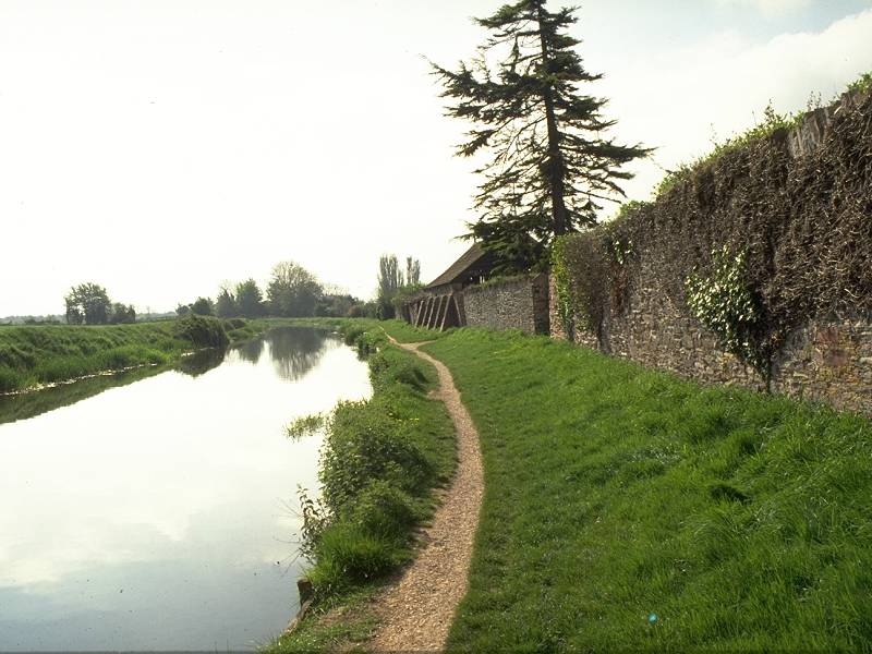

The towpath of the Bridgwater Canal between the M5 bridge and Creech St Michael
There's roughly 1km of towpath between the M5 bridge and the village of Creech St Michael, and the environs of this stretch are generally charming. The canal through Creech St Michael itself would be a picturebook scene but for the vast corrugated iron farm shed that stands on the opposite bank . Shame on whoever was responsible for such an eyesore.
Leave the canal towpath at the road bridge in the centre of Creech and follow the road south, across the railway bridge to the river bridge over the Tone. Don't cross this bridge but turn left, past the church, onto a back lane that reverts to a riverside path on the edge of the village. This is a pretty spot, a stretch of river where you'll meet the odd angler and a few locals exercising their dogs. We stay on the riverbank path for around half a mile before crossing a footbridge into the village of Ham.

The footbridge over the Tone, Ham.
There's very little to Ham, basically nothing more than two rows of houses strung along the lane. The path from the footbridge crosses the lane direct, and 200m south of the village it reaches a vehicle track, which you turn left to follow. The track curves around to the right.

Farm track south of Ham
The track heads southeast for about 400m then turns south for about 150m, after which it reaches a complex field corner; turn right and then follow the route around to the left. This new track is heading uphill and was, when I walked it in 1994, unbelievably rough. The track heads south for some 600m before ending at a "T" junction of vehicle tracks - turn left, to head east, along a more substantial track. You should leave this track for a footpath to the right after 1km that leads directly into the hamlet of Lillesdon, but the footpath was ill defined in '94 and you would do better to take a tiny farm lane that heads off right about 300m before the footpath. This lane comes out onto a road named Solomon's Hollow; turn left and walk the short distance into Lillesdon.

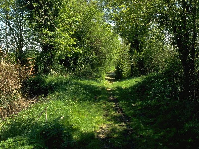
The footpath from Lillesdon to Wrantage
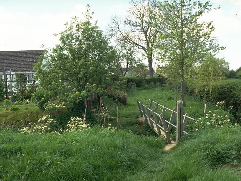
Lillesdon is tinier than Ham. Walk eastwards to the road junction then turn sharp right onto the road heading southwest, heading for Hammonds Farm. Opposite the buildings turn left onto a footpath that descends and crosses the fields towards Wrantage, three quarters of a mile away to the south. This footpath runs alongside a stream for a short distance but then tends to get a bit lost; the field boundaries it used to follow have been grubbed up. The route heads in the general direction of Weavers Farm, from where the short farm driveway delivers you onto the A378 just east of Wrantage. An alternative way into Wrantage involves turning right about halfway between Lillesdon and Wrantage onto another path heading southwest, which crosses the vague depression that is a remnant of the Chard Canal to reach a pretty footbridge to the rear of a cluster of houses (pictured below). This path delivers you onto the A378 just to the west of the village. Both footpaths were very hard to find in 1994 when I walked this section.

Depending on which alternative you took between Lillesdon and Wrantage, walk into the village along the road. You're now aiming for a substantial footpath that leaves the village to the southeast to climb the scarp of Crimson Hill. The climb is a steep one but it delivers you onto a road junction at the top of the scarp about 1km short of the village of Curry Mallet.


A retrospective view down Crimson Hill; road junction at Curry Mallet
It's almost a different world up here. There's a substantial view and you should be able to see back to Taunton, with the wedge of the Quantocks seen end-on to the north of the town. The Mendip hills may also be in view from here, and if you're lucky you may spot the slender white mast that is the Mendip TV transmitter, standing above Wells, two days' walk ahead. All my efforts to spot Glastonbury Tor from up here came to nought but it would be surprising if it were not in view.
You can take the road ahead of you, Staundle Lane, into Curry Mallet, or turn left onto the Rock lane for a footpath heading into Curry Mallet via Lyddons farm. The chances are that you'll be a bit fed up with paths after Ham-Lillesdon and Lillesdon-Wrantage, and these lanes are quiet enough anyway. There are two road loops; one through the village itself, and one to the north going past a cluster of farms. You might also spot a lane running between the two from Lyddons Farm to the manor house, the most elegant variation for off-road purists especially if you've tackled the footpath from the lane to Rock. From the manor house there is no alternative to the road; walk eastwards for a mile along the lane (which, you'll note, is called "Marshway") to the road junction at Stowey Farm, just west of the village of Fivehead.
Stillbrook Lane, Fivehead
We don't go through Fivehead but bypass it to the south by a series of green lanes. Turn right at the Stowey Farm junction, pass New House farm and then turn left onto Stillbrook Lane. This is a substantial green lane and is tree-lined, a welcome relief from the sun on a hot day and probably your best bet for a lunch stop. Stillbrook Lane runs for 500m and then comes out onto a road, which you follow in the same direction for another 400m. You hit a "T" junction just south of South View farm. Your onward route is Shell Drove, a farm track or dirt road that runs for some two miles in the direction of Curry Rivel. In 1994 the first few hundred meters of Shell Drove were flooded up to a depth of six inches, making progress quite impossible. If you find your way blocked by a flood then there's an alternative a few hundred metres to the south, Islemoor Drove. I followed this lane in '94. It was dog rough, and it was by a sheer stroke of luck that I found my way back to Shell Drove by the footpath across Hay Bridge.
Shell Drove continues as a substantial track, alongside and between fields, occasionally accompanied by hedgerows and lines of trees. It's a bridleway so don't be surprised to meet the odd horse rider. At some indeterminate point Shell Drove becomes Burton Mead Drove. Progress is good along this lane and there's no possibility of going astray; you can stride out and enjoy yourself. If only all walking in farming country was this straightforward.
![]() Service
54, Yeovil - Somerton - Langport - Taunton,
Mon-Sat (Summer 2002 timetable)
Service
54, Yeovil - Somerton - Langport - Taunton,
Mon-Sat (Summer 2002 timetable)
![]() Service
954, Somerton - Langport - Taunton,
Sundays / bank holidays (Summer 2002 timetable)
Service
954, Somerton - Langport - Taunton,
Sundays / bank holidays (Summer 2002 timetable)
The approved route doesn't go through the village proper. In fact the route I wanted to take, a footpath to Drayton from a point just southeast of the first crossroads on the edge of the village, proved impossible to locate. "Ain't no footpath across there, never has been," I was told by a farm hand who was mending a fence just a few yards away. What do you do in those situations? A right of way exists in law and the proper thing to do is to make a formal complaint to the highway authority (in this case Somerset County Council), but since you won't get anywhere for several months at least (and disputes with landowners have been known to take ten to fifteen years to resolve), the only thing to do on the day is to seek an alternative. If this route is still impossible to find then you may as well walk along Back Lane towards the centre of the village and turn right to approach Drayton by road. Alternatively you can walk southeast from the crossroads then turn left into Croftland Lane, then left again after half a mile to approach Drayton from the south.
From the crossroads at the centre of Drayton a little grid of footpaths runs around the fields to the northeast, and the three possible alternatives run off from various corners of this grid. The westernmost variation runs due north from the crossroads, leaving the road at a left-hand bend about half a mile north of the village to cross a field known as Eight Acre Plantation; it then reaches a farm track called Park Lane. A footpath heading ENE from here crosses the fields north of Merricks Farm, doglegging left and right halfway along to follow the field boundaries. It runs through a tiny copse of woodland to come out into Frog Lane, which runs north to hit the main A378 on the edge of Langport.
The centre route, the one I tried to follow, leaves the north-eastern apex of the footpath grid just beyond Drayton and runs past the western edge of Ash Wood and then the western edge of Ash Triangle Plantation. It's then supposed to converge with the farm track of Park Lane just east of Merrick's Farm, but no such route existed in '94, or if it did it was well and truly blocked through lack of maintenance. Park Lane turns left to become Frog Lane and the route is followed to the edge of Langport as above.
A third alternative takes the lane east of Drayton to the right-hand bend at the edge of the village. A path is shown running along the north edge of the wood, Law Plantation, then crossing a field on the diagonal to the locality of Park Meads. From here a footpath is shown running generally north-eastwards for about a mile, crossing a series of fields on a diagonal bearing before coming out at the trail alongside the river Parrett. The Parrett Trail is no doubt easy enough to follow but the state and status of the mile and a half of cross-field paths is anyone's guess.
If any readers have local knowledge of the path network between Curry Rivel, Drayton and Langport, I would be very pleased to hear from you.

Langport, and some useful mileage information. No mention of the distance to John O'Groats though!
Langport is an unremarkable though agreeable little market town. No cafes here as far as I remember, but enough pubs or village shops to provide you with whatever kind of liquid refreshment is most to your taste. Buses leave for Taunton and for Somerton (for connections to Street, Glastonbury and Wells) from the stance adjacent to the town square.
![]() Service
54, Yeovil - Somerton - Langport - Taunton,
Mon-Sat (Summer 2002 timetable)
Service
54, Yeovil - Somerton - Langport - Taunton,
Mon-Sat (Summer 2002 timetable)
![]() Service
954, Somerton - Langport - Taunton,
Sundays / bank holidays (Summer 2002 timetable)
Service
954, Somerton - Langport - Taunton,
Sundays / bank holidays (Summer 2002 timetable)
![]() First
Badgerline service 376/377, connections
onwards from Somerton to Street, Glastonbury, Wells and Bristol
First
Badgerline service 376/377, connections
onwards from Somerton to Street, Glastonbury, Wells and Bristol
| Bicknoller to Taunton | Back to Somerset Way index | Langport to Street |
This page last updated 6th January 2008
![]()