| Dunster to Bicknoller | Back to Somerset Way index | Taunton to Langport |
| Dunster to Bicknoller | Back to Somerset Way index | Taunton to Langport |
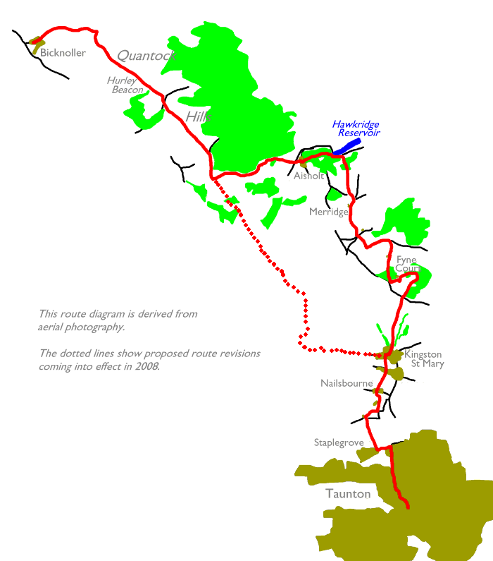
The Quantocks are a joy - the ridge is an area of firm, dry heath and the paths are very well defined, a favourite haunt of cyclists and horse riders as well as walkers. Much of the range, particularly the dip slopes to the east, are richly wooded and wild deer roam here. The southern half of the walk is a little "bitty" but there should be no routefinding problems, and an opportunity might be taken to visit the grounds of Fyne Court, a minor stately home near Broomfield.
Logistically the walk relies on the bus service between Taunton and Minehead. You'll need it to get to Bicknoller, and also to or from Bishop's Lydeard or any other nearby village should you decide to break the walk up. On Sundays and bank holidays the bus service is very infrequent and you might be better off using the preserved steam railway between Minehead and Bishop's Lydeard. The halt at Stogumber is about a mile and a half from Bicknoller.
Maps: OS 1:25000 Explorer nos 140 (The Quantocks) and 128 (Taunton)
Click
on
any thumbnail image in this gallery to display the corresponding full
size
image. The images are access protected through a cgi script to prevent
hotlinking. If you encounter problems while trying to view the full
size
images, please read the access advice
page.

The Quantock scarp from the village; the lane behind the church
Bicknoller lies east of the main A358 Taunton-Minehead road, and there are two lanes from the main road into the village. Your route from Dunster, assuming that you've been following it this far, came into the village along the northern lane; the bus halt is opposite the southern lane and it is along here that you will walk into the village if you have arrived by public transport.
![]() Service
28, Minehead - Dunster - Bicknoller - Taunton
(Mon-Sat) (Summer 2002 timetable)
Service
28, Minehead - Dunster - Bicknoller - Taunton
(Mon-Sat) (Summer 2002 timetable)
![]() Service
928, Minehead - Dunster - Bicknoller - Taunton
(Sun / Bank Holidays) (Summer 2002 timetable)
Service
928, Minehead - Dunster - Bicknoller - Taunton
(Sun / Bank Holidays) (Summer 2002 timetable)
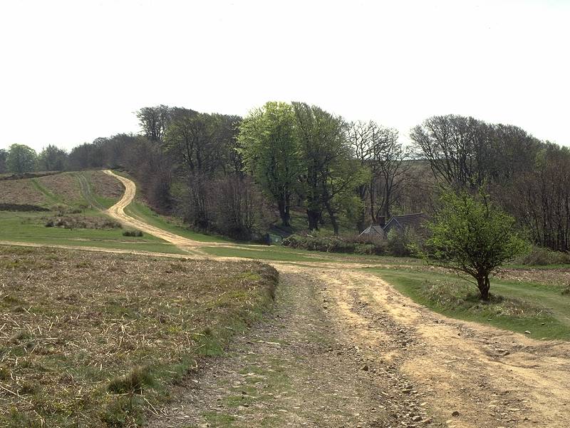
The route through the village is actually quite complex. The lane makes a left turn then curves right again to head for the church, where it makes another left turn. Here it diverges; you can take either loop but it's more straightforward to take the left fork, hitting a "T" junction a couple of hundred yards further on. This is the other lane in from the main road, and where you should have finished yesterday's walk; today's hike, therefore, starts here. Turn right to approach a triangular-shaped island junction. Take the left fork. At the far corner of the island take a minor lane straight ahead of you. At first this is a made road serving a couple of cottages but within two hundred yards it reverts to a footpath and begins to climb Bicknoller Coombe.

Ascending Bicknoller coombe
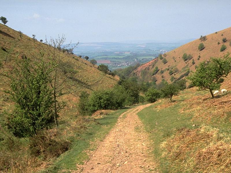
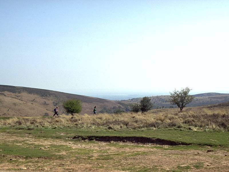
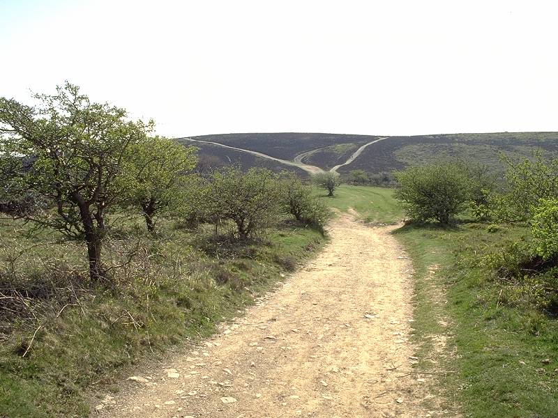
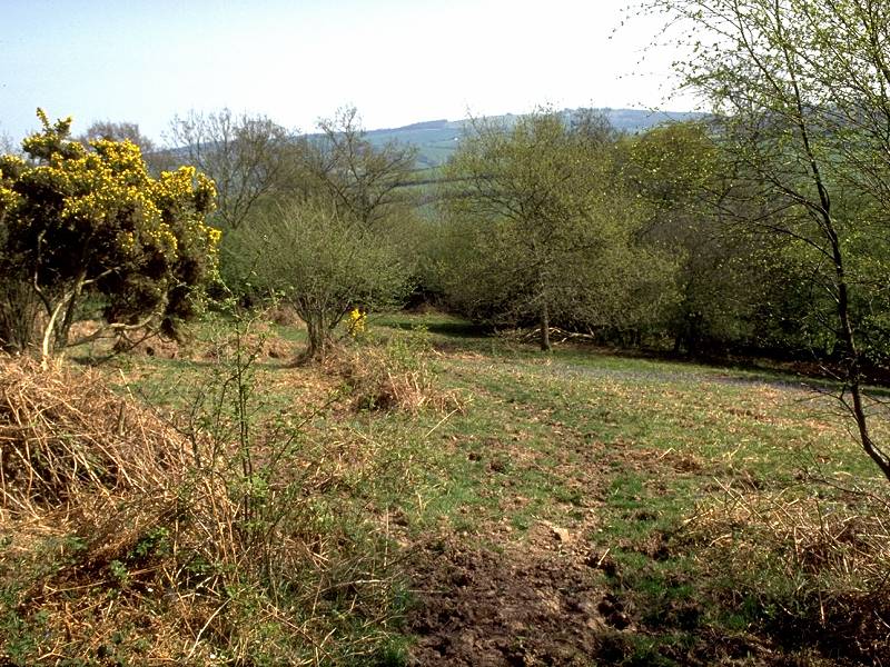
Bicknoller Coombe is an exciting little ravine, and is very reminiscent of the climb up to Bossington Hill from Porlock three days ago. The coombe rises straight into the scarp slope of the Quantocks and ascends some 670ft in roughly a mile. After a couple of twists in the higher part of the coombe the path emerges at a major complex of path junctions on the apex of the ridge. You've arrived at Black Ball Hill, 302 meters above sea level.
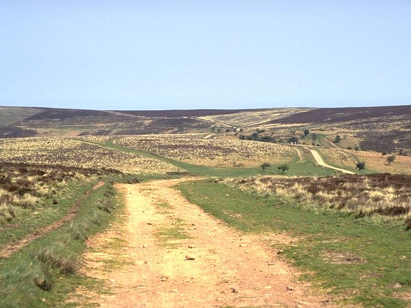
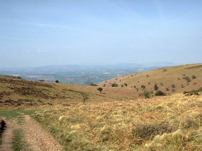
The main path along the ridge, a broad scar of sand among the heather and bracken, heads off more or less southeastwards to ascend the shoulder of Thorncombe Hill and heads for a col between the hill's two tops.
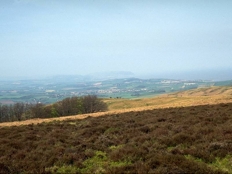

The view towards Minehead; the view along the main ridge to Hurley Beacon
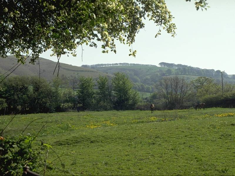
The west top of Thorncombe hill is the higher, at about 338 meters, and is a superb viewpoint. The view back along the coast towards Minehead is particularly arresting, while round to the south the switchback ridge of the Quantocks rises and falls across successive summits. Hurley Beacon is closest at hand, with Will's Neck - the highest and most prominent of the Quantock hills with its northeast ridge sitting proud of the general range - about 5 miles away to the southeast.
The path drops to Halsway col and then climbs again to Hurley beacon (elevation 353 meters, a tad over a thousand feet). The main ridge track misses the beacon to the east but a side trail goes out to it and it shouldn't be missed out, for once again the view is superb.


Looking back to Thorncombe Hill; view south from the summit; view SE to Will's Neck
Hurley Beacon has a cairned summit that is fairly close to the scarp edge and which consequently overlooks a fair swathe of country to the west and southwest. The Brendon Hills are prominent, of course, and you should still be able to make out both Minehead and Dunster to the northwest.
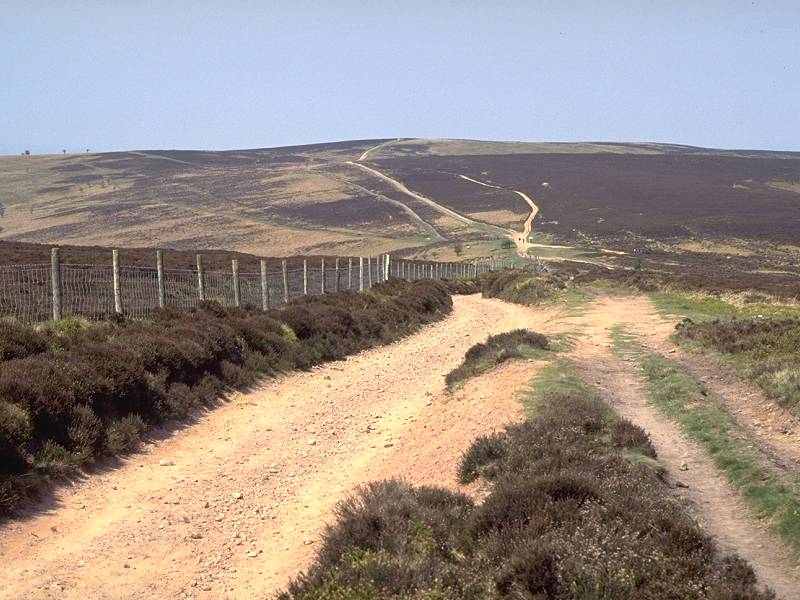
Retrace your steps to the main ridge path and head southeast, and downwards, towards Crowcombe Park gate.


Crowcombe Park Gate; Crowcombe Combe Gate; the path near Quantock Farm
Crowcombe Hill, which rises before you, has a fair amount of tree cover and this serves to hide the existence of a motor road ascending to the ridge at the next col right until you're almost on top of it. A small lodge can be made out close by to the right.
There's a shallow descent to a col at around 320 meters, and a bigger surprise; a road actually crossing the ridge. The first road, presumably serving the lodge, was obviously an offshoot. The road runs from Crowcombe on the west side of the ridge to Nether Stowey on the east side.
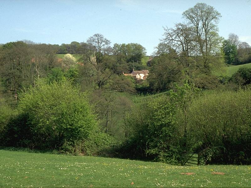
From the road col the ridge path ascends again to a minor top at 342m, then drops to the head of Little Quantock Coombe. Quantock Farm is marked on the map nearby though there are no obvious buildings in sight. The ridge rises again towards Great Hill.


Woodland paths on the Triscombe side of Great Hill
The main feature of Great Hill is not its elevation - indeed, the ridge path bypasses it to the east more or less on a level contour. The tree cover is what makes the place. I was so taken with the sheer beauty of the scenery at this spot that it was here (in fact where I stopped to take the second of the three pictures above) that the idea of going public with the walk and its pictorial record was conceived. For the next half hour the concept of a series of books formed in my mind. This was 1994, of course, before the Web appeared in our lives.
A mile and a half beyond the road crossing you meet a second one. This, another unclassified minor lane like the first, ascends from Triscombe on the west side and runs down to Plainsfield on the east side; not far beyond it emerges near the north side of Hawkridge Reservoir, which our route will later meet.
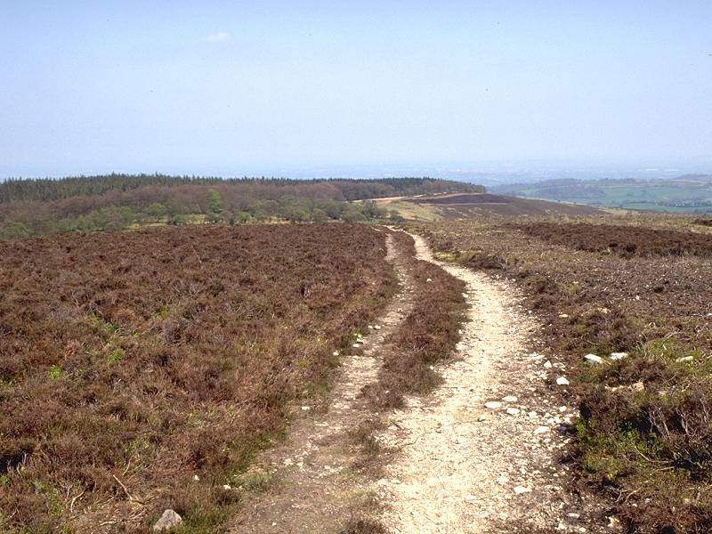
From the road crossing there is a short but steep climb (around 600 metres of distance but 63m of ascent) to the summit of Wills Neck, the highest summit of the Quantocks.

Will's Neck from Triscombe; looking north from the ascent path; the Bristol Channel to the NE
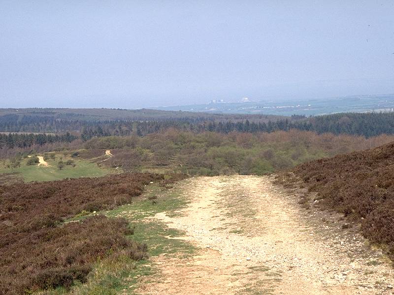
Wills Neck is a heather-covered dome rising to 386 meters, or around 1275ft. The views from the summit are superb. The Quantocks themselves are seen end-on in both directions, of course, but the countryside to either flank is superbly presented. Of particular interest are the views out to the northeast; the Bristol Channel is well seen. The prominent building near the coast is the Hinckley Point power station. The town of Bridgwater is in view about 9 miles away due east, while on clear days you should make out a good proportion of the rest of the Somerset Way across the Levels. The Mendips, Wells and Glastonbury Tor should all be seen; if the visibility is particularly good you should be able to spot the Severn Bridges, linking England to Wales across the Bristol Channel, way over to the northeast. They will be in view for another twelve days: it will not be until Leckhampton Hill near Cheltenham before you lose sight of them again for the last time.


Great Hill and Crowcombe Park; the summit trig point; the SE descent path
My route from Wills Neck goes eastwards, down the dip slope towards Aisholt. The path slanting down across Aisholt Common left the main ridge path from the col north of Wills Neck, but it's a simple matter to pick your way across the heather to the path junction at Black Knap, about four hundred meters away. Just head for the trees.

If you wish to vary the route and stay on the main ridge, descend Wills Neck to the southeast. The ridge path continues to Birches Corner, meeting the road network. Keeping straight on, follow the road and then another track across the shoulder of Merridge Hill; you have the option of climbing to the summit of Cothelstone Hill (332 meters elevation) just to the south. The track hits a road again through Buncombe Wood, from which another track ascends Broomfield Hill and joins my main route.
There are further options available from Cothelstone Hill; you could descend to the southeast and pick up the paths and lanes to Broomfield via Raiswell Farm; alternatively it's possible to drop down Ball Lane to Cushuish and make your way by paths and lanes via Greenway to Kingston St Mary.


Assuming that you've left the main ridge and are following my main route, follow the path around the south edge of the forest above Aisholt Common. There is an alternative available, involving the descent from Light Gate southeastwards down the coombe to Durborough Farm.


The main route keeps to the edge of the forest for about a mile, giving good views over Taunton vale to the south. At Parsons Plantation take a path forking off to the right. There is yet another alternative available here, which bypasses Aisholt to the north; stay on the forest edge path and continue past Parish's Lodge to meet a motor road that takes you to the west end of Hawkridge Reservoir.


The lane down to Higher Aisholt farm
The path down to Higher Aisholt Farm crosses an open slope at first but soon becomes enclosed by hedgerows. Woodland flowers make it a delight in late Spring, particularly the carpet of bluebells that grow here. From Higher Aisholt Farm the path crosses an open meadow to cross a stream at a small gap in the trees; the ground here is a bit boggy. Climb the far pasture (no path but the line is obvious enough) to enter Aisholt right by the church.


Descending to the stream; entering the village; the path passes a superb private garden
Aisholt is a tiny locality and seems to wear an air of serene peace. Walk north along the lane for about 200 meters, where you will find a public footpath heading right behind a private house. The path continues past the house towards Aisholt Wood nature reserve, and you cannot fail to be envious of the garden. (If the owner ever wants to sell up would he contact me? Only joking, I could never afford it).


Aisholt Wood nature reserve
The path winds through the nature reserve, curving around from northeast to east. Cross the stream at a ford about 500 meters beyond the house. The track continues through the trees to the east though there is scope for confusion here; the right of way forks left shortly before the end of the wood. If you stay on the track you will end up at a gate liberally decorated with barbed wire, which isn't easy to climb over. Why the right of way can't stay on the obvious track is a mystery.
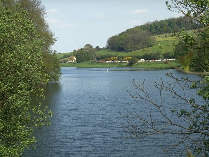


Hawkridge reservoir from the west; The footpath south to Merridge; Hawkridge Wood
Beyond Aisholt wood you emerge onto a minor road at the west end of Hawkridge reservoir. Follow the road south (for Lower Aisholt) but after a short distance turn left at a junction to follow a road around the south shore of the reservoir. After another 400 meters you'll find a public footpath heading off right to climb up through Hawkridge Wood to Merridge, about a mile to the south.
At Manor Farm you hit a road junction but a footpath continues straight on, to ascend Broomfield Hill (elevation 290m).


At the top of Broomfield Hill turn left for another footpath that runs for about 600 meters along the hill's summit ridge. There is a trig point in the field off to the left but there is no access to it. At the end of the path you merge with a minor country lane. There is a junction a short distance beyond, at which you turn right.
The lane heads south for another mile through hilly pastoral scenery. Another lane merges from the right, together with a footpath from Raiswell farm; if you followed one of the alternative routes from Wills Neck you should join the main route here. Now turn left for Broomfield. The grounds of Fyne Court lay to the left.
Just after Fyne Court's access drive, and just before the church that comprises most of the hamlet of Broomfield, another footpath hops off to the left. You can choose to stay on the lane but the path winds through a delightful shallow coombe eastwards of Fyne Court and is rather enjoyable. The path comes out at a dark minor lane that curves round, deeply hidden within trees, back round to the south towards Broomfield again. Where the lane turns right keep straight ahead, along a footpath to the southwest. The path climbs through another coombe to reach the road network once more; follow the road leading straight ahead. It runs for a mile, descending a long spur of land into Kingston St Mary.
When you reach the village turn right and walk into the village centre. At the main road junction you will find a short flight of steps up to the left; this gives access to a footpath running past a series of back gardens and heading south to Parsonage Farm.


Kingston St Mary; the footpath to Parsonage Farm; the footpath to Nailsbourne
From Parsonage Farm continue straight across Parsonage Lane and follow another footpath to Nailsbourne, half a mile south.

The most satisfying aspect of the local footpath network hereabouts is that it is well defined, easy to follow and free from obstruction. This is, unfortunately, still a rarity in the English countryside.
The next objective is the neighbouring locality of Dodhill. There are a number of footpath options available here and the route is a little complex, but the most straightforward route runs beside a couple of pastures behind Nailsbourne, crossing a stream by a small footbridge.

The footpath beyond the bridge merges with a driveway that serves Dodhill farm. Follow the driveway out to the road and turn right. At the next field boundary about 50 meters ahead, a footpath heads diagonally across the pasture to the southwest. A gate at the far corner (you may have to search to your left a little to find it) leads out onto another road. Follow it to your right.

It's been a long day and no doubt you're getting tired now. Take heart for the complexities are nearly over. Having come out onto the lane from Dodhill, walk southwest along it for 200 meters and then turn left, bypassing Smoky Farm along a track. Beyond the farm make sure that you're on the right-hand side of the fence. The track passes under two sets of power lines; at the second set the path switches to the left side of the fence and continues southwards past an apple orchard to reach the road just east of Staplegrove.
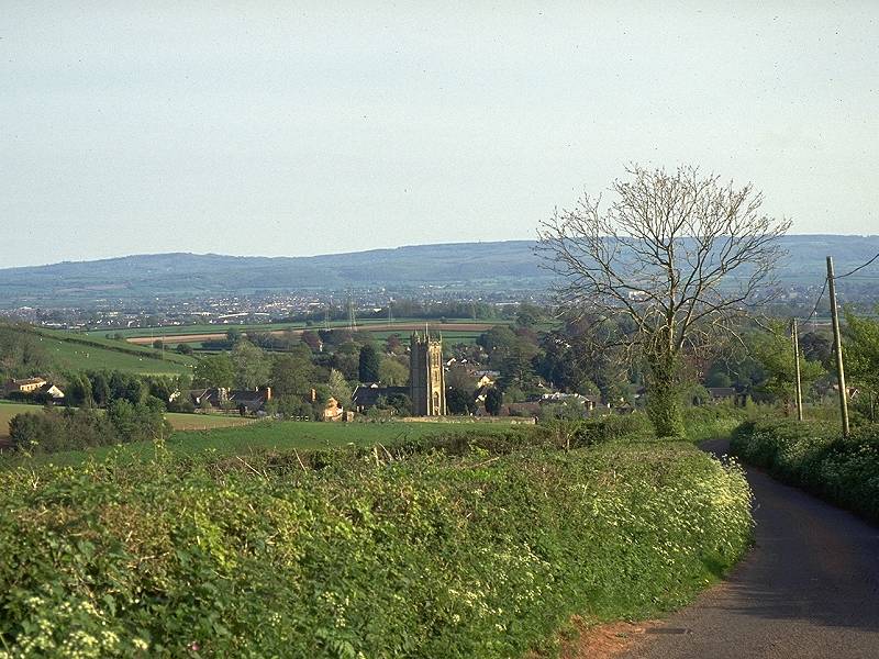
Turn left and follow the road for 300m to a junction (the road coming in from your left is an alternative route from Dodhill). There is a staggered junction here; turn right then left. The road crosses a stream and arrives at the northern extremity of Taunton.
The railway station is just along the road north from the aforementioned road junction; to reach it turn left instead of going straight on to cross the bridge. The station has a fast and frequent service to London (just 2 hours away) while Bristol, Bath, Exeter and Plymouth are even nearer. The bus station lies south of the town centre and can be found by rounding the grounds of the castle.
![]() Service
28, Minehead - Dunster - Bicknoller - Taunton
(Mon-Sat) (Summer 2002 timetable)
Service
28, Minehead - Dunster - Bicknoller - Taunton
(Mon-Sat) (Summer 2002 timetable)
![]() Service
928, Minehead - Dunster - Bicknoller - Taunton
(Sun / Bank Holidays) (Summer 2002 timetable)
Service
928, Minehead - Dunster - Bicknoller - Taunton
(Sun / Bank Holidays) (Summer 2002 timetable)
| Dunster to Bicknoller | Back to Somerset Way index | Taunton to Langport |
This page last updated 4th January 2008
![]()