


| Hebden Bridge to Ponden | Back to Pennine Way index | Thornton in Craven to Malham |


| Hebden Bridge to Ponden | Back to Pennine Way index | Thornton in Craven to Malham |
There are three villages on the route - Cowling, Lothersdale and Thornton-in-Craven itself - and all have both public transport links and accommodation, allowing you to adjust the length of your walk to suit your own whims. It's traditional, in fact, for through hikers to make their overnight stop at Cowling or Lothersdale, having started out from the Calder Valley, and then to press on from there to Malham the next day. Personally I think that's too much of a slog. The Aire Gap is there to be savoured. The terrain can be quite arduous - effectively you swap a couple of big ascents for several smaller ones, and the effect can be equally or even more tiring. Ponden Reservoir is two miles from Haworth (and only one mile from Stanbury, the end of a bus route out of Keighley), while Cowling, Lothersdale and Thornton all have frequent buses to Keighley or Skipton (to the east) or Colne, Nelson and Burnley (to the west).
|
|
|
| Length: | 12.4 miles / 20 km |
| Total ascent: | 2345 ft / 715 m |
| Total descent: | 2631 ft / 802 m |
| Estimated time: | 4 hrs 47 mins |
The walk begins at Rush Isles Farm at the southwestern corner of Ponden reservoir. This spot cannot be reached by public transport but it's a one mile walk from Stanbury, the terminus of the hourly bus from Keighley, and only two miles from Haworth.
Ponden Reservoir
The route follows a vehicle track around the south side of Ponden Reservoir. After some 400m you pass Ponden Hall, which was allegedly the model for Thrushcross Grange of Wuthering heights fame and nowadays is a centre for residential courses. It reputedly offers accommodation and refreshments though I saw no evidence of this when I passed it in 1989.
The environs of Ponden Reservoir
You pass a cottage which Wainwright illustrates as abandoned and derelict but which is now very much restored, then reach a gate and stile where there is something of a trail crossroads - the Bronte Way heads off westwards while the Pennine Way turns right to run past the western end of Ponden Reservoir and cross the river Worth. Just over the bridge you reach the Keighley - Colne road. Follow this for a few paces westwards then turn right into the steep coombe of Dean Clough.
Ponden Reservoir
The Pennine Way at the west end of Ponden reservoir

Road west of Ponden reservoir
There's a lot of confusing detail on both the map and the ground here and it's very easy to go wrong. The aim is to climb through the coombe of Dean Clough, keeping the watercourse itself about 150m to your left.
Dean Clough
The path is sketchy and confusing. You first climb through a couple of pastures, dotted with stands of trees. Tend to the right towards a prominent house half way up the slope, and once you reach it go left to pass between the house and the barn that stands in front of and below it. The path enters the grounds of the house (or did at the time of writing). Keep the house to your right and go around behind it, taking the driveway for a short distance. Then follow the path marker to the left beyond a stone wall. This path follows the line of the wall through tree cover. Assuming you manage to find the correct route, you come out onto another road some 500 metres north of, and 400 ft higher than, the lower road past the reservoir.
Looking back at Ponden Reservoir
upper Dean Clough
Turn left onto this road and follow it around a sharp left hand bend, around the head of Dean Clough. Some 300 metres past the stream, just after the road begins to curve right again, look out for a footpath heading sharp right uphill. It's a bit steep at first, but after 150 metres it swings to the left and progresses at an easier gradient alongside a wall.
Retrospective view of Ponden; footpath to Wolf Stones; old quarry
Moorland scenes and the Wolf Stones track
The path, climbing the aptly named spur of Bare Hill, now curves gradually around to the right, climbing again to hit a ridge top at a fence, crossed by a stile. (On the occasion of my visit in 2003 the fence was in the process of being replaced). Here you cross from the former county of West Yorkshire to North Yorkshire, and leave the metropolitan district of Bradford to enter the rural district of Craven. Flagstones have been laid here recently. Some 300m to your left is a nameless 1453 summit and an OS trig pillar, with the outcrop of Wolf Stones just beyond. Wolf Stones marks the boundary of Yorkshire with Lancashire, which is the only major county of northern England which the Pennine Way does not visit.
Boulsworth Hill to the west; Bare Hill
Ickornshaw Moor
Follow the path down, approaching an enclosure wall, and cross the curiously named watercourse of Andrew Gutter. You will pass an empty stone cottage and couple of curious little shacks on your left, reaching the locality of Further Dean Hole at the top of a steeper slope. The Way turns right here, more or less following the lip of the slope past Higher Dean Hole.
Ickornshaw Moor and shack country
This locality has an air of neglect, with its shacks and ruined buildings and collapsed walls. You pass six or seven of these shacks before crossing a wall and turning hard right. Be warned - the path in this area is dog rough and it's easy to rick an ankle.
The Pennine Way above Ickornshaw
Go down through a little dell then up to the lip of the slope again to reach the head of the coombe of Lumb Head Beck. The path now turns right again just short of a farm, heading generally north.
The Way above Lumb Head Beck
Lumb Head
You're now heading more or less directly for Ickornshaw, the locality at the western end of the village of Cowling, but there are still a number of intricacies to look out for. The route runs slightly uphill to hit the end of Lumb Lane, heading off west, then down the shoulder of the hill to Lower Summer House Farm.
Lower Summer House Farm
Keep the farm buildings to your left then go through a gate in a wall. Head down the pasture, tending towards the wall to your left. You should see Cowling church a little distance ahead; keep this some 20 degrees to your right, and you should hit the A6068 Colne - Keighley road at the correct point.
Arrival at Ickornshaw
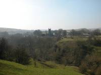
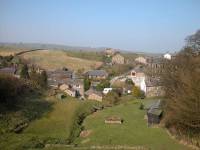
Ickornshaw from the main road
![]() Route
21, Keighley - Cowling - Colne - Burnley
Route
21, Keighley - Cowling - Colne - Burnley
You've reached Ickornshaw, a "suburb" of the extensive village of Cowling which spreads for a mile of so to the east. There's not much at Ickornshaw itself apart from the Black Bull pub just to the left, but Cowling itself has a number of shops. The Colne - Keighley bus service runs this way, affording you the opportunity to break the journey here.
The Black Bull, and the PW to the north
The Pennine Way leaves the main road by a narrow stone stile about 100m east of the Black Bull, from which a narrow grassy path alongside a fence leads down to a lane through the village. Turn right onto the lane.
Scenes in Ickornshaw
The map shows the Pennine Way bypassing the greater part of Ickornshaw to the west, but its divergence from the lane through the village is unmarked. It doesn't matter, it's easier (and more elegant in my view) to walk eastwards along the lane to Cowling church, and then turn left and walk up Gill Lane. A little way along is the curious row of terraced houses called Middleton, looking for all the world like an inner city street.
Holy Trinity Church and Gill Lane
Take a look backwards from Gill Lane, and at the eastern end of the ridge you've just left you will see the prominent towers on Earl Crag. Wainman's Pinnacle lays halfway along, Lund's Tower further east.
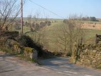
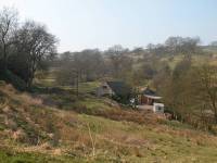
Walk north to a cluster of houses at a bend, from which a tiny lane goes steeply downhill half right. Take this lane down to Gill Beck, crossing the bridge and turning sharp left to come back along the north side of the gill on a grassy path. As you near the cottage turn right to follow the east bank of a shallow, grassy coombe. The path here is sketchy to nonexistent.
Path on north side of Gill Beck
Pathless route away from Gill Beck
Follow the map carefully, navigating by field boundaries and stiles. There are no paths to follow. Most of the stiles hereabouts take the form of stone steps jutting out of the enclosure walls, usually adjacent to gates. Several footpaths other than the Pennine Way cross these pastures so it's easy to find yourself going the wrong way. Initially, leave the farm of Low Stubbing about a hundred metres to your right. From the stile one field above Low Stubbing tend to the left, vaguely towards the cottage of Low Windhill (second image above). Then, find the gate in the hedgerow (third image above) and walk north towards High Stubbing.
Leave High Stubbing (first picture above) immediately to your right, walking between it and the adjacent stone wall. Now tend left across the succeeding pasture to the top right gateway (image below).
Pennine Way above Stubbing
Continue along the west (left) side of the subsequent field boundary until you come out onto the high road west of Cowling Hill.
walls and pastures; the Pennine Way above Stubbing
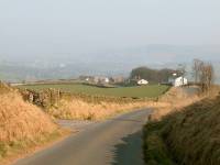
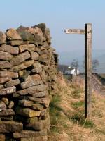
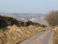
Go along the lane eastwards for a few paces and then turn left into a narrower lane, heading downhill towards Over House farm. Just before the farm the lane swings left. At the next (right) bend, leave the road at a footpath marker pointing straight on.
This is another pathless and quite intricate section. Head downhill, tending left across the pasture, then head downhill adjacent to a line of trees and a ditch. At the bottom is a ford over Surgill Beck. Go through the gate on the far side of the ford and follow the west side of the hedgerow up to Woodhead Farm.
Heading down to Surgill Beck
Crossing Surgill Beck
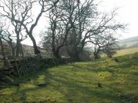

North of Surgill Beck; Woodhead farm
Woodhead Farm has featured in more than one written account of the traverse of the PW as a famed B&B stop, but I'm unable to find it listed in any of the current accommodation guides. From the farm continue along the driveway, which climbs to the shoulder of a hill. From here you see the village of Lothersdale below.
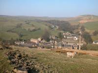
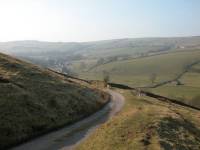
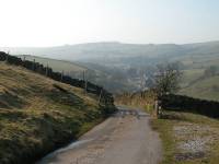
The approach to Lothersdale
Lothersdale is a thoroughly charming little place, nestling snugly within the confines of the surrounding slopes. Its single mill chimney looks tiny from up on the hill. Follow the driveway around a left-hand bend, then sharp right down to the main road through the village. There's a shortcut over grass but it's unmarked and difficult to find from above.
Entering Lothersdale
There's not much at Lothersdale - the Hare & Hounds pub, a shop / post office (closed Saturday afternoons and Sundays), and a handful of narrow lanes and surrounding the mill stream that invite exploration. There's a bus service to Skipton if you wish to break the journey here.
![]() Route
79/80, Skipton - Lothersdale / Cowling
Route
79/80, Skipton - Lothersdale / Cowling
Lothersdale
The main road; the PW leaving Lothersdale
Walk a couple of hundred metres through the village to the east. Just after the pub a lane leaves to the left (north), and a Pennine Way marker directs you along it. The lane runs up past a wall and a line of trees, then turns right then left to end up in a large barn. Go left just before the barn and walk northwards uphill along a wide grassy rake.
The Pennine Way out of Lothersdale
There's a line of trees over to your right, marking a small watercourse. This watercourse eventually swings right to cross the pasture; keep to the left here near the wall (second picture below) then continue northwards, heading for a gate at the far top left of the pasture.
Looking back at Lothersdale; passing the head of the watercourse; PW to Kirk Sykes
top of the pasture
At the top corner gate (pictured above) go left and through a short pasture to come out on a minor road. Directly opposite is the driveway to Kirk Sykes Farm.
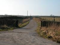

The driveway actually runs very close to two farms; Kirk Sykes is on the right, Hewitts is on the left, and I'm not sure if the driveway serves one, or the other, or both. It's ultimately unimportant as the PW slides between them, reaching a gate and stile into rough pasture (second image above). Follow the path, which hugs a stone wall immediately to the left of the route, tending uphill. After a short distance both wall and path turn left to head westwards towards Pinhaw Beacon.
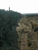
heading west to the beacon
Pinhaw Beacon is the highest point of Elslack Moor, a small but surprisingly wild patch of heather moorland. It doesn't take long for the wall and path to diverge. As you progress uphill you begin to see a couple of dark rises ahead of you, and the distances look vast. But when you look at the map you see that Pinhaw Beacon is only 900 metres away from the point at which the path turned left. Elslack Moor somehow contrives to look much bigger than it actually is. Don't worry, you're on the right path.
The Pennine Way approaching Pinhaw Beacon
Elslack Moor is managed for the rearing and shooting of grouse, and you're likely to see a notice or several requesting that you stay on the route of the Pennine Way. The route rises gradually, crossing the shoulder of a couple of low hills rising to the right, before topping a final rise to arrive at the trig point of Pinhaw Beacon.
Pinhaw Beacon sits at 388 metres or 1251 feet above sea level, and is not a bad viewpoint. Over to the southwest across the moor is a cluster of communications masts and it looks as though the PW is headed that way, but that's a false impression. You're actually headed for a road junction almost due west and only 500 metres away. The view is best towards the north and northeast, however. Skipton can be seen, while further away and more to the north it might be possible to see Malham. On clearer days Pen-y-Ghent should be in view to the north northeast, some 25 miles away.
descending from Pinhaw Beacon
approaching the road junction
From Pinhaw Beacon follow the obvious path to the west. The path forks into two, but both branches come together again not much further on. After some 300 metres from the summit you see that you are approaching a road junction, with one road crossing northeast to southwest and the other heading straight on. Your route follows this road.
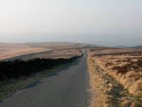

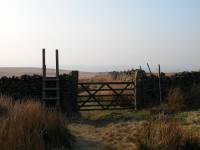
Elslack Moor road; the turnoff for the Low Hill track; Low Hill
Follow the road to the north west. For about 800 metres you have tarmac under your feet but it's not destined to last. Look out for the line of a wall diverging from the road to the left across the open moor. The Pennine Way follows this wall on its south side. Leave the road at the point of divergence, go through the gate or over the stile, and plod onwards.
Low Hill
Just around here the moor is called Low Hill. Just a bit further on it becomes Park Hill. There's no obvious difference. The wall runs pretty much in a straight line, with rough grassland either side. There's nothing to see, save for a sketchy track that diverges to the left to head for Earby youth hostel.
The Pennine Way crossing Park Hill
Low Hill becomes Park Hill at some indeterminate point. This pasture has always been notoriously sloppy and in the past the path made wide diversions to the left to avoid the boggier bits. Recent remediary work has been put in hand, and the worst bits of the route are now paved with flagstones or provided with wooden duckboarding. It rather serves to diminish the wilderness feel of the place, but it has made progress that much easier. You want to arrive at Thornton with a smile and clean boots, don't you? Well, then.
After what seems like an eternity but which is probably more like twenty minutes, the path starts to head downhill and you see gentler scenery ahead. Shortly afterwards you reach a footbridge across a stream to which the map doesn't give a name, but which I'll christen Brown House Gill. Once across the bridge you're in the grounds of Wood House Farm and once again you're in a world of green pastures with no obvious path. The rule is simple - stay with the gill close to your left. Walk downhill, tackling the odd stile and gate as they appear.
The Pennine Way between Wood House and Brown House
Eventually you reach the lowest pasture, and are now entering the grounds of Brown House farm. Find the gate in the bottom left corner (third image above), cross the wooden plank bridge across a ditch just beyond, and head for the bottom of the small rise with the house on top.
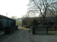
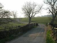
Leaving the house on the bank to your left, cross the pasture towards the cluster of buildings that is Brown House farm. It's a confusing spot and at first you might conclude that you've gone the wrong way. The correct exit from the pasture is via a gate and stile at the bottom left corner - once across it you're on the hard concrete stand of the farmyard (first image above). You'll see the farm driveway in front of you - make for it and follow it away from the farm towards Thornton in Craven.
Brown House Farm to Thornton, and the railway bridge
The farm driveway is quite elegant and could almost be the access drive of a country manor. It runs for some distance, with pastures of neatly trimmed grass on each side. eventually turning hard to the right just by an old railway bridge. Pass under this bridge and follow the vehicle track into Thornton, just beyond.
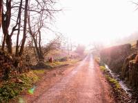
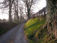
Approaching Thornton-in-Craven
The track into Thornton runs round a wide curve then begins to slope uphill, rather a cruel fate for weary legs. The track itself is charming enough, lined by trees and hedges either side. and the road from Thornton to Skipton begins to converge from the right. Finally the lane becomes a residential road, and you arrive swiftly and without ceremony at Thornton-in-Craven.
Arrival in Thornton-in-Craven
Thornton is a charming enough village but just about every guidebook writer pauses to lament the volume of traffic, and two have found cause to comment about the dismissive attitude of one of the local pub landlords to the hiking fraternity. Hopefully things have changed in that respect since those books were written (any first hand experiences and opinions one way or the other are welcome). There is B&B available in the village, and of course there's the hourly bus service into Skipton.
![]() Route
215, Burnley - Colne - Thornton in Craven - Skipton
Route
215, Burnley - Colne - Thornton in Craven - Skipton
|
Top Withins to Thornton, 278 images, £5.50 Note: Payment by credit card is handled by Pay Pal. If you are not already a member, their validation of your account can take up to 4 weeks. |
| Hebden Bridge to Ponden | Back to Pennine Way index | Thornton in Craven to Malham |
This page last updated 30th November 2004
