
| Blackstone Edge to Hebden Bridge | Back to Pennine Way index | Ponden to Thornton-in-Craven |
| Blackstone Edge to Hebden Bridge | Back to Pennine Way index | Ponden to Thornton-in-Craven |
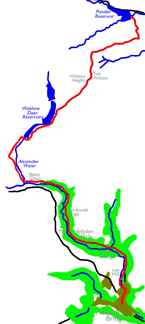
There's quite a multiplicity of routes available from Hebden into the vale itself; most of them are shown on the diagram above. Personally I favour the easternmost option, keeping hard by the river, as far as New Bridge; from then on the riverside path is preferable to the manicured driveway further up the bank.
From the watersmeet at Blake Dean there's
just a kilometre of path alongside Alcomden Water to rejoin the Pennine
Way proper at the Walshaw Dean reservoirs. If you wished you could cut
this corner out by following the Haworth to Hebden trail over High
Rakes.
This alternative is not shown in the diagram above but you'll find it
readily
enough on the OS maps. I don't recommend it as it involves an
additional
ascent and descent. The official PW climbs up to the moors at Withins
Height,
where there is a real change of character; you cross from metropolitan
borough of Calderdale into the rural edge of the City of Bradford, and
from the birthplace of Methodism into the landscape of the Bronte
sisters.
Just below the watershed is the ruined farmhouse of Top Withins, by
common
consent reckoned to be the setting for Wuthering Heights. Haworth
itself,
where the Bronte sisters lived, is just a few miles to the east. Once
you
finish the day's walk at the dam of Ponden reservoir then the two mile
walk into Haworth will reward you with both a cream tea and a trip on
the
steam railway into Keighley for your journey home.
|
|
|
| Length: | 10.3 miles / 16.6 km |
| Total ascent: | 1983 ft / 604 m |
| Total descent: | 1520 ft / 463 m |
| Estimated time: | 3 hrs 59 mins |
Map: OS 1:25000 Outdoor Leisure 21 (South Pennines)


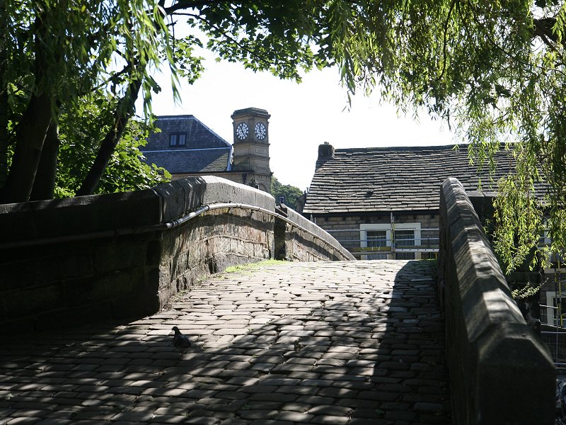


Street scenes, Hebden Bridge
The route out of town depends largely on
which
of the many alternatives you intend to follow. For my favoured route,
hoewever, make your way to the north end of the little cluster of
shopping streets and then follow the road signs for Keighley; this road
is initially Commercial St and then Keighley Road, and it goes pretty
steeply uphill. The river is some way down to your left and you can
fully appreciate the way that the town is laid out, as a series of
terraces climbing up along the steep valley sides.
At a complex junction on a left-hand bend, turn left into Foster Lane
(first image below) and then follow it to the far end and continue into
Spring Grove. A block of streets just to the south features
back-to-back houses, once a staple of Northern industrial towns but now
a rarity.

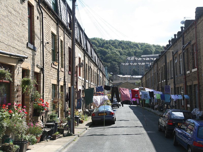
Steep streets and real back-to-backs
Follow Spring Grove, a street
of handsome new houses, to its far end. A small bridge gives access to
the riverside path; cross it and turn right.


Spring Grove and the riverside path


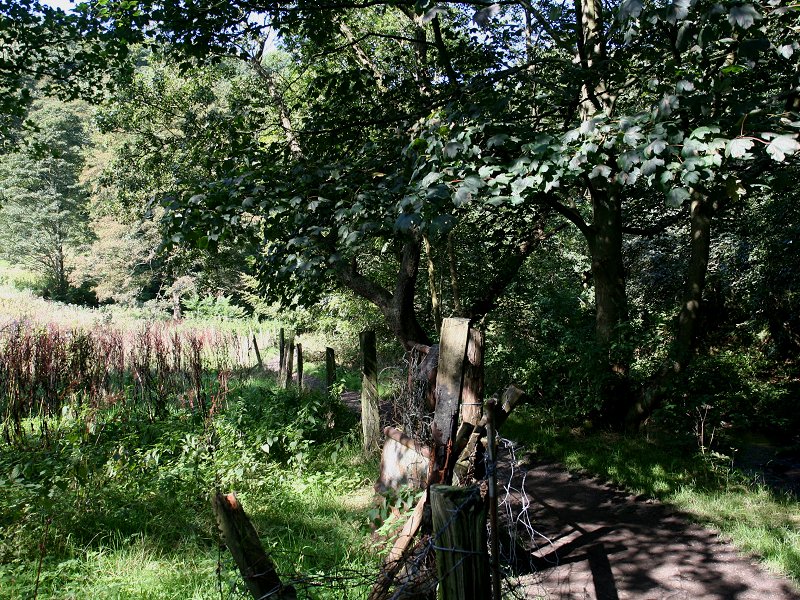
At New Bridge, the road crosses the side stream coming down from Crimson Dean and then turns sharp right. One variant of the Howarth - Hebden Bridge trail takes this route if you are following it in preference. If you ignore the main road off to the right, however, and choose the driveway straight on into the woods, then you enter the world of Hebden Vale.

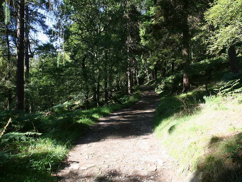
Hebden Vale: main track and riverside path
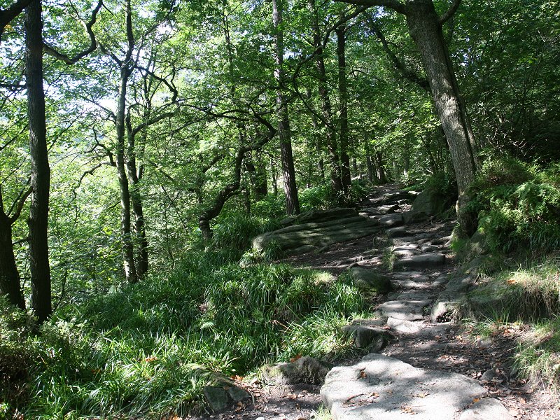
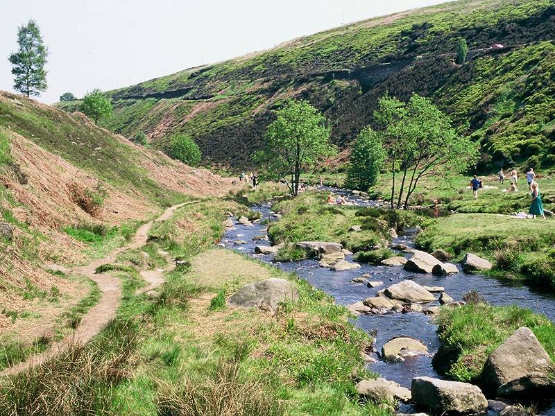
Hebden Vale is lovely. It features a lively, winding river set in shallow ravine and is cloaked in deciduous woodland with a large variety of tree species. Initially the walking is on a wide, level driveway but you will soon find opportunities to escape down to a simpler path hard by the riverbank if you wish. The vale is alternatively known as Hardcastle Crags, though properly this description belongs to a particular rock feature about a mile and a half west of New Bridge. Some tourist literature also promotes the vale as "Britain's Little Switzerland", though the lack of any soaring, glacier-covered peaks on the horizon rather spoils such a rose-coloured view of the place. It doesn't need any such hype. It's beautiful on its own terms.


The riverside path in Hebden Vale


Hebden Vale near the mill
About three quarters of a mile out of New
Bridge the main driveway and riverside path come close together in the
vicinity of Gibson Mill. Once defunct, is is now within the ownership
of the National Trust who are restoring it as a visitor and education
centre.

Gibson Mill

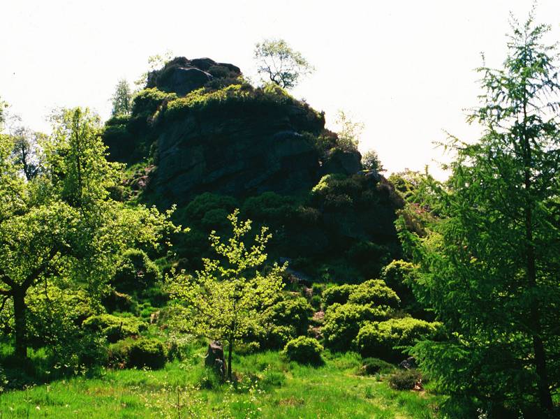
Half a mile beyond the mill, with the vale pulling out of a long right-hand curve, the outcrop of Hardcastle Crags is seen between the main drive and the river. As far as I am aware the crag plunges fairly precipitously to the riverbank leaving no room for a separate riverside path. The crag is a spooky, complex affair with a number of paths reaching several minor tops. Finding the way to the true summit is a matter of trial and error, but rewarding.


Ascending the crag


The summit of Hardcastle Crags
From the top of Hardcastle Crags the nature of Hebden Vale is seen to full advantage - you get the best possible idea of the lie of the land, the dimensions of the ravine and the variety of tree cover from here. Not far north of the crag the track splits, the main route diverging to the right to climb out of the vale to the locality of Walshaw. From here the other leg of the Howarth - Hebden Trail leaves to climb over the moors to the north, while yet another alternative track runs parallel to the vale to the north, rejoining our route at Holme nearly two miles further ahead.


Scenes in Over Wood
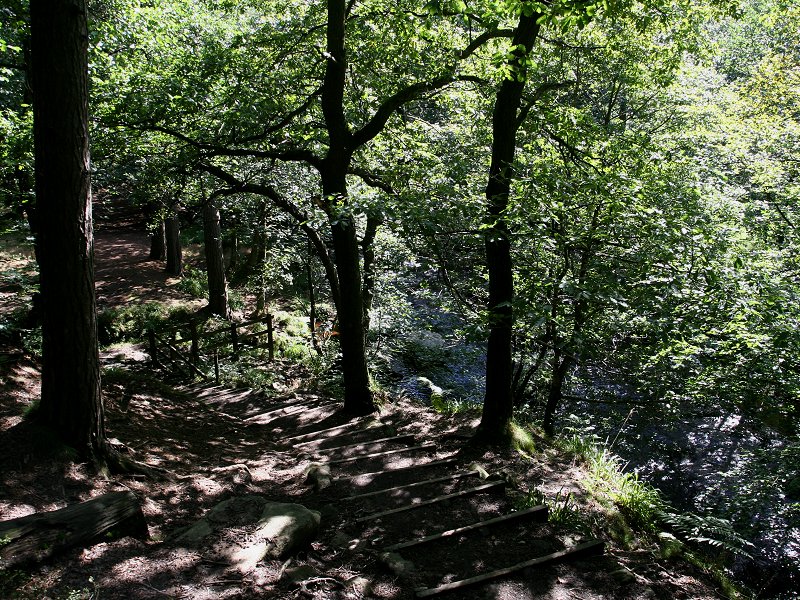
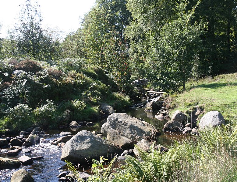
Hebden Vale itself curves back to the left now, running northwest and then west through Over Wood. Once again there are two parallel routes; a track some way above the riverbank, and a simple riverside path which is barely discernible on the map amongst the wealth of detail. For about 400 metres the main (upper) track comes out into the open and passes a cottage before re-entering woodland. The path in this vicinity is poorly defined and becomes rather choked with undergrowth in high summer.
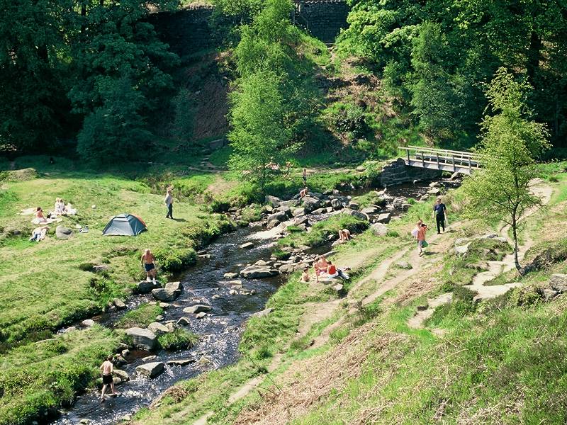
The wood begins to thin, then peters out and you come out into open country. Depending on which path you followed, you are either some way up the bank to the north of Hebden Water, or down in the ravine by the side of the stream itself. From the point of view of scenic value there really isn't much in it. Backpackers will be eyeing the patches of turf by the stream's edge for suitable pitches for an overnight stop - this really isn't a good idea as there is a motor road running along the lip of the southern bank of the ravine. This locality is marked on the map as Black Dean - confusingly, five hundred meters further west, where you're headed, is Blake Dean.


Black Dean / Blake Dean is obviously a well known local beauty spot, judging by the crowds of people who were present when I took these photos. The nearby motor road - an unclassified lane that crosses the Pennines by Widdop reservoir and heads for Burnley in Lancashire - ensures relatively easy access. If you like to avoid crowds and have scenery to yourself then you're going to be disappointed at Blake Dean.


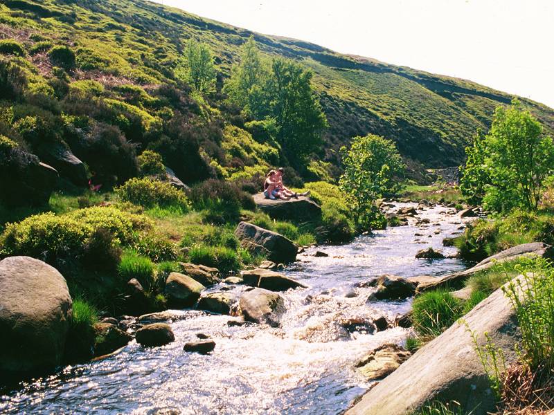
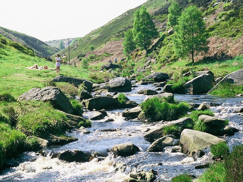
Hebden Water at Blake Dean

Approaching Blake Dean footbridge.


Blake Dean footbridge
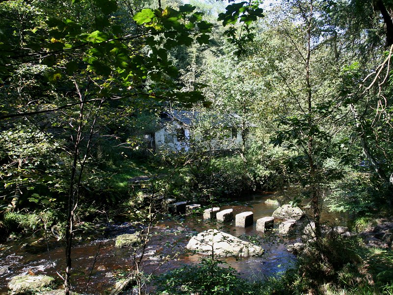
At Blake Dean itself the high track and
the
riverside path converge. Two streams, Graining Water and Alcomden
Water,
meet here to form Hebden Water. A footbridge carries the track over
Alcomden
Water. The main track turns left but you should leave it and take the
steep flight of steps a little to your right, which comes out onto a
track running above the left bank of Alcomden Water.


Blake Dean and the track by Alcomden Water


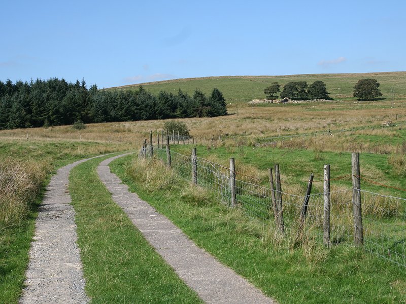
Turn right now, onto the waterworks road.
The scenery changes quickly; trees and lush pastures fall very quickly
behind, to be replaced by empty moorland, in which the Walshaw Dean
reservoirs and the lodge seem rather incongruous. After about 500
metres you come level with the dam of Walshaw Dean lower
reservoir,
which stretches about a kilometre ahead to the northeast. The Pennine
Way used to follow the track along the left (west) bank of the
reservoir, past the lodge, but a recent change now takes it across the
dam of the lower reservoir and along the east bank.


Walshaw Dean lower reservoir


Crossing the dam
Once across the dam turn left
and follow the path way between the reservoir (to your left) and a
drainage channel (to your right). In about a kilometre you reach the
southern end of the dam of the middle reservoir.


The track alongside Walshaw Dean lower reservoir
In the unlikely event that you have been following the entire End-to-End route meticulously from Land's End, you may like to know that the middle reservoir dam is, as far as can be determined, half way to John O'Groats. The exact halfway point has varied somewhat as I've revised the route here and there; at one point it was a few miles back at Gibson Mill. No doubt the exact point will change again. However, I have adopted it as the psychological halfway point. 696 miles down, about the same still to go. Feel like attempting the rest?
Good!
The path now continues alongside Warland
Middle reservoir. The reservoir is longer than its lower neighbour but
it curves to the
left,
hiding its upper reaches initially. The rest of
the
body of water now reveals itself as you progress.


The Pennine Way running beside Warland Middle
reservoir
About 800 meters from the dam the
waterworks
road bridges Black Clough, at which point the reservoir bends round to
the left. Some 200 meters further on, just after going through a gate
in
a drystone wall, the Pennine Way leaves the waterworks road to
climb
the open moorland on an ENE bearing. You're heading for Withins Height.

Warland Middle reservoir


The PW climbing away from the reservoir for
Withins Height


At the watershed you pass from Calderdale
borough into the City of Bradford. The top of Withins Height seems to
catch
most guidebook writers in a sombre mood. "A new and unattractive
landscape
is revealed ahead," writes Wainwright, "dreary moorlands descending
gradually
to the valley of the river Worth. The foreground is harsh and sour,
without
life and without beauty." The writer of the Dutch guide to the Pennine
Way, Gerard de Waal, was just as dismissive: "...a vast wasteland of
heather
and peat...what stands out in my mind about this grim area was the
dreadful
wind and rain on this exposed moorland." Turning to Barry Pilton for
light
relief, we find him in a state of near terminal exhaustion with various
bits of both body and kit malfunctioning, laying in a ditch
waiting for the vultures to arrive. It just shows that the mood of any
moorland locality depends to a large extent on the weather conditions
under
which you first experience it. For my part, sitting on a stone, gazing
over the sun-dappled moors at distant vistas of trees, fields and
far-off
townships, I was entirely unable to reconcile this scene of peace and
beauty
with the torrid descriptions in the books.


The borough boundary on Withins Height

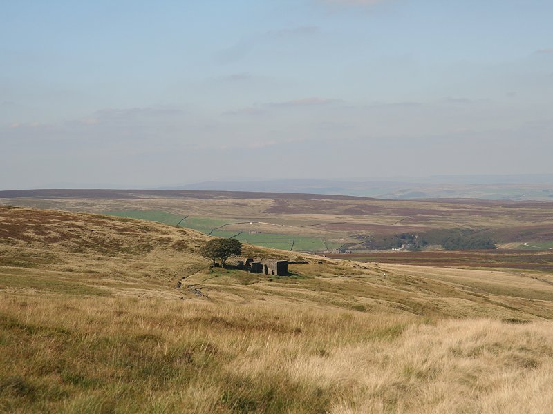
Top Withins
Not very far below the watershed is the roofless shell of a farmhouse once known as Top Withins. Public imagination has decreed that this house was the real-life model for Emily Bronte's "Wuthering Heights", even though there is neither documentary nor anecdotal evidence that there was any correlation, either intended or subconscious. It is almost certain, however, that Ms Bronte knew the place. "The buildings," reads a plaque on the ruin placed by the Bronte Society, "even when complete, bore no resemblance to the house she described, but the situation may have been in her mind when she wrote of the moorland setting of the heights."

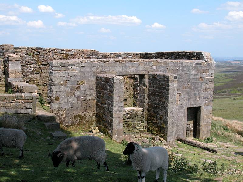


Top Withins, and the Bronte Society plaque
Whether or not she ever based Wuthering Heights on this particular homestead, the association has stuck and the place receives streams of visitors. The track down to Haworth, rough though it is, is thronged at most times of the year with tourists of all nationalities, many inappropriately dressed, most waving Sony Handicams and wearing expressions of earnest intent. "Wuthering Heights must be the only novel ever to have attracted groupies," observes Barry Pilton.
If you stop for a food break here watch the local sheep - they can be very assertive and won't take no for an answer if they fancy your sandwich. A gentle but firm tap on the nose usually discourages them.
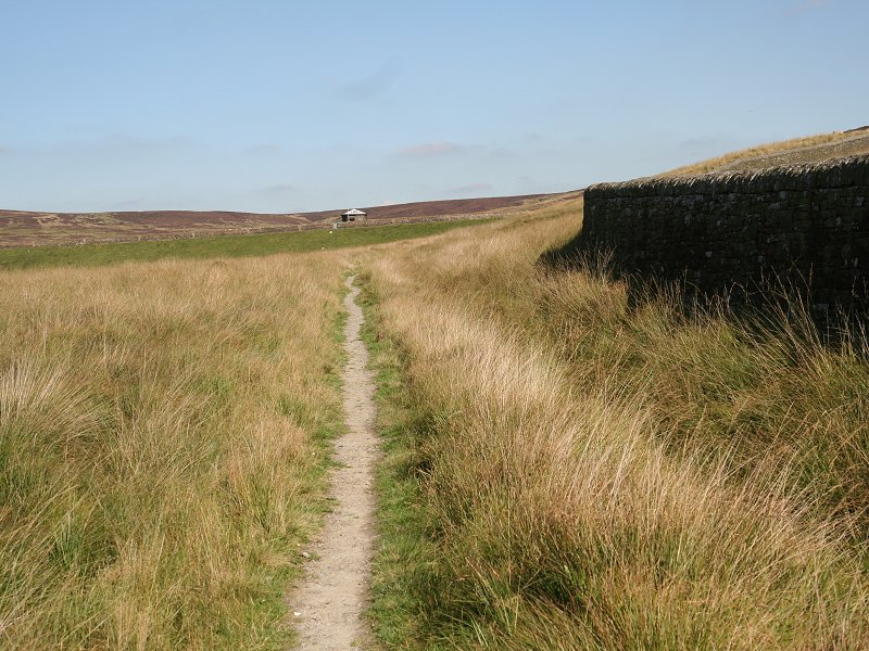
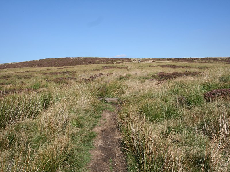
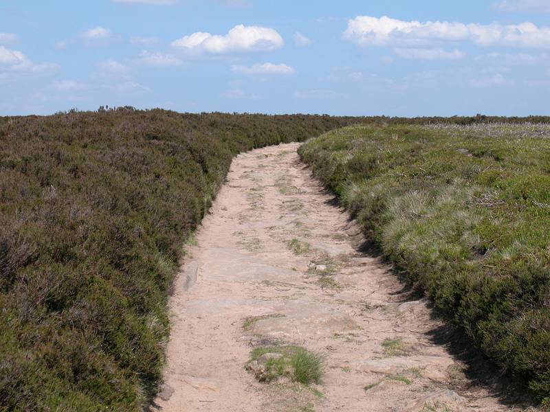
The Pennine Way follows the track east northeastwards off Withins Height, passing more ruined farmhouses on route.


Leaving Top Withins for Withins Height

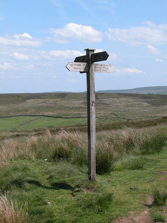
A footpath sign with Japanese legend


the view towards Howarth; Withins Height


The Height


Approaching Upper Heights
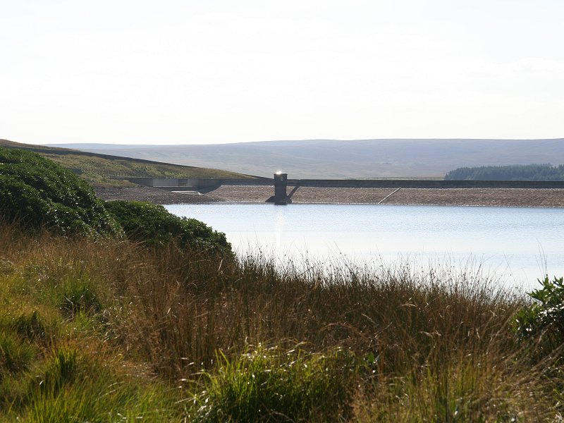
There is a multiplicity of lanes and public footpaths hereabouts and the exact route you take is really a matter of personal choice, but the official Pennine Way turns left a little way down the spur , then kinks right into a lane, then turns sharp left again past another farmhouse, bends half right to head down a steepish lane past Buckley farm, and comes out at the south end of the dam of Ponden reservoir.


First view of Ponden reservoir


Pennine Way at Upper Heights


Descent from Upper Heights


Lower Heights


The lane passing Buckley farm

Pennine Way near Buckley farm


The lane descending to Ponden Reservoir
![]() Route
664, Stanbury - Haworth- Keighley
Route
664, Stanbury - Haworth- Keighley
![]() Route
663, Oxenhope - Haworth - Keighley
Route
663, Oxenhope - Haworth - Keighley
![]() Route
500, Keighley - Haworth - Hebden Bridge
Route
500, Keighley - Haworth - Hebden Bridge
Haworth itself, even though it has more than its fair share of tourist tat, is nevertheless a charming little place that rewards prolonged exploration. It's also more than useful both as a place to find food and drink after the day's hike, and as a public transport link back to Keighley and then on into Leeds, Bradford or Skipton.
| Blackstone Edge to Hebden Bridge | Back to Pennine Way index | Ponden to Thornton-in-Craven |
This page last updated 9th June 2007
