A sketchmap of the route will appear here
| Bellingham to Byrness | Back to Pennine Way index | Border Gate to Kirk Yetholm |
| Bellingham to Byrness | Back to Pennine Way index | Border Gate to Kirk Yetholm |
It's twenty nine miles from Byrness to Kirk Yetholm, thirty miles if you start from the Cottonshopeburnfoot campsite or B&B. If you miss out the spur to the Cheviot you knock the distance down to twenty six and a half miles, but that's a bare minimum. As well as the distance and the terrain you face some 3,300ft of ascent, and the worst of these ascents is right at the start, a first class recipe for sapping stamina. The options, broadly, are these:
|
|
|
| Length: | 13.9 miles / 22.3 km |
| Total ascent: | 2701 ft / 823 m |
| Total descent: | 1653 ft / 504 m |
| Estimated time: | 5 hrs 23 mins |
Map: OS 1:25000 Outdoor Leisure 16 (The Cheviots)
Photographic note: The images on this
gallery
are both poor and sparse. I hope to replace them with another set at
some
future date.
Loins well girded, to coin a phrase? They need to be, for you have the most punishing section of the End to End ahead of you. Those attempting the whole Cheviots section to Kirk Yetholm in one day are advised to be on the trail no later than 7am.
The Pennine Way leaves Byrness a hundred metres or so to the northwest of the hotel and turns hard right up a track to approach the back of the hotel grounds. Just beforehand it swings left to climb straight up a forest ride to the top of Byrness Hill. Take your time here. There's six hundred feet of ascent involved and it's steep - in fact this is one of the three most taxing ascents along the whole Pennine Way and if you're carrying a backpack it will be sheer murder. To add insult to injury there's a mild scramble right near the top.
Looking back at Redesdale from Byrness Hill
You're above the forest on Byrness Hill and there's a good view back across Redesdale. All around you, however, is empty hill country. Miles and miles of rough grassland, with barely a feature in sight. This is going to be your world for the next twenty eight miles. Ready?
Windy Crag
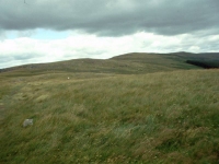
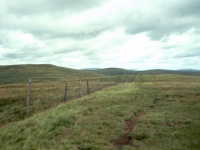
From Byrness Hill follow the obvious path off along the ridge line above the forest. Initially it runs a few degrees west of north but gradually curves right. The ridge climbs gradually to the next "top" of the Cheviots ridge, named either Houx Hill or Windy Crag depending on which map or guidebook you follow. The forest is still a few hundred metres to your left, while to your right is the tiny valley of Cottonshope Burn.
From Windy Crag / Houx Hill you follow a meagre path alongside a fence, tending northeast at first but then swinging more generally to the north from a shallow col. There's now a steeper rise to the first main summit of the Cheviots, Ravens Knowe, at 1729 ft above sea level.
There's not a lot to see from Ravens Knowe. The bulk of the Cheviots are seen more or less end-on, there's just a suggestion of a rollercoaster ridge running for miles ahead and gradually curving a little to the right. This impression is entirely correct. Down to your right is the valley of Fool Sike, while forest still lays to your left. Some 300m beyond the summit a path coming up from Cottonshope merges from the right; this is your first abort route in case of bad weather or other emergency. The path marks the boundary of an army firing range, and that same boundary now follows the Pennine Way to the north. Don't stray to the east, and in the unlikely event that you see anything that looks like an artillery shell, DO NOT touch it.
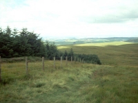
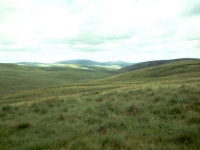
The route now continues a few degrees west of north, coming quite close to the forest edge on the minor top of Ogre Hill. Here you get a surprise, for a view suddenly opens up to the northwest - and you're looking into Scotland. A land of undulating hills covered by a patchwork of fields and woods spreads away in the distance, and if the day is at all clear then you will see a pair of isolated, conical hills some thirty miles off. These are the Eildons, and if you go on to tackle St Cuthbert's Way from Kirk Yetholm then you will walk over the col between these two hills in four or five days from now.
From Ogre Hill walk about 600m down the slope to the corner of the forest. A fence runs off to the northeast over the open moor. This fence is both very ordinary and very significant, for it marks the border between England and Scotland. The Pennine Way runs either adjacent to or within a couple of hundred metres of this fence for the next twenty miles, so if you get misted out you'll not get lost (but in bad weather the Cheviots are a thoroughly dispiriting place to be). Two more emergency escape routes are available here; the last forest ride you passed is the Border County Ride and will get you back to Byrness, while a path runs generally northwards off the ridge down the slopes of Whiteside Hill. It forks halfway down; the left fork peters out but the right fork comes out onto a lonely road at Nether Hindhope. It's a long way to civilization even from there, in fact it's some ten miles to Morebattle (which is on the route of St Cuthbert's Way and from where there's a bus service to Kirk Yetholm and Kelso).
The Pennine Way strikes out to the northeast along the Scottish side of the border fence, so go through the gate and turn right. Surprisingly, the border does not follow the ridge here but cuts across a hollow, this being the head of the river Coquet. The border is coterminous with that of the artillery range and also of the Northumberland National Park. The county of Northumberland, and the district of Tynedale, lays to your right, while to your left is the Borders region and the former county of Peebles-shire (or possibly Roxburghshire). There's certainly no feeling of having just crossed a national border. There's mud and rough tussock grass to the left, mud and rough tussock grass to the right. Onwards!
There's little in the guidebooks about Chew Green. It was obviously an extensive encampment, for the earthworks extend over an area roughly 250m square. Chew Green lays on the old Roman road of Dere Street, and again I can find little information on this route, but it's a fairly obvious place for an encampment, laying just below (and therefore in the shelter of) the Cheviot ridge. There was a signal station not far to the north on Browhhart Law, and presumably it would have been possible to signal to the Eildon Hills (where there was another Roman signal station) from there.
The Pennine Way runs through the camp and then turns north, to cross the side stream of Chew Sike. There's another abort route here. A track running just north of east reaches a tarmac road in less than a mile - this road was built to service the artillery range but it runs down into upper Coquetdale and reaches the village of Alwinton in about 12 miles. Be warned that Alwinton is barely bigger than Byrness and that it has few facilities, although there is an inn and some self catering accommodation. You're a sod of a long way from other amenities, shops or public transport on the English side. A bridleway, initially following Dere Street, runs southeast then east to Holystone further down Coquetdale, but unless you're cycling or on horseback then it's not worth considering. In the Scottish direction pathless grass slopes will get you to Nether Hindhope from where it's ten miles to Morebattle.
From the col follow the border fence northwards, on the English side. A mile further on, the PW leaves the border fence again to cut off a corner on the English side and round the head of Buckham's Halls Burn. Dere Street continues to follow the ridge and the border fence up to Blackhall Hill, from which it descends to the motor road at Tow Law; from there it's some eight and a half miles to Morebattle or ten to Jedburgh.
The Pennine Way now follows the English side of the border fence, initially north then northwest. You're climbing to the next main summit of the Cheviots, that of Lamb Hill. About halfway up the slope, more or less where the fence and path bend slightly to the right, is a wooden hut. This is the first of the two bothies or emergency shelters. If you use it, please leave it tidy (and be prepared to share it with others). There's another track off to the English side of the ridge from here, running down to the road at Blindburn farm in upper Coquetdale, but it's a hell of a long way from anywhere.
Lamb Hill sits at an elevation of 1677ft, and from here you can really appreciate the scale of the Cheviot ridge for the first time. It goes on, up and down, up and down, seemingly for ever. In practice you've covered nearly one third of the distance between Byrness and Kirk Yetholm. The immediate prospect is bleak. For miles around there's nowt but rough grassland, and it's here that it really hits you - you're on a bleak, muddy, windswept hilltop, miles from anywhere. This isn't the place to start feeling tired. Onwards! Follow the trusty border fence, which heads down to the next col, curving around to the left around the head of the valley of Callow Hope and then up to the minor top of Ewenmoorside Hill. A rough track goes down the northwest spur of this hill and eventually reaches The Yett, on the road about five miles short of Morebattle. Currently this is your best bet if you need to reach accommodation or transport.
Windy Gyle from Plea Knowe
Plea Knowe is a point at which many hearts sink, for you will undoubtedly be weary by now but the immediate prospect is of yet another summit ahead - further, higher and steeper than any of the summits behind you. At Plea Knowe itself the fence and the ridgeline lurch sharply to the left to run north down to a notch called the Foul Step, and a side path off to the right - surreally named, "The Street" - descends for some three miles to Barrowburn in upper Coquetdale. Barrowburn is some five miles short of Alwinton, which itself is a long way from anywhere useful.
The Foul Step is not a hazard but is a surprisingly steep little col, and will be unwelcome to legs and bodies already weary from the effort. If you're carrying a backpack this will be the point at which you will question your own sanity, and it was here in 1990 that I stopped and studied the map for the quickest way off the ridge to civilization, convinced that I'd taken on too much and wasn't going to make it to the end. In fact your best escape route from here on is down to the valley of Bowmont Water on the Scottish side, and from the vicinity of the Foul Step a track - in fact the continuation of "The Street" in the other direction - heads down a lateral ridge to Mowhaugh, three miles away. From there it's another four miles to Kirk Yetholm.
At the Foul Step, or to be exact just before it, the ridge, fence and path swing hard right to head almost due east. From here there's a long pull of two miles or so up to the highest point of today's walk, Windy Gyle.
The view from Windy Gyle is bleak. The rolling switchback of the Cheviots seems to stretch for an infinity in both directions. Far off to the left is the valley of Bowmont Water, even further off to the right are the lonely feeder streams of the upper Coquet, fringed by forest plantations. From the corner of the fence that the Pennine Way cut off, now some 250m to the southwest, a rough track goes down to Rowhope farm but it's miles from anywhere and of use only if you just have to get off the ridge at that point. But have a heart. If you're breaking the walk at the Border Gate then you've done all the uphill work for today. There's a long downhill run, of a mile and a quarter on the Scottish side of the fence, to the Border Gate.
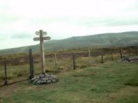
The Border Gate
You don't see the Border Gate until you're almost on top of it. The descent from Windy Gyle seems endless, there's a sea of heather on both sides and you begin to wonder if you've missed the crossing and are wandering on towards Auchope Cairn and the Cheviot. Fear not. The gate, once you reach it, is distinctive, marked by a cairn and a fingerpost. The track crossing the ridge here goes by the name of Clennel Street and is presumably a Roman road.
A good patch of turf breaks up the sea of heather just by the Border Gate and some hardy backpackers choose this spot to pitch their tents for an overnight stop. It is exposed to the wind, however, and has no water source nearby. A much better wild camp can be had at Davidson's Linn, a mile off route to the southeast. Follow Clennel Street off the ridge on the English side - it loses height quite rapidly and comes down to a forest plantation. About five hundred metres off the ridge a fingerpost marked "Salters Road, Waterfall" points off to the left along a forest ride, and this will take you to a magical little dell where there is space for several tents both above and below the fall. There is more room below but the noise of the fall is likely to be deafening, so the best pitch is had at the head of the fall.
Wild camp at Davidson's Linn
For those who have arranged to stop at Uswayford, follow Clennel Street down on the English side but ignore the side route to the fall and continue further down the track. The route to Uswayford is shown going along a forest ride to the left, further down from Salters Road. The farm is about a kilometre below Davidson's Linn. I've never been there but there are pictures of it on various Pennine Way websites, and it looks quite idyllic.
If you've arranged to be picked up from Cocklawfoot, then turn left at the Border Gate and follow Clennel Street direct. It's a tad over two miles to the end of the motor road along the Bowmont valley. If you've not arranged transport, be aware that it's seven and a half miles from Cocklawfoot to Kirk Yetholm. Wherever you spend the night, be aware also that you will have to retrace your steps up to the ridge tomorrow morning.
If you're walking on, remember that it's
another
six miles with some 700 ft of ascent before you reach the second bothy,
and nearly twelve miles to Kirk Yetholm.
| Bellingham to Byrness | Back to Pennine Way index | Border Gate to Kirk Yetholm |
This page last updated 29th December 2004
![]()