| Housteads to Bellingham | Back to Pennine Way index | Byrness to Border Gate |
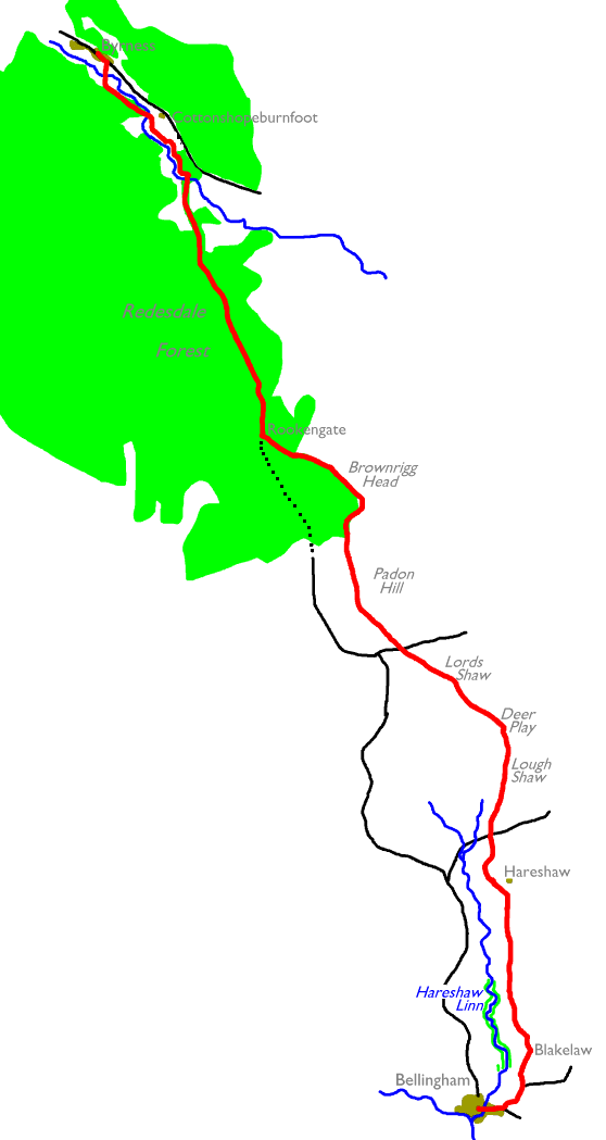
The walk divides down into four subsections; Bellingham to the road crossing north of Hareshaw; the upland section centred on Deer Play to the second road crossing; the Padon Hill / Brownrigg Head section to the forest track at Rookengate; and the Redesdale Forest section to Byrness. Neither of the road crossings feature any public transport and there is virtually no habitation en route, so there is no opportunity to cut this section into half-day chunks and no "opt-out" in case of bad weather or other misfortune. Once you start out you're more or less committed to finish.
Bellingham is the last shopping opportunity on the Pennine Way, so through hikers should stock up on provisions here and make sure they have enough of what they need for the final forty five miles. Byrness has limited accommodation; a campsite, some B&B, a small hotel and a youth hostel, so you would be wise to secure your nights' lodging in advance. It's also on the main A68 Newcastle - Edinburgh road and has three buses a day in each direction; make sure you have up to date timetable information if you are going to be dependent on public transport.
|
|
|
| Length: | 14.9 miles / 23.9 km |
| Total ascent: | 1775 ft / 541 m |
| Total descent: | 1442 ft / 440 m |
| Estimated time: | 5 hrs 12 mins |
Bellingham is the principal town of the North Tyne valley and can be reached by bus from Hexham if you're tackling the walk by public transport. It's the last opportunity to buy provisions before you reach the end of the Pennine Way at Kirk Yetholm, so stock up on food and any other necessary provisions. Although I normally rely on public transport I backpacked these last three sections of the Pennine Way, overnighting at the Byrness public campsite (where there are a few basic provisions on sale) and then camping wild at Davidson's Linn halfway along the Cheviots section. The logistics for these last three days are pretty stark, owing to the relative lack of transport nodes or habitation. Plan carefully. I'll say more about the Cheviots options on the next page.
Wainwright recommends an off route expedition to Hareshaw Linn, a picturesque waterfall at the far end of a pleasantly wooded side valley immediately north of the town. The Pennine Way was originally meant to go that way but sadly no right of way was secured north of the fall, and this expedition is now a dead end and a four mile round trip. If you reach Bellingham in good time on the previous day then I'd recommend Hareshaw Linn as an evening stroll. There's probably not time to take it in and do the Bellingham - Byrness hike in one day. The present PW route passes within four hundred metres of Hareshaw Linn but there is no connecting route. The upcoming Right to Roam legislation may possibly allow access in the future but don't count on it, and in the meantime don't trespass.


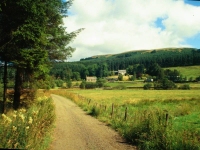
Looking back at Bellingham; approaching Blakelaw; rough pasture between Blakelaw and Hareshaw
The route out of Bellingham runs east from the junction in the middle of town, crossing the Hareshaw burn and passing the campsite and the old railway station, where you turn left onto a minor road heading for West Woodburn. The road climbs steadily and allows good views back to Bellingham and across the North Tyne valley. At a right bend in the road leave it for the driveway to Blakelaw farm, about 600m distant. At the farm turn left through the farmyard and then go slightly right for a simple path, running across a succession of rough pastures and tending uphill. The valley of Hareshaw Burn runs parallel about 400m to your left.


The Pennine Way north of Blakelaw; Hareshaw house
There's two miles, or 3km, of rough pasture between Blakelaw and the lonely Hareshaw House. It's a pretty featureless walk, tending very gradually uphill and with rising ground to your right and the Hareshaw Burn valley to your left. There's one mildly interesting rock feature along the way, the outcrop of School Crag which lies just to the right of the path slightly over a mile out of Blakelaw. The only other features are a couple of small streams and two drystone walls. The first stream - about one kilometre north of Blakelaw and at the closest approach to Hareshaw Linn - marks the boundary of the Northumberland National Park, which we enter properly for the first time. We'll be within the boundaries of the park until the Scottish border.
Hareshaw House is surrounded on three sides by a small forest plantation which does serve to soften its setting somewhat (and presumably provides some protection from the elements). The PW swings to the left here, crossing the driveway to the house and passing the southwest corner of the patch of woodland. At the corner of the enclosure some 200m beyond, you turn right again onto a track that once served a mine and quarry that operated hereabouts. You pass the site of the quarry, just to your right at a locality called Abbey Rigg, to come out onto the B6320 road from Bellingham to Otterburn.

Having reached the road you might like to be aware of the foul weather options. The road to the left leads back to Bellingham in three miles, while to the right it comes out onto the main cross border A68 (Newcastle - Jedburgh) road within three miles and the village of Otterburn (accommodation, bus route) a mile beyond. A further option to be aware of is the road alternative northwards to Redesdale Forest (and ultimately Byrness), which you might like to consider if the moors are too sloppy. Start back to Bellingham from here then after the first kilometre turn right onto an unclassified road, then after a further 1.5km turn right again onto a lonely moorland road heading due north. This leads to a junction just west of the PW at the end of the Deer Play section.
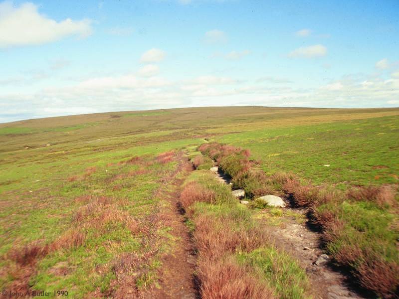
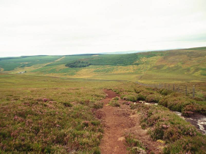
The Deer Play section is wilder, lonelier and even more featureless than the section from Blakelaw to Hareshaw. You cross three named summits, those of Lough Shaw (1102 ft), Deer Play (1183 ft) and then Lord's Shaw (1167 ft), but to be honest these are not so much summits as mere swellings in the general level of the moor. The terrain is a mix of rough grass and heather with very little bare rock. There are no fences or walls to act as guides. The path is reasonably distinct but in misty weather you would do well to dig out your compass and make sure you're sticking to the correct bearing. Barry Pilton, in his book "One Man and his Bog" dismissed this whole day's walk in a single paragraph, saying, "there was a lot of boggy moorland, for which I am bereft of adjectives." This is certainly a drab place in anything other than good, sunny weather but under the right conditions it can be quite an adventure. Its best redeeming feature is that you can see forwards across Redesdale, and the Cheviots now loom large ahead.

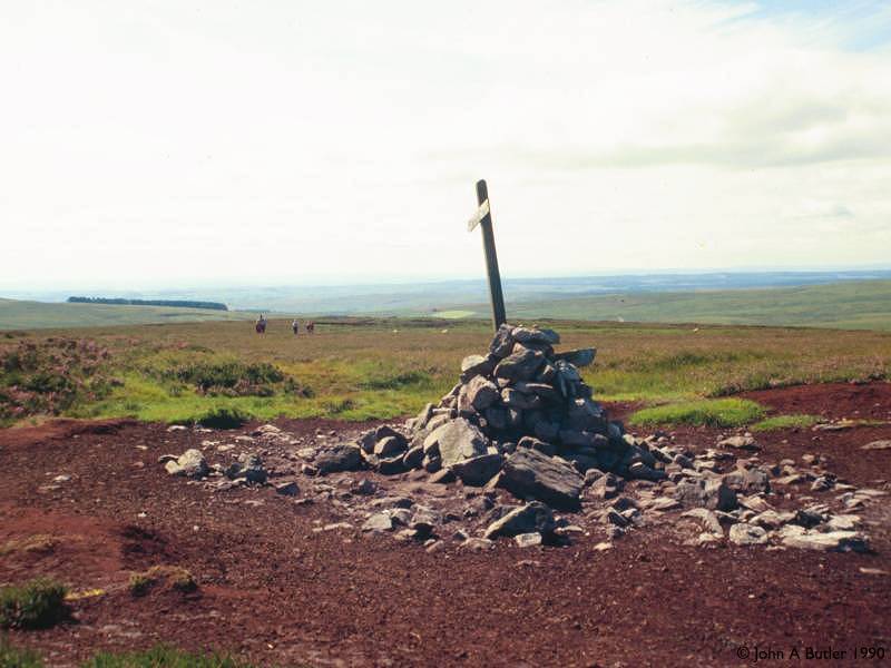
The summit of Lord's Shaw
At Lord's Shaw (a.k.a Whitley Pike) there's a cairn and a PW fingerpost. The map shows an enclosure boundary (a fence rather than a wall) but there is little evidence of it. The route heads generally northwest of here to come out onto an unclassified motor road about 500 metres ahead.
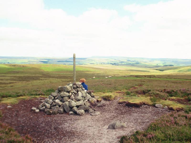
The direct route to Rookengate is over some three and a half miles of rough pasture, crossing the shoulder of Padon Hill and the summit of Brownrigg Head. This time you have a fence alongside you so there is no danger of going astray. The summit of Padon Hill lies to the right, just over a mile north of the road, and is marked by a distinctive "pepperpot" cairn. It commemorates Alexander Padon, who was one of the Scottish Covenantors, a group of nonconformist preachers who held services in remote spots like this several centuries back to escape persecution. There are several such Covenanters' memorials in the Borders. There is no right of way to the cairn and you would have to shin over the fence to reach it, but since it's all rough pasture there would seem to be no obvious objection.
From Padon Hill the path, still following the fence, descends to a little hollow where you cross a stone wall by a high stile (and where I found a couple of fellow hikers having their lunch when I did the walk in 1990). At this point Gib Shiel lies 500m to your left if you need to get to the road, but forest plantations are enroaching up to this point and the going might well be very tough. The Pennine Way leads onwards, alongside the fence, up to Brownrigg Head.


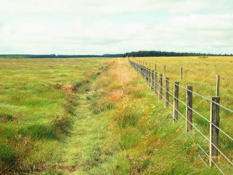
The Pennine Way on Brownrigg Head
The fence and the Pennine Way make a small detour to the northeast to reach the summit of Brownrigg Head and its junction of fences. Brownrigg sits at an elevation of 1191 ft and is our last summit of the day. There's no view down into Redesdale to the northeast thanks to the convex curve of the slope, but the dark mass of Redesdale Forest is now hard to the left and the Cheviots are looking closer to the north. Follow the fence initially north, then northwest. The area to the left was being planted when I passed this way in 1990, and the trees are probably ten or twenty feet high by now. A mile out of Brownrigg Head you reach a more mature forest section with trees on both sides.

The path from Brownrigg Head to the forest; approaching Rookengate
Initially the route of the PW within the forest isn't a proper track at all, just a ride (a ribbon of open grass between the trees) and is quite rough. However, half a mile after reaching the forest proper you come to the locality of Rookengate, where the PW joins the forest road between Gib Shiel and Byrness. From here on you're on forest road all the way but for a few hundred metres of riverbank footpath at Byrness itself. Rookengate is an obvious place for an afternoon refreshment halt.

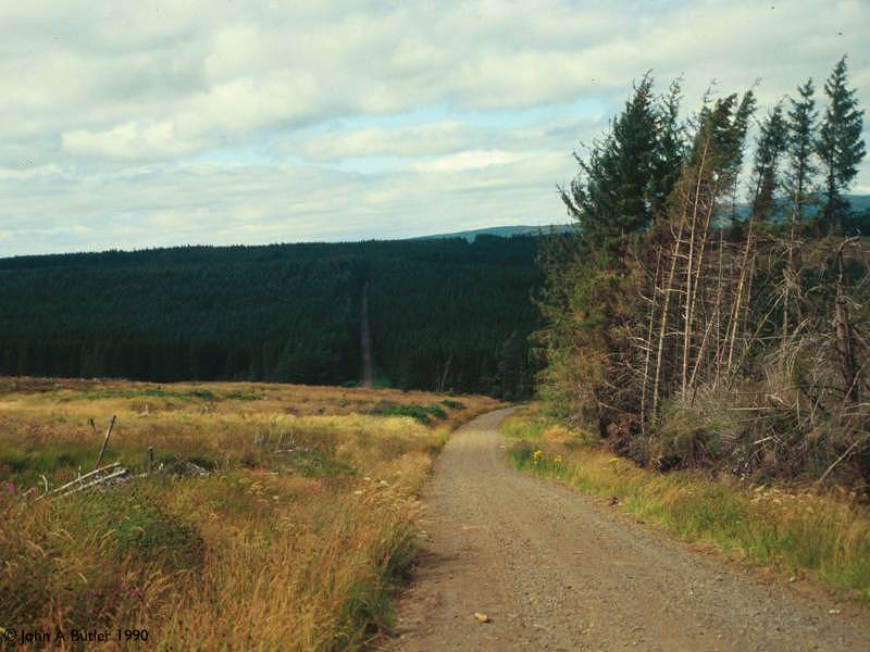
The route through Redesdale Forest
The four miles of forest road from Rookengate to Blakehopeburnhaugh is easy, but rather monotonous. It's pretty much like the sections encountered yesterday either side of Warks Burn, but longer. At any given time there will be felled areas either side of the track but all they will afford is views of more trees. There's the occasional glimpse of the Cheviots ahead.

Blakehopeburnhaugh
Blakehopeburnhaugh is a group of farm buildings but there is little evidence of an actual farm, the forest having spread all around it, but it's the first outpost of civilization in Redesdale. Blakehopeburnhaugh is the longest place name on the Pennine Way (and indeed the whole End to End Walk). The route onwards from here is a little tricky and is not helped by the fact that you have to change maps here. The Kielder Water sheet shows the PW taking a side track to the right immediately after the farm buildings, crossing the Rede and then heading along a vehicle track hard by the northeast bank; the Cheviots sheet (1995 edition) does not show this diversion but instead has the PW following Wainwright's route, straight on from Blakehopeburnhaugh. Once across the main river, turn left for the footpath along the riverbank.

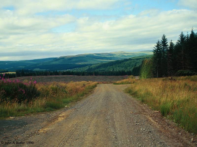
Forest walk beyond Cottonshopeburnfoot
Your route crosses the river here onto the southwest bank and takes a pleasant track through the forest to the northwest, eventually swinging right to cross the river once more and come out onto the A68 at Byrness proper. The hotel lays just to the right; the youth hostel is (I believe) a little way along the road to the left where there is a small cluster of former Forestry Commission cottages. There's also a pub and a cafe at Byrness, but apparently there is no longer a shop. The youth hostel is self catering only, and it requires 72 hrs notice to book accommodation.
Approaching Byrness
![]() Byrness
Youth Hostel
Byrness
Youth Hostel
![]() Byrness
Hotel
Byrness
Hotel
![]() Service
131, Newcastle - Otterburn - Byrness - Jedburgh - Edinburgh
Service
131, Newcastle - Otterburn - Byrness - Jedburgh - Edinburgh
![]() Service
383, Newcastle - Otterburn - Byrness - Jedburgh - Edinburgh
Service
383, Newcastle - Otterburn - Byrness - Jedburgh - Edinburgh
| Housteads to Bellingham | Back to Pennine Way index | Byrness to Border Gate |
This page last updated 29th December 2004
![]()