
| Byrness to Border Gate | Back to Pennine Way index | Kirk Yetholm to Morebattle |
The second of the two bothies or emergency shelters can be found about a mile beyond Auchope Cairn, though it's only six miles from the end and in my opinion is awkwardly placed. It's up to you whether you visit the Cheviot or not, and whether you choose the high level or low level route from Black Hag onwards. When I did the walk in 1990 the low level route was the official route and the high level route was an option, though now the situation is reversed. I'd still recommend the low level route, primarily because the high level route is just too much effort at the end of such a tough two days. The Cheviot spur is supposed to be walked if you wish to call yourself a true Pennine Wayfarer, but almost every fellow hiker I've spoken to, and nearly every guidebook writer, has considered their options at Cairn Hill and thought, "sod that!". And I'm equally guilty. The Cheviot is for masochists and purists only.
The Pennine Way keeps a nasty surprise for the very last mile, for to reach Kirk Yetholm from the Halterburn Valley you have to cross a ridge. Which involves an ascent of course. It's only 150ft but after the last two days of slog it's the ultimate cruelty. But Kirk Yetholm, when you reach it, is charming. A quiet, unassuming village, it seems quite unaware of its celebrity status as the destination of Britain's toughest long distance trail. The official end point is the Border Hotel, at the northeast end of the village green. Bona fide Pennine Wayfarers who have done the whole route in one outing used to qualify for a free drink at the hotel bar, courtesy of Wainwright, but I don't know whether this arrangement still holds.
Kirk Yetholm has three buses a day to Kelso, via neighbouring Town Yetholm (which is half a mile beyond Kirk Yetholm and has a couple of inns and a number of B&Bs). From Kelso you can reach either Edinburgh or Berwick on Tweed for the main east coast railway line.
|
|
|
| Length: | 11.2 miles / 18.0 km |
| Total ascent: | 1741 ft / 531 m |
| Total descent: | 3136 ft / 956 m |
| Estimated time: | 4 hrs 07 mins |
Map: OS 1:25000 Outdoor Leisure 16 (The Cheviots)
Click on
any thumbnail image in this gallery to display the corresponding full
size
image. The images are access protected through a cgi script to prevent
hotlinking. If you encounter problems while trying to view the full
size
images, please read the access advice
page.
Photographic
note: The images on this gallery
are both poor and sparse. I hope to replace them with another set at
some
future date.
Recommence your journey along the Cheviot ridge. From the Border Gate onwards the path keeps to the English side of the fence. It's lonely and drab up here. The path falls slightly towards a shallow and rather sloppy col, the ridge here being known as Butt Roads for some reason. The col is a kilometre northeast of the border gate. From here there's a steady and relentless climb ahead, during which the ridge climbs some 700ft in a distance of two and a half miles. The ridge, fence and path turn half left at this point to run north northeast.

At the top of the slope is the west top of Cairn Hill, standing 2419 ft above sea level; the highest elevation since Cross Fell. Cairn Hill marks a significant point in today's journey, for here the England - Scotland border, and the main route of the Pennine Way, turns northwest to leave the Cheviot ridge proper and run along a lateral ridge to The Schil. At this point you're only eight and a half miles from Kirk Yetholm but the official route of the Pennine Way proscribes a continuation along the main ridge as far as The Cheviot, and then back again to this point. From here the Pennine Way goes northwest along the English side of the fence to the next summit, Auchope Cairn.
By all accounts The Cheviot is a bit of a let down; a great sprawling mass of peat and tussock grass without much of a view. Only purists and peak baggers will wish to come here. For the record it's 2676 ft above sea level and, except for Cross Fell and its satellites, is the highest point of the Pennine Way.
Retrace your steps to the west top of Cairn Hill and then strike out north-westwards along the fence to Auchope Cairn, about half a mile away.
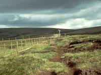
Approaching Auchope cairn; Auchope Cairn; view forwards to The Schil
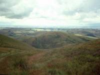
Auchope Cairn is 2382 ft above sea level and boasts a pretty decent view. You can see across much of Peebles-shire from here, and the Eildon Hills should be in view. The little rocky cleft of Hen Hole is down to your right and I know that the odd hiker likes to use it as a spot for an overnight bivouac. However, the second of the two emergency shelter huts or bothies is just a mile ahead, and unless the weather is fine and settled and you fancy a night under the stars, the bothy is probably a better bet. If you've slogged it this far from Byrness in one day you're probably fit to drop by now. The route continues west northwest down the far slopes of Auchope cairn, still on the English side of the border fence, to reach the shelter hut not far from a broad col. From here the path swings northwest at Red Cribs then starts to climb to the last main summit on the Pennine Way, The Schil.
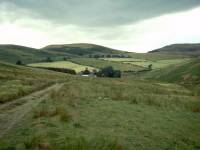
College Burn; The Pennine Way to The Schil; Halterburn valley
The Schil, elevation 1985 ft, is the last major summit of the Pennine Way. Unless you take the high level route beyond Black Hag it's all downhill from here, save for that last 150ft of ascent immediately before Kirk Yetholm. Follow the fence, still on the English side, north northwest off the summit. The valley of Curr Burn beckons off to the northwest. At the foot of the summit dome the border fence comes to an end, to be replaced by a border drystone wall. Follow it for a further 500 metres to reach a gate; go through this gate, leaving England behind for the last time, and take the grassy track northwestwards across the shoulder of Black Hag (which is up to your right).

The head of Curr Burn
Decision time again. Had enough, or up for yet more effort? If you still have reserves of stamina, or you're a purist, or both, then you will probably favour the high level route. It runs northwards from here, up to the col beyond Black Hag, and thence along the ridge and the border once more to White Law and Whitelaw Nick before turning left off the ridge to come down to the Halterburn road a mile short of Kirk Yetholm.
I chose the low level route (which was still the official route of the PW at the time I walked this section) and I would recommend it over the high level route. At this point most people have had enough and just want to get it over with. Your route ignores the bifurcation of the high level route and continues along the grassy trod to the lateral col between Black Hag and The Curr, the summit to your left. Once you reach this col the valley of Curr Burn opens out ahead of you. It's still quite bleak and is mostly rough pasture though it is softened by a couple of forest plantations some way down. Bleakness aside, it will probably look inviting in the afternoon sun after the relentless slog of the Cheviot ridge.
The path turns into a fairly decent track just after the col. Follow this northwestwards for 600m, at which point the side valley of Halter Burn opens up to the right. Turn right and follow this valley down to the abandoned Old Halterburnhead farm, a kilometre ahead.

The scene near Halterburnhead
You're on the home stretch now and you can afford to relax. The effort is nearly over, and there's just three miles to walk. At Old Halterburn head the valley swings to the left and immediately presents a more pastoral face. Trees, pasture, fences and enclosures begin to appear. A kilometre beyond Old Halterburnhead you reach the first outpost of civilization since Byrness; Halterburnhead farm, or just Burnhead farm (depending on which map or guidebook you follow). It seems almost weird, seeing vehicles and animals and people at last. Make your way carefully through the farmyard. You encounter the end of the public road just beyond the farm, and like as not there will be several vehicles here waiting for various weary Pennine Wayfarers to come struggling down the track. For some hikers the PW ends here, but most will wish to press on by foot to Kirk Yetholm itself.
Walk up the road now, looking out for the unaccustomed hazard of traffic. The scenery becomes ever more pastoral. You pass a lone building on the left; marked as the Peniel Centre in Wainwright's guide. Half a mile further on is a cattle grid. The high level route joins here, and now the road turns left away from Halter Burn to climb the ridge across to the valley of Bowmont Water.

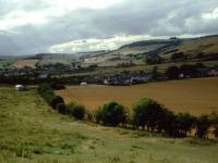
Kirk Yetholm from the road
It's cruel, that ascent. It's the last thing you need at this stage, but don't give up now. It's only 150ft, for heaven's sake! Half a mile along the road the gradient levels out and there, ahead of you, is the rich green valley of Bowmont Water. Look back at the Cheviots for the last time and then follow the road down as it slides past the eastern end of Kirk Yetholm just below. In no time at all the lane becomes a residential road that drops you, without warning or ceremony, into the centre of the village at the edge of the green.
You've just walked the Pennine Way. Over to your right, at the far end of the green, is the Border Hotel - it's traditional to call in at the bar and sign the Pennine Way logbook (though only if you've walked the way in one expedition. I didn't qualify).
The Border Hotel, end of the Pennine Way
The chances are that you'll be
overnighting
either here, or in neighbouring Town Yetholm just half a mile further
on.
Otherwise, if you're early enough (some hope!) you might catch the late
afternoon bus to Kelso. Masochists who don't know when to stop can pick
up St Cuthbert's Way here and walk on to Melrose, and for those hardy
souls
tackling the End to End it's now only 475 miles to John O' Groats. Go
on,
you know you can do it.
| Byrness to Border Gate | Back to Pennine Way index | Kirk Yetholm to Morebattle |
This page last updated 29th December 2004
![]()