

 |
||
| Dartmeet to Chagford | Back to Devon Coast-to-Coast index | Morchard Road
to Witheridge |
|
||
| Dartmeet to Chagford | Back to Devon Coast-to-Coast index | Morchard Road
to Witheridge |
Maps: OS 1:25000 Outdoor Leisure 28 (Dartmoor), Explorer 113 (Okehampton)
Click
on
any thumbnail image in this gallery to display the corresponding full
size
image. The images are access protected through a cgi script to prevent
hotlinking. If you encounter problems while trying to view the full
size
images, please read the access advice
page.


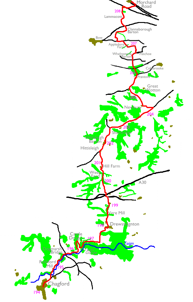
Rushford Mill and the riverbank footpath; by the banks of the Teign
At Rushford Mill, 300metres beyond the river bridge, look out for the public footpath signboard and turn left to join the path along the northwest bank of the river. You will be alongside the river for the next mile and a half and this stretch is exceedingly pleasant. Tree lined river meadows are the order of the day for the first half mile, after which the tree cover increases and you find yourself walking within a clump of woodland.


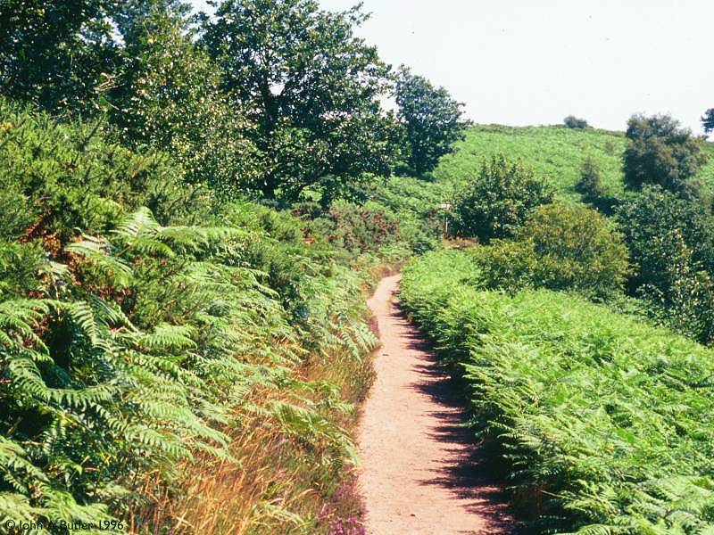
Woodland paths in the vicinity of Dogmarsh Bridge
A mile and a half out of Chagford you reach the main A382 road, which crosses the Teign by way of Dogmarsh Bridge. The footpath crosses the road just northwest of the bridge and resumes its course along the riverbank. You emerge from the trees once more to enter another pleasant stretch or river meadows. This section of the route is known as the Fishermens' Path. If you look slightly up to your left you may spot Castle Drogo nestling among the trees at the top of the hill.


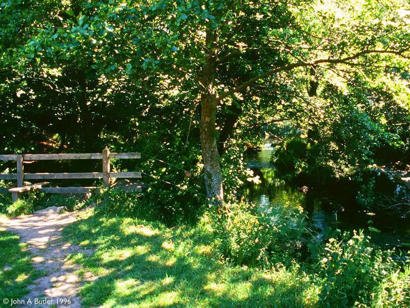
Fishermens' Path and a view of Castle Drogo


The path approaches another clump of trees, within which you will find a path junction. Follow the path to the left, for Coombe. This path nips smartly uphill through a tunnel of tree cover. Some 800metres to the north you come out into the open at another path junction. Our route turns hard right to contour along the hillside to Hunters Tor. If you wish to visit Castle Drogo, however, continue straight on to the road and follow it around to the entrance.
![]() The
National
Trust - Castle
Drogo website
The
National
Trust - Castle
Drogo website
Castle Drogo is one of only two castles built in the twentieth century. (By a curious coincidence the other one, at Culrain in the Scottish Highlands, is also just off the route of the End-to-End). Drogo was built by Lutyens for a wealthy industrialist and was completed in 1930, and is now owned by the National Trust. The house and gardens are open from Easter to the end of October, except on Fridays, and are well worth a visit.


Castle Drogo gardens; Hunters Path
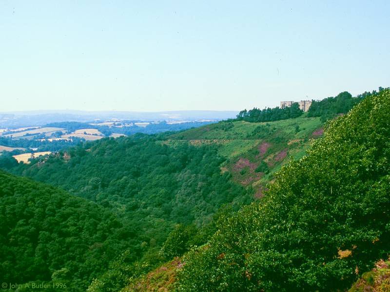
The path around the hillside below the walls of the castle is spectacular. It runs out to Hunters Tor and makes a sharp left to run northeast, thence curving around to the right as it contours round above the Teign. The river hereabouts runs through a deeply wooded gorge. Hunters Path, as it is known, looks down upon the gorge and over to Dartmoor to the southwest. the path curves round in the direction of Sharp Tor.


The Teign Gorge; Hunters Tor; Sharp Tor
From Sharp Tor there's another pedestrian route to Castle Drogo off to the left, not shown on the OS map. Our route continues along Hunters Path for another 200metres and then turns left onto a path heading north among bracken and light tree cover. The map gives the name of this locality as Piddledown Common. Never mind, we can be spared any further embarrassments of this type until we encounter Shitlington Farm in Northumberland. The path nips smartly northward, running into trees to approach Drewsteignton from the south.

The path runs just inside the western edge of Rectory Wood and crosses a tiny stream at the far end. Beyond the wood the TMW turns half right and heads smartly uphill along a track for 300metres, then turns half left again along a fieldside path to reach Drewsteignton at its southwestern corner. Turn right to walk into the village centre, Drewsteignton is thoroughly charming, a place of whitewashed cottages, some with thatched roofs. There is a public convenience in the village and a couple of pubs, but I don't recall seeing a village shop (so no ice creams, sorry). Drewsteignton is the last village you go through today so don't expect to be able to get any food or drink further on.
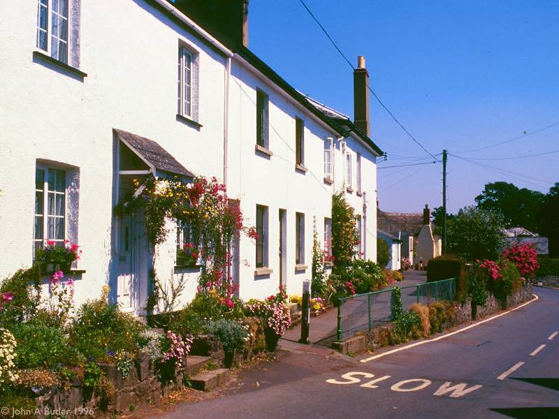


Drewsteignton
Leave Drewsteignton on the road to the north, taking the right fork at Netherton House. The lane goes downhill to Vere Mill, after which the TMW takes a vehicle track north through the tiny locality of Winscombe. Shortly beyond Winscombe you reach a main road, the old A30 trunk road through Devon and a spur off the new A30 just 200metres ahead. At this point you leave the Dartmoor National Park. Cross the new A30 using the old A30 as an overbridge.


The buildings of manor Farm are just ahead to your right but before you reach them turn right onto a minor road called Hask lane. This lane dives under the new A30 some 300metres ahead but before you reach the underpass you will see a footpath heading off to the left.
This footpath heralds a delightful section, roughly two miles of field paths rising and falling over undulating countryside. Keep your eye on the map and navigate by field boundaries. The TMW is well waymarked so you shouldn't have any problems. Initially the path hugs field boundaries but after about 600metres the route crosses two pastures on the diagonal, heading downhill into a ribbon of woodland. Walk through the wood towards Forder Farm.

At the far end of the wood cross a stream by a footbridge to come out onto a tiny motor road. This is an intricate and confusing section. Go left for a few yards to a junction and then right for a few yards, before turning left again for the continuation of the footpath, which rises uphill towards Hill Farm. Here the Dartmoor OS map, the Okehampton sheet and the TMW guidebook disagree on the exact route of the path but it should be obvious enough on the ground. This might be a good point at which to put the Dartmoor OS map away and get out the Okehampton sheet.


Hill farm is, appropriately, on top of a hill. Keep the farm buildings to your left but just beyond the farm ignore the lane (which curves off right) and go slightly left for a path heading downhill. A plank footbridge crosses the stream at the foot of the hill after which you go uphill yet again, to Whitethorn farm. The map shows a fieldside path passing the farm about 100metres to the right, the TMW guidebook has the path using the farm driveway. Take the path if it's obvious on the ground, and in any case the path merges with the farm drive after another 300metres. Follow the lane out to a motor road just south of Hittsleigh.

Most of the next few miles is on tarmac. Walk through Hittsleigh - just a scattering of cottages - and at the crossroads take the road heading slightly left. Hittsleigh Barton lays 600metres ahead, a slightly larger village with a church. You're in amongst archetypal mid-Devon scenery here, a world of tiny villages set among undulating countryside dotted with hedges and clumps of woodland. On a warm, balmy summer afternoon this is heaven. Follow the road north and just keep going. Amble and take your time. The traffic will be light.


The Two Moors Way between Newbury and West Wotton Farm
If you're feeling in need of cool, liquid refreshment then Newbury will disappoint; it's just another farm. Immediately before the farm buildings turn half right onto a vehicle track, which heads off northwestwards and uphill between trees and hedges. After some 500metres the lane gives out and the route now follows fieldside paths for a further 500metres, coming out onto another motor road by West Wotton Farm.


The road approaching Prestons Farm; The route at Prestons Farm
Turn right onto the road and walk along it to the northeast, passing West Wotton Farm, Westcombe Hill House, Great Wotton and Hill Crest. These are all individual buildings, not villages or localities. This road section lasts for some 800metres. Just beyond Hillcrest and just before Prestons (presumably a farm but just named as Prestons on the map) a track goes off towards woodland to the left.

Horwell Wood


Crossing the Okehampton railway line
The path through the wood is pleasant and
well defined. Towards the northern edge of the wood you cross the
single
track railway line to Okehampton on the level. The line no longer
carries
passengers but is still open to serve the quarry workings west of
Okehampton
- look out for approaching trains. Beyond the wood the path continues,
almost due north, heading smartly uphill across pastures to pick up the
road network once again at Whelmstone Cross.


Footpath at Paschoe; Paschoe House
The footpath goes initially uphill for
about
200metres then, having reached a ridge line, falls again towards a tiny
river
valley. The path crosses cropped fields. As you stroll downhill cast a
glance to the left where you will see Paschoe House. The path runs down
to Paschoe dairy farm then turns left and uphill along an enclosure
boundary, then
right again to pass through a ribbon of woodland. Beyond, and downhill,
is Appledore
Farm.


Paschoe
Dairy Farm


Paschoe
dairy herd, and the footpath beyond


Follow the path down to Appledore Farm,
which
lays immediately to the right of our route. The farm driveway takes you
out to the road just beyond; turn left (west) along the road.


The
TWM at Sweetfield Farm
About 100 metres
along the road you will
see a footpath sign pointing to the right (first image above). This
leads into the grounds of Sweetfield Farm, an area where the layout of
field boundaries looks nothing at all like the map. The first point of
ambiguity occurs straight away, where you are confronted with a short,
narrow flight of steps forking right and a short farm track to your
left. Choose the steps, and if no other route is obvious from here on,
follow the field boundary to your right (this field boundary is missing
from the map). This will lead you to a point just short of the
farmhouse, where you should spot a stile deep in the hedgerow (second
image above).
Go around the
side and then the back of
the farmhouse. It's pointless looking for the pattern of field
boundaries shown on the map to the rear of the farm, because they don't
exist. Find the TMW marker on a pole and follow its direction, towards
an electricity pole and subsequently along a gap between crops (third
image above) towards the western end of a copse of trees. Once you're
past the trees the map should start to make sense again.


Clannaborough
Barton
Follow the
obvious track to a point 100
metres north of the trees, where it bends sharply to the right. The
track becomes quite substantial and heads for the tiny locality of
Clannaborough Barton; a farm, a church and a couple of cottages. Turn
left just short of the church and follow the driveway out to the main
A3072 road beyond.

The
Lammacott farm lane
Walk along the
main road to the right
(east) for some 200 metres then turn left along the narrow lane to
Lammacott Farm. This is a pretty little section, with the lane
wandering downhill between lush fields. Follow the lane to the right
beyond Lammacott itself, and after 300 metres turn left for the
footpath heading due north and yet further downhill.


The
short woodland section approaching Barn Shelley
Towards the foot
of the hill the path hits
a little complex of field corners, so keep an eye on the map (which can
be trusted here). Follow the bends past a screen of trees (first image
above) then enter a short section of woodland (second image) to arrive
at a footbridge over the stream (third image).


Pastures,
and the road at Barn Shelley
Beyond the
footbridge cross an open
pasture (first image above) then follow the left hand side of a hedge
(second image) to emerge onto the Down St Mary road. Follow this to the
right, passing the house named Barn Shelley.


Pastures,
Wolfin Farm
Two hundred
metres beyond Barn Shelley you
leave the road to the left, for a footpath than runs through the
pastures of Wolfin Farm. Go half right after the first stile to reach
an open field, possibly grazed by sheep (as seen above). The field is
an odd shape, but just keep going and seek out the far top right
corner, passing Wolfin Farm itself to come out suddenly on the busy
A377 main road.


The
A377 and the footpath beside the railway
Take heart now,
for the intricacies are
behind you and there's less than half a mile to go. Follow the TMW
signs across the road to find a footpath that first wanders uncertainly
through a patch of scrub. Eventually it sorts itself out and leads to a
stile across a fence. Turn left now and follow the path alongside the
fence. On your right is the railway line from Exeter to Barnstaple.
Keep going for some 500 metres until you reach Shobrooke Bridge, where
a farm track crosses the line to the right. The route continues along
this track but we're finished for the day. Turn left, follow the short
track back to the main road, and walk along it for the short distance
to Morchard Road.
|
£3.50
inclusive
of postage / packing. |
|
||
| Dartmeet to Chagford | Back to Devon Coast-to-Coast index | Morchard Road
to Witheridge |
This page last updated 22nd December 2006
