|
Hergest
Ridge
Location: Herefordshire
Grid Ref: SO
254562
Height: 1398 ft (426
m)
Status: Marilyn,
Clement
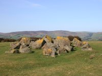
Notes: Hergest Ridge
achieved fame in the 1970's as the title of a Mike Oldfield album;
apparently he lived locally at the time. The ridge is an area of
heathland rising to the west of the small town of Kington and its
northwestesrn shoulder is crossed by the England - Wales border. The
ascent from the town takes about an hour and involves taking the minor
road past Hergest Croft gardens and then following your nose. The
panorama includes some very pleasant hill country around the Welsh
borders and extends to Black Mountain and the Brecon Beacons, the
Malverns, and the Shripshire hills to the north.
|
|

|
Herrock
Hill
Location: Herefordshire
Grid Ref: SO
278596
Height: 1217 ft (321
m)
Status: Clement
Notes:Herrock Hill is
an outlier of Bradnor Hill, just north of Kington in Herefordshire, and
it lies about a mile to the northwest of its parent. It's a heathland
dome that commands pleasant views of the Welsh border country,
particularly Hergest Ridge, the Radnor Forest, the Black Mountains and
the Brecon Beacons. There is no direct route from Bradnor Hill but
Herrock can be reached from the footpath that winds around Bradnor to
the west and north. An ascent can be combined with that of nearby
Rushock Hill.
|
|
|
Heughscar Hill
Location: Lake
District,
Far Eastern Fells
Grid Ref: NY
488231
Height: 1230 ft (375
m)
Status: Wainwright
outlying fell, Clement
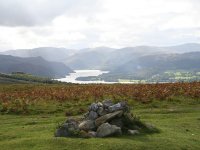
Notes: Heughscar Hill
is the northernmost outlier of the High Street range, lying to the
north of the Moor Divock track out of Pooley Bridge. A gentle dome of
heathland, it looks unpromising from afar but is actually quite
delightful. Ascent is simple; take the aforementioned Moor Divock track
then turn left and ascend the hill direct. The view of Ullswater is
especially good.
|
|
|
High
Hartsop
Dodd
Location: Lake
District,
Eastern Fells
Grid Ref: NY
393107
Height: 1703 ft (519
m)
Status: Wainwright
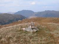
Notes: A slight
bump along
the north ridge of Little Hart Crag, barely qualifying as a fell in its
own right. High Hartsop Dodd overlooks Brothers Water to the north but
apart from that it's really sandwiched in between its higher
neighbours,
including Red Screes to the east and Hart Crag to the west. Fairfield,
St Sunday Crag and Helvellyn also appear nearby. This intimacy with a
considerable
number of higher fells does at least give the view from the cairn a
good
deal of interest. Can easily be visited from Little Hart Crag, a walk
of
around ten minutes with negligible reascent.
|
|

|
High
House
Location: Lake
District,
Southern Fells
Grid Ref: NY
240092
Height: 2244 ft (684
m)
Status: Nuttall
Notes: The north
top of Allen
Crags, situated between its parent fell and Glaramara. Strictly
speaking
it is nameless, but it qualifies as a Nuttall and for inclusion it was
named for High House Tarn, which it stands directly above. Although the
cairn is very close to the ridge path it's a sure bet that few walkers
bother to visit. Views are excellent, particularly around the southern
arc from the Langdale Pikes through to the Gables.
|
|
|
High
Pike
Location: Lake
District,
Eastern Fells
Grid Ref: NY
374088
Height: 2152 ft (656
m)
Status: Wainwright
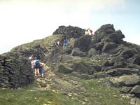
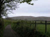
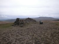
Notes: The second
top of the
Fairfield Horseshoe (if going anticlockwise from Ambleside), High Pike
has the appearance of a fine rocky peak when seen from the valley of
Scandale
but a visit to the top reveals that it's merely a shoulder on the ridge
with virtually no descent to the north. High Pike is marked by a
chaotic
jumble of large boulders and some clambering will be needed. A stone
wall
runs along the summit ridge. The view is not especially good but
includes
much of the High Street range to the east.
|
|
|
High
Pike
Location: Lake
District,
Northern Fells
Grid Ref: NY
318350
Height: 2159 ft (658
m)
Status: Wainwright,
Hewitt,
Nuttall
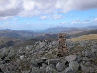
Notes: One of the
most northerly Lakeland fells, High Pike rises three miles south of the
village of Caldbeck and commands excellent views across the Solway
Firth to Scotland. The fell as a whole is broad, squat and grassy but
the top is stony and features some unusual summit furniture, not least
a stone seat, the ruin of a shepherd's cottage and an enormous cairn. A
number of abandoned mines litter the northern slopes and the easiest
ascent makes use of the old mine road from Nether Row. |
|
 |
High
Raise
Location: Lake
District,
Central Fells
Grid Ref: NY
280095
Height: 2500 ft (762
m)
Status: Wainwright,
Marilyn, Hewitt,
Nuttall
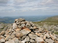
Notes: A great
sprawling mass of a hill, the highest summit of the Central Fells massif laying
a mile north of the Langdale Pikes. High Raise has more in common with
the Pennines than the Lakeland fells, being a flat-topped broad ridge
whose slopes are a fair distance from the summit cairn. While there is
little foreground interest the far panorama is among the best in
Lakeland and features a full 360 degree vista of mountainscape. Keswick
is just visible to the north. All approaches are long; perhaps the most
popular is from Grasmeme via Easedale and Sergeant Man, though the
route from Stonethwaite via Greenup Gill is probably the easiest and
that from Dungeon Ghyll via Stickle Tarn the shortest. |
|
|
High
Raise
Location: Lake
District, Far Eastern Fells
Grid Ref: NY
448134
Height: 2631 ft (802
m)
Status: Wainwright,
Hewitt,
Nuttall
Notes: High Raise is
the highest point on the northern section of the High Street ridge to
the east of Ullswater. The most popular route of ascent is from
Patterdale, at the southern end of the lake, via Wainwright's Coast to
Coast route, though it can also be reached more directly from Pooley
Bridge. The view is dominated by High Street and its outliers to the
south, while Penrith lays to the northeast backed by Cross Fell. There
are glimpses of Ullswater and Haweswater from the summit environs.
|
|
|
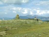
High
Spy
Location: Lake
District,
North Western Fells
Grid Ref: NY
234162
Height: 2142 ft (653
m)
Status: Wainwright,
Hewitt,
Nuttall
Notes: High Spy is
part of
the Dale Head - Catbells ridge that forms the western side of
Borrowdale,
and is usually climbed as part of that ridgewalk rather than on its
own.
Its flanks on the Borrowdale side are quite prettily wooded, while to
the
west High Spy falls steeply and dramatically to the upper Newlands
valley.
Although Dale Head blocks out the view to the southwest, views in most
other directions are excellent and Skiddaw, the Helvellyn ridge, the
Scafell
massif and the Grasmoor / Grizedale groups are all displayed to
advantage.
|
|
|
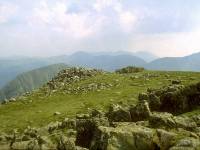
High
Stile
Location: Lake
District,
Western Fells
Grid Ref: NY
170148
Height: 2648 ft (807
m)
Status: Wainwright,
Marilyn,
Hewitt, Nuttall
Notes: The highest
of the
trio of fells standing high over Buttermere, High Stile is a superb
viewpoint
but is also a fell that is not easily won. It can be rarely climbed on
its own, almost all visits being made by those walking the ridge as a
whole
and approaching by either Red Pike or High Crag. Both these fells have
steep and slightly tricky ascents that require a good deal of effort,
although
the ridgewalk itself is straightforward and delightful.
|
|
|
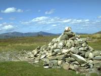
High
Tove
Location: Lake
District,
Central Fells
Grid Ref: NY
289165
Height: 1689 ft (515
m)
Status: Wainwright
Notes: High Tove
is one of
the summits of Lakeland's Central Fells ridge, which stretches north
from
the Langdale Pikes to the Keswick - Penrith gap. The ridge is atypical
of Lakeland, being low and marshy. Although situated midway between
Borrowdale
and Thirlmere, High Tove overlooks neither. The far panorama is
pleasant
enough, however, and includes the Dale Head, Helvellyn and Skiddaw
groups.
High Tove can easily be climbed from Watendlath in about half an hour,
the old path over to Thirlmere crossing the ridge via the summit.
|
|
 |
Hindscarth
Location: Lake
District, North Western Fells
Grid Ref: NY
215165
Height: 2385 ft (727
m)
Status: Wainwright,
Hewitt, Nuttall
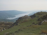
Notes: Hindscarth is
the second of the three fells that overlook
Honister Pass from the north. From this side Robinson, Hindscarth and
Dale Head form a continuous wall above the pass, but the system of
valleys and ridges that differentiate them from each other is well seen
from the Newlands valley to the northwest. Hindscarth is rarely climbed
on its own, but usually in conjunction with either Robinson or Dale
Head, from either of which it's but a simole ridgewalk away. The summit
stands off the main ridge to the north and provides an excellent view.
In the picture we're looking southwards across the Dale Head col
towards the Scafell range and Great Gable. |
|
|
Holme
Fell
Location: Lake
District,
Southern Fells
Grid Ref: NY
315006
Height: 1040 ft (317
m)
Status: Wainwright,
Marilyn, Clement
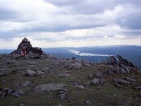
Notes: A rambling and
rugged little fell, overlooking the head of Coniston Water. A
mile or so northwest of Tarn Hows, it's perhaps best climbed from the
road junction at Yew Tree Farm via Uskdale Gap. Although the Coniston
fells crowd the view to the southwest the panorama in most other
directions is extensive and rewarding.
|
|
 |
Ill
Bell
Location: Lake
District,
Far Eastern Fells
Grid Ref: NY
436077
Height: 2484 ft (757
m)
Status: Wainwright,
Hewitt, Nuttall
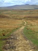
Notes: Ill Bell is
the highest top on the ridge between Troutbeck and Kentmere. It is seen
as a shapely pyramid from most aspects and ascents to it from any
direction are quite steep. It is normally climbed as part of the
Kentmere horseshoe via Yoke or Froswick. The Fairfield and Helvellyn
ranges dominate the panorama to the northwest, with Gable, Scafell,
Bowfell and the Langdale Pikes crowding in to the west. Windermere is
well seen to the southwest. |
|

|
Ingleborough
Location: Yorkshire
Dales,
Ribblesdale
Grid Ref: SD
740745
Height: 2372 ft (726
m)
Status: Marilyn,
Hewitt,
Nuttall
Notes: One of the
famous Three
Peaks of the Yorkshire Dales National Park, Ingleborough stands to the
west of Horton-in-Ribblesdale. Its characteristic flat top makes it
stand
out for many miles around, and it is even prominent from many of the
Lakeland
fells forty miles away. There are many well trodden routes to the
summit
though perhaps the best are those from Clapham and
Horton-in-Ribblesdale.
The view is superb, while the flanks of the fell are packed with
interest,
including potholes and caves (among them the famous Gaping Gill),
limestone
pavements, and waterfalls. There are enough footpaths in the environs
of
the fell to keep you exploring for a month.
|
|
 |
Kinder
Scout
Location: Peak
District, Derbyshire
Grid Ref: SK
085875
Height: 2088 ft (636
m)
Status: Marilyn,
Hewitt,
Nuttall, County Top (Derbyshire)
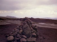
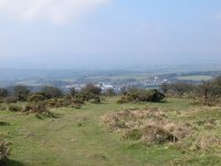
Notes: The highest
summit of the Peak District is a desolate spot in the middle of a huge
peat bog. The cairn pictured here may or may not be the actual summit
but it really matters little - Kinder Scout is a vast, flat plateau
with little variation in height, and the cairn must mark something or
other. It can have few visitors, for although the Pennine Way runs
across Kinder it misses the actual top by about half a mile. I took
this picture in September 1975 after several months of drought and I
was wearing ordinary street shoes at the time, a feat impossible in
normal conditions. |
|
|
Kit
Hill
Location: Bodmin
Moor, Cornwall
Grid Ref: SX
374713
Height: 1096 ft (334
m)
Status: Marilyn,
Clement
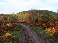
Notes: A detached
outlier of Bodmin Moor, Kit Hill stands some ten miles north west of
Plymouth and directly above the market town of Callington. Approaches
from the town are not straightforward and the best starting point is
probably the village of Kelly Bray to the west. The hill is a broad
dome of heathland and much of it has been designated a country park. A
tall brick communications tower stands at the summit, and a road also
runs to the top. Extensive earthworks suggest an iron age hill fort.
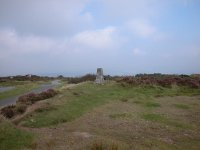
Views are pleasant but not extensive; Caradon Hill is seen to the west,
Dartmoor to the east. The summit view picture shows Kelly Brae to the
west. |
|

|
Knock of Crieff
Location: Scottish
Highlands, Perthshire
Grid Ref: NN
873233
Height: 915 ft (279
m)
Status: Marilyn
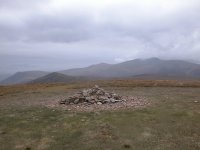
Notes: Knock of
Crieff is a splendid little hill that overlooks the Perthshire town of
Crieff. The lower top has a viewpoint and a topograph; the upper top
lays deep within the trees and is marked by a cairn. The ascent is easy
and is a delightful evening stroll from the town. From the lower
viewpoint one can gaze upon the Ochils to the south, Ben Vorlich to the
west, and Ben Chonzie and Auchnafree Hill to the northwest and north.
|
|
 |
Knott
Location: Lake
District,
Northern Fells
Grid Ref: NY
296329
Height: 2329 ft (710
m)
Status: Wainwright,
Marilyn, Hewitt, Nuttall
Notes: The highest
top of the Caldbeck or "Back O' Skiddaw" massif, Knott is sprawling and
remote. Perhaps the best approach is along the single track road from
Mosedale and the path along the north side of Grainsgill Beck. Although
much of the surrounding moor is covered in heather, Knott itself
features a beautiful grassy top. Knott's "middle of nowhere" situation
is magnificent but as a consequence its view does lack interest, being
largely composed of endless miles of empty moorland. |


