|
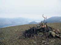
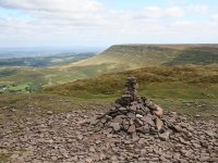
Sron a' Choire Ghairbh
Location: Scottish
Highlands,
Great Glen
Grid Ref: NH
222945
Height: 3074 ft (937
m)
Status: Munro,
Murdo, Marilyn
Notes: This Munros is
one of a pair that overlook Loch Lochy from
the north, and hence is very accessible. The easiest ascent starts at
Laggan Locls and takes the upper variant of the Great Glen cycleway to
the southwest, and then a rougher track up the Allt Ghlas Doire to the
col, and finally a stalkers' path that runs virtually to the summit
plateau. The view up and down the Great Glen is especially good.
|
|
|
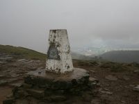
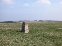
Staple Hill
Location: Somerset
Grid Ref: ST
240166
Height: 1033 ft (315
m)
Status: Marilyn,
Clement
Notes:The highest
point of the Blackdown Hills south of Taunton, Staple Hill is not
particularly interesting. The trig pillar marking the highest point is
buried in woodland and there is no view but the approach is pleasant
enough. Two public bridleways pass close by and there are several
nearby road access points, the closes being the top end of Underhill
Lane coming up from Staple Fitzpaine. This is also the approach for
non-drivers as the Taunton - Yeovil bus route passes through the
village.
|
|
|
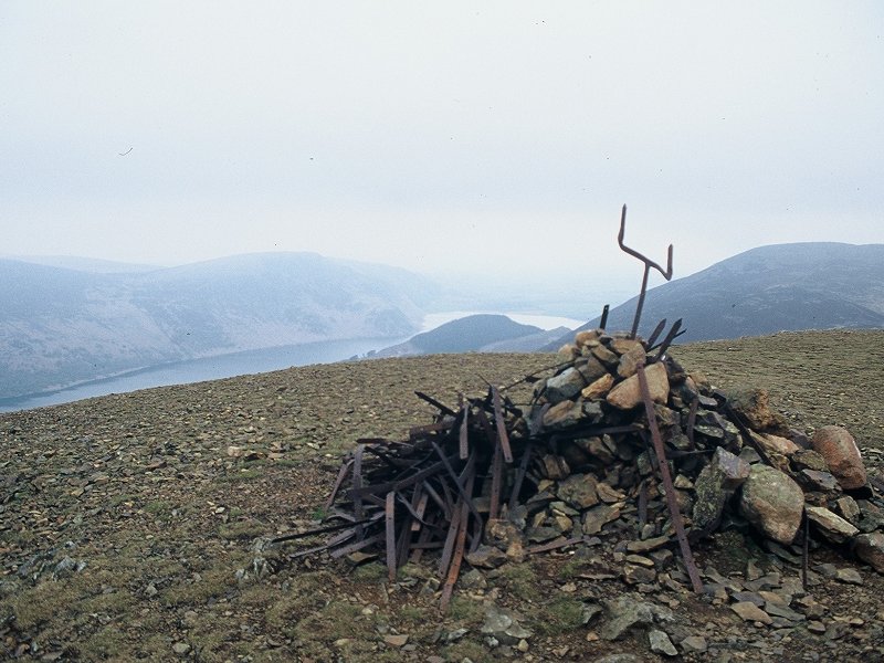
Starling
Dodd
Location: Lake
District, Western Fells
Grid Ref: NY
141157
Height: 2077 ft (633
m)
Status: Wainwright,
Hewitt, Nuttall
Notes: Starling Dodd
lays to the west of Buttermere's Red Pike and overlooks both Crummock
Water (to the north) and Ennerdale Water (to the south). To get to the
summit it's necessary either to climb the fell's flanks after
floundering through the marshy wastes of Mosedale, or walk out along
the ridge from the vastly superior and more exciting Red Pike. I'm not
convinced that Starling Dodd rewards the effort of climbing it,
something I can say about very few Lakeland fells.
|
|
|
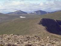
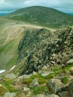
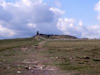
Stob Coire
an t-Sneachda
Location: Scottish
Highlands,
Cairngorms
Grid Ref: NH
996029
Height: 3858 ft (1176
m)
Status: Munro top,
Murdo
Notes: This top is
the highest
point of the headwall of Coire an t-Sneachda
("snow
corrie"), one of the "northern corries" of Cairn Gorm. From Aviemore
and
Strathspey it appears as a significant mountain in its own right, but
from
the parent mountain of Cairn Gorm it is revealed as just a bump on the
edge of the Macdui - Cairngorm plateau (top picture). The cliffs on the
northern side are dramatic, but on the southern side the ground drops
very
gently away towards Loch Avon. It's doubtful whether anybody has ever
set
out to climb Stob Coire an t-Sneachda in its own right, but it is
regularly
ascended by those crossing from Cairn Gorm to Macdui. The summit
picture
shows a retrospective view of Cairn Gorm. |
|
|
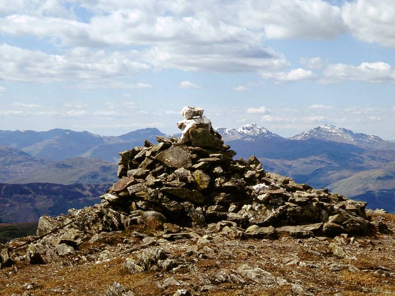
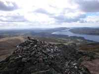
Stuc a'
Chroin
Location: Scottish
Highlands,
The Trossachs
Grid Ref: NN
617174
Height: 3199 ft (975
m)
Status: Munro,
Murdo,
Marilyn
Notes: Laying on
the Stirlingshire
/ Perthshire border north of Callander, Stuc a' Chroin is one of the
three
mountains clearly visible from the plains of Falkirk and East Lothian
between
Glasgow and Edinburgh. Although it is normally linked with its
neighbour
Ben Vorlich in the guidebooks, a longer but easier ascent can be made
from
Callander with a path all the way. Views are tremendous and include
Scotland's
central lowlands, the Trossachs, the Arrochar Alps, the Ben Lawers and
Ben More groups, the western Mounth and parts of the Tay basin.
|
|
|
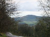
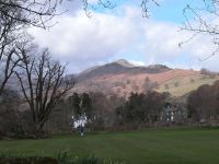
Sugar
Loaf
Location: Black
Mountains
Grid Ref: SO
272187
Height: 1955 ft (596
m)
Status: Marilyn, Dewey
Notes: A fine,
shapely hill a couple of miles northwest of Abergavenny, on the
southern tip of the Black Mountains. The hill can be ascended by a good
track all the way from Abergavenny town centre from where it's a
half-day expedition. There's a good view of both the Black Mountains
and the Brecon Beacons further to the west.
|
|
|
Swinside
Location: Lake
District, North Western Fells
Grid Ref: NY
243224
Height: 801 ft (152
m)
Status: Marilyn
Notes: If you ever
wondered about climbing that pretty little wooded hill on the northwest
corner of Derwentwater, then take my advice and don't bother. I say
this not because there are no rights of way on the hill and gaining the
summit is technially a trespass, but because it really isn't worth
climbing. The woods are opressive and unfriendly, the summit dome is a
pathless jungle and the view, surprisingly, isn't that great either.
Determined Marilyn baggers will find a way to the top. Everyone else
should leave it alone.
|
|

|
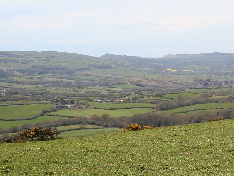
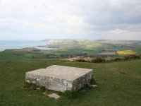
Swyre
Head
Location: Purbeck
Downs, Dorset
Grid Ref: SY
934784
Height: 682 ft (208
m)
Status: Marilyn
Notes: Swyre Head is
the highest point of the Purbeck Downs, southwest of Bournemouth and
Poole in Dorset. It stands close to the coast path and thus has a
glorious view each way along the English Channel coast, from the Isle
of Wight in the east to Portland Bill in the west. The summit carries a
trig pillar though there is also a nearby tumulus, which is higher.
Swyre Head is a simple stroll from the nearby village of Kingston.
|
|
 |
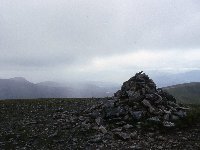
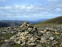
Thornthwaite
Crag
Location: Lake
District,
Far Eastern Fells
Grid Ref: NY
431100
Height: 2572 ft (784
m)
Status: Wainwright,
Hewitt,
Nuttall
Notes:
Thornthwaite Crag lays at the junction of four mountain ridges, an
important footpath crossroads since Roman times when it formed part of
the highway known as High Street. Its summit carries a massive columnar
cairn, one of the most distinctive in the district. Its position
ensures that it has a huge variety of approach routes, but perhaps the
most common is from the south, via Froswick, as part of the Ill Bell
ridgewalk. Thornthwaite Crag's parent fell is High Street itself,
laying a kilometre to the northeast along a broad grassy ridge. The top
is relatively flat and the immediate panorama is of other Lakeland
fells, but short walks off the summit bring the four radiating valleys
into view. |
|
 |
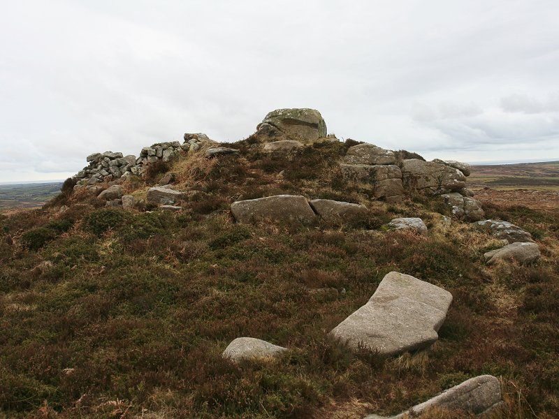
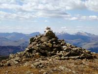
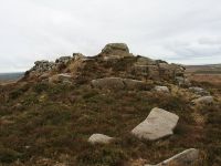
Thunacar
Knott
Location: Lake
District,
Central Fells
Grid Ref: NY
279079
Height: 2372 ft (723
m)
Status: Wainwright,
Nuttall
Notes: Thunacar
Knott is entirely undramatic yet strategically quite important, for
it's the highest part of the ridge immediately to the rear of the
Langdale Pikes, which effectively all radiate from it. However, it's
not untimately the parent fell as that honour goes to High Raise, a
mile to the north. It's a fair bet that Thunacar Knott has never been
climbed on its own account, merely visited as an afterthought by those
ascending the Pikes, but it does provide some quite dramatic views of
its offspring. Perhaps the easiest approach is from Easedale via
Sergeant Man, though it's crossed almost by default by those walking
from the Pikes to High Raise or vice versa. |
|
 |
Tom
na Gruagaich
Location: Scottish
Highlands,
Torridon
Grid Ref: NG
859601
Height: 3025 ft (922
m)
Status: Munro,
Murdo,
Marilyn
Notes: Formerly just
the southern top of Beinn Alligin, Tom na Gruagaich was promoted to
Munro status in 1997. The summit is beautifully situated at the
southern end of the great sandstone terraces of Toll a Mhadaidh Mor,
the eastern side of Alligin, and surprisingly it's Gruagaich rather
than Alligin's principal summit of Sgurr Mhor that carries the trig
pillar. Views of Sgurr Mhor, the other Torridon hills, Loch Torridon
and the whole sweep of Wester Ross, are awesome. The map doesn't show
it but there's a decent path all the way up starting at the Coire Mhic
Nobuill car park above Torridon house, via Coire nan Laogh. The path is
steep and a good deal of effort is required.
Photo by Graham Jackson. |
|
|
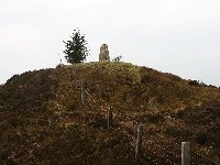
Torlum
Location: Scottish
Highlands, Perthshire
Grid Ref: NN
819192
Height: 1289 ft (393
m)
Status: Marilyn,
Yeaman
Notes: Torlum is a
minor summit situated a few miles west of Crieff in Perthshire. The
lower slopes are wooded, the upper slopes heathery. The easiest access
is by a forest path from the vicinity of Ballochargie to the east;
there is a path up to the summit dome but peversely it is more easily
found on the descent. The Strathearn towns of Comrie and Crieff are
well seen, while the Ochils occupy the southern arc of the view and Ben
Chonzie and its neighbours tower over the scene to the north.
|
|
|
Twmpa (a.k.a. Lord Hereford's Knob)
Location: Black
Mountains
Grid Ref: SO
224350
Height: 2264 ft (690
m)
Status: Hewitt,
Nuttall
Notes: Twmpa is a
bluff, the steep northern end of the ridge neighbouring that of Black
Mountain, and it is very similar in appearance to its eastern neighbour
Hay Bluff (seen in the summit picture, left). Twmpa is best climbed
from the car park at the summit of Gospel Pass, from which it's a
deceptively easy stroll of some 25 minutes. The view is very similar to
that from Hay Bluff, taking in the Black Mountains to the south, the
Brecon Beacons to the southwest, and the rural expanses of Powys and
Herefordshire to the northwest and northeast respectively.
|
|
 |
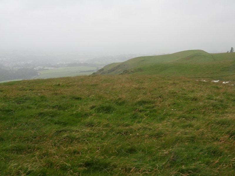
Walbury
Hill
Location: Berkshire
Downs
Grid Ref: SU
373616
Height: 974 ft (297
m)
Status: Marilyn
Notes: This
unassuming summit is the high point of the West Berkshire downs and is
also the highest point within 75 miles of London. It rises above the
scattered village of Inkpen a
handful of miles south west of the market town of Newbury. It's
possible to drive almost to the summit; roads cross the ridge a few
hundred yards away both to the east and west. Non drivers can walk up
from Kintbury station on the Great Western railway line from where it's
just over three miles, or the Newbury - Hungerford bus will get you to
Upper Green just a mile away. The ridge path misses the summit by a
hundred and fifty yards but it's a simple enough matter to shin over a
gate and take the short path to the trig pillar. Pleasant pastoral
country surrounds the hill though the best views are had from the
slopes to the north overlooking Newbury. |
|
 |
Walna
Scar
Location: Lake
District,
Southern Fells
Grid Ref: SD
257963
Height: 2037 ft (621
m)
Status: Nuttall
Notes: The
highest Lakeland top not to feature in Wainwright's guides, Walna Scar
lays just south of the pass of the same name between Coniston and
Dunnerdale and is a continuation of the southern ridge of Dow Crag. The
top is grassy and unexciting and it's easy to see why Wainwright did
not consider it to be part of "proper" lakeland fell country, yet it is
but a four-minute detour from the path and can be climbed from Coniston
village in little more than an hour. Dow Crag and its tops dominate the
view to the north while the shapely cones of Caw and Harter Fell
(pictured) feature prominently to the south and west respectively. |
|
|
Walton
Hill
Location: Worcestershire,
Clent
Hills
Grid Ref: SO
942797
Height: 1037 ft (316
m)
Status: Marilyn
Notes: Walton Hill is
the highest of the Clent Hills, a groups of heathland tops in north
Worcestershire immediately south of the Birmingham / Wolverhampton
conurbation. Walton Hill itself is a pleasant sandy ridge, mostly
wooded, and criscrossed by a maze of footpaths and bridleways. It lays
only two miles from Halesowen and is thus very accessible from the
city; the nearest public transport access is the village of Romsley.
The top is a bare 10 minutes of ascent from the nearest road, and
Birmingham dominates the view through the whole northern arc. The view
southwards is a complete contrast, taking in the pastoral countryside
of the Severn vale fringed in the distance by the Cotswolds, the
Malverns and Bredon Hill.
|
|
|
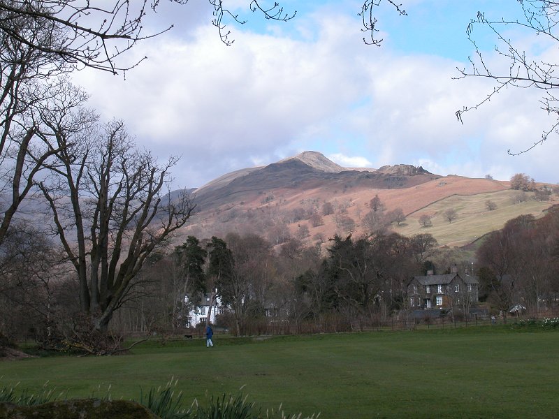
Wansfell
Pike
Location: Lake
District, Far Eastern Fells
Grid Ref: NY
394041
Height: 1581 ft (482
m)
Status: none
Notes:
Confusion surrounds Wansfell. The fell and the summit seen here is
Wansfell Pike, which stands proudly above Ambleside to the east. But it
is not actually Wansfell proper, which stands a kilometre northeast and
is several feet higher, and furthermore is actually given as Baystones
(q.v.) by all references except Wainwright. None of this takes anything
away from Wansfell Pike, of course, which is a fine little summit just
an hour's climb from Ambleside. There is an excellent view of the town
and down the length of Windermere, and further afield the Langdales,
Bowfell and Crinkle Crags look especially inviting from here. |
|
|
Watch Croft
Location: Cornwall
Grid Ref: SW
420357
Height: 827 ft (252
m)
Status: Marilyn
Notes: Watch Croft is
the highest point of the Land's End peninsula and is therefore
Britain's southwesternmost Marilyn. The terrain is rugged and thorny
and an easy ascent is a matter of finding the start of the correct path
from the road, which is at approx SW 415361. There is a parking place
several hundred metres to the west. Follow the track up to an old mine
building and then take a fainter track to the left; the summit is in
view and is obvious. The best feature of the view is the rugged North
Cornwall coastline; the other coast, just east of Penzance, can also be
seen.
|
|

|
Watch Hill
Location: North
West Cumbria
Grid Ref: NY
159318
Height: 833 ft (254
m)
Status: Marilyn
Notes: Watch Hill
lays a couple of miles northeast of Cockermouth in Cumbria, just off
the edge of the Lake District. A public bridleway, adopted as part of
the Allerdale Ramble, runs up to the ridge; thereafter it's a simple
grassy ridge to the summit. The ridge has three tops; Wainwright chose
the westernmost for his Outlying Fells book but it's the easternmost,
just to the west of a forest plantation, that is the highest. From the
top Skiddaw, the Whinlatter group and the Lorton Vale fells are seen
from an unfamiliar angle, but the greater part of the panorama consists
of Cumbria's pastoral northwest. The Solway Firth and the Dumfriesshire
coast
should be visible on clear days.
|
|
|
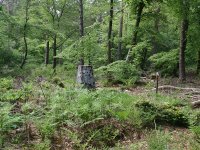
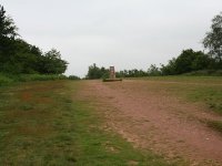
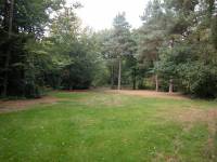
Wendover
Woods (a.k.a Haddington
Hill)
Location: Chiltern
Hills,
Buckinghamshire
Grid Ref: SP
890089
Height: 876 ft (267 m)
Status: Marilyn,
County
Top (Buckinghamshire)
Notes: Haddington
Hill is
the highest point of the Chiltern Hills, a chalk scarp northwest of
London.
Like many high points of scarps, the highest point is not actually a
point
at all, but an area - moreover, one that occurs deep in Wendover Woods
somewhere within an extensive car park and within a hundred metres of
an
ice cream van and a public convenience. Wendover Woods are lovely,
however,
and a circular walk from the town to the summit and back makes a nice
half
day walk. There's no view.
|