|
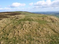
Wentwood
Location: Monmouthshire
Grid Ref: ST
411943
Height: 1014 ft (309
m)
Status: Marilyn,
Clement
Notes: This summit is
situated in woodland a few miles north of the Monmouthshire coast, and
lays not far from the lane between Parc-Seymour and Pen y Cae-Mawr. Non
drivers can get a bus to Parc-Seymour (which is on the Newport to
Chepstow route) and walk up. The trig pillar is a couple of hundred
metres south of a prominent forest track and is not difficult to find.
There is no view from the trig pillar itself but the lane up from
ParcSeymour has some rather nice views of the Bristol Channel and the
Somerset coast.
|
|

|
Wether
Hill
Location: Lake
District, Far Eastern Fells
Grid Ref: NY
455167
Height: 2198 ft (670
m)
Status: Wainwright,
Nuttall
Notes: It's likely
that a good many walkers stroll across the summit of Wether Hill
without even realising they've done so, for the gradients either side
of it on the ridge path are imperceptible and there's little feeling of
being on top of something. The fell stands part way along the northern
section of the High Street ridge, between the more notable tops of High
Raise and Loadpot Hill. The Hight Street ridge path is the obvious
approach. The view, like the fell, is unremarkable but does include the
Helvellyn group to the southeast and the Cross Fell group way to the
northwest.
|
|


|
Whernside
Location: Yorkshire
Dales,
Ribblesdale
Grid Ref: SD
738814
Height: 2416 ft (736
m)
Status: Marilyn,
Hewitt,
Nuttall, County Top (North Yorkshire)
Notes: The highest
of the
celebrated Three Peaks of the Yorkshire Dales, and the highest summit
in
Yorkshire, Whernside stands between the heads of Ribblesdale and
Deepdale
and overlooks the famous Ribblehead viaduct from the northwest. The
hill
is a long ridge with a steep southeastern flank, which makes a direct
ascent
from Ribblehead very hard work. A drystone wall (marking the boundary
between
the districts of Craven and Richmond) follows the top of the ridge,
accompanied
by a broad pathway, and at the summit itself the wall is formed into a
pair of wind shelters. The summit can be reached in about two hours
from
Ribblehead station, and the choice of two ascent routes can be combined
into a circular walk (up one way, down the other) of around four hours.
|
|

|
Whimble
Location: Radnor
Forest, Powys
Grid Ref: SO
205626
Height: 1965 ft (599
m)
Status: Dewey
Notes: A smal yet
shapely hill on the southern edge of the New Radnor Forest in mid
Wales, Whimble is a straightforward climb from New Radnor village.
There are good views of the countryside of Powys and Herefordshire
around the southern arc but the northern aspect is shut in by the
higher summits of the group.
|
|

|
Whinlatter
Location: Lake
District,
North Western Fells
Grid Ref: NY
196249
Height: 1722 ft (525
m)
Status: Wainwright
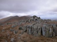
Notes: Whinlatter
is the fell
that has given its name to the high road between Braithwaite and
Cockermouth,
and to the forest plantations on its slopes and those of the
surrounding
fells. Easily ascended from the visitor centre at the top of Whinlatter
Pass, the highlight of its summit view is that of the Grizedale Pike
group
to the south. Wainwright actually chose the west top as his summit but
it's the east top (seen here) that is higher.
|
|

|
White
Maiden
Location: Lake
District,
Southern Fells
Grid Ref: SD
254957
Height: 2001 ft (610
m)
Status: Nuttall
Notes:
White Maiden is an outlier of Walna Scar, itself a satellite of Dow
Crag in the Coniston group, and just qualifies as a Nuttall. Its
splendidly rocky summit marks it out as a rather more interesting place
to be than Walna Scar itself, and further interest is added by the
adjacent meeting point of two beautifully constructed stone walls.
Neither Walna Scar nor White Maiden feature in Wainwright's guides and
the path between them is relatively unfrequented, being little more
than a faint trod in the rough grass of the ridge. A ten minute walk
south from Walna Scar with very similar views.
|
|

|
White
Side
Location: Lake
District,
Eastern Fells
Grid Ref: NY
337166
Height: 2831 ft (863
m)
Status: Wainwright,
Hewitt,
Nuttall
Notes: One of the
many tops
of Helvellyn's long northern ridge, White Side lays just over a mile
north
of its parent and is traversed by all those choosing the old mine track
from Glenridding as a route to or from Helvellyn. As such it is a
deceptively
easy climb, particularly as it ranks as one of the twenty highest
summits
in England. The highlights of its view include nearby Helvellyn,
Swirral
Edge and Catstycam.
|
|

|
Wills Neck
Location: Quantocks,
Somerset
Grid Ref: ST
165352
Height: 1261 ft (384
m)
Status: Marilyn
Notes: The highest
point of
the Quantocks, a hill range in western Someset running from Taunton
northwestwards
to the coast. The Quantocks are superb walking country, sandy heathland
with heathery tops and forested slopes. Wills Neck is best visited as
part
of a ridgewalk but could be climbed direct via a number of footpaths
from
down in the valleys to either side (e.g. from Crowcombe or Aisholt).
There
are superb views to the west and northwest, including the coast near
Minehead
and across the Bristol Channel to Wales.
|
|


|
Wilmington
Hill
Location: South
Downs, Sussex
Grid Ref: TQ
548034
Height: 702 ft (214 m)
Status: Marilyn
Notes: Wilmington
Hill is
the first major summit on the South Downs west of Eastbourne. It lays
some
400m off the roue of the South Downs Way but, by careful map reading
and
the use of a permissive path, it's possible to access the trig point.
The
actual highest point appears to be a grassy mound around 50 metres
further
along the path. The summit stands on the lip of a steep north-facing
chalk
slope and the views across the Weald are superb. To the west Firle
Beacon
presents an inviting profile while to the south there is a distant view
of Newhaven harbour and the Channel.
|
|

|
Winder
Location: Howgill
Fells
Grid Ref: SD
653932
Height: 1553 ft (473
m)
Status: Clement
Notes: Winder sits
immediately above Sedbergh and is likely to be the first top
encountered by anyone venturing into the Howgills from the town. There
is a topograph near the trig pillar, though unfortunately some of it is
illegible. The view, however, encompasses both the Lakeland fells and
the Pennines, with Kentmere Pike to the northwest and Whernside to the
southeast, each roughly 20 miles away. The ascent from Sedbergh takes
about 50 minutes.
|
|

|
Winter Hill
Location: Bolton, Lancashire
Grid Ref: SD
659149
Height: 1496 ft (456
m)
Status: Marilyn,
Clement
Notes: Winter Hill is
situated a few miles north of Bolton. The hill, which overlooks Greater
Manchester, Greater Merseyside and the industrial towns of Lancashire,
made it an ideal site for the Independent Television Authority (as it
was in those days) to choose it as the site of their main TV
transmitter for north west England and the mast overlooks and dwarfs
the trig pillar. There are also several other communications towers
nearby. It's possible to drive up from Howrich (south west of the
summit) but a more elegant ascent can be made from the village of
Belmont to the east, which also has a handy bus service from Bolton.
Apart from the aforementioned urban panorama the southern Pennines take
pride of place in the view to the east.
|
|

|
Wrekin,
The
Location: Shropshire
Hills
Grid Ref: SJ
628080
Height: 1335 ft (407
m)
Status: Marilyn
Notes: Surrounded by
woodland, myth and legend, the Wrekin is a suberb little hill sutuated
three miles southwest of Wellington, near Telford in Shropshire. The
summit is home to a TV transmitting station as well as a trig pillar
and a topograph. The view is superb; many of the principal hills of mid
and north Wales can be seen, including Pen-y-Fan and Cadair Idris,
while to the south the view extends to the Malverns and Cotswolds. To
the north and northeast lay the Cheshire plain with Winter Hill beyond,
parts of the Pennines including Blackstone Edge, and the Roaches and
Cannock Chase. To the east the hill overlooks Telford, Wolverhampton
and Birmingham. A rough track runs all the way up from a road junction
at the northeast end of the hill, and a lone cottage halfway up
provides drinks and refreshments.
|
|
 |
Yoke
Location: Lake
District,
Far Eastern Fells
Grid Ref: NY
437067
Height: 2316 ft (706
m)
Status: Wainwright,
Hewitt,
Nuttall
Notes: Yoke is a
prominent top, the most southerly on the ridge between Troutbeck and
Kentmere. As such it is well seen in views northwards from Windermere.
The usual approach is via the Garburn pass between Kentmere and
Troutbeck, and most walkers will not simply climb Yoke but will go on
to walk the ridge to High Street or to complete the Kentmere horseshoe.
The best views are to the west and northwest where the Scafell /
Bowfell massif and the Fairfield group form the skyline. |
|

|
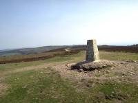
Ysgyryd Fawr
Location: Black
Mountains
Grid Ref: SO
331182
Height: 1594 ft (486
m)
Status: Marilyn,
Clement
Notes: This hill is
situated roughly three miles northeast of Abergavenny. The ascent is
simple; go through the gate off the road and follow the path up through
the trees and out onto the north-south ridge until you reach the trig
point. It's a hill that appears to be popular with families (although
maybe that's because I chose to climb it on Easter Sunday). Sugar Loaf
and Blorenge dominate the view, which otherwise consists largely of the
pastoral countryside of Monmouthshire.
|


