
| Rowardennan to Ardleish | Back to West Highland Way index | Tyndrum to Bridge of Orchy |
The difficulties of day three are behind us. This section of the way starts off on a simple path but at Beinglas it upgrades to a vehicle track, reverting to path only for the Strath Fillan forest section. The miles will seem to fly past now. There is an opportunity for making a shorter day of it and stopping for the night at Crianlarich if you wish, particularly as the following section to Bridge of Orchy is a short one.
The route follows Glen Falloch northwards
from the upper end of Loch Lomond, and after the first two and a half
miles
through rough pasture and open woodland it keeps hard by the river,
passing
water meadows and cascades. Further on it switches to the left side of
the glen, passing the lonely farm of Keilator before reaching the
forest
section west of Crianlarich. After two delightful miles of forest walk
with views down into Strathfillan, the path descends to this valley -
whose
river is a feeder of the Tay - and hops to the north side for a short
section
of pastureland before crossing to the woodland on the south side again.
the last mile and a half into Tyndrum lies alongside the track of the
West
Highland Railway (Oban branch)
|
|
|
| Length: | 14.2 miles / 22.9 km |
| Total ascent: | 2240 ft / 683 m |
| Total descent: | 1548 ft / 427 m |
| Estimated time: | 5 hrs 15 mins |


![]() Train
times to Ardlui (.pdf document)
Train
times to Ardlui (.pdf document)
![]() Citylink
bus times to Ardlui: Glasgow-Ft
William (.pdf document).
Citylink
bus times to Ardlui: Glasgow-Ft
William (.pdf document).
Unless you have camped near Ardleish the first task of the day is to cross the loch by the passenger ferry from Ardlui. This tiny village, on the A82 between Glasgow and Fort William, is served both by rail and Citylink coach.


The path by Cnap Mor; Dubh Lochan
From the ferry landing walk back up to the top of the pasture and pick up the West Highland Way heading north past the isolated cottage that is Ardleish. Initially there is a view back along Loch Lomond but the loch is soon lost to sight. Not only does it narrow appreciably here at its northern end, but the path also veers around a knoll, known as Cnap Mor, which separates the path from the lochside. The path runs through light woodland cover, passing the pretty Dubh Lochan ("Black Tarn") en route. The path is straightforward and exhibits none of the difficulties, such as twists, turns and clambers up and around rock outcrops, that livened up much of the previous section.
After about two miles the path emerges at Ben Glas Farm.

Once you cross Ben Glas burn and enter the grounds of the farm you leave Argyllshire and re-enter Stirlingshire. The simple path becomes a vehicle track once again and there is the feeling of a return to relative civilization.
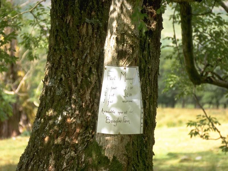
Ben Glas Farm and its delights are signalled to the hiker from some way out. Notices on trees and fenceposts advertise it facilities; camping, bunkhouse accommodation, refreshments and even foot massage (prices per foot are displayed). If you're backpacking then Ben Glas, rather than Ardleish, would seem to be the place to stop. For those travelling through there is a rudimentary cafe that also sells a few provisions, and like many such places en-route it acts as a rest, recuperation and information exchange centre. For those who have had enough of hiking, there is a driveway out to the main road and the village of Inveranan, with its inn and bus stop, is half a mile away.


The last steps in Argyllshire; The bridge over Ben Glas burn, and the farm; the track north into Glen Falloch
From Ben Glas the vehicle track heading northwards takes the West Highland Way into Glen Falloch.


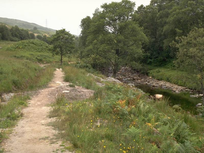
The path by the River Falloch
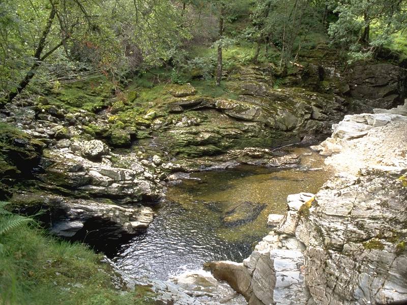
North of Ben Glas the West Highland Way pretty much hugs the east bank of the river Falloch, traversing a mixture of meadows, semi-rough pastures and open woodland. The glen is shared by the main A82 road, never more than 400 meters away, the West Highland Railway on the other side of the glen, and the inevitable line of pylons that are an eyesore but a necessity. After a mile the track follows the glen around a left-hand curve to head northeast. Another mile further on, the Way runs adjacent to a picturesque series of water cascades as the Falloch squeezes through a miniature rock gorge.


Falls of Falloch; distant mountains; the WHW in Glen Falloch

Falls of Falloch
Beyond the Falls of Falloch the Way heads through a couple of smallholdings and there is a general theme of fenced pastures and scattered stands of trees. The path passes a couple of isolated cottages such as Blackcroft and Derrydarroch. There are still occasional stretches of rough moorland.


Riverside meadows; trees by the riverbank; moorland section


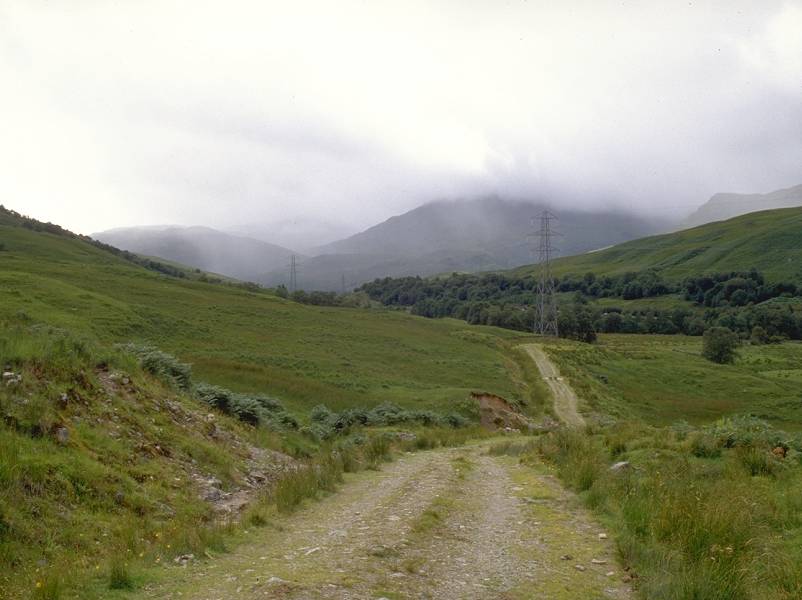
Beyond Derrydarroch the path becomes a little more primitive as the glen starts to look wilder. To your right are mountains such as An Caisteal ("The Castle"), Beinn Chabhair and Cruach Ardrain; to your left are wooded moorland heights that sweep up to the unseen Beinn Dubhcraig ("Black Crag Mountain"). The cultivated pasture falls away and the scenery reverts to rough grassland, bracken and gorse. The Way crosses to the west bank of the Falloch, and two miles short of the head of the glen it dives under the railway by a cattle creep and crosses the road (mind the traffic!) to adopt the course of the original highway through the glen, now a farm track serving the lonely cottage of Keilator.


The WHW on the west bank of the Falloch; the turn under the railway; rear view of the Keilator track


A passing shower crosses the Keilator track; Keilator farm

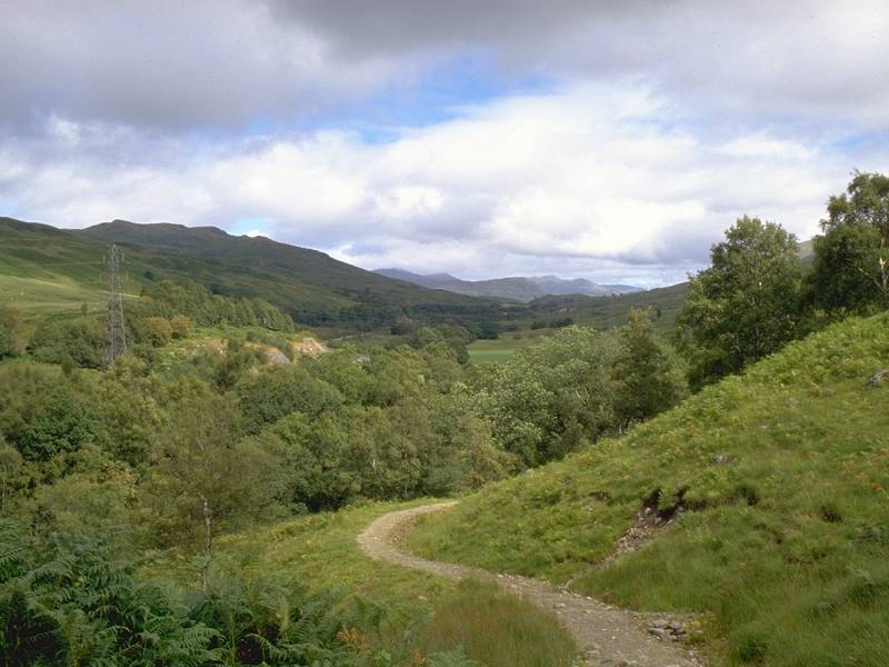
Once past Keilator the track becomes a forest road. It heads up the tiny Bogle Glen to enter the plantations above Crianlarich. Almost immediately past the forest gate, a side trail turns right to head down into this busy little village; there are a couple of inns, shops and B&Bs as well as the youth hostel and the railway halt. If you started the day as far back as Inversnaid you may well wish to rest your limbs here. Starters at Ardlui or Benglas, however, may prefer to push on to Tyndrum or even Bridge of Orchy.
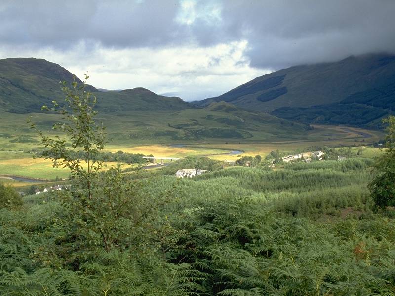


Crianlarich and Glen Dochart; The forest track above Strath Fillan
The forest track crosses the watershed between the Clyde and the Tay just here, and within two hundred meters you meet the return track coming back up from Crianlarich. The village stands at a junction of glens and this vantage point within the forest plantation affords good views. Eastwards from Crianlarich the River Fillan runs along Glen Dochart towards Loch Tay; the twin mountains of Ben More and Stobinian, the highest in Britain south of the Tay, stand immediately to the right and are a fine sight. To the left, running northwest, is Strath Fillan.
![]() Train
times at Crianlarich (.pdf document)
Train
times at Crianlarich (.pdf document)
![]() Citylink
bus times to/from Crianlarich: Glasgow-Ft
William, Edinburgh
- Ft William (.pdf document).
Citylink
bus times to/from Crianlarich: Glasgow-Ft
William, Edinburgh
- Ft William (.pdf document).


Forest paths in Strath Fillan; Strath Fillan
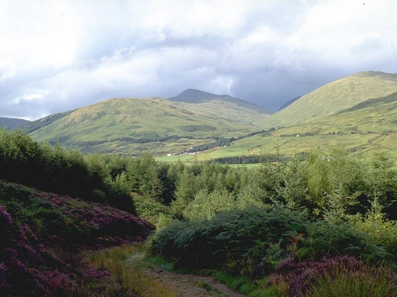
Having left Glen Falloch the West Highland Way repeats the theme of running along a cultivated valley before hitting its upper reaches five miles ahead. Strath Fillan is rather more open and populated than Glen Falloch, however. The forest path gives a series of excellent vistas down into the farm-speckled valley below.


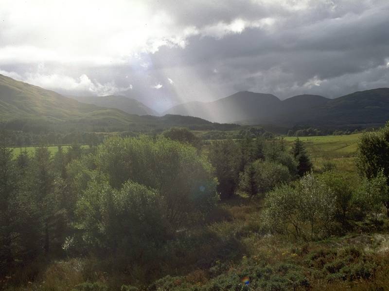
A shower runs along Strath Fillan


Forest scenery above Strath Fillan
The West Highland Way follows a forest road and then a made track through the nameless plantation for something over two miles, reaching a height of around 1200ft. The scenery here is excellent. You either like pinewood scenery or you don't, but at present the plantation is young enough, and dotted with enough clearings, to afford plenty of views up and down the valley to the distant mountainscapes beyond. The path through the latter mile of the plantation is itself rather invigorating, as it doglegs around streams and descends rocksteps. The heady mix of forest, water and sky is superb on a sunny afternoon.

WHW above Strath Fillan


Descent to Strath Fillan
About half way between Crianlarich and Tyndrum the Way forsakes the forest, descending by a lively little path to cross first the railway and then the road (mind the traffic again!) into a short strip of woodland hard by the river. After a short distance it turns right to cross a bridge to Kirkton farm on the other side of the glen. Take a moment to enjoy the views along the glen from the bridge; the vista downstream towards Ben More and Stobinian is especially fine.

Ben More and Stobinian seen along Strath Fillan; the Glen Cononish Munros


The track beyond Kirkton; Auchtertyre; The confluence of the river Cononish
A kilometre northwest of Kirkton the track reaches Auchtertyre, another farm that appears to do a sideline in camping and bunkhouse provision. The track turns left again here to run around the shoulder of the hill and rejoin the railway and river. The line is crossed and the track hugs the riverbank as far as Dalrigh farm, where the River Cononish joins the Falloch in an area of rather messy earthworks. When I walked this section in 1995 the correct line of the path was somewhat confusing and it would have been all too easy to have headed off into Glen Cononish by mistake. This glen is a dead end, albeit a magnificent one, giving access to a group of Munros including Ben Lui, Ben Oss and Ben Dubhcraig.

For the final mile and a half into Tyndrum the path more or less hugs the left bank of the river, mainly through open woodland. Across the river are scattered cottages, holiday chalets and a caravan park; Tyndrum's major business is tourism. Like Crianlarich, Tyndrum lies at a major junction of glens. To the west is the road to Oban, the county town of Argyllshire and a ferry terminal for many of the small isles off the west coast. To the north is the road to Fort William and Inverness. The railway also goes two separate ways, having actually divided at Crianlarich with the two branches running along opposite sides of Strath Fillan.
The path emerges at Tyndrum Lower railway halt and heads off diagonally across a rough pasture; most walkers will ignore this diversion and head along the track into the village proper. Tyndrum is roughly halfway along the West Highland Way and I can't have been the only one to decide that it makes a decent base for tackling the greater part of it. There is plenty of accommodation here though the Benmore - the largest hotel for miles around - appears to cater exclusively for those on coaching holidays. If you're arriving here by train be warned that the track from Tyndrum Lower into the village is very rough and seems to be deliberately engineered to wreck wheeled luggage.
Tyndrum caters for all grades of passing traveller and has everything for the hiker, backpacker, motorist, coach tripper and long-distance lorry driver. Just the place to rest and to stock up for the push north, in fact. There are no more shops until Kinlochleven, so if you're backpacking be sure to lay in everything you will need here.
![]() Train
times at Tyndrum (.pdf document)
Train
times at Tyndrum (.pdf document)
![]() Citylink
bus times to/from Tyndrum: Glasgow-Ft
William, Edinburgh
- Ft William (.pdf documents).
Citylink
bus times to/from Tyndrum: Glasgow-Ft
William, Edinburgh
- Ft William (.pdf documents).
| Rowardennan to Ardleish | Back to West Highland Way index | Tyndrum to Bridge of Orchy |
This page last updated 20th November 2004
![]()