
| Linlithgow to Falkirk | Back to South of Scotland Way index | Croy to Milngavie |

| Linlithgow to Falkirk | Back to South of Scotland Way index | Croy to Milngavie |
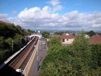
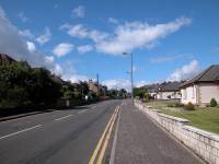
The walk begins from Falkirk High railway station, roughly half way between Edinburgh Waverley and Glasgow Queen St and about 25 minutes' travel from either. From the east end of the eastbound platform, climb the steps to Slammanan Road and turn right, proceeding along the road to the west. In around 300m you will see a path leading off to the right that gives access to the towpath of the Union Canal.
Rejoining the Union Canal from Slammanan Road
The Union Canal at Falkirk
Our route follows the canal towpath once more. The canal, having just emerged from a tunnel, bends to the left to resume its jourmey westwards. Initially it runs alongside a small area of parkland, though after the bend it comes alongside the railway. For the next mile or so, the canal and railway run alongside each other on the southern outskirts of Falkirk.
Scenes along the Union Canal towpath, Falkirk
Approaching the former terminus of the canal
The canal gradually develops a screen of trees on both sides, and less is seen of Falkirk's suburbs. We're approaching the former terminus of the Union canal. In the 1820's when the canal was built, a series of 11 locks was constructed in the locality of Tamfourhill to take the canal down 110ft to the Forth-Clyde canal about half a mile to the north. These were the only locks on the canal, which along the rest of its length stayed at exactly the same contour. At some later time (I have no information as to when, but presumeably sometime during the first half of the 20th century), the link was severed and filled in and the locks demolished. The first image below shows where the link diverged to the right. A few hundred metres beyond there is a turning bay (third image below) after which, up to the late 1990's, the canal simply stopped.
The Union Canal at its former terminus south of Tamfourhill
Our route would previously have led down a ramped track to Greenbank road, then along a residential road to the Union Inn (the site of the old canal junction) and thereafter along the Forth-Clyde canal towpath. Things have changed for the better, for major engineering works (recently completed as I write) have extended the Union canal by roughly a mile and a half to a new junction west of Camelon, involving the massive and futuristic canal lift known as the Falkirk Wheel.
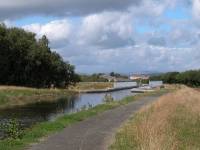

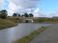
The new section of the Union Canal west of Greenbank
The new section of the Union Canal beyond Greenbank looks pretty much like a new road construction at the moment, and it will take a few years for nature to cloak the surroundings in greenery and blend it in. The new canal and its towpath crosses a small handful of roads, both by overbridges and underbridges. You soon reach the first lock, which drops the canal substantially (the figure is unknown but looks to be a good twelve feet or so), after which the canal turns right into a short tunnel.
The new Union Canal and the Falkirk Wheel upper lock
The tunnel beneath the railway and the Antonine Wall
The tunnel is around 200m long. There's no need for a torch, the tunnel is broad and the substantial towpath is protected by railings. At the north end of the tunnel you come out onto the Falkirk Wheel's upper approach viaduct. Pedestrian access is restricted.
Falkirk Wheel upper approach viaduct
The Falkirk Wheel from above
Only as you make your way down the embankment to the Wheel's lower level does its structure reveal itself. Its centrepiece is a pivoted structure with a boat cradle at either side, 35 metres apart, each holding 600 tonnes of water. In the vertical position one cradle mates to the upper viaduct and the other rests at the level of the lagoon. The two cradles counterbalance each other and the lifting mechanism is hydraulic, needing a bare minimum of energy (apparently just a couple of kilowatts). A half turn of the pivot brings the upper cradle to the lower level and vice versa, lifting eastbound canal traffic from the Forth-Clyde to the Union canal and dropping westbound traffic in the other direction in the same operation. The lift takes approximately five minutes.
The Falkirk Wheel
British Waterways realised at the outset that the Wheel would be a major tourist attraction in its own right, and have provided an adjacent visitor centre with car parks and a picnic area. The visitor centre contains an (expensive) cafe, viewing gallery, gift shop and toilets, and lays on entertainment and other events. The visitor centre is itself a futuristic piece of architechture.
Falkirk Wheel visitor centre
Falkirk Wheel and lagoon
Below the Wheel and adjacent to the visitor centre is a lagoon - part lake, part marina, and roughly circular in shape. Once the surroundings mature this will be a nice place to be. At the north end of the lagoon another lock drops the Union Canal the final few feet to the level of the Forth-Clyde. A pedestrian swing bridge allows access to the Forth-Clyde canal towpath on its northern bank.
The new junction between the Union and Forth-Clyde canals
Joining the Forth-Clyde canal
Turn left and follow the towpath of the Forth-Clyde canal. In a very short distance it leaves the environs of Camelon and the Falkirk Wheel and runs through pleasant pastoral country towards Bonnybridge.
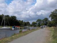
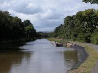
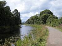
The first stretch of the Forth-Clyde canal
There isn't much to say about the towpath between Camelon and Bonnybridge, a distance of around a mile and a quarter. It echoes the stretches of Union canal between Linlithgow and Falkirk as it meanders a little, running through farmland and partially screened by ribbons of woodland. You're losing the views across Stirlingshire towards the Trossachs, and the Kilsyth hills are beginning to appear to the northwest.
Canal towpath, Bonnybridge
Just as the Union canal ran along the southern bounds of Falkirk,
the
Forth-Clyde canal more or less defines the southern edge of Bonnybridge
and you see little of the place from the canal. Should you want to
break
the journey here, any of the numerous paths that run off to the right
will
get you to the village centre from where you can get a bus back into
Falkirk.
I've not explored Bonnybridge to any extent but it appears to be
divided
into old and new parts, with the old village on this side of Bonny
Water
and the new part to the north.
The canal at Bonnybridge
Approaching the centre of Bonnybridge
The canal is bridged by the main road just outside
Bonnybridge town centre and there is a brief stretch of urban activity.
North of the little town there is a giant triangle
of motorways, with the M876 from Kincardine Bridge converging with the
M80 from Stirling. We'll be meeting the combined motorway at Castle
Cary
not far ahead.
Bonnybridge
The canal runs on past Longcroft, away to the right. As well as the
Antonine Wall, the Edinburgh - Glasgow railway line is also converging
from the left. We pass Underwood Lock and its adjacent pub (pictured
below) and then approach the motorway overbridge just outside
Castlecary. The views towards the Kilsyth hills to the northwest are
good.
Underwood Lock
The cnal towpath west of Underwood Lock
To reach the Antonine Wall option you first need to find Castlecary, and this involves tackling the maze of slip roads immediately east of the village. Take the slip road up to the eastbound B816 and then turn sharp right along this road to cross the M80. Then follow it down to the village, rounding a sharp left bend to dive under the railway line then an even sharper right bend to enter Castlecary itself. It's easy to miss the continuation of the route here. Right by an inn at the eatsern end of the village you will spot a driveway heading off to the right, to what appears to be an industrial yard (on the map it's right by the spot height of 63 metres). Go up this drive but, where it goes right into the yard you will find a stile giving access to a field to your left. Cross the stile into the field and follow its northeastern perimeter to converge with the railway line and then bend further left to follow the earth bank that is one of the better preserved bits of Antonine Wall.
You're OK on this course for some 500 metres, when you come to the outskirts of the vast Wardpark industrial estate. The layout of tracks is confusing and it's anyone's guess how to proceed along the line of the wall. To play safe consult the OS map and find the rough vehicle track heading slightly west of north towards Wyndford lock (this also gives you the option of returning to the canal towpath if you wish). To return to the line of the Antonine Wall turn left just before the railway bridge and follow a straight farm track for one kilometre, then left again to reach the earth bank and line of trees that marks the wall's course.
You pass Kelvinhead Jetty just over a mile west of Wyndford. Tree cover reappears beyond the jetty, and the surrounding terrain becomes hillier. Dullatur is seen across to the left. The canal reaches the pool of Craigmarloch, and immediately beyond it you should leave the canal towpath and go left across the bridge, then along the Dullatur road for a couple of hundred metres before turning off the road to the right, at a signpost, to ascend Croy Hill.
Descend to the northwest, taking care to avoid the quarry works on the west flank of the hill, and aim generally for the northern end of the village.
|
£4.50
inclusive
of postage / packing. |
| Linlithgow to Falkirk | Back to South of Scotland Way index | Croy to Milngavie |
This page last updated 10th November 2005
![]()