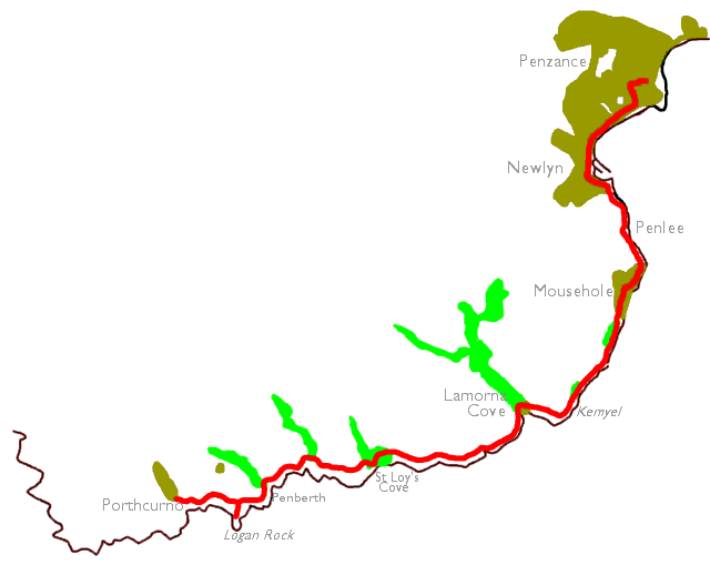
| Land's End to Porthcurno | Back to South Cornwall Coast Path index | Penzance to Porthleven |
The Walk
Once you reach the headland
beyond Lamorna
Cove the nature of the walk changes completely. You enter Mounts Bay, a
broad sweep of coastline leading right round to Lizard Point, some
thirty
miles away on foot. The eastward-facing coast of the bay is much more
benign
than anything you have met so far and the first couple of miles lays
through
a predominantly wooded nature reserve. After climbing a steep flight of
steps to the old coastguard lookout above Penzer Point the path hits a
vehicle track for the first time, and eventually comes out onto a motor
road leading down into the village of Mousehole (pronounced Mowzle).
From
here on it's a simple road walk up over Penlee point to Newlyn, the
headquarters
of the Cornish fishing industry, and then the seafront promenade into
Penzance
itself.
|
|
|
| Length: | 11.45 miles / 18.3 km |
| Total ascent: | 2180 ft / 664 m |
| Total descent: | 2273 ft / 693 m |
| Estimated time: | 4 hrs 24 mins |
Map: OS 1:25000 Explorer 102, Land's End
Click on any thumbnail image in this gallery to display the corresponding full size image. The images are access protected through a cgi script to prevent hotlinking. If you encounter problems while trying to view the full size images, please read the access advice page.
Porthcurno
![]() First
Western National service 1 Porthcurno, Mon-Sat
and Sundays/bank
holidays
First
Western National service 1 Porthcurno, Mon-Sat
and Sundays/bank
holidays
![]() Sunset
Coaches service 345 Penzance - Porthcurno, Mon
- Fri
Sunset
Coaches service 345 Penzance - Porthcurno, Mon
- Fri
If you missed either the Minack Theatre or the Cable & Wireless telegraphy museum yesterday you should make another attempt to see them today. Neither attraction should be missed.

![]() The Minack Theatre website
The Minack Theatre website
![]() Porthcurno
Telegraph Museum
Porthcurno
Telegraph Museum
![]() CATA
Cornwall - Porthcurno
CATA
Cornwall - Porthcurno
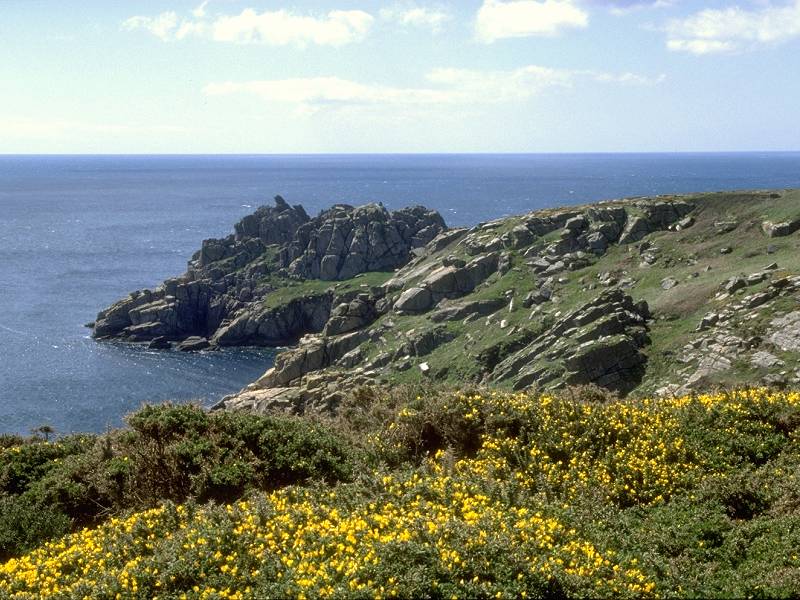
Leave Porthcurno beach by the track leading directly away from the beach and then turn right across a stile. The path reaches the top of a rather scrubby slope, marked as Percella Point on the map, from which the views of Logan Rock are superb.


The coast path out of Porthcurno; arriving at Percella Point; Porthcurno from Percella Point


Three views of Logan Rock from Percella Point


Coast path near Logan Rock; rock scenery at Percella Point; nearing Logan Rock
Logan Rock


You can walk out to Logan Rock, a worthwhile diversion if you can spare the time, because the rock formations are really quite special. The name of Logan Rock properly applies to one single boulder, which apparently can be rocked on its base. All the guidebooks tell of a naval officer who, in the last century, rocked it a little too hard and sent it crashing into the sea. The Navy took a dim view of this and ordered him, at his own expense, to hire a gang of workers and winch the thing back up again.


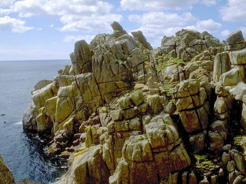


Logan Rock photo album
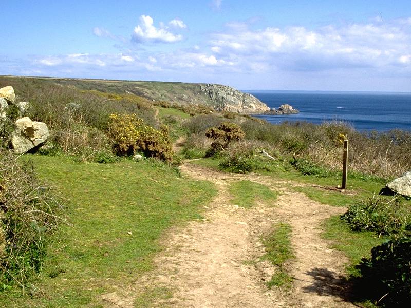
From Logan Rock walk onwards to Cribba Head, from where you descend to the fishing village of Penberth.


Penberth


Penberth is a charming little place, National Trust owned, and much is made of its unspoilt nature. The downside is that there are no facilities here of any kind except for a toilet hut. Another climb upwards and eastwards out of Penberth cove leads on to the next cliff top, where a rough track leads around LeScathe Cove; look out for the tiny vegetable plots cut into terraces on the slopes. Round the next corner is Porthguarnon Cove.


Porthguarnon Cove

Porthguarnon Cove
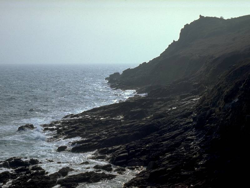
If you've been attempting to make it from Land's End to Penzance in one day, this is the point at which you realise that you've taken on too much. The path drops a couple of hundred feet to the floor of the cove and climbs straight out again; the reascent is, almost without doubt, the steepest you'll meet on the entire end-to-end walk. I renamed it "heartbreak cove" on my first visit in 1995; by the time I had struggled up to Trevedran Cliff on the far side it was approaching 4 p.m. and I knew that I wasn't going to make Penzance that day.

The ascent out of Porthguarnon

Porthguarnon Cove from the east
![]() Campsite
at Treveren
Farm, 500 meters inland after climbing out of cove (see OS map)
Campsite
at Treveren
Farm, 500 meters inland after climbing out of cove (see OS map)
Trevedran Cliff


Coast path at Trevedran; Trevedran Cliff


Cliff scenery at Trevedran


The coast path at Trevedran
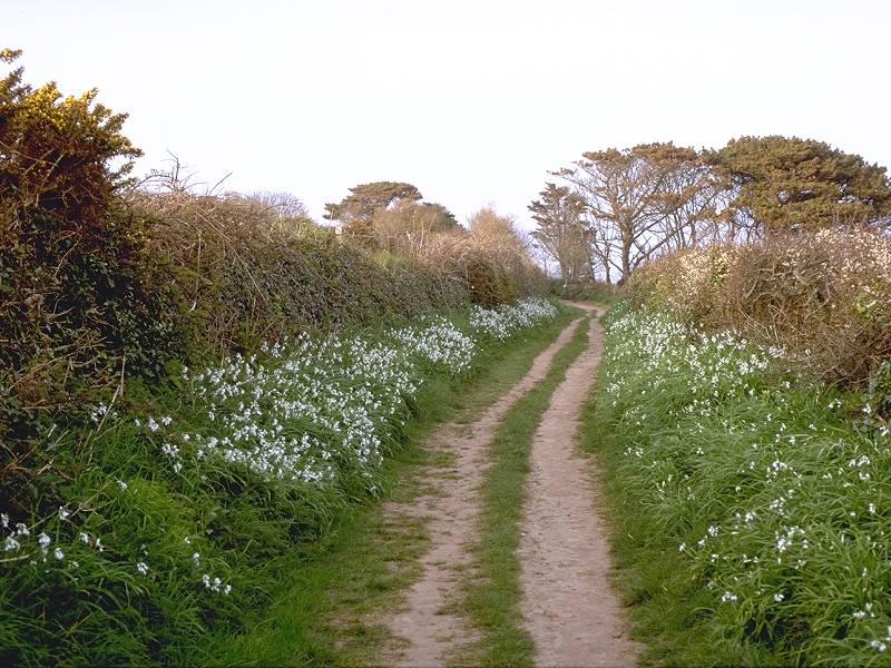
Take care not to miss the signposted path that leads downwards and to the right, about 900 yards after ascending from Porthguarnon. Although it appears to be a diversion it's the correct path and to stay on the main track would eventually lead you inland towards Trevedran village. The new path winds downwards towards St Loy's Cove.

The path to St Loy's Cove
St. Loy's Cove


St Loy's comes as quite a surprise, as for the first time on the walk you enter an area of woodland and lush vegetation. Several desirable houses shelter within this oasis, though you don't realise they are there until you've already passed them. The path drops to the cove through woods, crossing the access driveway to the houses, and comes out eventually on a very stony beach. At high spring tides this section could be tricky.


Woodland scenery in St Loy's Cove


The path emerges on to the rocky beach at St Loy's


The coast path climbing away from St Loy's Cove towards Boscawen Point
Boscawen


The stony beach leads around to the minor headland of Boscawen Point, where the path begins to climb upwards again through an area of open woodland. Once you reach the clifftop again the path meanders through a mile of what is probably the least remarkable scenery of the walk so far. The first lighthouse in Cornwall, named Tater Du, can be seen halfway down the slope to your right as you pass the access path. This path is not a right of way.

You'll probably be looking for a suitable place to stop for lunch by now. The rocky tor just past Dorminack Farm is probably the best choice. Here you can leave the path, get out of whatever breeze might be blowing, settle down on level turf and have yourself a good view while you eat.


The path from Tater Du to Lamorna
Lamorna

Lamorna Cove
Lamorna Cove itself appears quite suddenly and is a surprising hive of activity. There is a quayside here, a shop and cafe, and a short walk inland leads up to the village proper. If you're able to spare time out for some off-coast walking while you're in Cornwall then the woodlands of the Lamorna valley are splendid rambling country.
![]() Quayside
cafe and
shop
Quayside
cafe and
shop
![]() Hotel/inn
in village,
maybe some B&B.
Hotel/inn
in village,
maybe some B&B.
![]() Sunset
Coaches
service 345,
Lamorna - Penzance (see also First
Western National service 1, which calls at Lamorna Turn)
Sunset
Coaches
service 345,
Lamorna - Penzance (see also First
Western National service 1, which calls at Lamorna Turn)
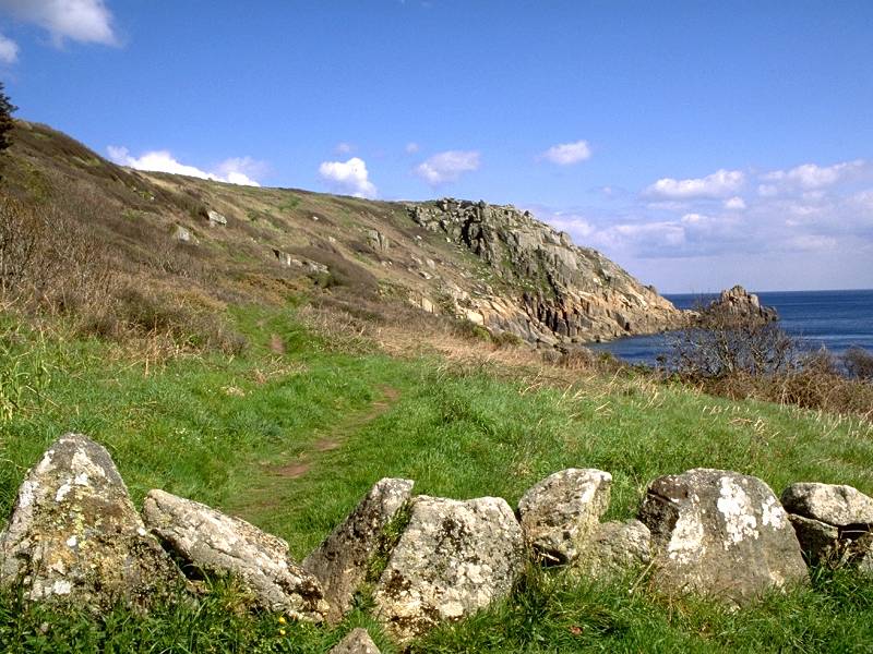
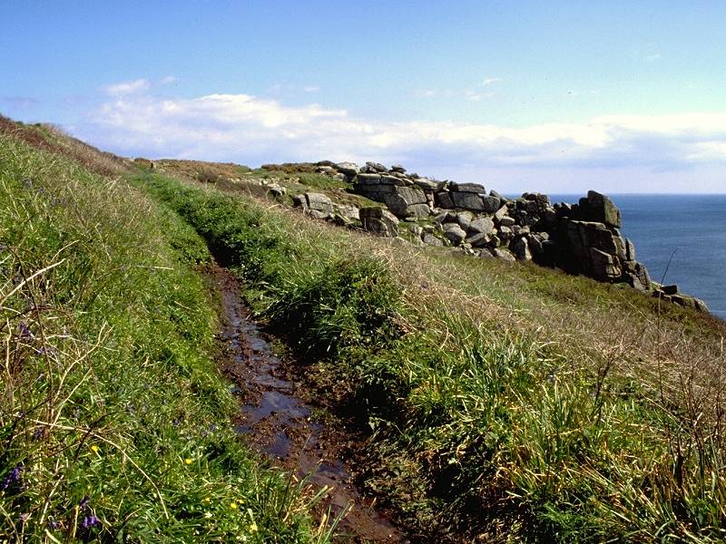
The path out of the cove, heading towards Carn Du, makes its way between trees initially and then climbs a terrace of pink granite that seems to glow in the afternoon sun. As you approach the headland the gradient eases and the nature of the walk changes completely as you turn the corner into Mount's Bay.


Leaving Lamorna Cove; Coast path to Carn Du

Coast path to Carn Du
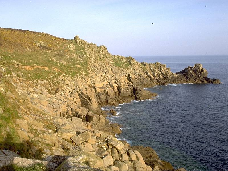
Carn Du
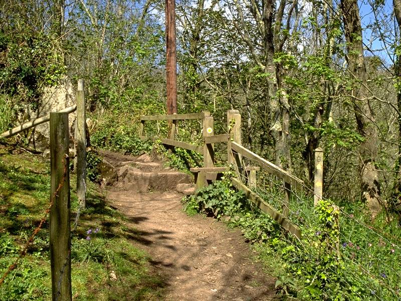
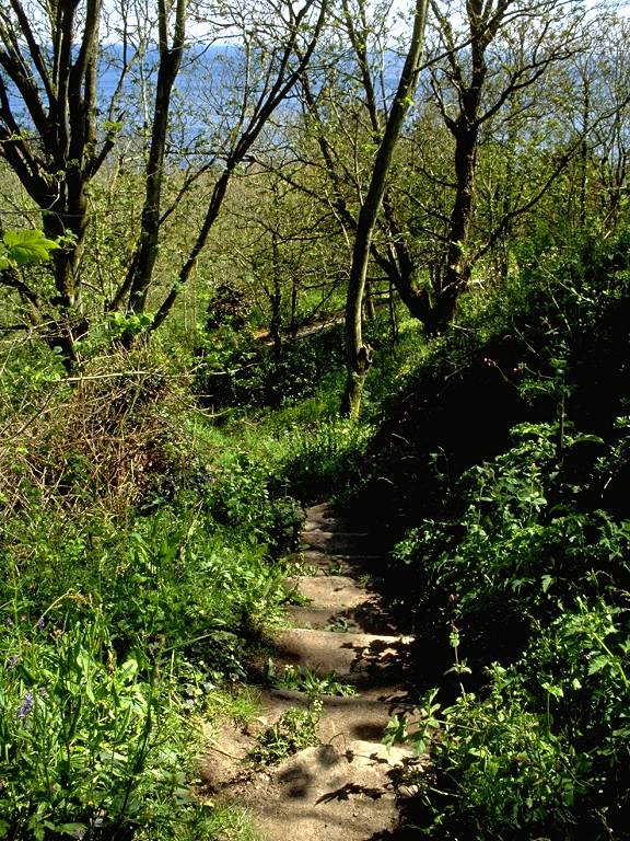
Kemyel


Two views of Kemyel Nature Reserve
For the next mile the path wanders uncertainly up and down through the wood and, despite the pleasantness of the scenery, the switchback nature of the route can become tiresome. You will already have caught sight of the daunting flight of steps leading up the cliff some way ahead and your heart will sink every time the path rises up the slope, only to fall again to the shoreline. But eventually the steps are reached, and conquered, and you follow the clifftop path to the disused coastguard station above Penzer Point.
Spaniard's Point
Coast path at Spaniard's Point
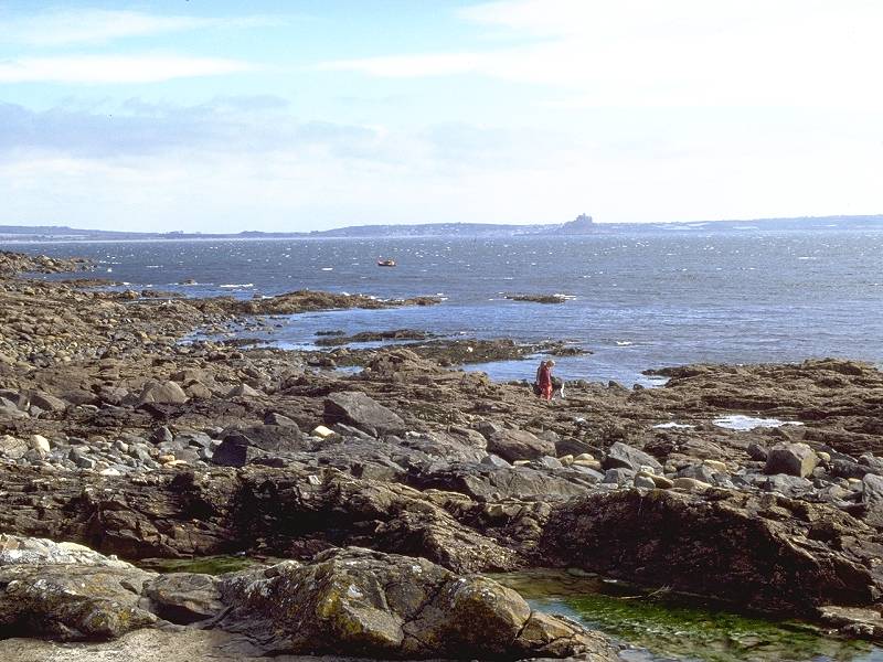
The vehicle track now joins a motor road, at a point seven miles out from Porthcurno and twelve from Land's End, and this road is followed down into the centre of Mousehole. From here you should get your first views of St Michael's Mount, a dramatic island laying a little way offshore two miles east of Penzance.
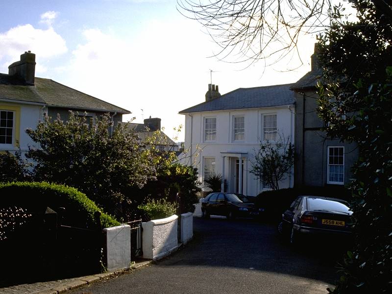
Mousehole


Two views of Mousehole Harbour; Mousehole "beach"
![]() Inns,
shops and
cafes.
Inns,
shops and
cafes.
![]() Inns,
B&B and
guest houses
Inns,
B&B and
guest houses
![]() Bus
Times from Mousehole to Penzance
Bus
Times from Mousehole to Penzance
![]() Penzance
Travel Tips - Mousehole
Penzance
Travel Tips - Mousehole
Road walking is involved all the rest of the way into Penzance now. A little of it can be avoided by using the sea wall a couple of hundred yards north of Mousehole harbour, but it's all too easy to miss the last set of steps back up to the roadway and find yourself at a dead end.
Penlee
Much of the history of the Cornish coast concerns shipping and shipping disasters; wrecks, salvage operations and smuggling feature strongly. This long and occasionally colouful history, however, does actually mask the fact that the worst shipping losses have taken place relatively recently. None can have been more unfortunate than the loss of the Penlee lifeboat as well as the ship whose crew she was trying to rescue, the Union Star, on Christmas Day 1981. Both ships foundered and none of those aboard either ship survived. A memorial garden has replaced the Penlee lifeboat station and the area is now served by a new station at Newlyn.

Penlee memorial garden
Newlyn

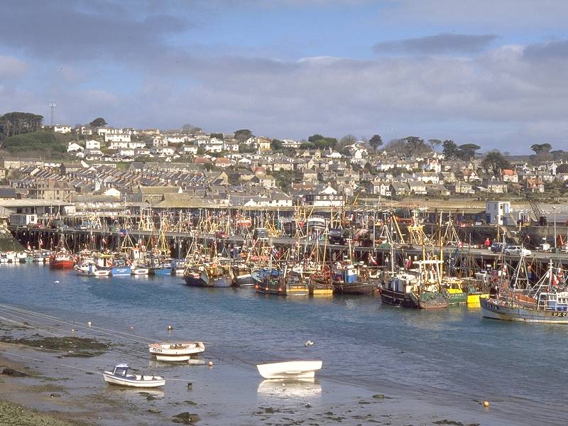
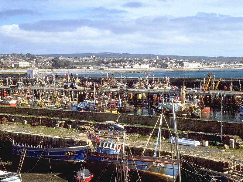
Newlyn Harbour
![]() Inns and
B&B;
but Penzance is very close.
Inns and
B&B;
but Penzance is very close.
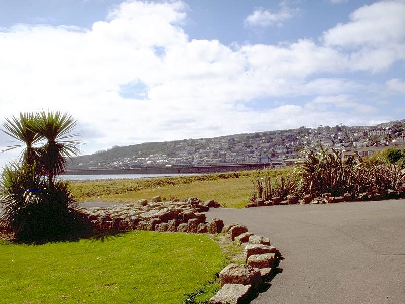
Penzance


Entering Penzance; Newlyn from Penzance;


Three views of the gardens
The official coast path keeps to the seafront beyond the promenade though I consider this to be an unrewarding route as it takes you through the harbour and docks area and misses the heart of the town completely.
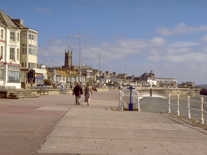

The seafront promenade in Penzance

St Michael's Mount from the promenade
Turn up left before you hit the end of the promenade and lose yourself in the little maze of residential streets south and west of the town centre. There are some rewarding crannies to discover such as streets of colourwashed Regency townhouses, and green paradises such as the semi-tropical Morrab gardens, probably seen at their best in spring.


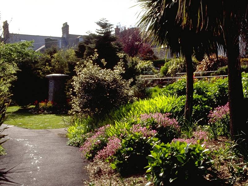
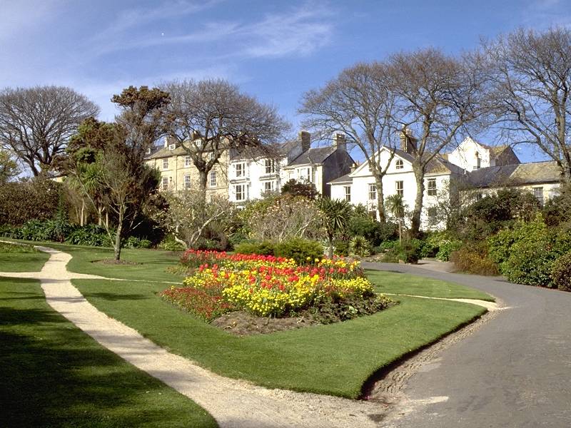


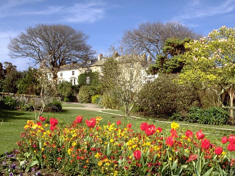
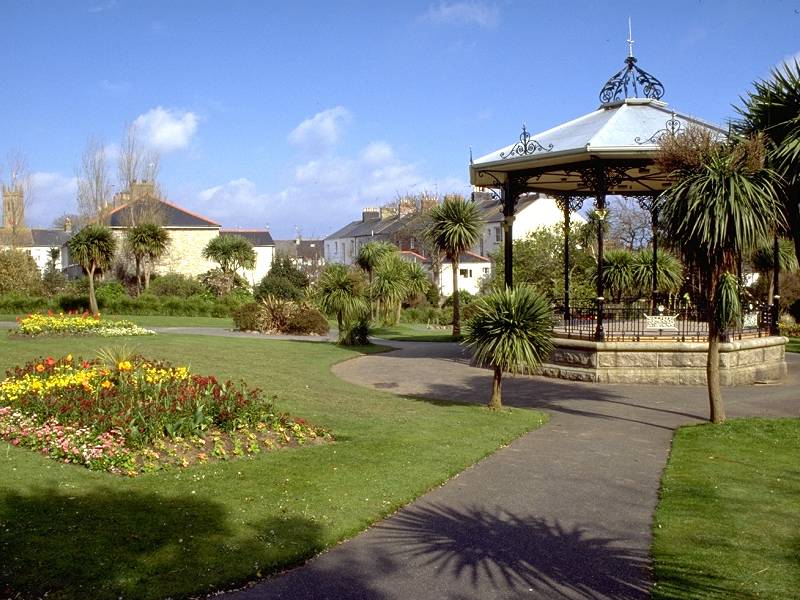


A Morrab Gardens photo album

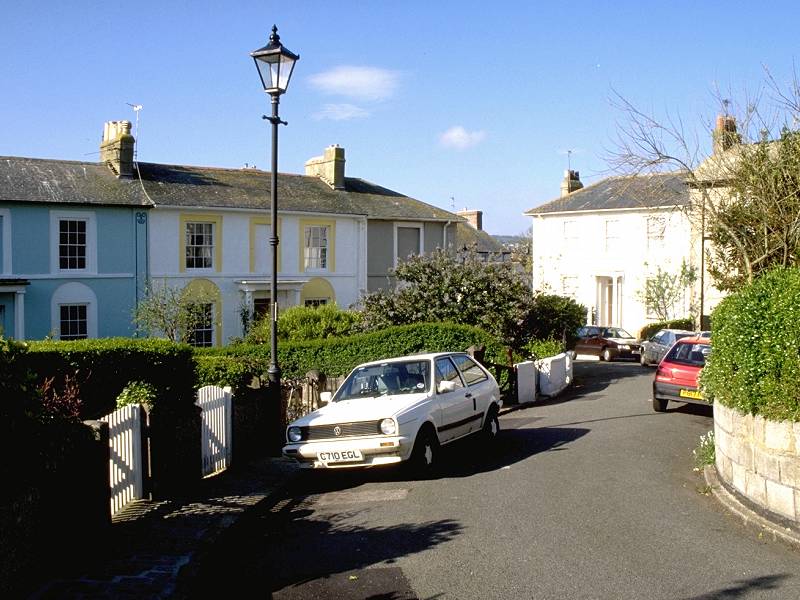
Penzance's residential streets
In the centre of town,
adjacent to the
rather
splendid Town Hall building (now a bank) is the statue of Sir Humphrey
Davey, a local engineer credited with the invention of the miners'
safety
lamp. It's a reminder of Cornwall's industrial heritage and, should you
wish to learn more, there are several museums in town with exhibitions
and displays dedicated to the mixed fortunes of the Cornish tin mines
and
the desperately hard lives of those who laboured within. Penzance's
main
shopping thoroughfare, Market Jew Street, runs eastwards from the town
hall down to the railway and bus stations. If you do take a stroll
round
by the harbour be sure not to miss the Trinity House Lighthouse Museum,
which tells the story of the development of lighthouses around the
English
and Welsh coasts and has plenty of working exbibits, up to and
including
those of modern satellite
navigation.
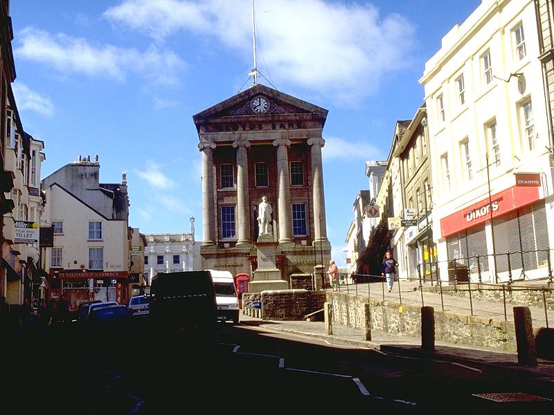
Penzance town centre


Market Jew Street - Penzance's high street


Cliff Road and the railway station
![]() The
western terminus of Brunel's Great Western Railway, Penzance has
InterCity
connections all over Britain including direct services to Plymouth,
Bristol,
London, Birmingham and Edinburgh.
The
western terminus of Brunel's Great Western Railway, Penzance has
InterCity
connections all over Britain including direct services to Plymouth,
Bristol,
London, Birmingham and Edinburgh.
![]() First
Western National service 2, Penzance
- Helston - Falmouth
First
Western National service 2, Penzance
- Helston - Falmouth
![]() First
Western National service X7, Penzance
- Marazion - Helston - Falmouth - Truro - St Austell
First
Western National service X7, Penzance
- Marazion - Helston - Falmouth - Truro - St Austell
![]() Plenty of
hotels, guest houses and B&B. Youth hostel. Campsite near heliport
terminal on road to Long Rock.
Plenty of
hotels, guest houses and B&B. Youth hostel. Campsite near heliport
terminal on road to Long Rock.
![]() Plenty of pubs/inns/cafes/coffee shops. Seafood restaurants. For a
steakhouse/pizzeria
try the Hungry Horse.
Plenty of pubs/inns/cafes/coffee shops. Seafood restaurants. For a
steakhouse/pizzeria
try the Hungry Horse.
| Land's End to Porthcurno | Back to South Cornwall Coast Path index | Penzance to Porthleven |