| Back to South Cornwall Coast path index | Porthcurno to Penzance |
| Back to South Cornwall Coast path index | Porthcurno to Penzance |
There are three reasons for keeping the distance short on this first day. Firstly, and most obvious, is that you don't want to overdo it first time out, particularly if you're not all that fit. Secondly, it's likely that you'll spend half the morning just getting to the start from wherever you spent the night. But thirdly, and most importantly, is that there is much to see along the route; clifftops and rock outcrops, coves and beaches, natural wonders that are more than inviting and which can be so rewarding to take some time over. Penzance is fifteen miles away: you could do it in a day if you put your head down and marched along without looking at the scenery or anything else of interest. But there would be no point in such a march. The scenery is here to be enjoyed; after all, why else are you doing this?
|
|
|
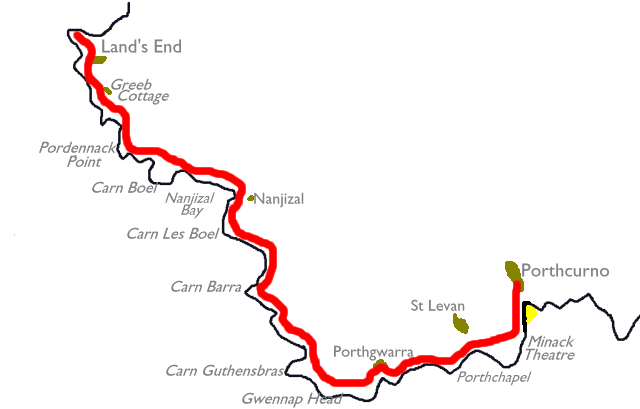
| Length: | 5.51 miles / 8.85 km |
| Total ascent: | 1216 ft / 371 m |
| Total descent: | 1195 ft / 364 m |
| Estimated time: | 2 hrs 12 mins |

![]() The
Land's End Hotel (expensive) is the only place to stay in the immediate
vicinity. Guest houses and B&B at Sennen Cove, 1½ miles
northeast.
Plenty of accommodation at Penzance, about 45 mins' bus ride away.
Nearest
youth hostels at St Just and Penzance. Campsite at Trevescan, one mile
due east.
The
Land's End Hotel (expensive) is the only place to stay in the immediate
vicinity. Guest houses and B&B at Sennen Cove, 1½ miles
northeast.
Plenty of accommodation at Penzance, about 45 mins' bus ride away.
Nearest
youth hostels at St Just and Penzance. Campsite at Trevescan, one mile
due east.
![]() Cafeteria,
coffee shop and hotel bar at Land's End Hotel; refreshments at First
&
Last House.
Cafeteria,
coffee shop and hotel bar at Land's End Hotel; refreshments at First
&
Last House.
![]() First
Western National service 1 Penzance - Land's End, Mon-Sat
and Sundays/bank
holidays
First
Western National service 1 Penzance - Land's End, Mon-Sat
and Sundays/bank
holidays
![]() Sunset
Coaches service 345 Penzance - Land's End, Mon
- Fri
Sunset
Coaches service 345 Penzance - Land's End, Mon
- Fri
![]() First
Western National service 300 Penzance
- St Ives - Land's End
First
Western National service 300 Penzance
- St Ives - Land's End
![]() Land's
End official website
Land's
End official website
![]() CATA
- Land's End
CATA
- Land's End
![]() Penzance
Travel Tips - Land's End
Penzance
Travel Tips - Land's End
Land's End is the westernmost tip of Cornwall, and of England, and is generally accepted as the southwestern extremity of Britain and the starting point of all journeys from one end of the country to the other.
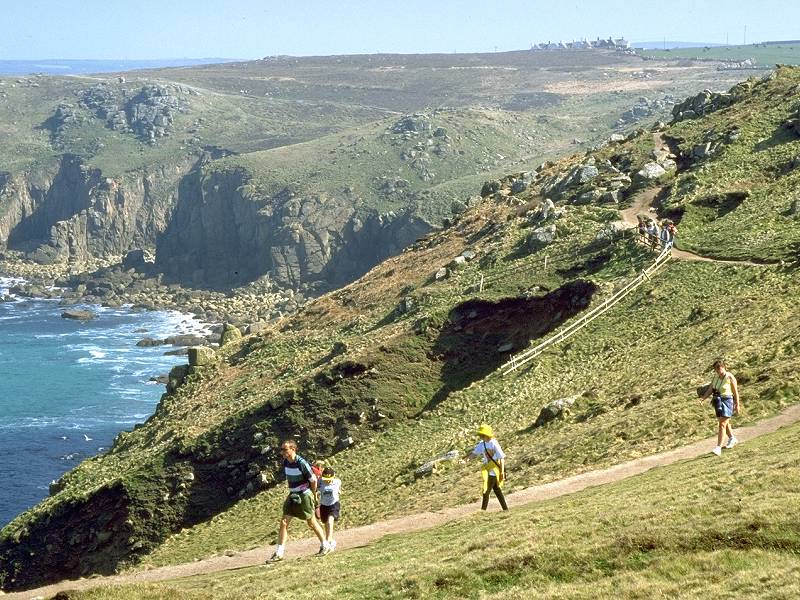
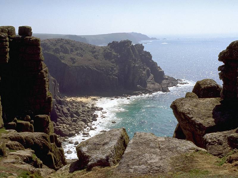
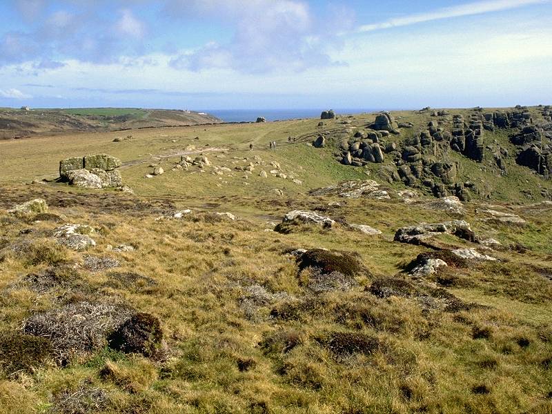
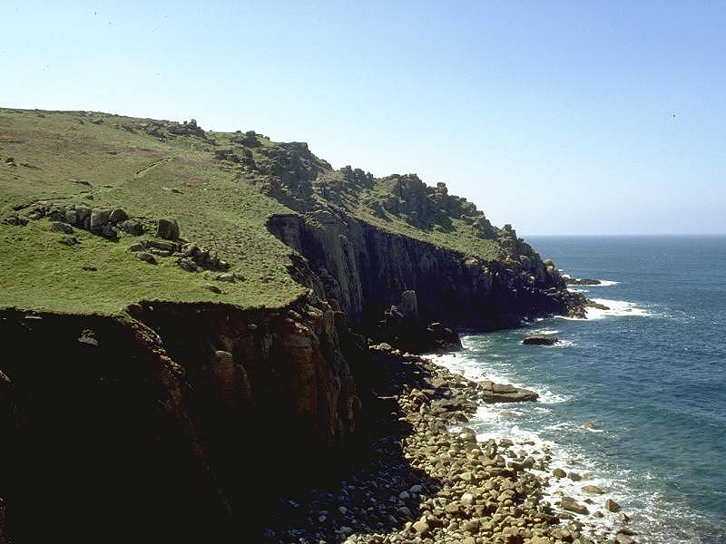
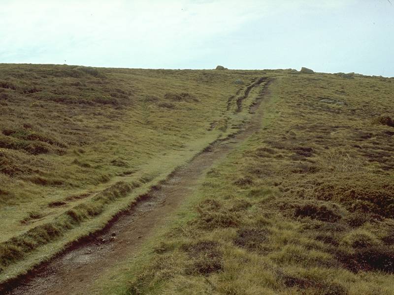
Land's End is a wild place. The Land's End peninsula is composed of granite, a rock that creates the bleak, heathland scenery of the area and which forms dramatic, shattered cliffs on its Atlantic face. The first three miles, as far as Gewnnap Head, are among the most scenic of the entire End-to-End walk.


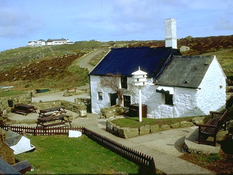
There is no habitation at Land's End; the place consists of the Land's End Hotel and its associated facilities, among which are shops and a theme park. The place is geared to the entertainment of families and children and it has, overall, a rather tawdry air. But the rampant commercialisation of this spot can do little to mar such a dramatic setting. Look out to the west and you will see, well beyond the rocky islands offshore, the Longships Lighthouse. Beyond the lighthouse lay the Scilly Isles, visible on clear days, and beyond the Scilly Isles there is nothing else until Canada. At the northwest corner of the hotel is the Land's End Sign; you can pay for a souvenir photo of yourself standing beside it, with the distance to your home displayed on one of the fingerposts.
The sign is the "ceremonial" starting point of the walk, but the "practical" start, the westernmost point of the land, is a boss of rock known as the Peal that lays just below the First and Last House about 200 meters northwest of the hotel. The First and Last is, of course, a souvenir shop though it also does refreshments. Walk out as far as you think is prudent; the path suddenly ends at an outcrop of granite boulders beyond which progress is very tricky. This is Mile Zero, the start of the walk to Plymouth, and ultimately, John O'Groats.

The Peal; looking south from the Peal

Three views of Gamper Bay, looking northwards from Land's End
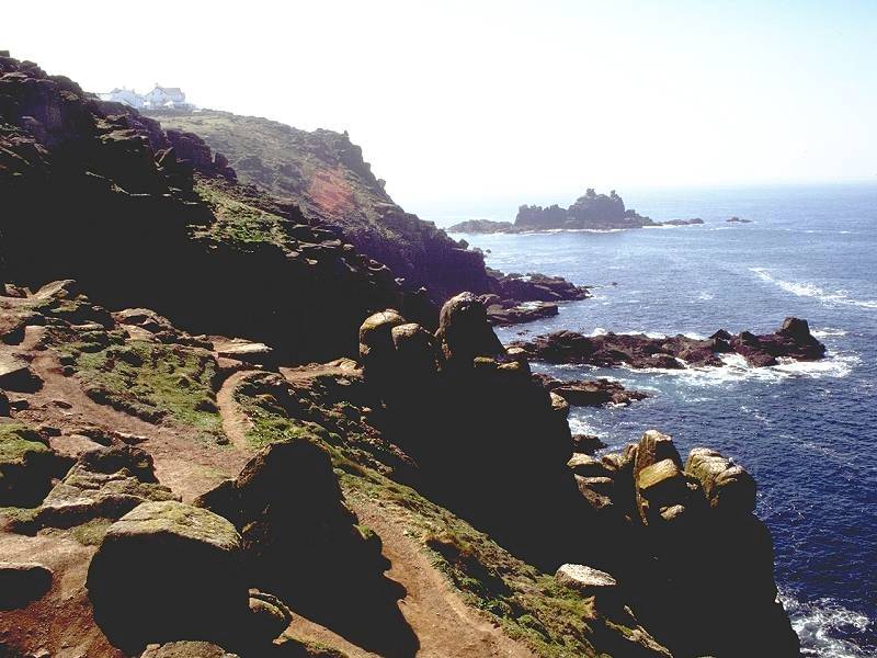
Walk back to the clifftop and along past the front of the hotel. Your eyes will be drawn to the Armed Knight, an island of shattered rock several hundred meters offshore and colonised by seabirds. Another island, Enys Dodnan, lies a little further south. You can't fail to notice how the ground here is rippled and fluted; this effect is caused by wind and frost erosion and the tramp of many thousands of shoes and boots each day. Make your way towards Greeb Cottage, four hundred yards south.


Greeb Cottage; Two views of the Armed Knight
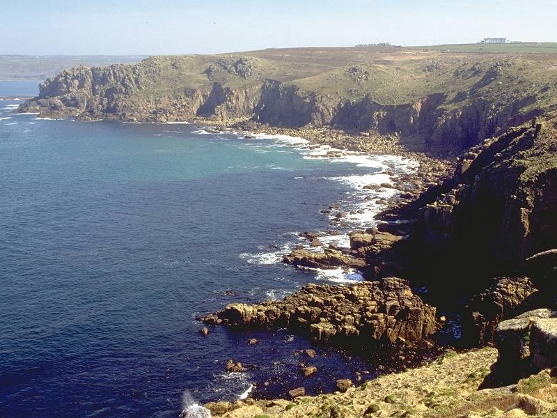
The Armed Knight is seen at its best from here. Keeping to the obvious path, leave the grounds of Greeb to round the prominent gully in the cliffside. You now have a choice; stay on the main path or head right and walk out to the first major headland, Pordenack Point. Unless you're really pushed for time you shouldn't miss the headland.


Enys Dodnan; Pordenack Point; Enys Dodnan


The coast path at Pordenack Point; Pordenack point; Trevilley Cove


The same scene in stormier conditions
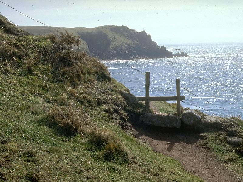
As you walk around Trevilley Cove you cross a ruined stone wall that marks the completion of your first mile.

Rock formations at Trevilley Cove


Two views of Carn Boel


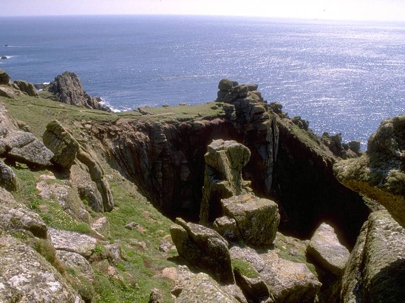
As you round the headland into Nanjizal Bay the next three headlands (Carn Les Boel, Carn Barra and Carn Guthensbras) appear in a straight line ahead. Take the path around the tiny inlet of Zawn Beeth, where the pink colour of the cliff indicates its relatively fresh exposure.


The path squeezes between rock outcrops to swing round into Nanjizal Bay proper. The bay is also known as Mill Bay, and the remains of a watermill may be seen at the foot of the gully below the cottage. Stop to look back here and there; the rock architechture is superb and, on a breezy day, the waves crash over the rocks in a dramatic fashion. Look out also for a cave off the path to the left.
Nanjizal Bay


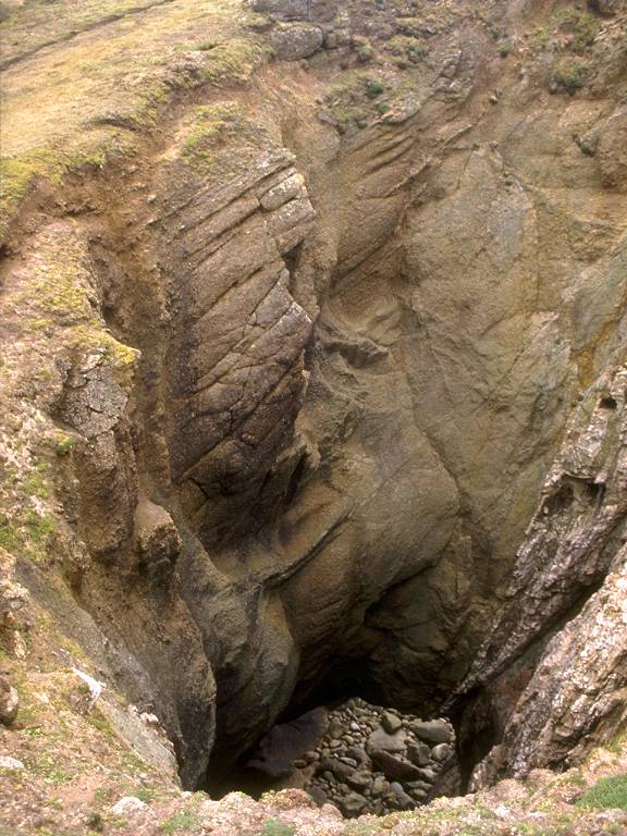
The gully at the head of the bay is crossed by a footbridge. Take some time out here to clamber down to the rocky beach where a beautiful granite cave floored by coarse-grained sand opens back into the rockface. The enormous slit in the southern wall of the bay is even more awe-inspiring but it cannot be reached on foot even at low tide. Note the large crystals of feldspar in the rocks hereabouts.

Coast path at Nanjizal Bay

Cliff scenery at Nanjizal Bay


The sea cave in the south side of the bay


Three views of the "beach" at Nanjizal


A cave at Nanjizal Bay
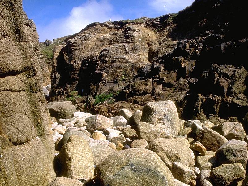
Rock debris at Nanjizal
Now climb up out of the bay towards Carn Les Boel, the two-mile point of the walk.

The coast path to Carn Les Boel

The coast path approaches Carn Les Boel


Nanjizal Bay from Carn Les Boel; Carn Les Boel; Pendower Coves


Coast path at Pendower Coves; Pendower Coves; Carn Barra


Pendower Coves and the coast path


Carn Barra is where your brain goes back into gobsmack mode, for the scenery here is truly dramatic. Across Folly Cove, about five hundred yards away, is the splintered, jagged rock tower of Black Carn.
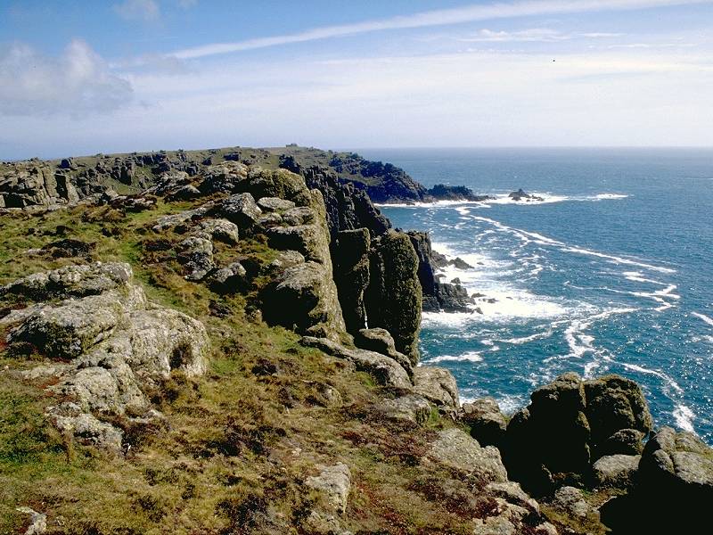


Three views of Carn Barra, looking towards Black Carn


Approaching Black Carn; The coast path looking north; looking south


Three views of Black Carn
Black Carn is a daunting piece of rock and not a place to be unless you posess good rock-climbing skills. Ordinary mortals must be content to gaze upon it from the adjacent clifftop.


Climbers and cliff scenery at Black Carn


Coast south of Black Carn; Mile Three; Porth Loe


Six views of Porth Loe
The Coast Path approaching Carn Guthensbras


Rock formations at Carn Guthensbras


Carn Guthensbras


More rock scenery at Carn Guthensbras
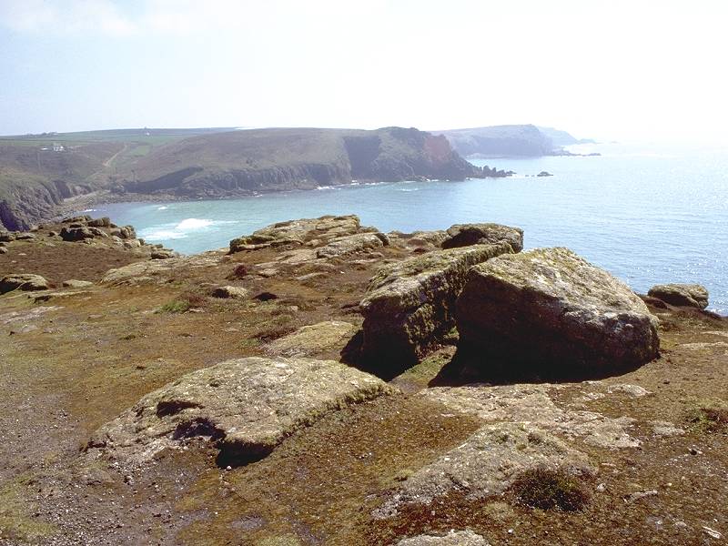
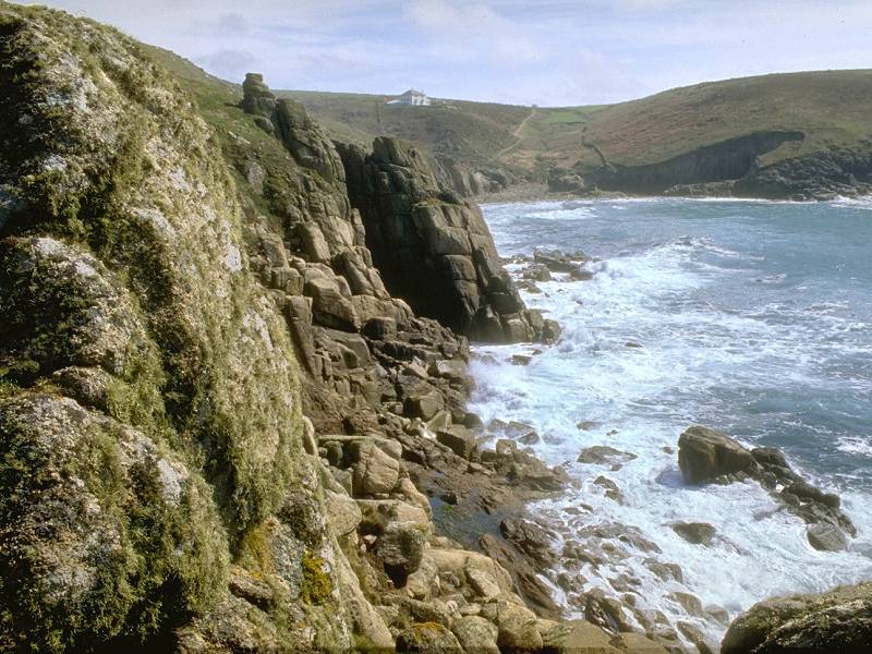
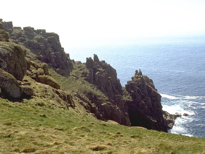
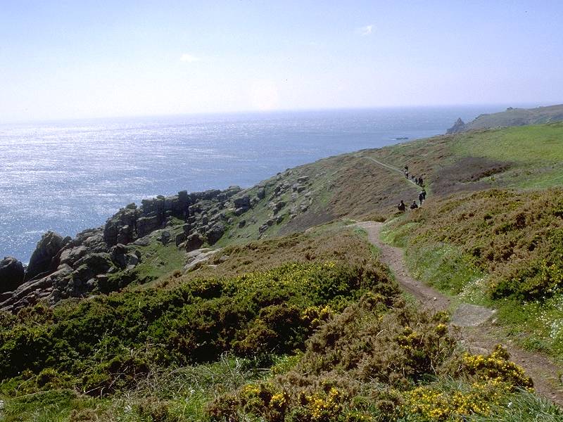
Don't take the path across by the coastguard station but keep to the edge of the land, where the scenery is at its finest. Take care, however, not to stray too far from level ground as the land falls away sharply. The fearsome rock formation immediately ahead , as you leave Guthensbras to walk eastwards, is Gwennap Head.

Gwennap Head
The tortuous rock formations immediately south of the coastguard station could easily be missed, yet they are arguably the highlight of the day. Two awesome blow-holes are situated just inland from the cliff edge and a path between them may easily and safely be traversed provided that the ground is dry. The rock towers at the cliff edge are sculpted into fantastic shapes by wind, sea spray and frost erosion.


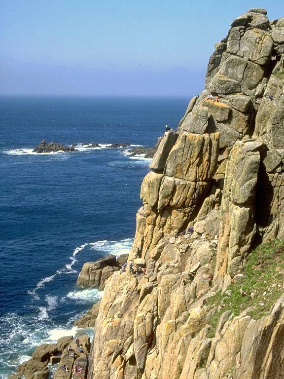
Rock formations at Gwennap Head


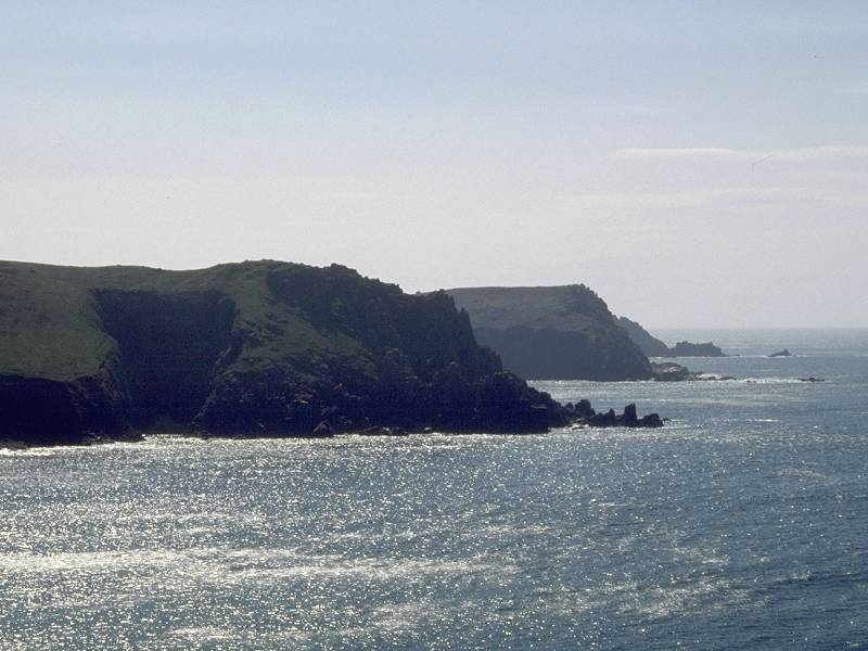
Gwennap Head from Hella Point; Cliffs at Hella Point; Hella Point


Retrospective view; Hella Point; Cliffs at Hella Point


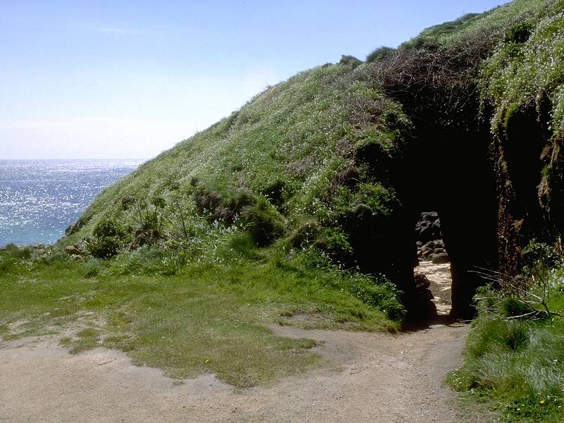
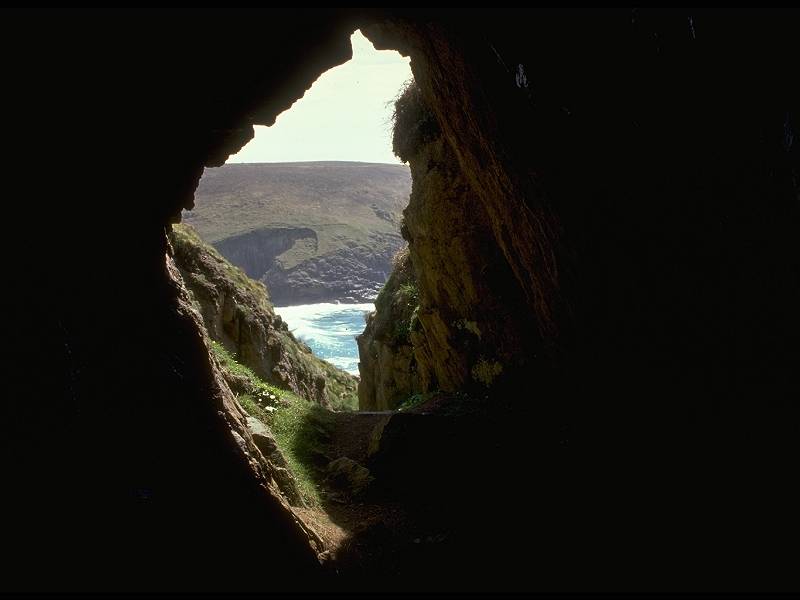
Above Porthgwarra beach; Beach entrance tunnel

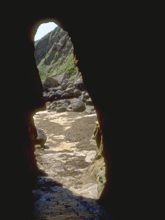
Caves and cliffs at Porthgwarra Beach


Porthgwarra Beach


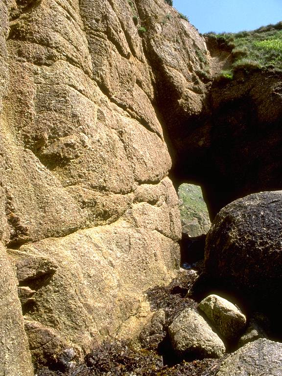
Feldspar crystals and caves in the Porthgwarra red granite
![]() Refreshment
kiosk by car park, seasonally open.
Refreshment
kiosk by car park, seasonally open.
The official coast path leaves Porthgwarra by a lane beside and behind a rather desirable cottage, but if you're not pushed for time and can spare the effort then the seaward walk around Carn Scathe is rewarding.


The coast path leaving Porthgwarra; Carn Scathe
Carn Scathe


Gwennap Head from Porthchapel; Porthchapel beach


Three retrospective views of Porthchapel beach
From Porthchapel continue aound the coast to Minack Point
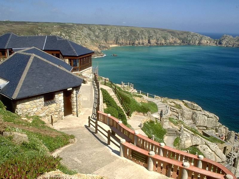


Minack Theatre photo album
The story of its conception and creation is too long and involved to tell here, and Ms Cade herself no longer lives, but her monument lies below you in all its glory. Construction of the theatre has been a long and gradual process, spanning over 50 years. Much of the physical work was done by Rowena herself, although she had the services of her gardner for the heavier tasks. She worked in concrete (hauling stone was too much for her), mixing it herself from sand she carried up in bags from the beach. The auditorium and stage have been gradually extended and the theatre now boasts a seperate dressing room complex and a visitor centre. Performances take place on summer evenings and are very well patronised; the programme is diverse but the plays of Shakespeare and the operettas of Gilbert & Sullivan are the most preferred works.


Minack Theatre photo album, part 2
![]() The Minack Theatre website
The Minack Theatre website
![]() CATA - Minack
CATA - Minack
![]() Penzance
Travel Tips - Minack
Penzance
Travel Tips - Minack

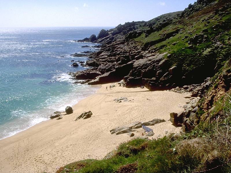
Porthcurno beach seen from Minack Point
The bus terminus for Penzance lies at the far end of the car park above the beach but this might be a good opportunity to explore Porthcurno's second visitor attraction. Porthcurno is a company village; it is almost wholly owned by the Cable & Wireless company, for Porthcurno Beach is the landfall site of Britain's transatlantic telephone cables. The company maintains a museum here, and it's a fascinating insight into the pioneering days of telegraphy and communication. Tours start from the cable hut at the head of the beach; if you're too late to join one you're strongly advised to try again in the morning before walking on to Penzance.
![]() Porthcurno
Telegraph Museum
Porthcurno
Telegraph Museum
![]() CATA
Cornwall - Porthcurno
CATA
Cornwall - Porthcurno
![]() Beach
cafe and shop on west side of beach, on road up to Minack theatre.
Beach
cafe and shop on west side of beach, on road up to Minack theatre.
![]() Very
limited amount
of B&B. Campsite marked on map near Trendennen farm, ½ mile
north.
Very
limited amount
of B&B. Campsite marked on map near Trendennen farm, ½ mile
north.
![]() First
Western National service 1 Porthcurno - Penzance, Mon-Sat
and Sundays/bank
holidays
First
Western National service 1 Porthcurno - Penzance, Mon-Sat
and Sundays/bank
holidays
![]() Sunset
Coaches service 345 Porthcurno - Penzance, Mon
- Fri
Sunset
Coaches service 345 Porthcurno - Penzance, Mon
- Fri
| Back to South Cornwall Coast path index | Porthcurno to Penzance |
This page last updated 9th April 2005