

| Longendale to Standedge | Back to Pennine Way index | Blackstone Edge to Hebden Bridge |


| Longendale to Standedge | Back to Pennine Way index | Blackstone Edge to Hebden Bridge |
This section of the Pennine Way, given that it lays so close to urban sprawl on both sides, is crossed by several busy roads and is well served by public transport links. It divides up comfortably into three sections of around two and a half miles each. The first lays between the A62 Huddersfield - Oldham road at Standedge and the A640 Huddersfield - Rochdale road at Oldgate Nick, and encompasses the gritstone formations of Millstone Edge and the empty expanses of Oldgate Moss. The second runs from Oldgate Nick to Windy Hill and the A672 Halifax - Rochdale road, reaching its summit at White Hill halfway between them. The third, from Windy Hill to the A58 Halifax - Littleborough road at the White House, includes the crossing of the M62 motorway, the tamed wastes of Redmires Moss and a significant scenic highlight of the Way, the gritstone pavement and outcrops of Blackstone Edge itself. The whole 7½ mile section stays at a fairly level contour, never really straying outside a range between 1300ft and 1550ft
In the early days of the Pennine Way this section was regarded as the tail end of the tricky Dark Peak section, and the guidebook writers promised easier times ahead on Oldham's waterworks roads. Nowadays the path has been improved to the extent that the easier times are here already. Indeed, this section is now both a delight and a bit of a doddle, and it can be polished off in just three hours. Through hikers will probably wish to push on and do the following section, from the White House onwards to the Calder Valley. Youth hostellers will be making for Mankinholes, some seven miles further on from the White House.
|
|
|
| Length: | 7.17 miles / 11.5 km |
| Total ascent: | 958 ft / 292 m |
| Total descent: | 981 ft / 299 m |
| Estimated time: | 2 hrs 33 mins |
Click on
any thumbnail image in this gallery to display the corresponding full
size
image. The images are access protected through a cgi script to prevent
hotlinking. If you encounter problems while trying to view the full
size
images, please read the access advice
page.
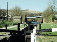
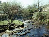
Canal and river at Marsden
Marsden is where most walks of this section will effectively begin. Laying two miles to the east of Standedge, it has some overnight accommodation (though no youth hostel any more, apparently) and is also well served by bus and rail links. Village-sized, but with a compact little shopping centre, Marsden is quite a handsome stone-built town and is largely unscarred by industry. A canal visitor centre had opened in 2002 when I was last there - I'm told it's now closed again but it would be worth checking locally. Take a look at the Standedge Home Page as well..
Standedge is approached along the A62, a busy road which is not as lonely as it might look from the map; there are several pubs strung out along the climb to Standedge, each with large car parks. It's two and a half miles from Marsden to Standedge and the walk takes about an hour, but you could save yourself time and effort by catching the bus (see timetable link below). Ask to be dropped off at the car park just the other side of the cutting.
Standedge Cutting seen from the south side
You'll see from the OS map that the A62 Huddersfield-Oldham road loops some way to the south on both sides of the watershed in order to cross the lowest part of the ridge. A substantial cutting has been built for the road but the real civil engineering feat of this area is some way beneath your feet. The railway and the canal between Marsden and Diggle, either side of the watershed, plunge through parallel tunnels more than three miles (4km) in length. The canal tunnel opened in 1811 and "working" it was quite a feat, as boats had to be propelled along it by canal barge crews "legging" or walking along the tunnel walls and roof. It could take up to four hours. The canal fell into disuse in the 1940s but has been recently restored, and it reopened in the spring of 2001.
The Pennine Way leaving Standedge to the north
The Pennine Way leaves from the western end of the cutting, at the signposted stile. The ground immediately to the north of the cutting was once an open area on which vehicles could park and the route was a little confused, but it's now all been enclosed and an obvious, well-signed path leads among stiles and fences, changing directions a couple of times before climbing towards the trig pillar on Millstone Edge. The path pretty much follows the former Yorkshire - Lancashire county boundary, nowadays the borough boundary between Kirklees (to the east) and Oldham (to the west).
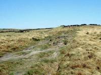
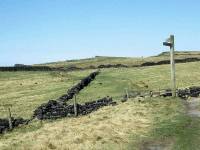
The Pennine Way approaching Millstone Edge
Another marked path, the Standedge Trail, joins from the right; this also originates at Marsden and is an alternative approach to the road. The Way climbs gradually, sometimes in the open but more often alongside fences or walls, towards the rocky outcrops seen on the skyline a short distance ahead. Once you reach the first of these outcrops you discover that there's a considerable line of them stretching ahead of you. This is Millstone Edge, the first summit of the day, which reaches a height of 448m or approximately 1470ft. Just like the edges back at Kinder Scout, Millstone Edge is a sill of gritstone, a dark and rough variety of sandstone. As befits its name, millstone was typically the stuff from which grinding stones were fashioned for the milling of corn into flour. The Edge faces west and looks down over the rural edge of Greater Manchester, towards Diggle and Saddleworth. Reservoirs glint in the sun. It's a nice spot to settle down out of the wind for your morning refreshment break.
Views down towards Diggle; approaching the top of Millstone Edge
The Pennine Way on Millstone Edge
Millstone Edge: rock formations on the summit
Millstone Edge; the Pennine Way heading for Northern Rotcher
The terrain does not dip appreciably beyond Millstone Edge, the path staying more or less on the 1400ft contour. The watershed broadens out here into a featureless plateau and the county boundary follows the watershed across the middle; the PW, though, sticks to the plateau edge on the Oldham side and continues to provide good views down into the Castleshaw valley. At a locality shown on the map as Northern Rotcher about a kilometre north of the summit, the path leaves the plateau edge to head half right into the featureless moorland splodge of Oldgate Moss.
Northern Rotcher; the Castleshaw valley and reservoir; Northern Rotcher
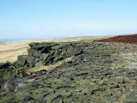
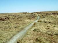
The Pennine Way leaving Northern Rotcher for Oldgate Moss
Oldgate Moss is, as its name would suggest, a rather juicy wilderness of rough grassland and peat but it was never anything like as inhospitable as Black Hill or Kinder Scout. Nevertheless, the path has been improved to the extent that walking is firm and dry, and the days of getting wet and muddy on Oldgate Moss are past. The path curves very gradually around to the left, running alongside a shallow watercourse and converging once again with the county boundary. You pass a spot height of 447 meters, the nominal summit of Oldgate Moss. The path straightens out again and the little ravine of Oldgate Nick (aka Haigh Gutter) appears slightly to the left of the path up ahead.
The Pennine Way on Oldgate Moss
Oldgate Nick and the A640 Huddersfield-Saddleworth road
The track drops into a little gully just short of Oldgate Nick to cross a watercourse on wooden decking and then climbs the bank beyond to reach the A640 road, which runs down to Denshaw and Saddleworth to the west and across the ridge of Slaithwaite Moor to the east. For just about the first time since leaving Standedge there's a bit of a view to the east; the moorland slope is shallower on that side and the few features are a long way off. March Haigh reservoir is down there somewhere and further off is Slaithwaite, hugging the slopes between Huddersfield and Halifax. The BBC's medium wave transmitters at Moorside Edge are prominent.
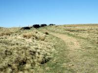

Ascending from Oldgate Nick: looking forwards; looking back
White Hill, elevation approx. 1529ft, is a great splodge of a hill, and the summit is really just the highest point of a sprawl of grassy moorland. The trig pillar lies a good mile northwest of Oldgate Nick. The ascent is gentle and the terrain is easy, but you don't get much of a view - there are featureless grassy slopes all around. Only to the southeast, in the direction you've come from, is there any real interest. You look back at Millstone Edge and Pule Hill and the Peak District moors beyond, with only the Holme Moss radio mast to give you any real guide to which feature is which.
White Hill - reaching the summit
Windy Hill from White Hill; the Pennine Way leaving White Hill
You don't really get to see much detail from the summit of White Hill. There's a suggestion of distant towns way over to the east, and for almost the first time on the Pennine Way you can see quite a way to the north. The microwave tower on Windy Hill is a mile and a half away and is your next objective, and beyond that and slightly to its right is the dark mound of Blackstone Edge. Way off in the distance you see the white towers of a couple of wind farms. I've never actually been able to establish where these are - any information gratefully received. The bulk of tomorrow's walk lays beyond and to the right of Blackstone Edge and in theory Stoodley Pike ought to be visible, but I've never been able to spot it. The county boundary doesn't cross the summit of White Hill but prefers instead to visit its northeastern outlier of Linsgreave Head, about 400m away; here it also meets the boundary between Kirklees (which is centred on Huddersfield) and Calderdale (which is centred on Halifax).
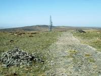

The Pennine Way heads almost west off White Hill but then gradually curves around to the right as it descends gently to the col this side of Windy Hill. This western slope of White Hill is known as Green Hole Hill; it is nominally a separate top as there is a barely discernible col formed between Dry Clough (draining north) and Culvert Clough (draining southwest). You're unlikely to notice any reascent. As you hit the curve and begin the gentle descent you merge with the county boundary again; this time you have Calderdale to your right, with Oldham still to your left. The map marks this part of the route as Axletree Edge; in truth it's a shallow spur rather than an edge and you won't see any rock outcrops like those at Millstone. A mile and a half northwest of the top of White Hill and three miles out of Oldgate Nick, you come to the A672 Halifax - Ripponden - Denshaw road (marked on older maps as the A58). In this land of municipal boundaries you've now reached yet another, as you take your last steps within Oldham and your first in Rochdale.
The Pennine Way doglegs about a hundred meters to the right on the far side of Windy Hill and as you breast the slope you see the M62 trans-Pennine motorway slicing through a cutting just ahead of you.
The M62, opened in the early 1970's, connects the Leeds-Bradford conurbation to Manchester and Liverpool. Linking four of northern England's principal cities together as it does, it's arguably the single most important road crossed by the entire End-to-End Walk. It was being planned as the Pennine Way was brought into existence, and its engineers factored in the Pennine Way crossing from the outset; the footbridge is a graceful concrete arch that actually contrives to look quite handsome. Effectively the footbridge was planned by Ernest Marples and was built by Barbara Castle, two successive transport ministers who were both keen outdoor enthusiasts.
The M62 crossing looking west; looking east; the PW heading into Redmires Moss
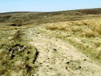
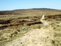
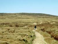
The Pennine Way on Redmires Moss
Redmires Moss used to have a notorious reputation among early Pennine wayfarers as one of the nastiest bogs and probably the worst quarter mile of the entire Pennine Way. "Standing knee deep in this filthy quagmire on a wet day", says Wainwright, "there is a distinct urge to give up the ghost and let life ebb away." Barry Pilton was almost as disdainful, remarking that Redmires was not a cartographer's whimsy. Looking at the wide, firm path that crosses it nowadays, it's perhaps difficult to appreciate that a generation ago our predecessors had to wade through a quarter of a mile of glutinous peat to reach the firmer ground of Blackstone Edge beyond. Look about you, however, as you ascend the long mile from the motorway bridge; about halfway up, in a shallow depression drained by Longdon End Brook and Redmires Clough, you do catch an impression of how things used to be. Purists may scoff at how easy things are nowadays, but I believe we owe a great deal to those who improved the path across Redmires.
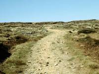
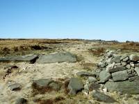
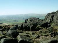
The Pennine Way arriving at Blackstone Edge
A mile and a half beyond the M62 crossing, and after a reasonably graded but steady ascent, you reach the fascinating rock formations at the 1549ft summit of Blackstone Edge.
Blackstone Edge
The gritstone edges around the Pennines are legendary among outdoor enthusiasts and you've just reached one of the best - certainly the most outstanding such feature on the Pennine Way itself. As previously mentioned, gritstone is a dark, hard, coarse-grained variety of sandstone, and it often forms the edges of moorland plateaux such as this. It tends to get sculpted by the wind into weird, fantastic shapes and the rock architecture hereabouts is the finest since Dartmoor. The gritstone sill found here is wide enough to form significant areas of pavement, an uncommon but fascinating feature, and one that will be echoed yet contrasted some 45 miles further ahead at Malham where there is a similar feature formed of white limestone.
Blackstone Edge
Blackstone Edge is just that - an edge, rather than a simple summit, and the whole feature is some 200m in length. You can use up film here at an alarming rate. It's an inspiring and invigorating place to be, a bit like a film set for an alien planet. Views westwards are extensive, taking in Littleborough, with Rochdale beyond and central Manchester in the far distance.
The trig pillar on Blackstone Edge
The Ordnance Survey's trig pillar that marks the 1549ft summit sits towards the northern end of the Edge. It contrives to look faintly incongruous; a column in white concrete sitting atop an outcrop of black sandstone.
Blackstone Edge summit; views over Littleborough; the path off to the north
Back in the days before the path improvements, Blackstone Edge marked the end of the Dark Peak section of harsh, inhospitable peat moorlands and the beginning of the easier Calderdale / Aire Gap country. It was at this point that the walking became so much easier. The improvements have actually introduced an inversion here for the six hundred meters of the Pennine way north of Blackstone Edge, which lay over firm rocky terrain, are still in their original state and are now the roughest and rockiest part of today's walk. Take it slowly along here and watch where you're putting your feet. This section is tiring and, despite the fact that the map is telling you that you're descending, it does feel as though you're going uphill again.
The path descending from Blackstone Edge;meeting the Roman Road
Suddenly you reach a dilapidated gate and this short section of rocky terrain is over. You've reached the course of an old packhorse road, reputedly the course of an earlier Roman road across the moors between what are now the towns of Ripponden and Littleborough. Turn left and descend this road for some 400m. It goes smartly downhill, with views of Littleborough directly ahead. Much of the trail is still cobbled and even the original drainage channel can still be seen. Is this the original Roman surfacing or are the stones more recent? Nobody seems to know for sure. But it's murder on the calves and ankles, and you need to watch your footing during or after rain.
The old packhorse road to Littleborough; the Oldham Corporation waterworks road
At the foot of this section of packhorse road you reach a modern vehicle track, the first of the original Oldham Corporation waterworks roads built to service the dams and reservoirs hereabouts. These provide good, easy walking and will be a major feature of the next section to Hebden Bridge. Turn right onto the track and follow it to the White House.
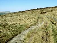
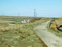
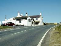
The waterworks road; the White House appears; the White House
Once you reach the waterworks road you just have 800 meters of easy, uneventful walking to complete until you round a curve and find yourself deposited onto the A58 Halifax - Rochdale road just a hundred meters short of the White House, a roadside pub standing on the Rochdale side of the watershed.
The hourly bus service between Rochdale and Halifax passes this way; alternatively you can walk some 800m to the east, to the far end of Blackstone Edge Reservoir, to take advantage of the less frequent service between Hebden Bridge and Huddersfield via Ripponden. Through hikers may well wish to press on and complete the White House - Hebden Bridge section, another eight miles of route, in the same day.
![]() First
Calderline service 528, Rochdale
- Blackstone Edge - Halifax (Blackstone Edge (White House Pub)
is between Lydgate and Ripponden)
First
Calderline service 528, Rochdale
- Blackstone Edge - Halifax (Blackstone Edge (White House Pub)
is between Lydgate and Ripponden)
![]() First
Huddersfield service 900, Huddersfield
- Blackstone Edge - Hebden Bridge (the service runs along the
roads
east and north from the road junction a few hundred yards to the east)
First
Huddersfield service 900, Huddersfield
- Blackstone Edge - Hebden Bridge (the service runs along the
roads
east and north from the road junction a few hundred yards to the east)
|
£4.00
inclusive
of postage / packing. |
| Longendale to Standedge | Back to Pennine Way index | Blackstone Edge to Hebden Bridge |
This page last updated 5th March 2006
