| Horton-in-Ribblesdale to Hawes | Back to Pennine Way index | Thwaite to Pasture End |
| Horton-in-Ribblesdale to Hawes | Back to Pennine Way index | Thwaite to Pasture End |
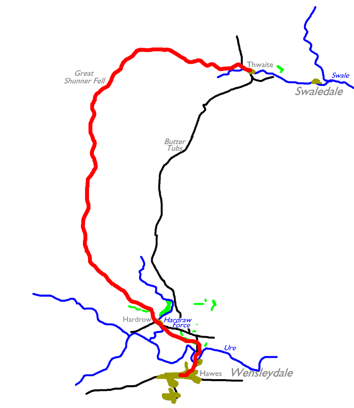
It's only seven miles by road from Hawes (at the head of Wensleydale) to Thwaite (at the head of Swaledale) by the Buttertubs Pass road, but the Pennine Way takes the long scenic route across Great Shunner Fell. The fell reaches a height of 2340ft, the highest ground so far on the Pennine Way and indeed on the entire End-to-End Walk. It could hardly be described as a mountain, or even a hill. It's really a massive sprawl of rough pasture forming a shallow dome, rising fairly gently from all aspects. What it lacks in steepness it makes up for in distance. The approach from Hardraw is five miles long, and involves about 1500ft of ascent, while the descent to Thwaite covers a further four miles.
The initial mile of the day's walk is atypical and crosses the flood plain of the Ure north of Hawes, among lush pastures and farm buildings. The highlight - just off route but regarded as mandatory in terms of Pennine Wayfaring - is Hardraw Force, England's highest waterfall. The vertical drop of the fall is a modest 96ft and there are far grander falls in both Wales and Scotland, but it's a charming sight nonetheless. You have to pay a toll at the Green Dragon Inn to access it (see below).
There used to be a daily coach service
between
Hawes and Thwaite over Buttertubs Pass, part of a circular tourist
route
out of Harrogate, but to get from one to the other nowadays involves
either
walking over Buttertubs or a long triple bus hop via Richmond and
Leyburn.
That does make this section logistically awkward as a day hike, and
B&B
in Thwaite is fairly limited. Youth hostellers will probably wish to
push
on to Keld, another five miles ahead.
|
|
|
| Length: | 9.47 miles / 15.2 km |
| Total ascent: | 1729 ft / 527 m |
| Total descent: | 1570 ft / 479 m |
| Estimated time: | 3 hrs 37 mins |
![]() Service
112
Garsdale - Askrigg - Hawes (from Settle-Carlisle railway)
Service
112
Garsdale - Askrigg - Hawes (from Settle-Carlisle railway)
![]() Leeds
- Settle - Garsdale - Carlisle rail timetable (Arriva Northern)
Leeds
- Settle - Garsdale - Carlisle rail timetable (Arriva Northern)
![]() Service
157
Northallerton - Wensleydale - Hawes
Service
157
Northallerton - Wensleydale - Hawes


Pastures north of the Ure, between Hawes and Hardrow
Your route out of Hawes lays initially along the Thwaite road. From the town centre walk east a couple of hundred yards then turn left by the old railway station (now the tourist information centre). You can avoid about 300m of road walking by taking a straight line across the pasture between the station and the river bridge, but most walkers will consider it barely worth the effort.
You cross Wensleydale's river, the Ure (so why not Uredale? Nobody seems to know) by Haylands bridge and follow the road north. In about 400m the route of the Pennine Way leaves to the left to cross a series of pastures forming the Ure's flood plain. Much of the route is on flagstones, not altogether what you want to see on a walk in the wilds. Barry Pilton, in his book "One Man and his Bog" remarks ironically that it was a surface he'd rather expected to be provided along the Pennine Way's entire length. The path approaches a farm and comes out onto the road in Hardrow.

Hardraw, or Hardrow? "a" or "o"? Depends on which map you open and on which guidebook you read. The two spellings appear to be completely interchangeable, and Wainwright provides a clue - "Hardraw", he says, "is the older spelling of Hardrow". So You've arrived in either Hardraw or Hardrow, and in a glade a few hundred yards to the north is Hardraw Force, England's highest waterfall. Unless, of course, it's Hardrow Force.


Hardraw (or Hardrow) Force
There is no public footpath to the fall. The glade leading from the village to the fall is private ground, and you are expected to pay a toll at the bar of the Green Dragon pub. Leaving the pub by the back door, walk along the glade to reach the fall, a single vertical drop of 96 ft over a sill of limestone. This is, admittedly, a very modest drop but England's highest fall cannot be missed out. You can amuse yourself by walking behind it, a feat easily achieved. Tourists looking for the falls can easily be deceived by the map, which lays the name of the falls to the north east and appears to indicate an approach through the woods from the Thwaite road above. No such approach is possible.
From the Green Dragon walk a little way along the Appersett road to the west and then turn right into a walled lane.

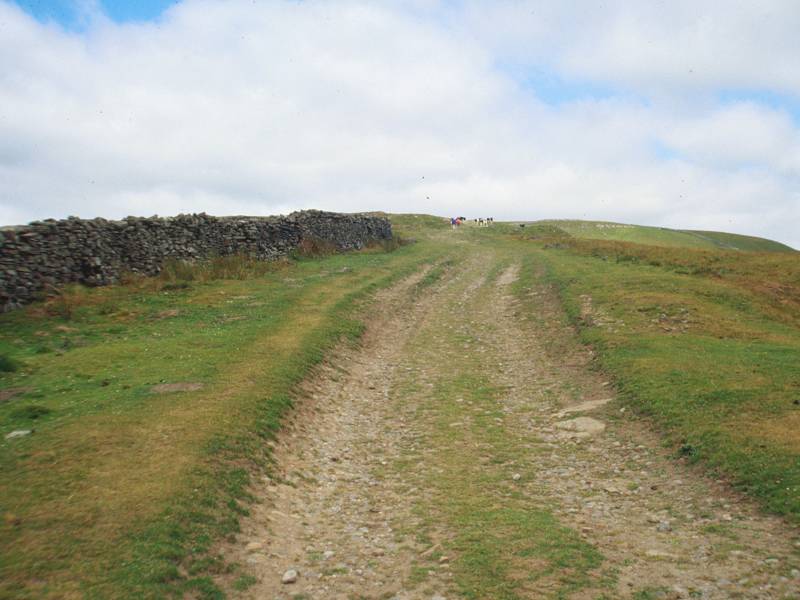

The Bluebell Hill lane, with (1) and (3) retrospective views of Wensleydale
The lane is the first part of the long, lonely trudge up to the summit of Great Shunner Fell. It's a farm track now but used to serve a brace of coal mines on the slopes of the fell. After the first mile the path reaches open country at a junction of walls and from there on the climb is pretty featureless.


Ascending Great Shunner Fell
There's little to see on the climb. The convex slope doesn't allow a view of Buttertubs Pass and all you really see is a retrospective view of Wensleydale, plus an opening cleft to the northeast which gradually reveals itself as the head of Swaledale. Between the two, to the east, is the sprawl of Lovely Seat, which reaches a height of about 680 meters and is bereft of public footpaths, but can be climbed fairly directly from the summit of Buttertubs pass. While we're on the subject, the Buttertubs are a series of limestone shake holes a few yards to the west of the road, about a kilometre north of the watershed.

Ascending Great Shunner Fell, and higher Swaledale
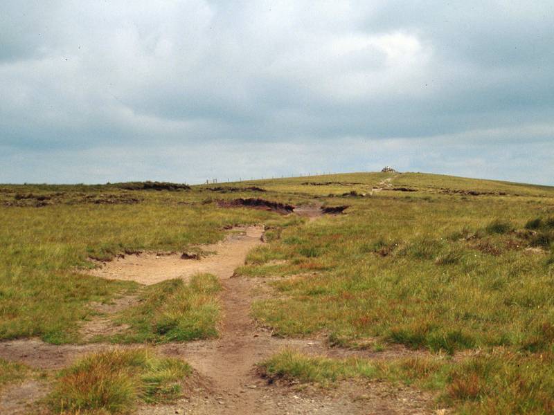
It becomes apparent as you trudge onwards that the climb of Great Shunner Fell is not one of uniform gradient, but rather consists of a series of "ledges" of fairly level ground punctuated by pitches of slope that are actually quite steep in places. The terrain is good but the scenery is monotonous, and this would be a dispiriting place to be under bad weather.


The summit of Great Shunner Fell; a retrospective view from the descent to Thwaite
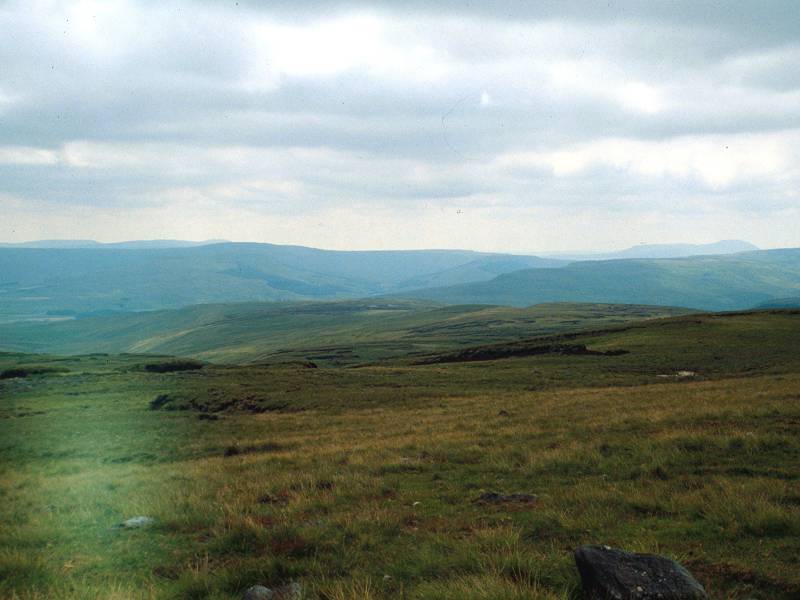
You do, eventually, arrive at the 2340ft summit. It is a lonely spot and as the summit dome is so broad you have little feel of actually being at the top of a hill, and none at all of having reached your highest altitude so far. The view is extensive but largely featureless, encompassing nothing much except high hill ridges in pretty nearly every direction. In theory it should be possible to see some of the Lakeland fells to the west, though they failed to reveal themselves when I was there. To the south you should still be able to make out the Three Peaks (Pen-y-Ghent, Ingleborough and Whernside), while to the east is the featureless sprawl of Lovely Seat. Northwards, in the direction you're heading, there's little detail. Somewhere out to the northwest is Nine Standards Rigg, on the route of the Coast-to-Coast walk and on the main watershed between Yorkshire and Cumbria. To the north northeast, which is the way we're going, are the successive moorland ridges of Stonesdale, Sleightholme and Stainmore. If your eyes are keen you may be able to make out moving traffic on the A66 trunk road about ten miles to the north. And if you are very lucky you might make out the bright radome of the air traffic control radar station on the summit of Great Dun Fell. That's four day's walk ahead.


The descent to Thwaite from Great Shunner Fell
The path has been tending northeast to cross the top of the fell and it sticks to pretty much the same direction at first, though after about two more miles it starts curving round to the right to head around the upper reaches of Stock Dale. The path drops pretty smartly now, and is rewarding in that you have the upper reaches of Swaledale directly ahead of you. About a mile short of the village the route reaches the intake wall at the edge of open country, and from here on you're in yet another green lane between twin drystone walls. "There are no public conveniences in Thwaite" observes Wainwright, dryly, "so you had better do it in this lane."

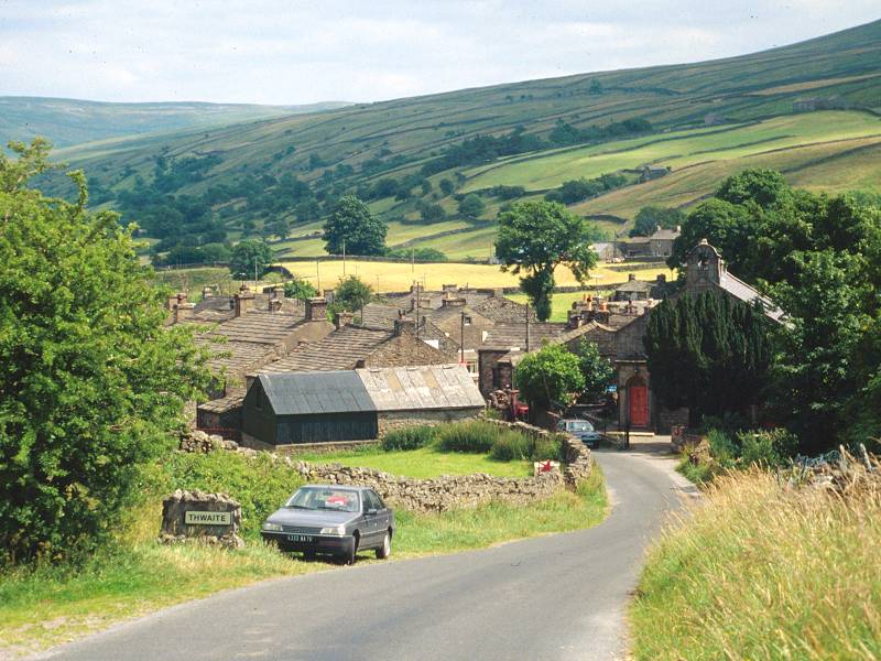

Thwaite
Thwaite is a lovely little village, stone-built and handsome. The scene in the third image above is mirrored (sans cars and TV aerials) in Wainwright's book and probably hasn't changed for several hundred years. There are few facilities in the village except for Kearton's, which is the shop, and the cafe, and the guest house. Once upon a time there was a daily bus over Buttertubs pass back to Thwaite, but now the only link to the outside world is the service along the valley to Richmond, from where connections are available to railheads at Darlington and Northallerton, as well as Leyburn and Barnard Castle for the preceding and succeeding sections of the Pennine Way.
![]() Arriva
North East service 30: Keld - Thwaite - Reeth - Richmond
Arriva
North East service 30: Keld - Thwaite - Reeth - Richmond
![]() service
55
connections from Richmond to Northallerton railway
station
service
55
connections from Richmond to Northallerton railway
station
![]() service
X27,
connections from Richmond to Darlington railway station
service
X27,
connections from Richmond to Darlington railway station
![]() service
159,
connections from Richmond to Leyburn (for
Wensleydale
/ Hawes)
service
159,
connections from Richmond to Leyburn (for
Wensleydale
/ Hawes)
![]() service
79,
connections from Richmond to Barnard Castle (for
Teesdale)
service
79,
connections from Richmond to Barnard Castle (for
Teesdale)
| Horton-in-Ribblesdale to Hawes | Back to Pennine Way index | Thwaite to Pasture End |
This page last updated 5th December 2004
![]()