
| Dale Head to Horton | Back to Pennine Way index | Hawes to Thwaite |
The route between Horton and Hawes makes use of a network of old drove roads, of which one at least is Roman in origin. The first, Harber Scar Lane, leads northwards out of Horton and crosses the watershed at Birkwith Moor to drop into Langstroth, an offshoot of upper Wharfedale. The Pennine Way leaves Horton Scar Lane just at the watershed and turns left to cross a mile of open moorland, on the other side of which is the farm of Old Ing (at the end of a long motor road on the east bank of the Ribble).
From Old Ing the Pennine Way adopts a second drove road, which crosses Ling Gill by an ancient packhorse bridge and rises to the watershed once more at Cam End. This was an important road junction in ancient times and nowadays is just as important to the long distance path network, for this is where the Pennine Way joins the Dales Way. A path to the left falls westwards to Ribble Head, while the combined Pennine Way and Dales Way head northwestwards along Cam High Road.
Cam High Road is an old Roman road and, in common with most of the roads constructed in that era, is dead straight. The Dales Way drops to the right, into the Oughtershaw valley and ultimately into upper Wharfedale. The Pennine Way heads onwards, along the top of a windy moorland ridge, eventually reaching the limit of a tarmac road at Kidhow Gate.
From Kidhow Gate the Pennine Way leaves the Roman road (which is heading for Bainbridge in Wensleydale) and instead runs along West Cam Road, along the western slopes of Dodd Fell. The picturesque valley of Snaizeholme Beck lies down to the west. After many miles the Pennine Way drops down the long northern spine of Dodd Fell and veers right, or northeast, into the delightful stone built village of Gayle (home of Wensleydale cheese and built around one of the loveliest natural water features in the Dales). A simple flagged path leads the short distance into the busy market town of Hawes, situated near the head of Wensleydale at an altitude of around 700ft.
There are public transport links along the
length of Wensleydale to Northallerton, and also a rather more useful
though
skeletal link to the Settle-Carlisle rail halt at Garsdale. Hawes's own
railway station is long since closed and now functions as the tourist
information
office.
|
|
|
| Length: | 13.7 miles / 22 km |
| Total ascent: | 1760 ft / 536 m |
| Total descent: | 1727 ft / 527 m |
| Estimated time: | 4 hrs 51 mins |
![]() Leeds
- Settle - Horton - Carlisle rail timetable (Arriva Northern)
Leeds
- Settle - Horton - Carlisle rail timetable (Arriva Northern)
If this walk has an official start it's the well known Pen-y-Ghent Cafe, one of the Pennine Way's premier staging posts and a refreshment, information and gossip centre for hikers, cavers, cyclists and all manner of outdoor types. Head north along the main road and, at the corner just before the bridge over the Ribble, turn right and walk in front of the Crown Hotel, then immediately left. If you're coming down from the railway station you'll approach this corner from the west and go straight on past the Crown and then left. You're in Harber Scar lane.
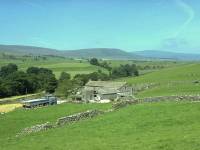
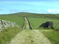
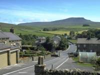
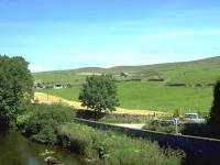
Harber Scar Lane is almost a twin of Horton Scar Lane, along which you entered Horton yesterday. It meanders lazily up, down and among the contours between twin drystone walls, with green limestone pastures to either side. A low moorland ridge rises to the right, while the Ribble meanders not far down to the left. Between the Ribble and the lane is a lonely motor road, serving a couple of farms and a scattering of stone cottages. Across the valley is the vast limestone hump of Ingleborough (elevation 723 meters).
Looking back to Horton; Harber Scar lane
Harber Scar lane is one of the many old drove roads in this area, along which cattle would have been driven between one valley and another, and which probably served as ancient trade routes The lane is heading ultimately for Langstrothdale, an offshoot of Wharfedale, and in the course of its journey will describe a wide, graceful curve around to the east. The Pennine Way follows Harber Scar lane for nearly 3 miles, turning off quite close to the watershed.
Harber Scar Lane at Sell Gill; Sell Gill Hole; limestone pavement
There's plenty of interest within those three miles. There's the gentle rises, falls and twists, which ensure that no vista is ever the same. The pattern of drystone walls changes now and again, with open pasture beckoning sometimes either to the right or left. And the Way passes several prominent potholes, the first of which is Sell Gill; the entrance to this cave (which is for experienced and properly equipped cavers only) lies just off the path to the right, in the slight depression formed by Sell Gill Beck. Limestone terraces and areas of karst, or limestone pavement, decorate the scene in the immediate vicinity.
You will catch sight of a tiny lake down to the left; standing water is very much a rarity in limestone country and the Tarn, as it's called, is probably going to have a very short geological lifetime. Ingleborough continues to dominate the scene to the west, while Whernside (the third of the Three Peaks of the Yorkshire Dales) begins to come into its own to the northwest. A little copse of trees is soon reached, which marks the position of Jackdaw Hole (yet another of the many potholes hereabouts).
Refreshment halt at Jackdaw Hole; Harber Scar lane continues
I've more than once made use of Jackdaw Hole as a refreshment halt; it's a tranquil spot and a natural magnet for walkers who want a brief sit down off the path. Jackdaw Hole itself is one of several pots within the immediate vicinity - a look at the map will also reveal the existence of Cross Pot and Penyghent Long Churn. Six hundred meters further north are Canal Cavern and Red Moss Pot, both just off the path.
Harber Scar lane nearing Birkwith Moor
Not far north of the potholes Harber Scar lane starts to level out as it approaches the watershed on Birkwith Moor. It begins to turn to the northeast and sheds first one, then the other, of its enclosing drystone walls.
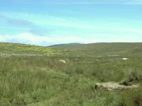
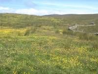
Moorland scenery at Birkwith Moor
Harber Scar lane continues, no longer enclosed by twin drystone walls, across the rough pastures of Birkwith Moor. The track makes a very gradual curve to the right as the gradient, already shallow, begins to flatten out. Forest plantations are glimpsed across the brow of the hill ahead and slightly to the right.
Harber Scar lane on Birkwith moor
The unenclosed section lasts perhaps half a mile. The lane is heading for the Ribble/Wharfe watershed not much over a mile ahead, but before this point is reached the route of the Pennine Way veers off to the left. The point at which it does so is obvious, just after the lane crosses a transverse stone wall on a diagonal. Take the prominent path up the slope to the left.
The Pennine Way crossing Birkwith Moor towards Old Ing
The path breasts the top of the slope in about 200 meters and, from the vantage point, the Pennine Way is seen continuing down the other side towards the greener pastures adjacent to Old Ing farm, about half a mile to the west. The path is a little sketchy in places and may be juicy in wet weather but its line is never in doubt. It heads through a gate in another wall, near a stone barn, and follows alongside a wall to the north as it approaches the farm.
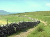
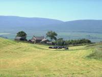
It's somewhat galling to approach Old Ing and find cars parked there after you've walked almost four miles from Horton. Old Ing is, in fact, just beyond the end of the motor road that led off northwards from beside the Crown Hotel.
Another old drove road leads north from Old Ing, apparently the route of an ancient thoroughfare from Settle to Hawes. Almost immediately north of Old Ing the track comes alongside Dry Laithe Cavern.
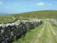
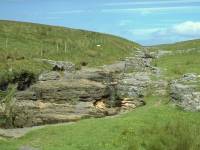
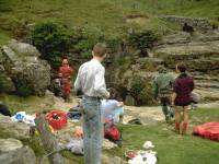
Pennine Way at Dry Laithe; Limestone formations; Cavers at the entrance to Dry Laithe cavern
Dry Laithe (otherwise known as Calf Hole) is a popular venue for cavers. The cave swallows a beck which re-emerges from Browgill Cave a short distance to the northwest.
Dry Laithe (aka Calf Hole Cavern)
The Pennine Way north of Dry Laithe
The Pennine Way between Dry Laithe and Ling Gill
The Pennine Way continues along an excellent and nicely scenic lane for a mile north of Dry Laithe, eventually coming alongside Ling Gill.
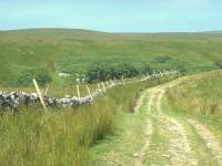

Ling Gill itself, described by Wainwright as one of North Yorkshire's finest limestone gorges, is reputedly 200ft deep in places. Unfortunately it is choked with vegetation and is poorly seen from the path. It is believed to be a collapsed cave system, and the sheer size of the boulders in the depths of the gorge would appear to support that theory.
The PW adjacent to Ling Gill; Ingleborough glimpsed along the line of the gill; Ling Gill south of the bridge
The packhorse bridge; Ling Gill from the bridge
The most famous feature of Ling Gill, however, is the 400 year old packhorse bridge that carries the old drove road across the gill northeast of the ravine. A carving on a stone built into the bridge states that it was repaired in 1765.
The packhorse bridge from the west bank; the PW leading away from the bridge to the north
The Pennine Way, having crossed Ling Gill via the bridge, now tracks more or less northwards up a nameless slope to head for Cam End.
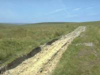
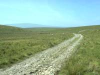
The track from Ling Gill Bridge to Cam End
The maps fail to give a name to the moorland ridge that the Way ascends for a mile or so north of Ling Gill bridge. To the west there is a feature called News Head Hill; nothing else in the vicinity has a name and to be honest there is very little to give a name to. The track has an excellent surface, fortunately, though even a brief perusal of the guidebooks indicates that this was far from the case until quite recently. Mud appears to feature prominently in various accounts.
The Pennine Way approaching Cam End
A first view of Ribblehead; a retrospective view of Pen-y-Ghent; and one of Ingleborough
Eventually the path reaches the top of the ridge and a view opens out to the west, giving you a glimpse of the famed Ribblehead Viaduct about three miles away. You are pretty much in the midst of the Three Peaks here - Whernside sprawls beyond Ribblehead to the west, while behind you Pen-y-Ghent resembles an upturned boat and Ingleborough displays its characteristic flat summit plateau. Shortly afterwards the Way reaches the Cam End path junction.
From Cam End junction: onwards to Cam High Rd; back to Ling Gill; down to Ribblehead
At Cam End the Pennine Way joins the Dales Way, which has come up from a west-southwesterly direction and has itself recently diverged from the Ribble Way back at the Ingleton - Hawes road, a mile away. This road heads up through Widdale and more or less runs parallel with the route of the Pennine Way for the next eight or nine miles. In the other direction is the valley of Cam Beck, a tributary of Ling Gill. Between the two valleys is a long ridge of moorland running northeast, and it is along this ridge that the combined Pennine Way and Dales Way run, following the course of an old Roman road.
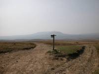
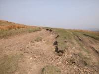
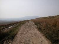
Path junction; Cam High Rd; retrospective view of Ingleborough
Cam High Road runs almost dead straight for the next three miles, at first along the summit of the ridge, later along its eastern slopes. There is little to see. There are views down into the valley of Cam Beck for a while, and a mile north of Cam End the Dales Way diverges from the Pennine Way and heads down to the left on a falling gradient. It's heading for the lonely farm of Cam Houses, which sits almost on the main watershed; beyond it the land begins to fall again to the valley of Oughtershaw Beck, a far offshoot of Wharfedale. Another mile ahead the Pennine Way clocks up its hundredth mile, an event one feels ought to be physically marked; alas, there is still nothing to see.
Cam High Road and the view eastwards to Cam Houses
The Dales Way diverging to Cam Houses and Wharfedale
The watershed; Cam High Rd; looking back
The tarmac section of Cam High Rd, and Cold Keld Gate
Cam High Road is joined by the driveway coming up from Cam Houses and beyond here it is surfaced with tarmac. It's fortunate that the tarmac section lasts only about a kilometre. Shortly before the turnoff the road passes through a gate; the drystone wall on either side used to mark the county boundary between the West Riding and North Riding of Yorkshire but nowadays it is merely a district boundary. You are leaving Craven and entering Richmondshire. The wall also follows the main watershed; behind you is the Ribble (draining into the Irish Sea), ahead is the Ure (draining into the North Sea).
Three hundred meters beyond Cold Keld Gate the road reaches a second barrier, that of Kidhow Gate. Here the road dips right to fall into the basin of the Wharfe (and back into Craven) for a short distance. The Pennine Way, however, bends left to follow yet another old drove road, West Cam Road.
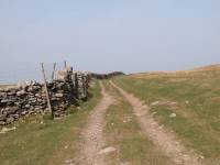
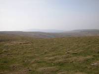
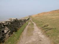
West Cam Road and the first feeders of Wensleydale
West Cam Road is even longer and lonelier than Cam High Road; it's still five and a half miles to Hawes and West Cam Road runs for three of them. In fact, you could leave the official Pennine Way and follow West Cam Road all the way but by doing so you would miss out Gayle, and by Pennine Way standards that's an unpardonable sin.
West Cam Road and Snaizeholme valley
West Cam Road is grassier than Cam High Road. It hugs the western slopes of Dodd Fell (648 meters), and follows the long, northeastern limb of the fell pretty nearly all the way into the head of Wensleydale. An offshoot of that lovely valley, that of Snaizeholme Beck, can be seen down to the left; it contains a few forest plantations and a tiny cluster of farms and from up here it looks really delightful.
West Cam Road and Snaizeholme valley
There is a drystone wall on the Snaizeholme side. It's made of limestone again, but this local stone has a curious, bleached look and seems to weather into rounded shapes not really characteristic of limestone. Further north this shoulder of Dodd Fell carries the name of Rottenstone Hill, which suggests that this local limestone tends to crumble or erode easily and is not suitable for use as building material.
West Cam Road and its environs
Approaching Ten End; looking back at Dodd Fell; Ten End
At Ten End, just over halfway between Kidhow gate and Hawes, there is a choice of routes. The walled lane, now named Cam Road, descends slightly left to fall for a further two miles before joining the Hawes - Ingleton road about a mile west of the town. The Pennine Way heads slightly right, keeping to the higher ground and reaching the prow of Rottenstone Hill.
Ten End, the path junction and Snaizeholme
Rottenstone Hill
First view of Hawes
Hawes, and it's nearer "suburb" of Gayle, are now in view. The Pennine Way continues, now as a simple grassy path, down the ridge of Rottenstone Hill across pastures.
Rottenstone Hill
Descending Rottenstone Hill
The path eventually adopts another track, Gaudy Lane, which comes out onto the motor road network by Faw Head.
Gaudy Lane
Faw Head
Entering Gayle from the west
Gayle is built around a stone bridge crossing Gayle beck at the road junction in the village centre. The houses around seem to have grown rather than been built, and the whole scene is aesthetically perfect. How fortunate that Gayle grew into being before the world of bureaucracy and planning laws became the norm, for surely this scene of beauty could never have been devised on a sheet of drawing paper.
Gayle village centre
Walk north now down the Hawes road, passing to your right a lovely little waterfall that has no name on the map but should - if there's any poetic justice - be called Gayle Force. It's possible to walk the short distance down to the main road and turn right into Hawes, but a better option is to follow the PW which takes a local footpath across a water meadow, which runs behind Hawes church and goes through a stone arch to deposit you slap in the town centre.
Main road to Hawes
A Hawes scrapbook
Hawes is a compact little market town. It's of no great size and probably has a population of less than two thousand, but the real surprise is that it's here at all right at the top end of Wensleydale. It probably owes its existence to a junction of ancient roads, for high moorland roads strike out across the Pennines from here to Ingleton and to Sedburgh. There are also roads across the lateral watersheds to Oughtershaw (at the head of Wharfedale) and to Thwaite (at the head of Swaledale). Hawes itself has a handsome main street of stone-built houses, shops and inns, behind which is a maze of little alleys that often lead to bridges over Gayle Beck. Just to the north of the town is the flood plain of the Ure and the trackbed of the long abandoned Wensleydale railway line. The old station is now the tourist information office. For through hikers and backpackers the town provides invaluable resources for rest, recuperation and restocking.
There are a number of places to stay in Hawes, but if you're day hiking the key transport route is the bus hop to Garsdale for the Leeds-Settle-Carlisle line. Up to date bus times are essential, for the service is both irregular and seasonal. Buses in the other direction run to Northallerton along the length of Wensleydale - a delightful run in itself but time consuming
![]() Service
112
Askrigg - Hawes - Garsdale (for Settle-Carlisle railway)
Service
112
Askrigg - Hawes - Garsdale (for Settle-Carlisle railway)
![]() Leeds
- Settle - Garsdale - Carlisle rail timetable (Arriva Northern)
Leeds
- Settle - Garsdale - Carlisle rail timetable (Arriva Northern)
![]() Service
157
Hawes - Wensleydale - Northallerton
Service
157
Hawes - Wensleydale - Northallerton
|
£4.00
inclusive
of postage / packing. |
| Dale Head to Horton | Back to Pennine Way index | Hawes to Thwaite |
This page last updated 4th December 2004
