| Fort Augustus to Torgoyle Bridge | Back to Great Glen Way index | Cannich to Struy |
Like its grander neighbour, Strath Glass is graced by a significant area of original Caledonian pine forest, the natural vegetation of the Highlands. There is artificial planting too, however. We reach Strath Glass in the environs of the Guisachan estate, a world of woods, river meadows, neat cottages and the splendid village of Tomich at the end of the public road. From Tomich there is a four mile road walk to Cannich and the end of this variation of the Great Glen Way.
The Guisachan estate
poses a cruel dilemma for day hikers. The key to tackling this section
as a day hike is the morning bus to Portree from Inverness, and the
evening
bus from Cannich to Beauly. The time between them is tight and does not
allow for one of the End-to-End's most compelling diversions - the
Plodda
Falls loop. This diversion adds only about half a mile to the total
distance
but, as the supreme scenic highlight of the Great Glen Way, it will
doubtless
add some 90 minutes to the time. Give serious consideration to finding
overnight accommodation at either Tomich or Cannich so that you can
enjoy
the walk to the full extent that it deserves. Plodda Falls should not
be
missed.
|
|
|
| Length: | 17 miles / 27.3 km |
| Total ascent: | 2190 ft / 668 m |
| Total descent: | 2343 ft / 714 m |
| Estimated time: | 6 hrs 2 mins |
Map: OS 1:25000 Explorer 415 (Glen Affric)
Click
on
any thumbnail image in this gallery to display the corresponding full
size
image. The images are access protected through a cgi script to prevent
hotlinking. If you encounter problems while trying to view the full
size
images, please read the access advice
page.
Photographic note: the bulk of these images
were taken in August 2000 on a splendid afternoon, though they cover
less
than a third of the walk. The rest of the photographs, taken on a dull
day in the summer of 1998, are included merely for completeness and
will
be replaced at a later date.


![]() Citylink
bus times, Inverness
- Skye (.pdf document). Torgoyle Bridge is between
Invermoriston
and Bunloyne
Citylink
bus times, Inverness
- Skye (.pdf document). Torgoyle Bridge is between
Invermoriston
and Bunloyne
The first mile of today's walk lays along the A887 road northwards then eastwards towards Dundreggan, roughly a mile away. However, if you're tied to bus times and you planned things well, then this first mile will have been added to the end of yesterday's walk; if you have the bus driver drop you at Dundreggan itself you will save at least 20 minutes, time which could prove invaluable later on.
A couple of hundred yards out from Torgoyle Bridge you may well spot a signboard erected by the Scottish Rights of Way society indicating a path to Tomich going off into the trees to the left. Ignore it; it runs as far as a small chapel just inside the wood and then peters out. Ralph Storer's excellent book on Scottish hill tracks indicates that this right of way is in dispute. It's certainly impossible to follow, but if it is ever reinstated it will cut a good mile or more off the day's distance.
About half way to Dundreggan you pass under the pylons again. The ride cleared beneath them is too rough to follow; continue along to Dundreggan for the hill track.

There's very little to see at Dundreggan. A rough tarmac drive turns left off the road and splits in two almost immediately after. Take the left fork, which runs uphill behind a chalet and into the woods.


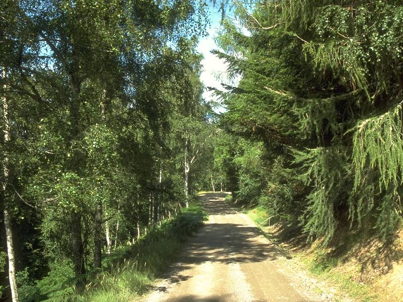
The hill track through the woods west of Dundreggan
The track leads away from Dundreggan almost due west, climbing smartly through the trees, to reach the power lines yet again after a kilometre. Just beyond the lines the trees give out and the track takes a sharp right turn to head northwards across the moor.

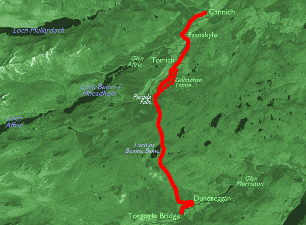
It would be stretching it somewhat to call this a magnificent wilderness. The scenery is uninspiring and not a little drab, and the ever present pylons don't help. At least there is only one line of them now, the other having turned off down the glen towards the Dundreggan hydroelectric power station. The only feature even named on the map hereabouts is Meall na Doire, a formless lump of a moorland summit off to the left of the path about two kilometers from the road. The vehicle track is very well maintained and allows relatively swift walking but there isn't that much to see apart from the retrospective view across Glen Morriston. You should be able to spot yesterday's descent from Inchnacardoch. If the weather is at all kind there should be a view westwards towards the easternmost Glenshiel Munros, of which Sgurr nan Conbhairean and Carn Ghluasaid are very prominent about 12 miles away.


The hill track north of Meall na Doire
The path reaches its summit about five kilometers or three miles out from Dundreggan, at the formless 1500ft col between Beinn Bhan and Meall Ruigh Uisdean, two sprawls of moorland that barely merit a name. There is a view forwards at last, though the country ahead looks surprisingly uninspiring from here; it's probably the fact that there's another five kilometers of moorland and two kilometers of forest track to go before you hit Strath Glass and the good scenery. At least, if the day is clear, the mountains surrounding Glen Affric should be coming into view towards the northwest. Closer to, Loch na Beinne Baine sits in a moorland hollow below and slightly to the right; surrounded by nothing other than featureless moorland, however, it fails to please the eye. The ugly concrete shed that sits beside the path just about sums up the mood of this stretch. Lonely. But not lovely.


The hill track at the col; initial descent beside the power lines; Loch na Beinne Baine and the Glen Affric hills


The long descent towards the Guisachan Forest
The track runs close to the outfall from the loch and follows the issuing stream for about a kilometre before veering away right towards the power lines once more. There follows a long, shallow descent towards the edge of the forest plantation two kilometers beyond. The Glen Affric hills look a bit more exciting now and, as the featureless moor falls away and a sense of perspective resumes, there is a tangible promise of good scenery ahead.

Just before you reach the forest boundary another track strikes off to the right; it provides an alternative route to Tomich and ultimately drops into the valley of the river Enrick, a feeder of Glen Urquhart. But it's just more moorland and there is more lively scenery ahead.

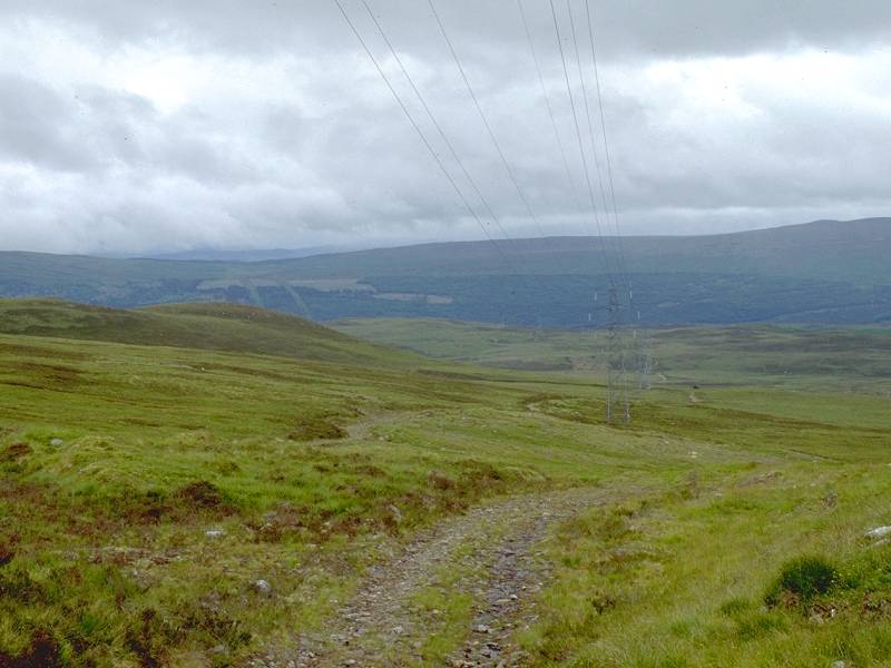
The track through Guisachan forest
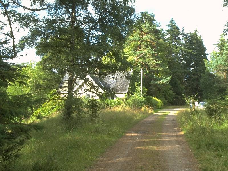
We've lost the power lines for the moment, although we'll encounter them again at Cannich and they'll be alongside us again tomorrow. This part of the Guisachan forest is an artificial plantation and the track runs through it for two kilometers, initially alongside the Allt nam Foidhag. Eventually new varieties of tree begin to appear and the landscape becomes more open; shortly afterwards the path reaches valley level and merges with the main forest track along upper Strathglass. To the southwest the track runs on to the isolated lodges of Garve Bridge and Cougie. Ahead of you is Hilton Lodge.

I don't know anything about Hilton Lodge but it's a grand, secluded and well maintained property and is very probably the seat of the Guisachan estate, Guisachan House itself having fallen into ruin. There are tracks through and around its grounds but they are assumed to be private. A sizeable pond, thick with water lilies, fronts the house and the main track runs off around the south side. You are now faced with a choice. The direct route to Tomich, now about 2½ miles away, is along the track to the northeast. Take this route if you are over tired or pushed for time, or if you need to escape from the weather. Otherwise, turn left and head up the valley to the southwest for some 800 meters to take in the Plodda Falls loop
The vehicle track south of Guisachan House
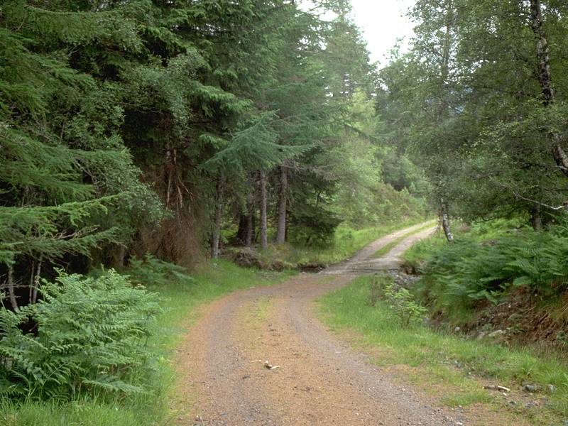
The direct route to Tomich from Hilton Lodge is very pleasant indeed, though you do have to keep an eye out for traffic; although the track is just a dirt road public access is allowed as far as the Plodda Falls car park and you will meet a small but steady stream of tourists. There will probably be plenty of bike traffic as well; this is a famed mountain biking area. This area of the Guisachan estate is extensively wooded and the track makes quite a wide dogleg in the vicinity of Guisachan House, which remains hidden throughout.


The track to Tomich from Hilton Lodge
A few scattered cottages lie off the track; all of them seem to have immaculate gardens and you quickly form the impression that this little corner of the Highlands is a mini paradise. The track runs on towards Tomich, in places only a hundred meters south of the Guisachan House road which the Plodda Falls route is following. The routes converge in an open area of grass and trees about a mile short of Tomich.

Having turned left at Hilton Lodge, walk along the track to the Plodda Falls car park about 800 meters to the southwest. Turn right into the car park, walk through to the far end and find the path leading down through the trees beside the Allt na Bodachan.


There is quite a little maze of paths in this area and all of them invite exploration; one reason why this walk should not be rushed. You first come to a pleasant waterslide in a small clearing, in which the stream cascades down two rock sills. This is not Plodda Falls, just a prelude. Continue along the path, which is running roughly northwest. The noise of the fall should soon become apparent. Slightly off to the left, a path gives access to an observation platform above the falls proper.

None of my guidebooks give more than a passing reference to Plodda Falls, which is a pity because I have no record of its height, but it looks to be something a little short of 100ft. While the word "spectacular" would be overdramatising the falls, they are exceedingly pleasant and more than repay the effort of getting here to see them.


Plodda Falls; four sequential shots from lip to base
From the viewing platform above the falls make your way along the forest path to a junction a couple of hundred yards below. The left turn gives access to a narrow passage through the trees that leads to a superb little glade at the base of the falls. Here you can see them in all their glory.

Once you've had your fill of the falls return to the path junction and turn left, resuming the course you left. The path winds down through extensive but varied tree cover. In sunlight this part of the walk is so beautiful that you may well never want to leave.


The Abhainn Deabhag fords
Somewhere behind you the Allt na Bodachan has joined the Allt Riabhach to form the Abhainn Deabhag; it's not at all clear from the map exactly on which of these three watercourses Plodda Falls is actually situated. No matter. The woodland path emerges at a clearing onto a vehicle track of sorts; to the left, this track plunges through the river towards a gate on the far side. This track heads up to Garve Bridge. A minor track sharp to the left heads back up the riverbank a little way; it's worth following just for the scenic gems it reveals though it peters out at a rockpool somewhere below Plodda Falls.


Scenes from the riverbank

Return to the fords and turn right now, along the vehicle track to the northeast. It's some five kilometers or three miles from here to Tomich, and every step is a gem. The path runs through largely natural woodland, which is punctuated by clearings, river meadows and the odd cottage here and there. You first encounter Plodda Lodge, apparently the headquarters of a tree conservation charity; from here a side path to the right is an alternative route down from Plodda Falls (presumably the right turn from that path junction below the observation platform) and keen-eyed walkers might just spot the back of Hilton Lodge high in the trees.
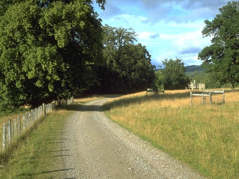
About a mile from the fords you reach the ruin of Guisachan House. The structure is dangerous and you should not attempt to explore. It is very sad to see such a magnificent structure in a state of advanced dilapidation.


Guisachan House; the route to Tomich
Beyond the house the route crosses a greensward and joins the main drive coming down from Hilton Lodge. At this point the direct route from the Torgoyle Bridge hill track is running parallel to the right, at one point less than a hundred meters away although it is never seen.


The Guisachan Estate near Balcladaich


Balcladaich
The next mile is exceedingly pleasant, with woods to the right and a succession of river meadows to the left. The track passes several isolated cottages, every one (Balcladaich, in particular) a dream home. The direct route from Hilton Lodge converges from the right and now it's just a mile to Tomich.


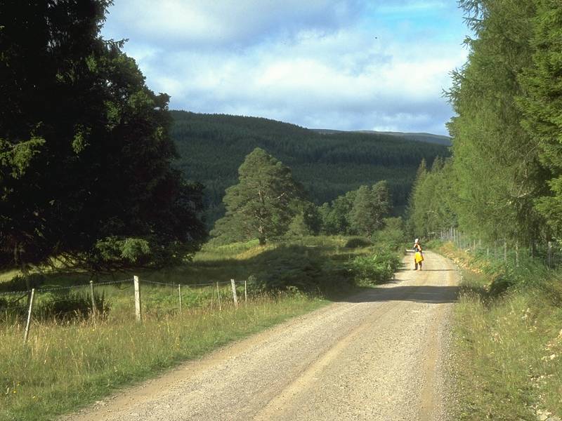
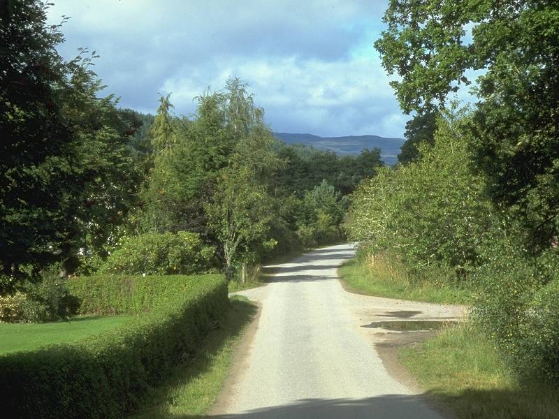
Approaching Tomich along the Guisachan Estate road
Tomich was apparently constructed in the nineteenth century by the Guisachan estate as a village for the estate workers. It is very much in the vein of similar places built around the country by benevolent and philanthropic landowners. It is regarded as a model Highland village and is a scenic gem. It is outdone, though, by its own immediate environs - the approach from the west, along a tree-lined avenue fringed by lush green pastures, is a scenic wonder when the sun is out.


The last mile into Tomich


Entering Tomich from the west
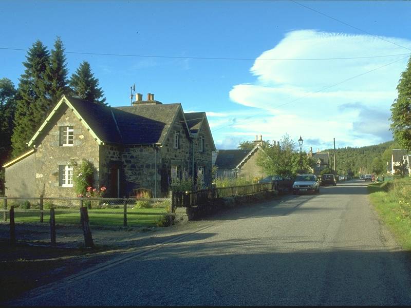
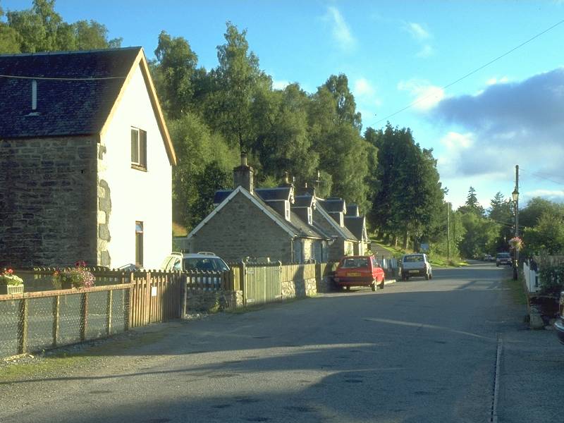
Tomich
There are few facilities at Tomich apart from the hotel - a former hunting lodge - and a small shop / post office. I am pleased to recommend the Tomich Hotel, having stayed here for a couple of nights in the summer of 2000.
A bus service from Inverness terminates here but the timings are awkward. The Ross minibus service to Beauly via Cannich and Struy is almost as elusive, running on certain days only and calling at Tomich only on request. To make certain of catching the afternoon departure it's necessary to walk to Cannich, at the end of the Great Glen Way, a further 2½ miles by road.
![]() Service
18 / 317 , Tomich
- Cannich - Drumnadrochit - Inverness
Service
18 / 317 , Tomich
- Cannich - Drumnadrochit - Inverness
![]() Ross's
Minibuses: operate to Tomich only by prior arrangement, tel 01463
761250:
Summer 2000 timetable: Tuesdays only depart 1315 for Beauly; Fridays
only depart 1722 for
Beauly. Check for up to date times.
Ross's
Minibuses: operate to Tomich only by prior arrangement, tel 01463
761250:
Summer 2000 timetable: Tuesdays only depart 1315 for Beauly; Fridays
only depart 1722 for
Beauly. Check for up to date times.


The road from Tomich to Cannich


Fasnakyle Bridge and the River Glass
The walk from Tomich to Cannich is largely uneventful. Fortunately the traffic is light and should not prove a nuisance. Somewhere to your left the Abhainn Deabhag has been joined by the River Affric to form the River Glass. After about a mile and a quarter you will notice a side road to the left; take this, crossing the Glass by a stone bridge, to join the Glen Affric road at Fasnakyle power station.

Fasnakyle is a hydroelectric power station built sometime around 1950, boldly fashioned in a beautiful gold sandstone. It generates power from the head of water coming down from the Loch Beinn a Mheadhoin dam a couple of miles upstream in Glen Affric; if I remember correctly it houses three main turbines each capable of generating 22 megawatts. It used to be possible to simply wander inside; sadly, the growing problems of security and vandalism have put a stop to casual public access.


The Glen Affric road; Cannich post office; Cannich crossroads
Once past Fasnakyle there remains only the short mile and a half walk into Cannich along the north bank of the Glass. There's not a great deal here; a cluster of houses including a small residential estate, an inn or two, the highly useful post office and general store, and the Cannich Hotel (outside which you'll find the bus shelter). Down the road to the right is the public convenience and a cluster of self-catering chalets which can apparently be hired by the day, and adjacent to these is a campsite and bike hire facility.
Cannich marks the end of this version of the Great Glen Way. For those walking on to John O'Groats, another two weeks and 184 miles of walking lie ahead. The immediate destination is Struy, but that's for tomorrow. Or maybe next year.
![]() Service
317 / 18, Tomich
- Cannich - Drumnadrochit - Inverness
Service
317 / 18, Tomich
- Cannich - Drumnadrochit - Inverness
![]() Ross's
Minibuses, Tomich - Cannich - Struy - Beauly: Tuesdays only,
depart
1322: Fridays only, depart 1715 (or 15 minutes later if a call at
Tomich
has been requested): Saturdays only, depart 1310 for Inverness. Times
as published 22 May 2000. (See also the Glen Affric summer bus
timetable 2004)
Ross's
Minibuses, Tomich - Cannich - Struy - Beauly: Tuesdays only,
depart
1322: Fridays only, depart 1715 (or 15 minutes later if a call at
Tomich
has been requested): Saturdays only, depart 1310 for Inverness. Times
as published 22 May 2000. (See also the Glen Affric summer bus
timetable 2004)
| Fort Augustus to Torgoyle Bridge | Back to Great Glen Way index | Cannich to Struy |
This page last updated 13th January 2005
![]()