

| Jubilee Inn to
Exford |
Back to Devon Coast-to-Coast index | Porlock to Minehead |


| Jubilee Inn to
Exford |
Back to Devon Coast-to-Coast index | Porlock to Minehead |
Today's walk takes us across the wildest
and highest part of Exmoor . From Exford the route takes a steep lane
among
fields,
woodland and pasture to reach Exford Common on the moorland heights,
and
from here we take a hill track to the stony top of Dunkery Beacon. The
stretch between Dunkery Beacon and Porlock is also very pleasant,
taking
in the slopes above the valley of Horner Water and the woodlands within
the valley itself. The Horner tea rooms a mile or so short of Porlock
are
an added bonus.
|
|
|
| Length: | 8.57 miles / 13.8 km |
| Total ascent: | 1160 ft / 354 m |
| Total descent: | 1868 ft / 569 m |
| Estimated time: | 3 hrs 4 mins |
Exford village green
Exford is a lovely village, built around a huge green and featuring a number of buildings of great character. The village is a riding centre and its two big hotels each have stables. Apart from the youth hostel and the two main hotels, there is plenty of other B&B accommodation here, as well as a handful of shops. The bus stop is beside the village green.

Turn right here
Our route out of Exford is Coombe Lane, which is a lane off to the right at the north end of the green. It goes uphill steeply and soon becomes a simple farm track.
Coombe Lane
Our route follows Coombe Lane to its far and, a distance of a good mile and a half. This is a very straightforward section and the only thing to watch out for is the fork in the path just past the unseen Coombe Farm after one kilometre. The path is enclosed by hedges for a good distance but after a while there are open pastures and fields to the left, allowing you to look across the little valley of Edgecot Water to Mill Lane beyond, the road from Exford up to Exford Common.
Combe Lane, midsection
Eventually the farm track goes off to the right for Sharcott farm, and our route continues across open pasture, climbing all the time. Eventually you come to a track junction, where you turn left.
Upper Combe Lane
This track is known as Stone Lane and it forms a bridleway from the hamlet of Stone, two miles to the south east, up to Exford Common. We've joined it near its northwestern end. The track runs between tall hedges for 250 metres to come out at a lonely road junction at the edge of Exmoor Common, and the start of the wild, upper heights of the national park.
Once again there is an enclosure wall to your right, and once again you are pretty well surrounded by heather. It would be nice to climb up to Great Rowbarrow, the ridgeline just to the north, but it would just be too much effort for little obvious reward. Stick to the track, which continues for two miles.
The track to Dunkery Beacon

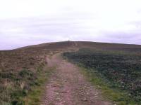
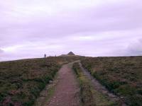
The approach to Dunkery Beacon
After a mile and a half the enclosure wall diverges to your right and the track forks, with the right-hand fork still following the wall away to the southeast. Continue straight on, along the track that is now converging with the ridgeline and heading directly for Dunkery Beacon, Exmoor's highest point. You're already on the ridge and the ascent is shallow and gentle.
Topograph and summit cairn on Dunkery Beacon
Dunkery Beacon itself, elevation approx. 520m or 1707ft, is not the prettiest of summits. It's stony, the cairn is absurdly large, and while the summit is at least a kilometre from the nearest road access it does seem to attract an unfortunate amount of undiscerning trippers. Since the ridge is fairly flat you don't get much of an immediate view, but if the day is clear the distant panoramas should be rewarding. You will get your last glimpse of Dartmoor from up here, while to the north you should be able to see clear across the Bristol channel to Wales, with perhaps a glimpse of the Brecon Beacons some fifty miles away. To the east the Quantocks will be in view, while to the northeast you will have much of the succeeding walk in view - as far, apparently, as Haresfield Beacon in the Cotswolds, 188 walking miles ahead.
The route off the Beacon
The main track to the east continues to a point on the Porlock - Luckwell Bridge road, but you can save yourself half a mile of road walking by taking a simpler pathway diverging to the northeast. This path, which runs through a mix of heather and moorland shrubs such as gorse and broom, traverses below the lip of the moor and runs around the head of a number of combes feeding Horner Water, below to your left. It's a little tricky to find its commencement from the summit - to find it walk north for some twenty to thirty metres then strike off on the path to the right.


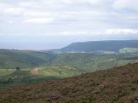
The valley of Horner Water; looking back to Dunkery Beacon; view forwards to Webbers Post and Porlock
The slopes hereabouts are known as Dunkery Hill, but after a mile and a half the path joins the Luckwell Bridge - Porlock road just west of the minor summit of Robin How. From here on you follow the road northwards, and Dunkery Hill becomes Luccombe Hill. The major scenic highlight is not the moor itself, which continues to display a dark and brooding carpet of heather, but the lushly wooded valley of Horner Water down to your left. It looks very inviting and soon we shall be making our way down there. The immediate objective, however, is Webber's Post, a locality on the edge of the forest that boasts an extensive car park. It has in fact been visible all the way from Dunkery Beacon and it will forever be fixed in my mind as the Three O'Clock Car park, as I guessed - to within five minutes, as it turned out - that it would be a good place for my afternoon tea break.
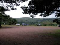

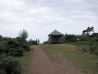
The "Three O'Clock Car Park at Webber's Post; path to lookout point; lookout point
Webber's Post turns out to be a small maze of forest tracks and dirt roads, complicated by the converging Cloutsham lane which has come up from a farm halfway up the valley (and which, ultimately, was the road that diverged from our route at Porlock Post back on Exford common. Cross this road to reach the car park and go to the far northwest corner, where you'll find a path. Follow this, avoiding any tracks going steeply downhill, and merrge with a more substantial track. This leads you to a wooden hut on a hilltop clearing.
the path down the slopes of Horner Hill
At the wooden hut go left to a side path that heads steeply downhill. This path, in woodland cover for most of its course, describes a number of sharp zigzags as it loses height.
Horner Wood and the footbridge across Horner Water
Horner Wood is lovely - a relatively open area of natural deciduous woodland that lets in plenty of daylight. You are surrounded by the best of countryside sounds - a mix of bird song, breeze in the treetops, and running water not far below. The sound of running water emanates from Horner Water, which you reach in the vicinity of a substantial footbridge. Cross the bridge and turn right, heading along the woodland path following Horner Water's left bank.
Path by Horner Water

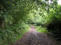

Woodland path, Horner
Horner tea rooms and packhorse bridges
The path delivers you to the tiny village of Horner in just under a mile. The path first reaches a packhorse bridge which you are obliged to cross, for the path peters out on the left side of the stream. Just across the bridge is the beginning of a motor road; there is a car park here, but more importantly the splendid Horner tea rooms stand adjacent. Immediately you pass the tearooms cross a second packhorse bridge back to the left side of the stream. You could take either the road or the woodland path from here, though I recommend the woodland path for it avoids a roadwalk through the village of West Luccombe just to the north and cuts off a corner.
At the foot of Crawter Hill you come to the back lane between West Luccombe and Porlock. There's a campsite adjacent just across the river. Another woodland path converges from the left at the same point, and those walking north to south might easily go astray here (treating the road as the leftmost of three possible routes, choose the centre path). The first houses of Porlock are now just a few of hundred yards away.
Approaching Porlock

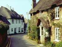
Residential roads in Porlock
You enter Porlock through its southern "suburb", a locality named Doverhay. Porlock is a picturebook English village of stone, limewashed and thatched cottages haphazardly set among narrow, winding lanes. By rights it ought to be a coastal community but for reasons I've not been able to discern its founders sited it here, a mile south of the bay that bears its name. Porlock relies to some extent on tourism but thankfully not to the extent that the gift shops have taken over. It's a pleasant place to explore and it's in a lovely setting, surrounded by woods and steep little hills that invite exploration and are a magnet to the walker.
Porlock
Porlock is on the Somerset Coast Path (which we shall be following tomorrow) and has B&B accommodation and a campsite, as well as bus services to Minehead and Lynton.
![]() Service
38, Minehead - Porlock (Mon - Sat, Summer
2002
timetable)
Service
38, Minehead - Porlock (Mon - Sat, Summer
2002
timetable)
|
£3.50
inclusive
of postage / packing. |
| Jubilee Inn to
Exford |
Back to Devon Coast-to-Coast index | Porlock to Minehead |
This page last updated 19th December 2004
