
| Lairg to Crask Inn | Back to North of Scotland Way index | Kinbrace to Forsinard |
| Lairg to Crask Inn | Back to North of Scotland Way index | Kinbrace to Forsinard |
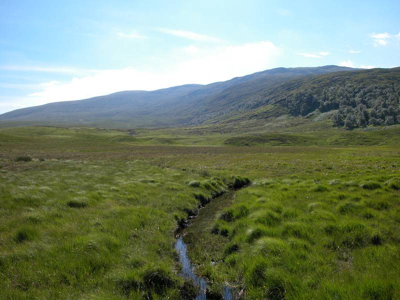
The walk breaks up naturally into three subsections. The first, the four miles from Crask to the Bealach Easach (pass of the waterfalls) lays over moorland pasture on a simple path. The underfoot conditions are rather better than on the average Scottish hill path and there are plenty of plank footbridges, though also one or two boggy bits. Cattle graze this section. The second part runs from the bealach to Loch Choire Lodge, and is superb walking country. In sunny weather this is a paradise of mountain, moorland, loch and forest. Loch a Bealach gives way to Loch Choire (lake of the hollow) and here you can choose to go along either the north or south shore; the former route, shown on the map, is more straightforward.
After Loch Choire Lodge (what an amazing place to live!) the scenery deteriorates somewhat as you traverse ten miles of estate track out past the cluster of fishing lochs centred around Loch Rimsdale. This is much flatter country and the few mountains stand out, isolated domes and towers of rock in this wilderness of moorland. At Badanloch, the first village since Crask, you join a motor road for the final four miles to Kinbrace station. There is no accommodation at Kinbrace so you will have to rely on the train to whisk you off to your night's lodging. Allow plenty of time and make sure you have sufficient fluid with you (five litres is recommended, despite the weight).
Maps: 1:25000 OS Explorers 443, 444, 448, 449
Click
on
any thumbnail image in this gallery to display the corresponding full
size
image. The images are access protected through a cgi script to prevent
hotlinking. If you encounter problems while trying to view the full
size
images, please read the access advice
page.


Sustrans (national cycle network) marker at Crask; Crask Inn; Loch Choire path
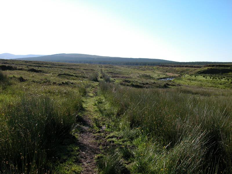
Walk a hundred metres or so back down the road towards the forest, and find the small gate just north of the river bridge. Go through, and follow the path. Keep straight on for 25 miles.


There's not much to say about this section. You follow the path, which is in good shape for the most part, steadily eastwards. The river meanders somewhat immediately to your right but the path keeps to a much straighter course. There is forest some way beyond the river but your immediate surrounding are of rough grass and heather. Many side streams are crossed, by plank footbridges that are mostly in good repair.


The path to Loch Choire and receding views of Crask
The distances are vast out here but there is little against which to judge the scale of things. You can see the path snaking gently uphill and curving left into the bealach ahead, but there is nothing to indicate that the intervening distance is four miles. The only fixed point is the Crask Inn itself, which gradually recedes into the distance behind you.


You might expect to find sheep out here but there are none; instead you may come across a small herd of highland cattle. You might also be lucky enough to spot the odd deer. The path continues ever onwards, heading for the steeper section up to the bealach. The slopes of Ben Klibreck, one of the most northerly Munros, rise to your left.


Ascending towards the bealach
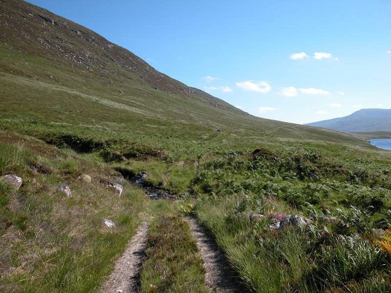
The path kinks left now and begins the ascent to the Bealach Easach. The path is good and the ascent is less steep than it looks.


Reaching the bealach, and the first view of the lochs
Bealach means "pass" (between mountains), while "eas" is waterfall, and "easach" is an adjective derived from its parent noun (there's no equivalent in English, it would come out as "waterfalley"). The name, then, means "pass of the waterfalls".

Buttresses south and east of the pass
The scene changes quite dramatically as you near the top of the pass. The gradient falls away and the path meanders uncertainly a little as it approaches the highest point, marked by an old fence post or two. And suddenly, the scene lays spread out before you. Two lakes, sparkling in the morning sunlight (if you're lucky), stretch into the distance. Impressive buttresses rise to the high country to the right, while the slopes to your left rear up towards the unseen summit of Ben Klibreck.


The view from the summit of the pass (image manipulators might like to stitch these three images together)


Descending towards Loch a Bealach
The nearer of the two lakes is named Loch a Bealach ("lake of the pass"), and you can see the path running down towards it and along its northern shore. The waterfalls from which the pass is named are seen among the many streams and cascades the fall down the slopes of Ben Klibreck to the left.

Looking back at the pass
Descend along the path from the bealach, marvelling at the scenery as you do so, to approach Loch a Bealach.


Loch a Bealach and one of the many watercourses that feed it

The path along the north side of the loch
Loch a Bealach is a very pretty body of water, fringed by trees along its southern slopes. The path runs a couple of hundred meters above its northern shore. The loch is 2km, or about a mile and a half, long. The path crosses a number of watercourses descending from Ben Klibreck, mostly on plank footbridges.


Views of Loch a Bealach
At the foot of the loch, the path rounds the loch towards the short river that connects it to Loch Choire, just beyond.
The foot of Loch a Bealach looking back towards the pass


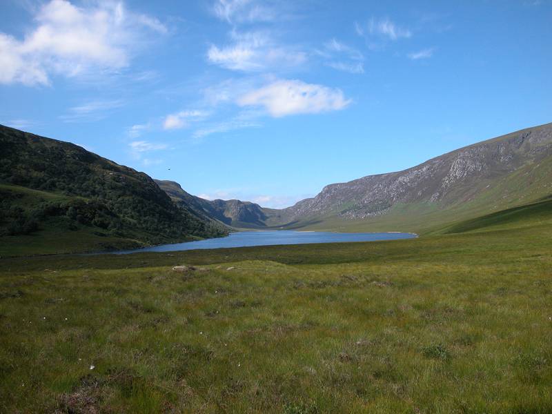
The head of Loch Choire
The head of Loch Choire is a little patch of paradise, a tree-girt patch of turf where the path along Loch a Bealach meets the path coming over from Dalnessie down the Coire na Fearna, and the paths running along each side of Loch Choire itself. You now have the choice of walking along either the south side or the north side of the loch. I chose the north side on the grounds that it's probably more even and straightforward, but it's up to you.


The head of the loch, and the path along the north side
Loch Choire is 3 miles long and the path runs fairly close along the north shore. The vegetation becomes lusher and more varied. Roughly one third of the way along, the path reaches a stand of trees that was prominent from the top of the bealach. I found it an excellent spot for my morning refreshment break (though you'll probably be besieged by midges of the weather is dull and damp).


A stand of pine trees on the north side of Loch Choire


Loch Choire
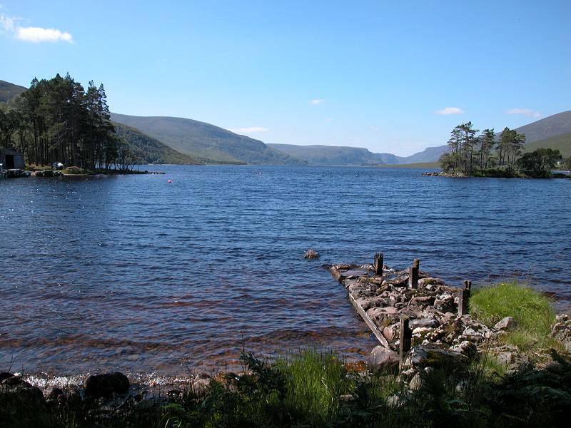
Continue along the path. The heights to the southeast side of Loch Choire run up ultimately to Ben Armine, a Graham of 2311 ft, though the summit is some miles distant and is not seen from here. You will begin to catch glimpses of Loch Choire Lodge, tucked well in behind a screen of trees at the foot of the loch on the south side.


Scenes alongside Loch Choire
The path continues along the north side of Loch Choire, passing through a second and more substantial group of trees (upper row of images above). As you near the foot of the loch you see flatter, open country ahead.


The foot of Loch Choire
At the foot of Loch Choire the path swings round in a wide arc to the right, crossing two substantial bridges and then hugging the lochside to approach the environs of the lodge. This is a particularly picturesque spot, although you also begin to see the unscenic yet necessary trappings of living in such a remote spot - outhouses, vehicle stands, refuse containers and the like.


The environs of Loch Choire Lodge at the head of the loch
The path runs almost right up to the lodge, coming out at a junction with the main vehicle track, onto which you turn left. After passing a brief screen of trees the road comes out into the open and begins its ten mile run out to the public road at Badanloch.

Natural forest on the Ben Armine slopes

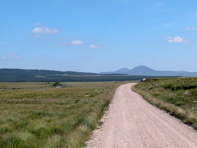
The estate road, with the Ben Griams coming into view
The Mallart river, the outflow of Loch Choire, runs northeast then north, heading ultimately to Strath Naver and out to the north coast. The estate road, formed of compacted gravel and sand, runs initially northeast along the course of the river but then turns east, over a drab stretch of moorland named An Dubh-lon, laying south of the Naver forest plantations and the complex of fishing lochs centred on Loch Rimsdale. Rising from the flat country some miles ahead are the twin summits of Ben Griam More and Ben Griam Beag, which you will be passing on tomorrow's walk from Kinbrace to Forsinard.


I'm not going to pretend that this section is anything like as scenic as that from Crask to Loch Choire. Under cloud cover this is undoubtedly a drab place. Slopes and a few crags lay to the south of the road, but to the north there is a seemingly endless vista of moorland. The Naver forest plantations are seen some distance away, and you will probably spot the flash of blue that is Loch Truderscraig, a mile to the north. It's not revealed to any real advantage as the road is very little higher than the loch.


The estate road, and views to the northwest
The immediate prospect is rather uninteresting now. The vague complex of fences shown on the map appears not to relate well to those seen in reality, and consequently there is little way of judging your progress along the road. The only real feature is a bend in the road with a small stand of trees a couple of miles ahead, at the locality of Gearnsary. Keep an eye to the northwest, however. As you progress the strange, rocky towers of Ben Loyal (Scotlands's most northerly Munro) slide into view many miles away across the moors of Sutherland.


The environs of Gearnsary
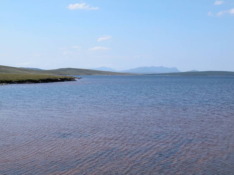
Keep plodding along the path. Its habit of keeping close to the slopes and crags to the south means that you will encounter a few ups and downs, which can be tiring and somewhat irritating after sixteen miles of walking. You reach the locality of Gearnsary, where the map suggests there is a building or two. Presumably there was in the past, but I don't remember seeing anything there as I passed by. The road continues, heading towards the northern end of a prominent little hill that seems to be nameless and disappearing around the back. There is a hint of Loch Rimsdale a mile or two to the north. It's part of a substantial body of water that has three names: Loch Rimsdale at the western end, Loch nam Clar in the centre and Loch Badanloch to the southeast, suggesting that formerly there were three separate lochs before the water level of Loch Badanloch was raised by a dam. You'll pass this dam in an hour and a half..


Loch an Alltan Fhearna
As you round the spur of high ground, Loch an Alltan Fhearna lays before you. Roughly a kilometre square, this loch is separate from its neighbours and has a little outfall stream to the west that runs into Loch Badanloch. The scenery is still pretty much the same as before. The path loops around the south side of the loch then rises slightly to a little col.


Loch Badanloch and the estate road
Once you reach the col there is something of a new scene ahead. Loch Badanloch is spread out to the northeast, with Beinn Griam Mor rising from its far side, and in the distance you will spot habitation - the lone speck of the Garvault (Garbh-Allt, or rough stream) Hotel, the most isolated hotel in Britain. Walk on a little further, and a tiny village appears at the far end of the lake. This is Badanloch itself, and marks the point where the forest road meets the motor road network four miles short of Kinbrace. It looks close, but you won't reach it for over an hour. Directly ahead you may spot the cone of Morven, east of Strath Halladale and about twenty miles away.


The estate road runs right around the south side of Loch Badanloch for about three miles, eventually curving around to the left to run alongside the dam. Badanloch village is about half a mile further on, though the road runs up a bit of a slope to get there.


Approaching Badanloch; the end of the Loch Choire estate road
It's nice to reach civilization at last but, sadly, Badanloch has no facilities to offer the visitor (even an outside cold tap somewhere would be a godsend). Immediately after the last building in Badanloch the Loch Choire estate road finally comes out onto the public road network. This is the B871, a single tracked road with very little habitation, and it will get you to Kinbrace four miles hence.


The road from Badanloch to Kinbrace
There's not much to see on the road. There's a forest plantation to the left, and there's the River Helmsdale (which will ultimately reach the east coast at Helmsdale itself) to the right. For a short stretch the river widens out to form Loch Achamonie, a body of water that doesn't really have much scenic value. The road passes a single habitation, a sheep farm, before crossing the Bannock burn over a bridge and turning northwest to approach Kinbrace.

Kinbrace seen across the fields
Kinbrace looks like a bustling metropolis when you reach it, but in fact there are less than a dozen buildings in the village and none of them appear to offer accommodation. An ice cream vendor, a cafe, a pub, a shop, any or all of these would be welcome but there is not a single facility here save for the railway station. Kinbrace is a request stop so be sure to signal to the driver as the train approaches. Now you can be whisked off to Thurso or Inverness or wherever else you have based yourself, for a meal and a drink and a shower (not necessarily in that order). There should be a refreshment trolley on the train.


Arrival at Kinbrace
|
£5.50
inclusive
of postage / packing. |
| Lairg to Crask Inn | Back to North of Scotland Way index | Kinbrace to Forsinard |
This page last updated 11th January 2004
![]()