
|
|
||
| Crask Inn to Kinbrace | Back to North of Scotland Way index |
|

|
|
||
| Crask Inn to Kinbrace | Back to North of Scotland Way index |
|
The road crosses a minor watershed in its short journey between the two stations. You leave the basin of Strath Kildonan (draining southwards) and cross into that of Strath Halladale, which drains to the north coast. The terrain is low lying, but to the east is the forbidding ridge of the Knockfin Heights - not high, but vast, extremely boggy, and among the most inhospitable terrain in Britain. To your left are the small but shapely summits of the Ben Griams - Ben Griam Mor (first spotted yesterday, of course) is the more southerly of the two, while Ben Griam Beag is the more northerly. Both overlook Loch an Ruathair, a popular place for fishing. There are a few forest plantations in view but the terrain is virtually all blanket moorland. No change from the last few days, basically.
The road you follow is classified as an A-road, but it is single-tracked and traffic is very light (expect one vehicle every three to four minutes on average). It's not quite empty of habitation - there are half a dozen cottages at Kinbrace (none of which offer accommodation, unfortunately), another half dozen plus an absurdly large hotel at Forsinard, and a few on route that comprise the localities of Achentoul and Ballach. The railway line is never far away but traffic is so light that you are unlikely to see any activity.
Maps: 1:25000 OS Explorer 449 (Strath Halladale)
Click
on
any thumbnail image in this gallery to display the corresponding full
size
image. The images are access protected through a cgi script to prevent
hotlinking. If you encounter problems while trying to view the full
size
images, please read the access advice
page.

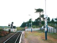
Kinbrace Station
The seven miles to Forsinard lies along one straight road with no turnoffs so there are few directions to give. Stroll off the north end of the platform and walk the few short yards to the junction with the A897.
![]() Scotrail
(North Scotland Line) timetable(.pdf document)
Scotrail
(North Scotland Line) timetable(.pdf document)
Ben Griam Mor ; Joining the A897 to Forsinard
Turn left and start walking north. There are only six cottages at Kinbrace; you soon leave them behind. The last cottage on the left is a school.
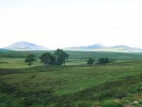
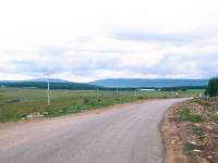
There's about a mile of walking before you reach the locality of Achentoul. The railway line stays fairly close to the road to the left; beyond it, across a sprawl of empty moorland, is the imposing little height of Ben Griam Mor. To the right is the low but sprawling ridge of the Knockfin Heights; part of the main Flow Country ridge, it's arguably Britain's wettest and nastiest bog.

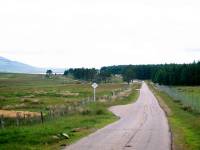
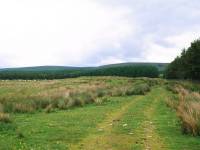
You first pass a ribbon of woodland to the right and then you reach Achentoul, which consists of a couple of roadside houses. A couple of hundred meters ahead is Blar Mhor. The railway line still keeps close to the left. A couple of vehicle tracks off to the right don't go far; there is no marked route across the Knockfin Heights, and the only reason we're taking this route north is to get to Forsinain from where a forest track leads eastwards to Altnabreac. The track is the one and only route across the Flow Country ridge.
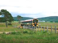
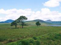
The traffic on the A897 is extraordinarily light, but the road and its environs is classic "can't sit down" country. I did find a rather inferior place for a refreshment break, a stand of trees just to the west of the road a couple of hundred meters short of Achentoul Lodge. The Thurso-bound train passed as I sat having a cup of tea.
Ben Griam Beag and the loch ; the road near Achentoul Lodge; Loch an Ruathair and Ben Griam Beag
As you reach Achentoul Lodge you also draw level with the southern end of Loch an Ruathair, a popular venue for fishing as are most bodies of water in these parts. Recreational fishing appears to support both the area's hotels, at Garvault and Forsinard; something has to, really, as they are the two loneliest and remotest hotels in Britain. The loch is about 2 sq km in area. It would be fairly unphotogenic were it not backed by the isolated heights of Ben Griam Mor and Ben Griam Beag. The latter peak is now coming into view to the northwest.
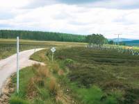
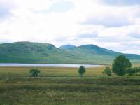
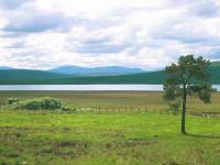
About a kilometer north of Achentoul Lodge, around halfway along the shore of the loch, you pass another small plantation of conifers. The road starts to climb very slightly. There's little in view apart from the loch, the Ben Griams and the road. About a kilometer further ahead is Ballach cottage.
Just short of the cottage you will notice a track heading off to the west. It rises across the moorland to a lone building known as Greamachary, and probably represents the best line of approach to anyone wishing to climb either of the Ben Griams. The track crosses the railway on the level and brushes the northern end of Loch an Ruathair.
The road continues its gradual climb as it approaches another conifer plantation. Close to this plantation it meanders around a double bend to hug the western edge of the trees. The tiny Loch Lucy appears just on the other side of the railway line, which is now beginning to wander away from the course of the road to keep to a level contour. Just here you walk off the top of the Kinbrace map and on to the Forsinard sheet. After another 500 meters you reach the watershed, at an elevation of 196m. From here you descend into Strath Halladale.
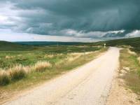
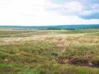
The downward gradient is very gentle and there's not much of a view to the north. The most interesting features are still the Ben Griams; Ben Griam Beag now looms large, its peak now looking quite shapely from this aspect. To your right is the little hill of Meall a Bhealach (the lump by the pass). It carries a radio mast and in any other part of the world would probably be named Telegraph Hill.
The walk down into Forsinard itself is lonely and virtually featureless; you pass no other habitation on the way. There's just one path leading off the road, just a few hundred meters short of Forsinard itself and part of a reserve owned by the Royal Society for the Protection of Birds.
Forsinard Station and the RSPB's Flow Country Visitor Centre
Forsinard is a tad bigger than Kinbrace but that's purely thanks to the Forsinard Hotel, a building of a sufficient size to look absurdly out of place in this setting. Forsinard railway station is a lively little spot and is spoiled only by the sordid little shelter on the southbound platform. The station building itself houses the RSPB's Flow Country Visitor Centre , an interesting little exhibition that informs passing visitors all about the local fauna, flora and geology. The staff there will arrange guided walks of the reserve and the centre also features a webcam trained on the nest of a hen harrier.
Forsinard Hotel
If you got either the early morning or the lunchtime train out of Thurso for Kinbrace, you will have arrived at Forsinard some two to three hours before the next train back. You might as well call in at the hotel for a meal; they will be very glad of your custom. If you do see anybody there it's odds on that they're on a fishing holiday. The hotel lounge features a logbook of the guest's catches and you don't need to flick through it very far to realize that many of the hotel's patrons are regular visitors.
After that it's just a matter of strolling back to the station for the train back to Thurso. Or you could always stay the night here in Forsinard of course. There's a guest house as well as the hotel, its owners sound jolly friendly and they tell me that they get quite a few walkers staying with them including an increasing number of end-to-enders.
![]() Forsinard
Hotel
Forsinard
Hotel
![]() Station
Cottage guest house
Station
Cottage guest house
![]() Scotrail
(North Scotland Line) timetable(.pdf document)
Scotrail
(North Scotland Line) timetable(.pdf document)
|
|
||
| Crask Inn to Kinbrace | Back to North of Scotland Way index |
|
This page last updated 27th April 2004
![]()