
| Deanich Lodge to Ardgay | Back to North of Scotland Way index | Lairg to Crask Inn |

| Deanich Lodge to Ardgay | Back to North of Scotland Way index | Lairg to Crask Inn |
Map: OS 1:25000 Explorer 441 (Lairg & Bonar Bridge)
Click
on
any thumbnail image in this gallery to display the corresponding full
size
image. The images are access protected through a cgi script to prevent
hotlinking. If you encounter problems while trying to view the full
size
images, please read the access advice
page.
In spite of the official view Ardgay is tiny. You get off the train, and there's little to see and little to do. There is a cafe (the Lady Ross) attached to the post office, and there's also a small general store across the road. There's no accommodation. Your first objective is Bonar Bridge, and to get there it's necessary to walk along the main road - formerly the A9, until a new main road bridge was built downstream - and across the bridge into Bonar.

The bridge across the Dornoch Firth
A metropolis compared to Ardgay, yet anywhere else in the UK this place would be but an insignificant village. I've been here twice - on the first occasion it was a dull morning and the place was deserted. On the second, it was a sunny June evening and the place was alive with people. Which of these is its true character I just wouldn't know.
Geological display north of the bridge; views of Bonar Bridge
The main road runs alongside the firth, running to Lochinver and Lairg to the left, and Golspie and Wick to the right. Our route, however, runs straight on, up the hill, and past the hospital to a road junction about 800m beyond the village centre. Turn left here onto a lonely back lane for Tulloch.
Northern reaches of Bonar Bridge
Back road near Tulloch
Continue along the road for another 250m. As it bends to the left, a prominent forest road goes off to the left and immediately forks into two, the leftmost track bending hard back to the southeast. Take the other track, which initially runs parallel to the road you just left. After about 300m, there's a junction: go left here.
Woods near Tulloch
Maikle Wood and the Kyle of Sutherland
Keep to the track as it skirts the edge of the wood above the locality of Maikle, then goes right again into the wood. After a slight uphill rise it keeps to a fairly level contour for a good while. Ignore the side tracks above the locality of Balbair and keep going. Maikle Wood becomes Balbair Wood and the path now descends steadily towards the Kyle, with the occasional glimpse of the railway bridge at Invershin and the edifice of Carbisdale Castle on the hill opposite.
Ky;e of Sutherland and Balbair Wood
Balbair Wood and Carbisdale Castle across the kyle.
As you approach Bailachreagain turn left onto a descending track. This track twists and turns somewhat but eventually it brings you out onto the A836 road. Walk along the road to Invershin.
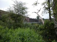
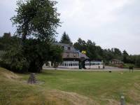
Invershin has a railway station and a hotel and a handful of cottages. In Sutherland that makes it a big place. The railway station allows you to break the journey if you wish, while youth hostellers will head across the footbridge and up the hill to Carbisdale Castle, dating from the 1930s and now Britain's grandest youth hostel. It's one of two 20th century castles close to the route of the End-to-End (the other was Castle Drogo, back in Devon).
Carbisdale Castle; road to Shin Bridge
Unless you take the forest road alternative from Shin Bridge to Achany it's road walking the rest of the way into Lairg (and indeed the whole of the next day, to the Crask Inn). Fortunately there's not that much main road. It's about a kilometre north of Invershin along the A836 before you come to the a road junction. The road straight on goes to Lairg direct, but we're taking the back road on the western side of the river Shin so we turn left. This road, the A837, is heading ultimately for Lochinver and Scourie on the west coast, but we shall follow it for just one kilometre, as far as Shin Bridge.


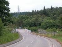
Shin Bridge
The road bends round to the right by a handful of cottages to cross the Shin by a smart new bridge immediately south of the old one (which is dangerous and should not be visited). The main road now goes off left round by the power station, but our route goes right to follow the B864. This is the minor road along the west side of the Shin and doesn't get a lot of traffic save that heading for the Falls of Shin a mile and a half ahead. The road is single track with passing places, it bends quite a lot, and it's fairly well hemmed in by trees with the occasional glimpse of the river Shin nearby on the right.
The B864 road to Shin Falls
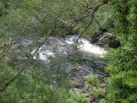
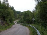
A glimpse of the Shin; the road
Two kilometres north of Shin Bridge the trees on the left suddenly give way to reveal a clearing, a car park and the smart wooden structure that is the Falls of Shin visitor centre. Most of the interior is a retail opportunity but there is also a welcome cafeteria. The Falls of Shin can be reached by either of two footpaths leading off the road to the right. The falls are pretty rather than spectacular, though if you are lucky you may spot leaping salmon from the viewing platform.
The River Shin and the falls
Falls of Shin
Having seen the falls, and perhaps whiled away a quarter of an hour in the visitor centre, resume your walk along the road. Not far to the north a crescent of former forestry houses stands to the left. Beyond here the road continues much as before, bending liberally among tree cover with the occasional glimpse of the river to your right.
Road and river scenes at Achany
pastures and meadows
Soon afterwards the road crosses a small but handsome stone bridge and bends round to the right, hugging the side of a wood. There are several tracks into the wood, which might promise a respite from the road walk, but unfortunately none of these tracks lead anywhere useful. Some of them have little wooden markers adjacent that say "visitors welcome", a nice touch.
Scenes at Achany
Gruids
The road ploughs on, ever northwards, through increasingly open vistas. There's a long strip of river meadow down to your right, the forest being restricted to the land on the east side of the river.
Road and river meadows north of Gruids
Road junction and footbridge
About a mile and a half north of Achany bridge you will spot a suspension footbridge spanning the river to the right. It's a nice little place to stop for a late afternoon snack (midges allowing), river access having been pretty near impossible since Shin falls. A path into the forest beyond the bridge allows fast access to Lairg railway station should you be pushed for time.
The views continue to open up as the trees thin out. You really expect moorland and rough pasture this far north but the scene continues to be dotted with meadows and cottages. I was particularly taken by one of the gardens I passed (see above), which indicates just how lush this area actually is.
Strath Shin
You come eventually to the junction with the A839, which runs off southwest to join the Strath Oykel road across to Lochinver. The road now leads up to the dam of Little Loch Shin.
Road junction
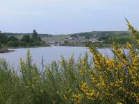

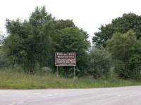
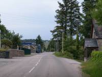
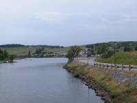
The road runs up along the west side of Little Loch Shin for the next half mile. The loch is not a beauty spot by any means though is pleasant enough on a sunny day. The village of Lairg is visible opposite and further along. The road becomes screened by trees again and the loch is hidden, but before long the road passes a number of "Welcome to Lairg" signs, with the Gaelic version of Lairg being spelt a different way on each.
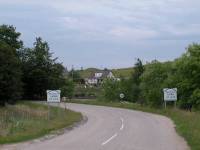
Lairg
The road crosses a narrow neck of Little Loch Shin on a bridge to meet the main A836 once again. The village centre is a few hundred metres further north, its main street leading off east from a road junction.
It's doubtful whether Lairg has a population of more than a couple of hundred, but it's the biggest place for a good many miles in any direction. In fact it's the biggest place left on the End-to-End. There's only one more place big enough to have its own shop, and that's Watten, which is six days' walk ahead. Through hikers should stock up here. Lairg has a hotel and a couple of guest houses and a handful of B&Bs, plus an eclectic sprinkling of shops. It's hard to see what actually keeps the place going apart from tourism and fishing.
Bus services are skeletal and most leave from the post office half
way
along the main street. The rail station is a mile and a half to the
south,
along the main A836; allow adequate time.
|
£3.25
inclusive
of postage / packing. |
| Deanich Lodge to Ardgay | Back to North of Scotland Way index | Lairg to Crask Inn |
This page last updated 9th September 2004
![]()