

| Contin to Inchbae Lodge | Back to North of Scotland Way index | Glencalvie Lodge to Ardgay |


| Contin to Inchbae Lodge | Back to North of Scotland Way index | Glencalvie Lodge to Ardgay |
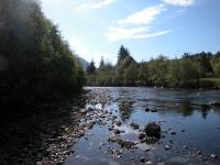
The Blackwater and the grounds of the Inchbae Lodge Hotel
The walk begins at the Inchbae Lodge Hotel, a highly walker-friendly establishment. Not two hundred yards to the west, along the main road, a forest track leaves to the right (north); this is the Strath Rannoch track. It's popular with both walkers and cyclists.

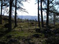
There's a single gate to negotiate, after which you have two delightful miles of forest walk ahead of you. The forest has mixed tree species and appears to be at least partly natural. A feisty little stream, the Abhain Strath Rainich, accompanies the path to the left.
The forest walk along lower Strath Rannoch
Strath Rannoch
Two miles from Inchbae the path comes out into more open country, with the mountainside rising to the right and the stream down to the left. In another mile you reach the grounds of Strathrannoch Lodge, surrounded by a scattering of trees. Leave the lodge to your left and follow the path, which swings left now to head northwest. The track fords the stream and curves round to the southwest, climbing some 300 ft to reach the low ridge separating Strath Rannoch from Strath Vaich to the west.
From the ridge, the path runs generally west for a further mile, looping around the intake walls. Loch Vaich can be seen off to the right; that's where we're headed next. The track makes a final sweep around to the right and downhill, to join the main Strath Vaich track about half a mile below the Vaich dam. Turn right and keep going.


The A835 west of Inchbae
The Strath Vaich alternative is a mile shorter than the Strath Rannoch route and involves less ascent, but it is rather less scenic and it begins with a not entirely pleasant road walk of two miles along the main A835. At least there's a reasonably decent verge most of the way along. But treat the traffic with particular care; the A835 is the main Inverness - Ullapool road, a principal artery of the Highlands, and there will be plenty of heavy lorries and fast traffic. Beware particularly of overtaking traffic from behind.
The A835 from Inchbae to Black Bridge
After you pass the cottage of Lubfearn on the left, the road climbs slightly and begins to leave the "soft" highlands behind. The woods thin out and disappear and suddenly you're in a bare mountain landscape, relieved only by the Blackwater which continues to splash about through pleasant rock scenery to the left.
Two miles from Inchbae you reach Black Bridge, where the road crosses the Blackwater to head westwards to the Altguish Inn and Loch Glascarnoch. Just beyond is the confluence of the Glascarnoch River and the Abhain Strath a' Bhathaich (Strath Vaich River), which of course form the Blackwater. To the right is a drab car park from which a single track tarmac road heads off into the hills to the north-northwest. That's the Strath Vaich road, and it's our route. We shall follow it for eleven miles to Deanich Lodge.
The Strath Vaich road
The environs of Black Bridge were drab, but the scenery improves somewhat as you progress along the road. Pastures adjoin the road to either side and there are a couple of farm buildings and cottages. After two miles, near the locality of Lubraich, the road swings to the left to cross the river (the Abhainn Strath a' Bhathaich) by a substantial bridge. Leave the road at this point and continue straight ahead, on a dirt road on the east side of the river.
The track near Lubriach
The Loch Vaich dam seen through a cloudburst
You don't really get to see much of the loch or the dam until the track crests the top of the small hill called Cnoc na h-Iolare (Eagle's Knoll). Once you reach this point the whole of Loch Vaich, some five kilometres or three miles long, is seen before you. The prominent hill seen just to the left of the far end of the loch is Meall a' Chaorainn (Hill of the Rowan tree), a Graham of 2073 ft.
The track beside Loch Vaich
Upper Loch Vaich
The track descends slightly from the Eagle's Knoll and runs beside Loch Vaich, generally some two to three hundred metres to the east. There is little variation in the scene - there are woods on the west side of the loch but gradually these fall away. After two miles the loch narrows briefly and a small cottage, Lubachlaggan, is seen beside the lake. The cottage is apparently uninhabited and could be used as a shelter.
Loch Vaich and Meall a' Chaorainn
Continue along the track, Loch Vaich narrows and comes to an end, some 9 km north of Black Bridge and 12 km (8 miles) out of Inchbae. Upper Strath Vaich is lonely and drab, and the terrain immediately beyond the loch is marshy. The track stays to the eastern side of the valley. After another kilometre the valley of Toll nan Muc opens out to the left and Meall a' Chaorainn begins to dominate the scene straight ahead.
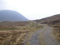
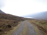
Meall a' Chaorainn, and a receding view of Loch Vaich
The valley curves slightly to the right now, and as the track rounds the foot of Beinn a' Chaisteal (Castle Hill), Loch Vaich is gradually lost to view. The track crosses the side stream of Allt nan Cumhain; this is a locality called Cuiltean and presumably there used to be a cottage here, but there is no sign of anything now. Beyond here the track switches to the west side of the valley and begins to round the lower slopes of Meall a' Chaorainn.
Upper Strath Vaich
At some indeterminate point you cross the watershed between Vaich and Carron, and the scene ahead looks identical to the one behind. But suddenly, as the track hugs the slopes of Meall a' Chaorainn and curves to the left, the shallow depression of Gleann Beag appears ahead - and there, just before the gap in the hills to the northeast. is Deanich Lodge.
A final look back at Strath Vaich; Gleann Beag appears; the driveway to Deanich Lodge
Approaching Deanich Lodge
Deanich Lodge is owned by the Alladale estate out to the northeast, and is apparently available for hire by the week (self catering, of course). It has no electricity. Keep to the left in the vicinity of the lodge, passing between it and the outhouses. At the rear of the lodge find the track heading half left for the narrow gap leading into Gleann Mor.
The entrance to Gleann Mor, and the bridge
A look back at the bridge and Deanich Lodge; the craggy portals of Gleann Mor
The scene is rather empty of interest along the first two miles of Gleann Mor, although the stream (Abhainn a' Ghlinne Mhoir) forms a couple of pretty waterfalls now and again. Keep an eye on the slopes either side of the glen, for you may well see substantial herds of deer.
Deer in Gleann Mor; the Gleann Mor track
The route along Gleann Mor
Plod steadily along the track, with Carn na Speirig drawing gradually closer. The river meanders along to the right, and at one point there is a well maintained wire footbridge crossing to the south side of the glen. Once you're past the abrupt height of Greag Ruadh to your right the valley opens up a little more, the scenery softens and trees begin to appear.
The grass is lusher now, and trees are beginning to dot both the slopes and the riverside pastures. There are two wooden huts in this section, presumably used as stores for the Alladale estate; they might be pressed into service as emergency shelters if necessary. Backpackers will find plenty of wild camping spots hereabouts (though remember that it would be courteous to ask the Alladale Estate office for permission in advance). The river widens and becomes a bit playful; there are a few rocky rapids and an island or two along this stretch.
Scenes in lower Gleann Mor
Gleann Mor becomes ever lovelier but it does have a sting in its tail. Once you finally pass Carn na Speirig the track starts to climb. It's rising away from the river and climbing a little way up the shoulder of Sron Ugaidh, the spur of land between Gleann Mor and Glen Alladale. It's hell on tired limbs, but at least it serves to give some excellent retrospective views of Gleann Mor.
Upper Gleann Mor
The track, now within substantial tree cover, turns left away from the glen.
The track on Sron Ugaidh
Woodland track
At the foot of the slope things get a bit complicated. The track goes to the left again and crosses a bridge over the Alladale River then goes through a gate. There's a brief but potentially confusing series of twists and turns before the track crosses a second bridge and emerges at a junction. You've arrived at the Glen Alladale track. Turn right.
Alladale River and woodland track
Arriving at Glen Alladale; river meadows and woods.
This is a delightful spot; trees, meadows, glades, running water. Maybe sunshine too, if you're lucky. Life feels good here. Pass an open area of meadows to your right, passing between the stone columns that mark the entrance to the environs of Alladale Lodge. The lodge is a substantial building, a little way up the hill behind and to the north side of the glen. It's difficult to spot. Like Deanich Lodge it can be hired by the week, though it costs a bit!
Easain nam Toll Dubha
Somewhere to your right the Alladale River has joined the Gleann Mor River to form the river Carron. There's just a mile and a half to walk now until you reach the beginning of the public road at Glencalvie Lodge. There's some good water scenery to your right and it's worth lingering here and there if you're able.
The track to Glencalvie, and another waterfall
Approaching Glencalvie Lodge
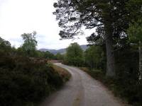
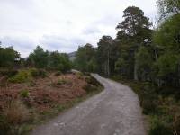
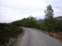
The last mile of dirt road from Alladale to Glencalvie runs through open woodland, with the river to your right continuing to jump over rocks and generally misbehave itself. The hills on either side are not especially high so the scenery becomes ever more open. Quite abruptly you reach a gate, and beyond it is a tarmac turning circle. You've reached the public road at the end of Glen Carron, and Glencalvie Lodge is down to your right (it's not open to visitors and has no public facilities. If the owners are reading this, how about opening a coffee shop for tired hikers and cyclists?). The road junction and telephone box at Craigs is a mile further on.
Reaching the public road at Glencalvie
|
£3.50
inclusive
of postage / packing. |
| Contin to Inchbae Lodge | Back to North of Scotland Way index | Glencalvie Lodge to Ardgay |
This page last updated 29th March 2005
![]()