
| Westerdale to Hastigrow | Back to North of Scotland Way index |
| Westerdale to Hastigrow | Back to North of Scotland Way index |
This, the last section of the End-to-End Walk, ought to be special in some way, but it's actually very ordinary in every respect but one. And that one exception is very obvious. Once you arrive at the very northeastern tip of the UK mainland, that's it. There isn't anywhere else to go.
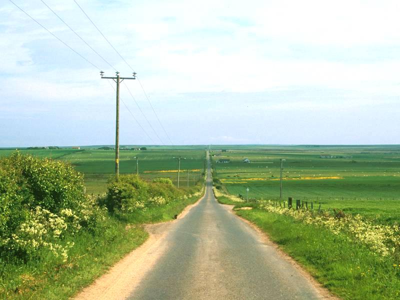
So, let's look at the detail. It's remarkably similar to yesterday's walk, in fact. Virtually all of it is on tarmac and most of it traverses that same, empty country of rough pasture and scattered communities and wide skies. Much of it lays along the unclassified moorland road between Hastigrow and Gills that runs dead straight for eight miles, and in fact this is the longest straight stretch of the entire End-to-End walk. You might imagine yourself in the American midwest or the Australian outback but for the sombre moorland that surrounds you.
The arrival at Britain's north coast is a real surprise; the coastal stretch lays beyond a slight ridge and doesn't even appear until you're within a couple of miles of the shore. The sudden appearance of the sea changes the character of the walk completely, and once you arrive at Gills Bay there is a sense of anticlimax. It remains only to walk along the coast road to the east, and even this stretch is deceiving. The map tells you that you're about to run out of land but there is no physical indication of the end until you're literally yards from the very northeastern tip of the nation at Duncansby Head; suddenly the east coast is before you, with the rock towers of Duncansby Stacks to your right, and there is a 270 degree sweep of ocean around where you stand. Her Majesty's Coastguard has seen fit to fence off the extremity of the land and has built a foghorn right on the absolute tip; the nearest you can actually get to your final goal is the corner of two barbed wire fences a few yards to the south.
John O'Groats, the ceremonial northeastern extremity of the nation, lays a mile and a half to the west and you reach it before getting to Duncansby Head itself. The route between the two is a pleasant stretch of heath open to the north coast, featuring scenery eerily reminiscent of that at Land's End over a thousand miles behind you. The similarity doesn't end with the scenery. The John O'Groats visitor centre is almost an exact copy of the one at Land's End, perhaps not surprising given that it is owned and run by the same company. Here, as at Land's End, you can have your photo taken by the fingerpost that is the ceremonial end of the route, with the distance to your hometown or any other location of your choosing slotted into the spare arm.
And then you get the bus home.
Maps: 1:25000 OS Explorer 451 (Thurso & John O' Groats)
Click
on
any thumbnail image in this gallery to display the corresponding full
size
image. The images are access protected through a cgi script to prevent
hotlinking. If you encounter problems while trying to view the full
size
images, please read the access advice
page.

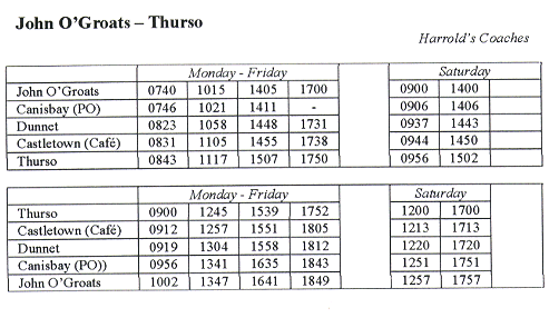
| Service 958 / 58 (Citylink / Rapson's Coaches) Inverness - Wick - Thurso , via Hastigrow. Hastigrow is not shown in the timetable but is 2 miles east of Bowermadden; times will be approx 3 mins earlier than Bowermadden for buses from Wick, and 3 mins later for buses from Thurso. |
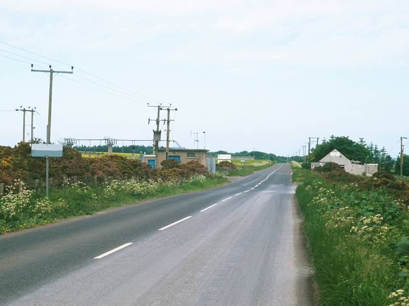
Have the bus from Wick or Thurso drop you at Hastigrow. Our route is the turning off, signposted "Lyth", that heads north northeast.


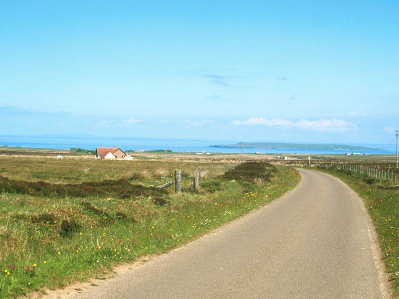
The road to Lyth, the beginning of the Long Straight, and a retrospective view of Hastigrow.
The road runs past a forest plantation on the right and then comes out into open, and virtually empty, country. After a couple of slight bends the road enters a straight stretch that seems to go off to infinity. In fact it keeps pretty much the same bearing for the next eight miles, save for a slight bend after 5½ miles. There is a slight uphill gradient, and a tiny handful of buildings appear on the skyline. That's Lyth, two miles out of Hastigrow. The slight rise serves to give a decent view to the rear - there's not enough elevation to see Watten Loch but the hills south and west of the Thurso valley - Morven, the Knockfin Heights and the Ben Griams - reappear, made blue by distance.


Lyth is actually a little bigger than Hastigrow, and there are several cottages, houses and farms scattered about within half a kilometre or so. Amazingly, the road that you're crossing carries a bus route, albeit a skeletal one. Even more amazingly, this tiny outpost of civilization in the middle of nowhere supports an arts centre. I didn't have time to check this out, but I did some research on my return and found it to be a worthy little concern with its own web page.
![]() Highland
Country service 190 / 390 Thurso - Wick via Lyth
Highland
Country service 190 / 390 Thurso - Wick via Lyth
![]() Lyth
Arts Centre
Lyth
Arts Centre
Go straight across the road at Lyth, continuing along the Long Straight. The road is now signposted "Gills". Still no acknowledgement of John O'Groats, even now we're only a dozen miles away. The road dips slightly, passes a couple more isolated cottages, and runs uphill again towards the ever receding skyline.


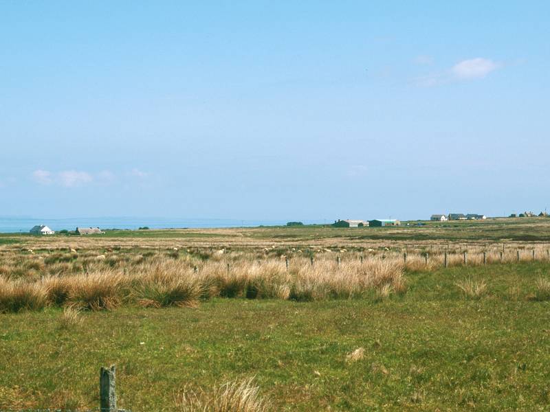
Views across the moor towards Warth; looking back towards Lyth
Even though you've been walking through scenery like this for hundreds of miles now - at Land's End, on the Lizard, across Dartmoor and Exmoor, along the Pennines and through the Border Forest, across the Cheviots, Minchmoor, the Meldons and the Pentlands, beside Rannoch Moor and through the vast nothingness of Easter Ross and the Flow Country, it still fascinates. You still can't get it into your head that, in a densely populated country like Britain, there are these vast areas so absolutely, unremittingly empty. Look across to the northeast and east. What do you see? A slight swelling to the northeast, maybe seven or eight miles away, that is the 124m summit of Warth Hill. To the east, a single structure that might be a building or might be a tower or folly, an unknown distance away. In between, green nothing and brown nothing. It is named, this emptiness; bits of it have poetic titles such as Hill of Stroupster, Baddens of Brabster and Moss of Quintfall. But naming an area of emptiness doesn't make it any less empty. Your world at the moment is reduced to a set of stark fundamentals; a strip of tarmac, a line of electricity supply poles, a few hundred sheep, a few million midges, and you.


There's nothing out there; heading towards Slickly; another look back.
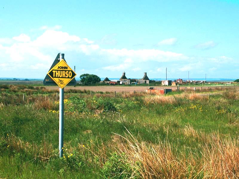

The long, straight road continues to climb slightly and reaches an elevation of around 50m in the vicinity of Slickly. Slickly is a bizarre little community - the usual thin scattering of cottages and barns, among a neat grid of enclosures in the midst of this vast area of wilderness. One of the cottages proudly displays a red "Post Office" sign in its garden, and on the back of a road sign I found a poster urging Slickly's vast electorate to support John Thurso (Liberal Democrat) in the recently concluded British election. An aside may be of interest here - the said John Thurso was indeed elected by the voters of Caithness, Sutherland and Easter Ross, and was the first hereditary peer ever to be elected to the House of Commons.


The Long Straight ; There's Nothing Out There (contd) ; approaching Brabstermire
Not far past the road sign mentioned above an Ordnance Survey trig pillar (elevation 66m) stands just off the road to the left, and not far beyond the trig pillar the road bends almost imperceptibly to the right. The slight uphill trend continues, for a further mile and a half towards Brabstermire.


There's Nothing Out There (part 3) ; the Long Straight (I've lost count)
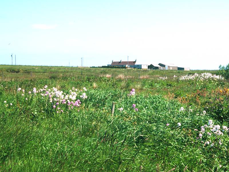
If you were to guess that Brabstermire was going to be yet another lonely scattering of cottages, farms and barns in the middle of a vast expanse of nothing, you'd be absolutely correct. There are a few idiosyncrasies, though; the first is a tall communications tower off the road to the left, the second is an obviously ancient ruin (styled as "St Dunstain's Chapel, Site Of" on the map), and the third is the fact that the horizon has suddenly got very short. You're reaching the top of the ridge. Just short of the mast you walk off the top of the Freswick map; stow it back in your rucksack and pull out the next one. It's the John O'Groats sheet, the last one of this trek.

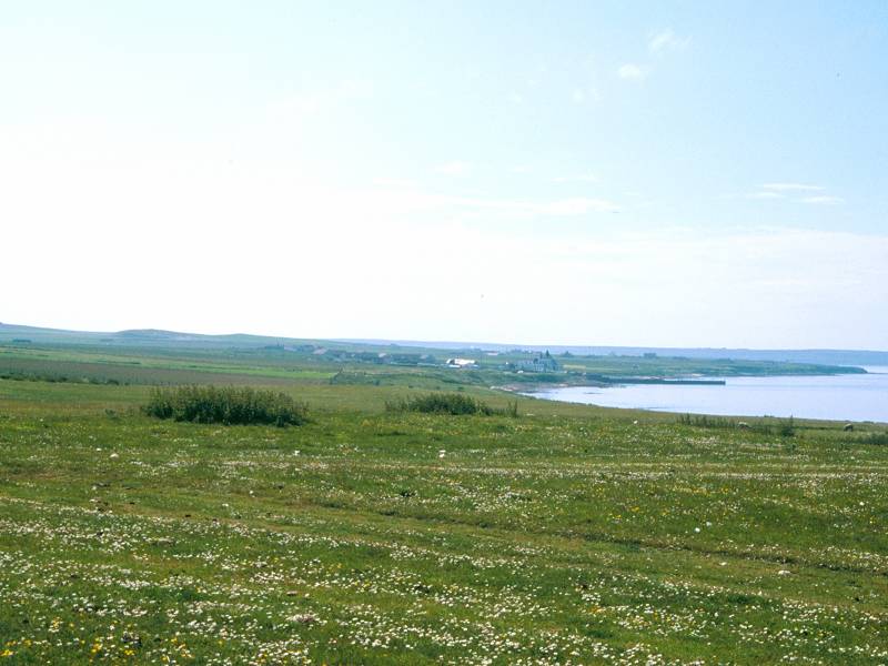
As you draw level with the mast, take a look back along the Long Straight; this will be your last view of Morven, the Knockfin Heights and the Ben Griams back in Sutherland. Suddenly, and dramatically, a view opens up ahead - and it's not a view of yet more empty and inhospitable moorland, but a vista of blue sea, far-off islands and villages nestling among green fields and pastures. You're within a mile and a half of Britain's north coast, and those far-off islands are the Orkneys.

Walk a few paces forwards and it's like entering another world. The empty moorlands fall out of sight behind the low ridge, and ahead of you are the coastal plains of Caithness. The road even develops curves at last. Walk gently downhill towards the cluster of cottages ahead.


The long road that started at Hastigrow ends at a very ordinary T-junction. There is still no signpost to John O'Groats, even though that's just about the only place left to go. Take the turning to the right. It's heading to Canisbay, away from the coast. To get to the coast proper, find a farm track on the left about 300m east of the T-junction. It feels strange to leave tarmac for the first time since Strathmore Lodge back beyond Westerdale. The farm track heads more or less north, passing two farmhouses, heading steadily downhill. At the foot of the track you hit the A836 coast road at Gills Bay.

An Orkney ferry approaching Gills Bay
Gills Bay is a pleasant little spot. You've got short grass to sit on well away from the road, for just about the first time in two days; and you've returned to rural coastal scenery, for the first time since the last day of the Somerset Way. Out there are the Orkneys, once part of Norway, and the home of a few thousand people and a few million seabirds. If you're lucky you may see a ferry on its way to or from the pier a few hundred yards to your left.


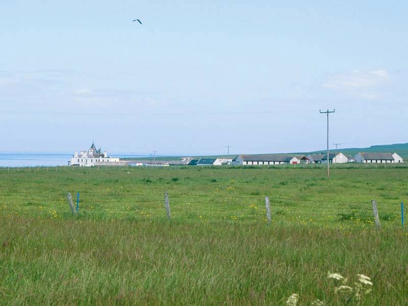
Scenes near Huna on the road from Gills to John O'Groats
It's a three mile walk along the road from Gills to John O' Groats. There is no pedestrian pathway but fortunately the traffic is light. Apart from the proximity of the coast it's a little like being back at Watten, a day's walk behind you; there is that same pattern of neat enclosures and scattered homesteads, and although few of these habitations form clusters dense enough to rate being called somewhere, there's rarely more than a couple of hundred yards between one house and the next. One of the most prominent is Kirkstyle, where a gaunt church stands beside one of the high-walled cemeteries so characteristic of this part of the world; some of the memorial stonework within is remarkably large and intricate.
Half way along this stretch you pass a cluster of a dozen or more homes grouped around a right-hand bend in the road very close to the coast. This is Huna and it's the last named locality before John O'Groats, which should now be in view a mile and a half away across the pastures. You should also be able to see the white dot that is the coastguard building on Duncansby Head, and is your ultimate destination. Three miles to go!


Approaching John O'Groats
There's a final bend in the road, just by the only coastal inlet of note along this stretch; there are three or four cottages here but the map gives no information other than the bland legend, "mill (corn)". And then the road heads dead straight in an east southeast direction for about 1200m to approach another cluster of buildings.
You've arrived at John O'Groats, regarded as the most northeasterly named location on the UK mainland. Which is a little hard on Duncansby, which is another kilometre further on.
Directly ahead of you is the Sea View hotel, and a signboard at the road junction finally points you towards John O'Groats; bizarrely, it directs you away from the village proper and down towards the visitor centre, about 600m along the road to the left.


The John O'Groats visitor centre is the ceremonial end of the walk, and it's almost an exact copy of the visitor centre at Land's End. This is not surprising given that the two places are owned by the same organization. There are, admittedly, fewer facilities here and in that respect the place is a little less tacky.
There's a tourist information centre here, and a museum of sorts, and a gift shop, and a hotel, and a craft centre, and another First & Last House, and a fingerpost that marks the ceremonial extremity of the nation. You will be confronted with a little hype and misinformation. A prominent display informs you that John O'Groats is the northernmost point of the UK mainland - this is complete nonsense, as the real northernmost point is Dunnet Head about 12 miles to the west. You're also told that the place is named after a Dutchman, Jan de Groot, who operated the first ferry service to the Orkneys a handful of centuries ago. This is true enough, but the same information board then goes on to inform you that his fare of four pence became known as a "groat" in consequence. This is also nonsense, as the groat pre-existed De Groot.
Finally, you're informed that Land's End and John O'Groats are the two places on the UK mainland that are the greatest distance from each other. Apart from the discourtesy of ignoring poor little Duncansby just up the hill to the east, this is probably correct. It's why Land's End and John O'Groats are recognized as the extremities of our nation. And it's why we just walked from one to the other. If that's what you did, of course.
![]() The official
John
O'Groats website
The official
John
O'Groats website


The coast path from John O'Groats to Duncansby Head
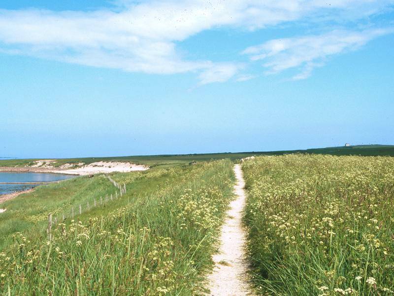
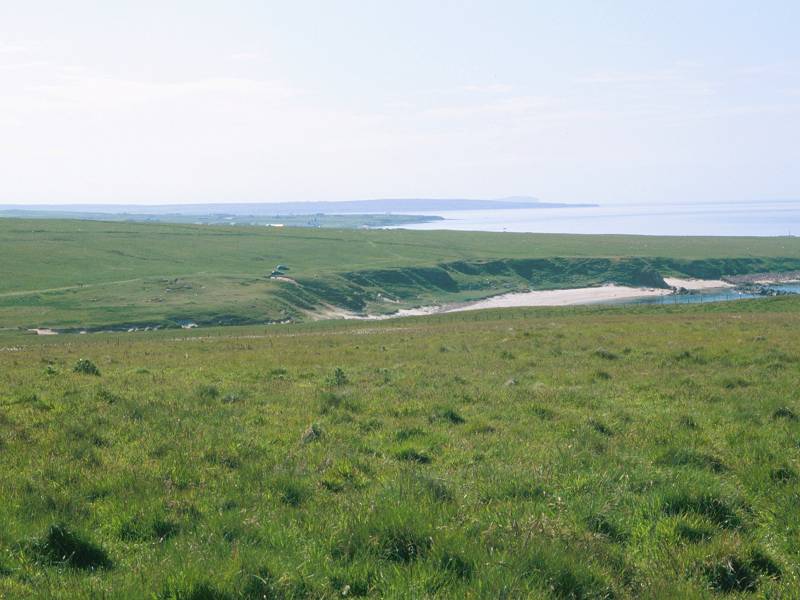
If you're a purist like me, then you won't yet be satisfied. John O'Groats may be the "official" northeastern extremity of the nation but the real northeastern tip is a mile and a half away yet, at Duncansby Head. You can see the coastguard station from here, and the route to it lays along a delightful stretch of downy heath open to the coast. The initial path dodges down along the coastal side of the John O'Groats caravan park but then opens out into grassy pastures with an initial sweep of shingle, then a lovely little beach of white sand, to the north.


The coast route to Duncansby Head


The coast between John O'Groats and Duncansby Head


Bay of Sannick
The white sandy beach is known as Bay of Sannick. It's likely to be deserted.


Bay of Sannick
Beyond the bay there are enclosure fences and it's necessary to walk over to the prominent stile (the last one on the route!) that gives access to the road up to the coastguard lookout.


The final three hundred meters to the coastguard lookout is up a steep, zig-zag road that is open to public use. Duncansby Head is a lure to the tourist, not so much because it is the geographical extremity of the nation but because of its population of puffins and other semi-exotic seabirds. The coastguard station itself is fenced off - a pity, because these fences deny access to the true northeastern tip of Britain (occupied by a concrete sill on which a large foghorn is mounted). The nearest you can get is a corner formed between two barbed wire fences. It's not until the last few yards before this point is reached that you breast the summit of Duncansby Head and see the east coast at last; and what a splendid sight it is, with the twin towers of Duncansby Stacks beckoning to the south. It almost makes you want to start walking to Dover.
But not quite.


The far northeastern tip of Britain; Duncansby Stacks and the east coast
There's only one thing left to do. Retrace your steps to John O'Groats, get your photo taken at the fingerpost, buy a postcard or several, call your family to tell them you've done it, have a celebratory ice cream / pot of tea / pint of beer as is your preference, and then catch the bus back to Thurso or Wick. Okay, so that's six things. But you get the idea.
![]() Harrold's
Coachesservice 999 John O'Groats - Thurso (Mon-Sat
only)
Harrold's
Coachesservice 999 John O'Groats - Thurso (Mon-Sat
only)
![]() Highland
Country service 77 John O'Groats - Wick (Mon-Sat only)
Highland
Country service 77 John O'Groats - Wick (Mon-Sat only)

The author at the John O'Groats sign, June 2001
Most writers of guides and guidebooks would start getting philosophical at this point, employing their purplest prose to bring their work to a grand finale; they might wax lyrical about challenges, dreams and ambitions, they employ words and phrases such as "achievement" and "reward" and "personal fulfilment". Some may even go as far as to suggest that your quest has made a man of you (even though there's a fifty percent chance that you're a woman) and to imply that you have demonstrated the will and tenacity to take on any challenge in life, and succeed.
That isn't my style.
I never thought about Quests, or Challenges, or Achievements, or Ambitions. I just wanted a bit of personal adventure. It wasn't a question of proving anything to myself - I didn't set out to see if I could do it. I knew I could do it. It was fun doing it, sure, and it's even more fun (and let's face it, a far tougher challenge) sharing the experience. And, as I write this, there is still work to do: sections that remain unphotographed, others that would benefit from revision and simplification, and more than forty percent of the website itself still to build. I hope you've enjoyed what I've done. Maybe I will inspire some of you out there to try something similar yourself. As I said back at the beginning, there are no rules. Walk as much or as little of the trail as you please. Take all the time you want. Tinker with the route, modify it, adapt it to your personal whims, discard it and follow a different one instead, make up your own from scratch.
But enjoy yourself. And be sure to let me
know how you get on.
| Westerdale to Hastigrow | Back to North of Scotland Way index |
This page last updated 9th January 2005
![]()