| Altnabreac to Westerdale | Back to North of Scotland Way index | Hastigrow to John O'Groats |
| Altnabreac to Westerdale | Back to North of Scotland Way index | Hastigrow to John O'Groats |
So the walking is easy, even monotonous. The terrain is largely flat. The land is empty, the skies are open, and there is every sense of walking close to the edge of the world.
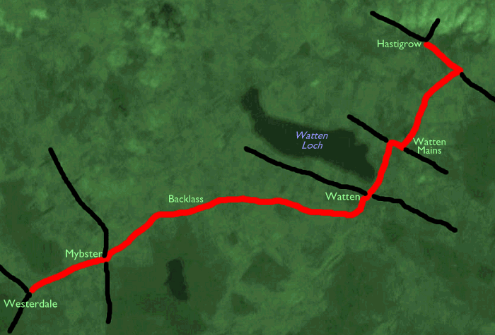
Maps: 1:25000 OS Explorer 451 (Thurso & John O' Groats)
Click on any thumbnail image in this gallery to display the corresponding full size image. The images are access protected through a cgi script to prevent hotlinking. If you encounter problems while trying to view the full size images, please read the access advice page.
Photographic note: I'm still plagued by
weird colour casts on the scanned images, and the last three miles of
this
walk were dogged by a heavy mist that rolled in off the coast and gave
a subdued and rather surreal quality to a landscape that was already
largely
empty. Although I'm not happy with these images they are unlikely to be
improved upon, at least in the foreseeable future.


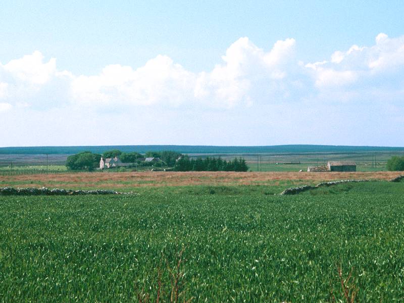
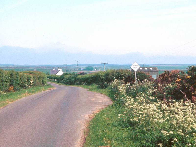
Approaching Westerdale from Halkirk
Westerdale lays just on the boundary of the "populated" part of Caithness, and the empty moors of the Flow Country lay immediately south and west. The village itself has no facilities and consists of no more than a dozen cottages. To get there for the start of the walk it's necessary to get the school bus (service 181) starting from Thurso bus garage at 0740, arriving Westerdale at 0815. If that's too early for you or if it's a weekend or a school holiday, the alternatives are to get the Thurso - Wick bus to Halkirk and then the postbus or to walk, a distance of five miles from Halkirk.

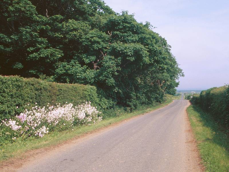
The walk proper begins at the road junction by Corner Cottage, which is where you will arrive if you walk down from Halkirk. Take the road to the east, which is simply signposted "Inverness". The scenery is still largely empty; with virgin moorland lying to your right and a mixture of rough pasture, forest plantations and the odd cropped field to your left. The Morven / Knockfin hills are seen behind you to the southwest, while to the north northwest are a couple of isolated hills west of Scotscalder sprouting communications masts and a crown of trees. Apart from that the terrain is largely flat, a world of vast pastures, heathland and isolated cottages that can be seen for miles. Here and there you will see the glint of moving vehicles. The few roads, too, can be seen for miles.


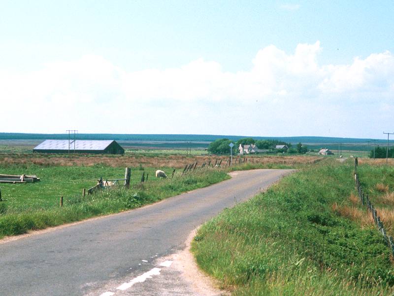
The road to Mybster and its environs

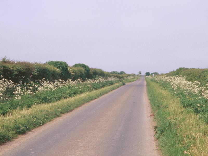
The road to Mybster is a lonely one and traffic along it is almost non-existent. Mybster approaches gradually; you can see it coming for forty five minutes or more. Two more features of the Caithness landscape become apparent. Firstly, the existence of what I call "slate hedges", large but thin slabs of slate propped vertically along the roadside, usually against wire fences, where you might normally expect to find a hedgerow. Their purpose is unclear. Secondly, this is classic "can't sit down country". All the surrounding pastures and fields are enclosed and what roadside verges exist are pretty rough and uninviting. If you do spot even a half likely pitch to stop for a refreshment break, grab it. It might be the only one for three miles or more.


Mybster and the road to Watten.
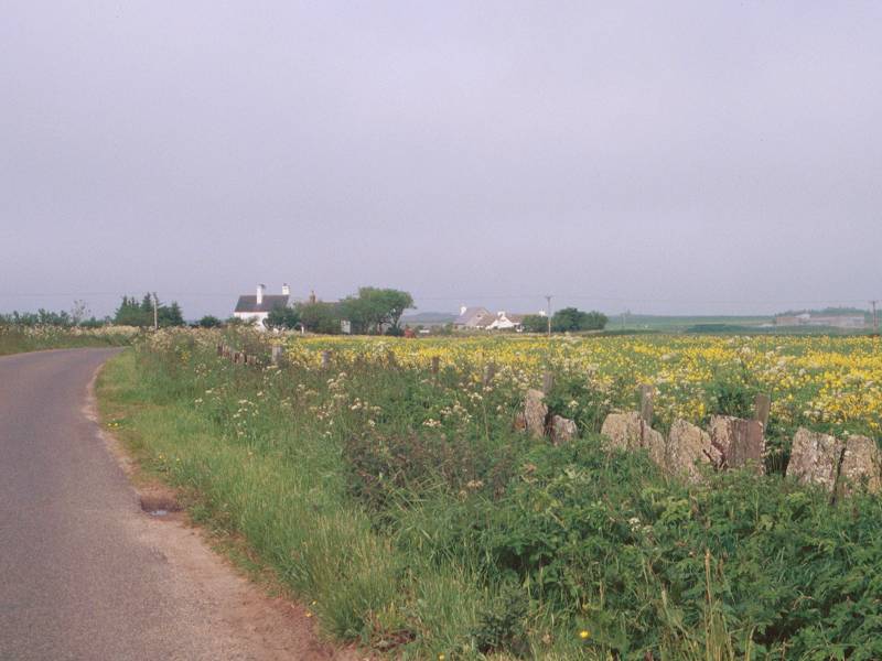
Mybster, once you do reach it, turns out to be no more than a lonely crossroads with a couple of cottages standing adjacent. The A895 road that you're crossing runs from Thurso to Latherton, which is on the east coast between Wick and Helmsdale; Mybster is virtually the last habitation going south, the intervening country consisting of more empty moors, the odd lochan and one or two isolated hills.
Take the road onwards to Watten, three miles ENE.


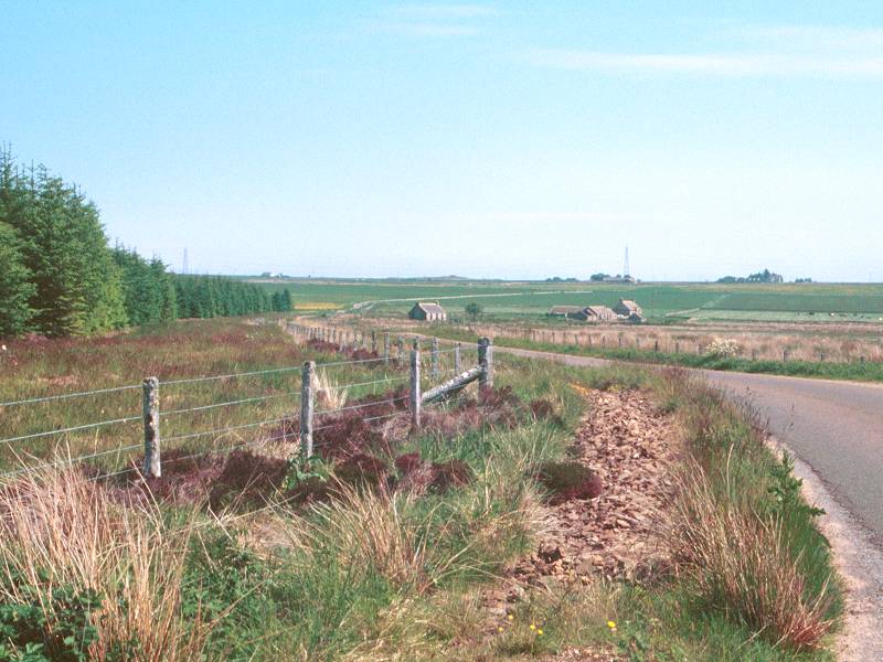
The Mybster - Watten road near Houstry
The B870 from Mybster to Watten continues exactly the same theme as before. The pastures to either side are a little more cared for, the number of isolated cottages increases a little (in fact there always seems to be one within half a kilometre) and to your left, about a mile away, is Spittal - which, as it consists of more than four houses in the same square kilometre, qualifies it as a bustling metropolis in these parts. More typical is the locality styled as Houstry of Dunn, which proves to be a farmhouse and a couple of barns set back from the road behind a brief screen of vegetation. On the right is the isolated hillock of Backlass. The road crosses its northern shoulder and veers slightly south of east, and its giddy elevation of 88 meters above sea level enables you to look out over the expanse of Loch Watten to the north and northeast. The loch is some 4 sq. km in area but, set as it is within Caithness's flat and open landscape, it is almost entirely unphotogenic.


A distant view of Watten Loch; The road near Houstry; Watten in the distance

The long and lonely approach to Watten
The road drops gradually from Backlass Hill, changing direction slightly now and again but still tending just south of east. Gradually the amount of grazing cattle increases, the vegetation grows a little more lush and the roadside scrub gives way to gorse and then to hedges. Watten, in view at the eastern end of the loch down to your left, gets gradually nearer. The road suddenly swings left between thick hedges and the traffic seems to increase exponentially. And suddenly there's trees and manicured lawns and flower beds and white gates and sumptuous houses. This is Watten. You could be in Surrey rather than Caithness. The place is simply incongruous.


Hedgerows on the approach to Watten, and a little bit of Surrey in the Highlands.
Watten lays on the A882, the main road between Thurso and Wick (the only towns for 150 miles), and is just about the only place of any size between the two. Consequently it's busy, and it also has a pub (the Brown Trout) and a village shop that actually opens on Sundays. The Wick-Thurso bus plies this road should you have had enough for one day.


![]() The Brown
Trout website
The Brown
Trout website
![]() Highland
Country
service 82 (Wick - Watten - Halkirk - Thurso)
Highland
Country
service 82 (Wick - Watten - Halkirk - Thurso)
Assuming that you are fit enough to carry on, and haven't succumbed to the Brown Trout's ale or the village shop's supply of Mars bars and Lilt, your onward route lays along the good old B870 which is now signposted to Stanstill. It's a little surprising that there isn't a sign to John O'Groats by now, but Stanstill will do as our next objective. You pass a surprisingly downmarket council estate on the left, decorated by garden walls of breeze block, and about half a mile later come to the eastern end of Watten Loch.
Here at last is somewhere to sit. The surroundings are satisfactory rather than beautiful, and the seating opportunities consist of a patch of rough grass near a couple of boat moorings, and a brace of picnic seats by a pull-in on the opposite side of the road. But this is Caithness, and you take what opportunities you can. From Watten Loch the B870 runs NNE to Watten Mains - the road is dead straight for about 1100 meters, and half way along you cross the single track railway line from Wick to Thurso at what looks suspiciously like an abandoned station. (The house called Station Cottage, and the platform, are a bit of a giveaway in this respect). At Watten Mains (a farmhouse, a few outhouses and a cottage with a neat flowerbed) turn right onto the B874 Thurso - Wick back road, then left in another 300m onto another leg of the good old B870.


The B870 Watten-Stanstill road
The road from Watten Mains to Stanstill is about 3 miles long and is mostly uphill, though the gradient is very gentle. However, the countryside begins to revert to pioneer country again; the verdant hedges, trees and flowerbeds of Watten fall behind, the roadside vegetation reverts first to gorse and then to scrub, and the patchwork of rough pastures and isolated cottages returns. A network of driveways, laid almost on a grid system, gives access to such unlikely outposts of civilization as Scottag, Cromiequoy, Catchory and Knapperfield, each set several hundred yards back from the road. The first mile is dead straight but then the road curves to the right and climbs, approaching the unlovely collection of sheds that is Quoybrae - why, even out here, do farms have to look so much like industrial units?
Past Quoybrae the road levels out and the surroundings revert to moorland. There's something of a view to the north east now, but no hint of coastline in any direction - odd, because the sands of Sinclair Bay lay only five miles to the right and the north coast is not much over twice the distance ahead of you. There is just the same vista of slightly undulating nothingness, dotted with the odd cottage, the occasional tree and one or two moving vehicles to prove to you that there are one or two roads through this emptiness.


Approaching Stanstill
The road drops slightly now, accompanied by a forest plantation to the left that serves only to bring home the presence of the empty moorland of Flow of Seater on its far side. To the right is the equally empty landscape of Moss of Wester, backed by Moss of Killimster and Cogle Moss further out. The road is dead straight once more, and runs out to a T-junction. This is the locality of Stanstill; there appears to be nothing here whatsoever. The farm of Stanstill lays over to the northeast somewhere.
You've reached the B876, one of the two main roads between Wick and Thurso. It's this road along which the Citylink express coaches run between Wick and Thurso on the last leg of their journey out from Inverness. Though it's a B road it's wide, straight and busy, and seems to attract an unpleasant amount of heavy goods traffic. Hastigrow is a mile along this road to the northwest.
The trees give out, first to your left and then to your right; you've arrived at a lonely road junction at which the right turn is signposted "Lyth". This is tomorrow's route and John O'Groats lies just off the other end of that road, but apparently it still doesn't merit being mentioned on the road signs. You're at Hastigrow, which travel writer Bill Bryson reckons would be a good name for a brand of fertilizer. A charming locality it isn't - on the left is an enclosure bristling with electrical plant, and on the right is what looks like a comely cottage but for the signboard "Hastigrow Fabrication Facility" that adorns it. A track into the corner of the forest is guarded by security fences and is plied by men wearing hard hats and driving all-terrain landrovers - I don't know the full story but this unlikely spot does appear to be where the local water authority does some of its heavier pipeline construction.
So if you don't fancy waiting here for the next Citylink coach - and who could blame you - you might consider braving the traffic for a further two miles and heading for the little village of Bowermadden, where there is a crossroads and a couple of dozen houses and an inn and a bus shelter (which doesn't contain a seat, unfortunately).
Tomorrow at this time it will all be over.
| Service 958 / 58 (Citylink / Rapson's Coaches) Inverness - Wick - Thurso, via Hastigrow and Bowermadden. Hastigrow is not shown in the timetable but is 2 miles east of Bowermadden; times will be approx 3 mins earlier than Bowermadden for buses to Thurso, and 3 mins later for buses to Wick and Inverness. |
| Altnabreac to Westerdale | Back to North of Scotland Way index | Hastigrow to John O'Groats |
This page last updated 26th January 2004
![]()