 |
Strath Cluanie from the hotel grounds. Quite a lot of cloud in this direction. |
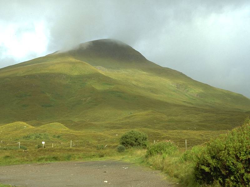 |
The southeast shoulder of Aonach Meadhoin looks down on the hotel. |
 |
Cluanie Inn at 9am, with yesterday's ridge walk in view behind. If only it had been this clear yesterday... |
 |
The South Glenshiel Munros and Glen Shiel. |
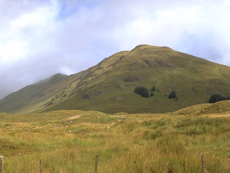 |
Am Bathaich, a Corbett immediately to the northeast of Cluanie Inn. |
 |
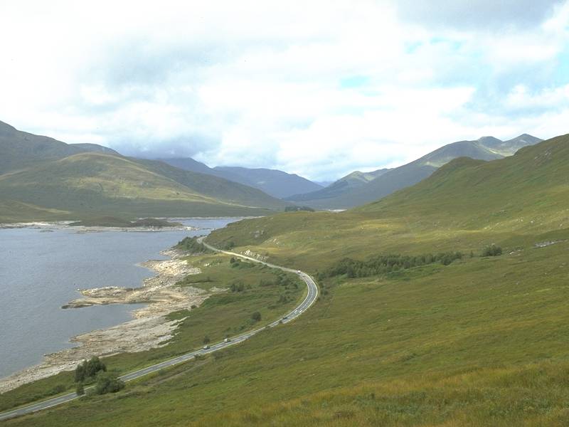
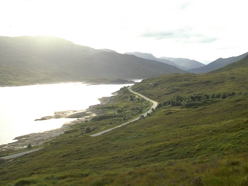
The first part of the walk out along the Glen Shiel road. The hills on the south side of Loch Cluanie. |
 |
Maol Chinn-Dearg seen at the end of a sweep of road. |
 |
Creag a Mhaim, and the stand of pines surrounding Cluanie Lodge, seen opposite the loch. |
 |
Clouds building over Glen Shiel. I could see a shower coming for about half an hour before it hit. |
 |
The Allt Coire a Chair, with the south ridge of A Chralaig rising to the left. |
 |
The shower hit soon afterwards and I sought shelter under a stand of trees between the road and the loch. I waited for twenty minutes and decided to have my morning break there. The sky was clearer after the shower passed. The eastern end of the South Glenshiel Ridge seen over Loch Cluanie. |
 |
The Allt Coire nan Clach, coming down from the remote Coire Lair. My route to the first summit of the day, Carn Ghluasaid, followed a path up the right side of this burn for a short distance before turning right along an old estate track above the main road. |
 |
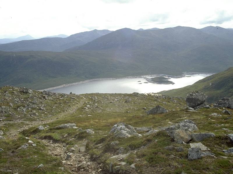
Loch Cluanie seen from the old estate track. After half a kilometre I found my ascent route, a half hidden zigzag path rising through the heather and bracken. It was a bit sloppy at first. |
 |
The path rises to the west of a 1500ft hill called An Cruachan. The big hill in the background is Carn Ghluasaid. |
 |
The rear of An Cruachan. The path peters out for a couple of hundred yards but fortunately it's not too difficult to find your way. It's necessary to cross a small depression over long grass to join a second path, this one having come up from Lundie on the other side of An Cruachan. |
 |
This new path is firm, even and gently graded yet gains height deceptively quickly. A view southeaswards into the corrie above Lundie. |
 |
In no time at all the path approaches the 2000ft contour and reaches this bed of exposed rock that I call the Shelf. The bulk of Carn Ghluasaid is seen directly behind. |
 |
The path, like the one that I used to ascend Creag a Mhaim the day before, is deceptively easy. Well-engineered stalkers' paths are a feature of this area, and this is one of the best. Above the Shelf it tracks northward, keeping to the left of a rising minor ridge, then veering northwest to tackle the steeper slopes of Carn Ghluasaid's higher reaches. It climbs another 500ft before you know it. |
 |
The weather is rapidly clearing. The path continues upwards in a series of lazy meanders, threading between and cleverly avoiding the steeper bits. I stopped for a water break at this point overlooking Loch Cluanie. I caught sight of two people crossing the Shelf, about twenty minutes behind me. |
 |
It looks as though the path is going to encounter crags, but at every steep rocky bit it turns and zigzags around the obstacle. About 2500ft here. |
 |
The weather continues to improve and it's actually getting warm. Despite the ease of ascent the mountain plays a cruel trick or two. The terrain levels out here and you think you're breasting the slope of the summit dome... |
 |
...yet a couple of minutes later you reach another steeper section and you realise you aren't actually as high as you thought you were. |
 |
A second sloping off, and the path eases its way up this pleasant grass slope with a glorious view of Loch Cluanie. |
 |
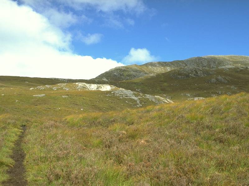
The path encounters an area of tilted bedding planes. |
 |
Approaching 3000ft now and the weather could hardly be better. The South Glenshiel ridge revealed in all its glory to the west. |
 |
The path continues to make excellent progress and the ascent is easy, but it's still longer than you think. That cairn up ahead is not the summit. |
 |
This is, however, the southwest shoulder of the summit dome. More bedding planes add interest to the walk. |
 |
Once more the slope levels out and this time the scenery attains picture postcard grandeur. |
 |
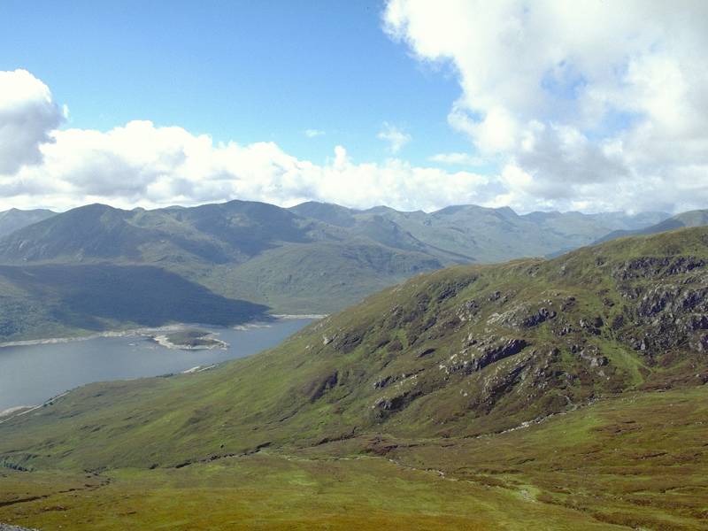
Loch Cluanie from the same point. It just goes to show that it really is worth persevering with the Scottish climate. When the weather does come good there is nowhere else on the planet to match beauty like this. |
 |
The sun glints off the loch below. I'm above 3000ft now, there is almost no wind, and I'm in heaven. |
 |
From the same point, looking southeastwards towards the Cluanie Dam. |
 |
Still some more climbing to do. The terrain is kind, a mixture of gravel and short, wiry turf. |
 |
High above Loch Cluanie and almost at the top of the ridge, looking back at yesterday's walk along the South Glenshiel ridge. Why couldn't the weather have been like this? |
 |
A view northwest; the "top" of Creag a Chaorainn with the parent mountain of the group, Sgurr nan Conbhairean, just visible a mile and a half away. |
 |
One last bit of rocky slope... |
 |
...and suddenly I find myself on the summit plateau. |
 |
This little area of bog is quite atypical of the summit plateau as a whole, which is a mixture of turf and slaty rock. |
 |
The summit of Carn Ghluasaid,
3140ft or 957
meters, Scotland's 203rd highest mountain and my twentieth Munro. There
are two cairns, only about 30 yards apart, situated towards the
northern
edge of a summit plateau that is almost 2000 square meters in area.
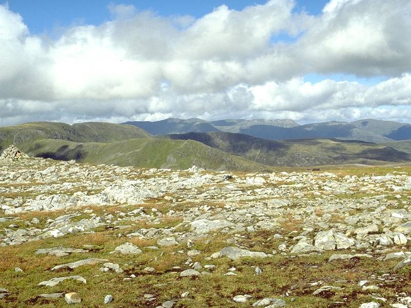
Summit panorama 1, looking NNE towards the Cannich and Strathfarrar ranges. |
 |
Summit panorama 2, looking NE, towards Easter Ross. |
 |
Summit panorama 3, looking ENE, towards Inverness |
 |
Summit panorama 4, looking E, down Glen Morriston towards the Great Glen. |
 |
Summit Panorama 5, looking ESE towards the Monadhliath and Laggan. |
 |
Summit Panorama 6, looking SE towards Creag Meagaidh |
 |
Summit panorama 7, looking S across Lochs Cluanie, Loyne and Arkaig (all unseen) towards Ben Nevis. |
 |
Summit panorama 8, looking SSW across Garry and Arkaig towards Gulvain. |
 |
Summit panorama 9, looking SW towards the Morar and Quoich Munros including Gulvain, Gairich, Spidean Mialach and Gleouriach, with Creag a Mhaim nearer to on the right. |
 |
Summit panorama 10, looking WSW across the South Glenshiel ridge, with the Quoich and Knoydart Munros behind. |
 |
Summit panorama 11, due west along Glenshiel, featuring the South Glenshiel ridge, the Saddle and A Chralaig. |
 |
Summit panorama 12, looking NW to Creag a Chaorainn and Sgurr nan Conbhairean |
 |
Summit panorama 13, looking NNW to Sgurr nan Conbhairean, Sail Chaorainn and An Socach |
 |
Summit panorama 14, NNW towards Mam Sodhail and Carn Eighe |
 |
Summit panorama 15, looking north over the Affric, Cannich and Strathfarrar Munros. |
 |
A close-up of the Cluanie Dam from the summit plateau |
 |
The east ridge of Carn Ghluasaid, descending to Glen Morriston. |
 |
I had some lunch here, during which the couple who had been twenty minutes behind me arrived on the summit plateau. They were the only other people I saw all day, and on a magnificent day like this... it was 2pm when I shot this image of Carn Ghluasaid's NE ridge, and I was in shirt sleeves at over 3000ft. |
 |
Looking across Coire Bodach nan Gobhar to the crags descending from Creag a Chaorainn, with Sgurr nan Conbhairean beyond... this one shot alone made up for all the disappointing weather of this summer and the last. |
 |
Another once in a decade shot - looking down into the depths of Coire Bodach nan Gobhar, with Gleann nan Lochain Uaine beyond |
 |
Time to move on. Sgurr nan Conbhairean had been sitting in shadow for twenty minutes but the sun had now reached it and I wanted to climb it. The distance is a mile and a half, and there's 330ft of ascent to Creag a Chaorainn followed by over 500ft to the main summit. |
 |
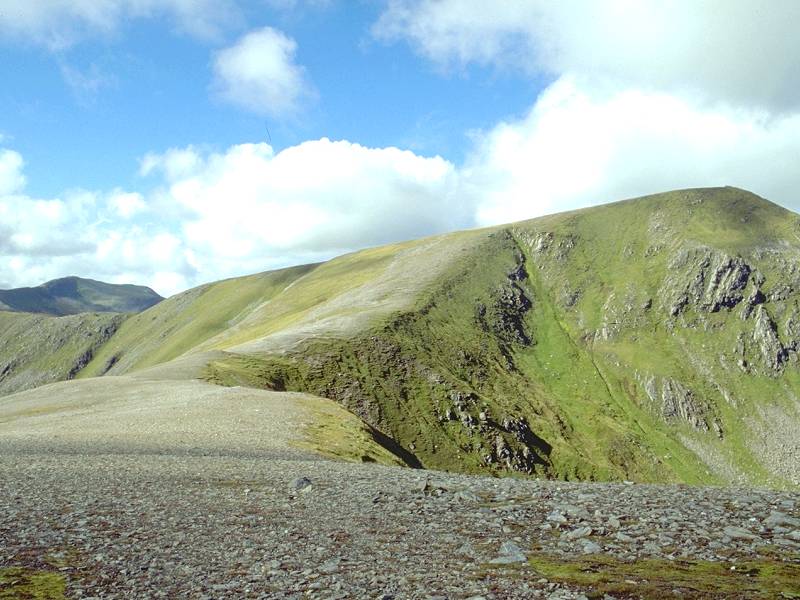
Creag a Chaorainn from the col. |
 |
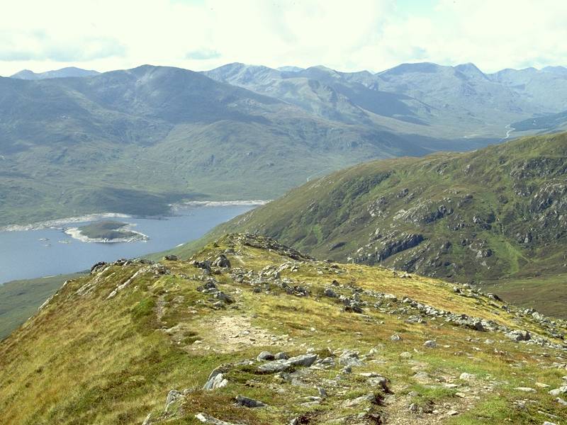
Creag a Chaorainn is a "top" of Sgurr nan Conbhairean and is actually higher than Carn Ghluasaid. Since there's only 150ft of reascent from the intervening col to Carn Ghluasaid, it's possible that Ghluasaid may one day lose its Munro status. Looking back from the Chaorainn - Conbhairean col, with a simple grassy path leading the way. |
 |
A beautiful little ridge of gravely stone sweeps up to Sgurr nan Conbhairean. |
 |
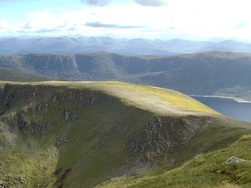
From the Ghlas Bealaich half a mile short of the summit, a view opens up along the magnificent Coire Sgreumh into Ceannacroc forest. |
 |
Five minutes and about 150ft from the summit. |
 |
3pm, and I'm standing on the summit of my 21st Munro, Sgurr nan Conbhairean. At a height of 3638ft (1109 meters), it's Scotland's 44th highest mountain and what we walkers call a "big bastard". The view down An Garbh Choire, along the Allt nan Lochan Uaine into Coire Sgreumh. The rippled crags dominating the centre of shot form one of the ridges of Carn Ghluasaid. |
 |
Summit panorama 1, looking WNW. A Chralaig, two miles away, dominates the shot. To its left are the main summits lining Glen Shiel, including Sgurr a Bhealaich Dheirg and Aonach Meadhoin; the hill to the far right beyond A Chralaig appears to be Ciste Dubh. |
 |
Summit panorama 2. The NW view. A Cioch is nearby across the upper reaches of the unseen Gleann na Ciche, while just beyond is the ridge northwards from A Chralaig to the pointy summit of Mullach Fraoch Choire. In the distance are Ciste Dubh (left), A Ghlas Bheinn (centre) and Sgurr nan Ceathreamhnan (right). |
 |
Summit panorama 3, looking NNW. Mullach Fraoch Choire and its northeast ridge dominate the left of shot while behind it is Sgurr nan Ceathreamhnan and its eastern neighbour An Socach. Way out on the skyline on either side on An Socach are two distant summits that may well be Beinn Alligin and Liathach. To the right of shot, along a dip formed by Gleann na Ciche, Gleann a Choilich and Coire nan Each, the conical Bidean a Choire Sheasgaich and the more rounded Lurg Mor can be seen clearly in the distance. |
 |
Summit panorama 4, looking north. Nearby to the right is Sail Chaorainn, while to the left Gleann na Ciche runs north and then turns east to run into the unseen Loch Affric. The two summits in the centre left about 8 miles away are Mam Sodhail and Carn Eighe. The Affric, Cannich and Mullardoch peaks crowd the skyline; most obvious is Loch Mullardoch's Sgurr na Lapaich. Mam Sodhail's top of the same name is the long hump in the middle distance on the right. |
 |
Summit panorama 5. Looking NNE. Sail Chaorainn is in shadow nearby. Further afield we're looking across the eastern bounds of the Affric and Mullardoch peaks. Pride of place here goes to the Strathfarrar Munros slightly right of centre. |
 |
Summit panorama 6, The NE view across ranges of lesser hills, and pretty much along the line of Loch Beinn a Mheadhoin and Strath Glass to the Beauly firth. |
 |
Summit panorama 7, looking due E down Coire Sgreumh into Glen Morriston. |
 |
Summit panorama 8, ESE past the northern ridges of Carn Ghluasaid across Glen Morriston and Ceann a Mhaim towards the Great Glen and the Corrieyairack hills. |
 |
Summit panorama 9. The SE view. Carn Ghluasaid is nearby; further afield are the hills fringing Lochs Loyne and Garry; Laggan, Glen Roy and Creag Meagaidh. |
 |
Summit panorama 10. SSE, across the Conbhairean-Ghluasaid ridge and across Loch Lochy towards the Grey Corries and Ben Nevis. |
 |
Summit panorama 11. S view across Loch Cluanie (in view) and Lochs Loyne, Garry and Arkaig (hidden) towards the Firth of Lorn. |
 |
Summit panorama 12. The SSW view. Loch Cluanie to the left, Creag a Mhaim to the right with Spidean Mialach behind. |
 |
Summit panorama 13. SW across the South Glenshiel ridge, with Gleouriach behind. |
 |
Summit panorama 14. WSW towards the western half of the South Glenshiel ridge. |
 |
Summit panorama 15. Due west along the spine of Glenshiel. The Saddle and the Saileag group in view, and back where we started 15 frames ago. |
 |
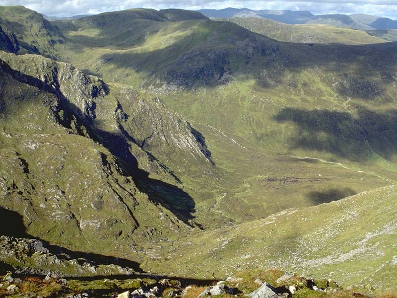
The wild grandeur of Coire nan Lochan Uaine, below the summit to the northeast. |
 |
Rippled terrain, probably caused by meltwater runoff, on the slopes of A Chioch to the west. |
 |
Just for the record, the summit cairn of Sgurr nan Conbhairean. |
 |
An Garbh Choire |
 |
Time to leave. To avoid climbing Carn Ghluasaid again I contoured around below its western slope, along an obvious terrace of grass. The terrain was rockier and more uneven that I had bargained for, but I soon hit the stalkers' path again. |
 |
The true test of a path is not how well it aids your ascent, but how well it aids your descent. Many "built" paths force the feet to point downwards, putting undue strain on calves and ankles and turning every footfall into a potential accident. Not this one, which was exceptionally well engineered. I was down at the Shelf in thirty minutes, and another twenty minutes later was looking over Loch Cluanie from the old estate track. |
 |
It was now just after 4.30 in the afternoon. The climb over, it remained only to walk back the three miles along the road to the hotel. Under fine weather it seemed to take only half as long as the outward walk this morning. |
 |
Loch Cluanie, with Creag a Mhaim behind. |
 |
Am Bathach in late afternoon sun. |
 |
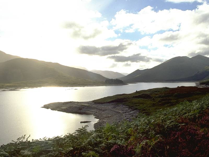
Loch Cluanie drenched in sunlight |
 |
...and finally, the same shot as
above with
a couple of stops less exposure.
That was the end of my short but rewarding stay at the Cluanie Inn but I was moving on to Inverness for the second half of the week, where I was to tackle the Contin to Garve section of the End-to-End Walk. |