 |
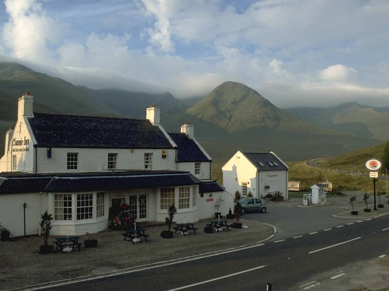
The Cluanie Inn is a hotel and bar
with a
small filling station attached. A couple of cottages and mobile homes
stand
nearby. To the west there's nothing else until Shiel Bridge, and to the
east there are just a scattering of similar localities down near
Torgoyle
Bridge in Glen Morriston. The inn has been imaginatively extended, with
a single-storey ranch style quadrangle around a central garden area.
It's
inexpensive, and popular with climbers and hikers as well as passing
tourists.
(This endorsement was entirely unsolicited. I just like the place). |
 |
There's no TV signal available here but the radio weather forecast promises one of those all too familiar Scottish days - bright but not sunny. There is likely to be hill fog but at least there's a very good chance of it staying dry, and that's a bonus in the Highlands. There are breaks in the cloud, particularly to the east as seen in this shot. |
 |
The South Glenshiel Ridge is almost unique in Scottish topography - it consists of seven Munros and two lesser summits, all spread out in a single line along the southern side of the glen. The whole expedition is one of 24km - plus, of course, the return walk along the glen - and only the super fit would consider tackling it in one day. More ordinary walkers like me are inclined to follow the recommendation in most of the guidebooks and to regard it as two separate day walks. I'm setting out to walk the eastern half, which will consist of four Munros. The sun glints over the unseen Loch Cluanie to the east of the hotel as I begin the walk. |
 |
The route runs along the road for a couple of hundred yards before turning right for an estate track running around the west end of Loch Cluanie and heading for Cluanie Lodge. Here, about 10 minutes after starting off, I'm looking back at the Cluanie Inn with the pass of An Caorainn Beag behind. |
 |
Further along the Cluanie Lodge track, the view northwest encompasses the west end of Loch Cluanie and the pass of An Caorainn Mor, which leads to the Altbeithe youth hostel in upper Glen Affric. |
 |
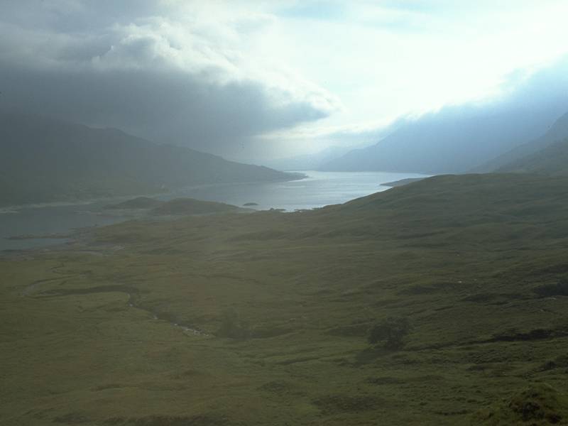
Looking east along Loch Cluanie. rather a lot of cloud, but Glen Morriston is down there somewhere. |
 |
The shoulder of Aonach Mheadoin and the shapely cone of Am Bathach form the north wall of Glen Cluanie. Loch Cluanie is in the foreground and the Cluanie Inn can still be seen over to the left. |
 |
The route now leaves the Cluanie Lodge access track for a hill track leading over to Loch Loyne. This is another view eastwards along the length of Loch Cluanie. The clouds are building up and what little sunshine there is can surely not last. |
 |
The path curves around the eastern end of Creag a Mhaim, the easternmost mountain in the South Glenshiel range. Here it doglegs into Coire Guibhais. One guidebook recommends this corrie as an ascent route, but there is no path here and I have my eye on a much more straightforward ascent. |
 |
Three miles from Cluanie Inn, and the track has curved some three quarters of the way around the mountain. Just beyond the point where it starts to lose height again on the way to Loch Loyne a fainter path strikes off over the moorland to the southwest, and in three hundred meters this path joins the southeast ridge of Creag a Mhaim. Loch Loyne is seen here from the ridge. |
 |
A stalker's path climbs the southeast ridge and proves to be the easiest ascent I've ever tackled in the Highlands. I've often read that Creag a Mhaim is an ideal first Munro thanks to the ease of ascent, and now I'm finding out that this opinion is probably justified. The path is easily graded, well defined and - above all - firm, level and easy on the ankles. From the foot of the ridge to the summit is an ascent of almost exactly 500 meters, around 1650ft. I make good time but, two thirds of the way up, I hit the cloudbase and climb the rest of the way in fog. |
 |
Creag a Mhaim, 947 meters or 3107ft, was a deceptively easy climb. I've had better summit views, though. |
 |
From Creag a Mhaim there's perhaps a kilometre of ridge walk west northwestwards to the second Munro, Druim Shionnach (foxes' ridge). Looking back along the way I've come there's a sudden and tantalizing clearance of the mist from the southern slopes. |
 |
The reascent to Druim Shionnach is only about 350ft, though the last two hundred meters is surprisingly narrow and is a little like Striding Edge in the Lake District - though wider, and not as extensive. I reached the summit only half an hour after leaving Creag a Mhaim. Druim Shionnach is my seventeenth Munro and my second of the day, and at 3238ft above sea level it's Scotland's 160th highest mountain. |
 |
There's a slight change of direction now. There's over 2km of ridge between Shionnach and the third Munro, Aonach air Chrith, and it initially runs west southwest then veers west. Another brief clearance as the cloudbase lifts momentarily. |
 |
I'm dropping to the col at around 900m, and suddenly the cloud lifts to reveal this view along Coire an t-Slugain, looking straight down to the Cluanie Inn. |
 |
And, suddenly, I can see the rather daunting shape of Aonach air Chrith a kilometre ahead. |
 |
With the cloudbase lifting I can start snapping away at last. The retrospective view of Druim Shionnach. |
 |
Pretty much at the lowest point between the two Munros here. The path is very well defined all the way along the ridge - not that it's necessary, for you're not going to go astray (even in mist), and the terrain is easy. |
 |
A nameless corrie west of Coire an t-Slugain, with the north ridge of Aonach air Chrith forming its west wall. The peak at the far end is A Chioch ("The Breast"), a "top" of Aonach air Chrith. |
 |
Aonach air Chrith is a complex little Munro. |
 |
The view to the rear is improving and I can now see both Druim Shionnach (to the left) and Creag a Mhaim (just right of centre). |
 |
Looking along that northern corrie again, with A Chioch to the left and a shaft of sunlight down at the Cluanie Inn. Muriel Gray, in her book "The First Fifty" makes great play of being able to see the inn from most of the ridge. "You can keep an eye on the chambermaid turning down your bed," she says. |
 |
Looking back at the col on the way up to Aonach air Chrith. There's 140m of reascent, or nearly 500ft - a rather daunting prospect. |
 |
It didn't take too long, however, and an hour after leaving Shionnaich I'm looking at the view westwards from the summit of Aonach air Chrith. |
 |
The summit of Aonach air Chrith: 3350ft, or 1021 meters, the 109th highest mountain in Scotland. And my eighteenth Munro. |
 |
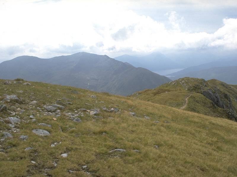
The view southwestwards to the shapely bulk of Gleouriach (3396ft), with a hint of Loch Quoich beyond. |
 |
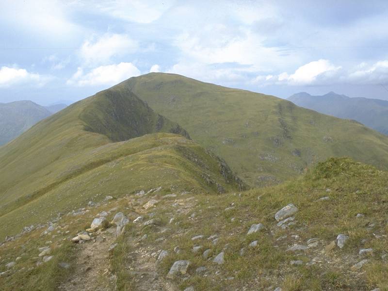
The view westwards along the South Glenshiel ridge towards the fourth summit, Maol Chinn-Dearg. I don't like the look of that rather precipitous drop about half a kilometre ahead. |
 |
Aonach air Chrith's north ridge is quite a sight, though. It's called Druim na Ciche (the breast ridge). Wonder how it got that name? |
 |
Another view of Druim na Ciche. (Yes, alright, it does look like a huge nipple. There, I said it). |
 |
The cloudbase having lifted now, I'm getting an excellent view eastwards along the ridge, back along the route I've already walked. |
 |
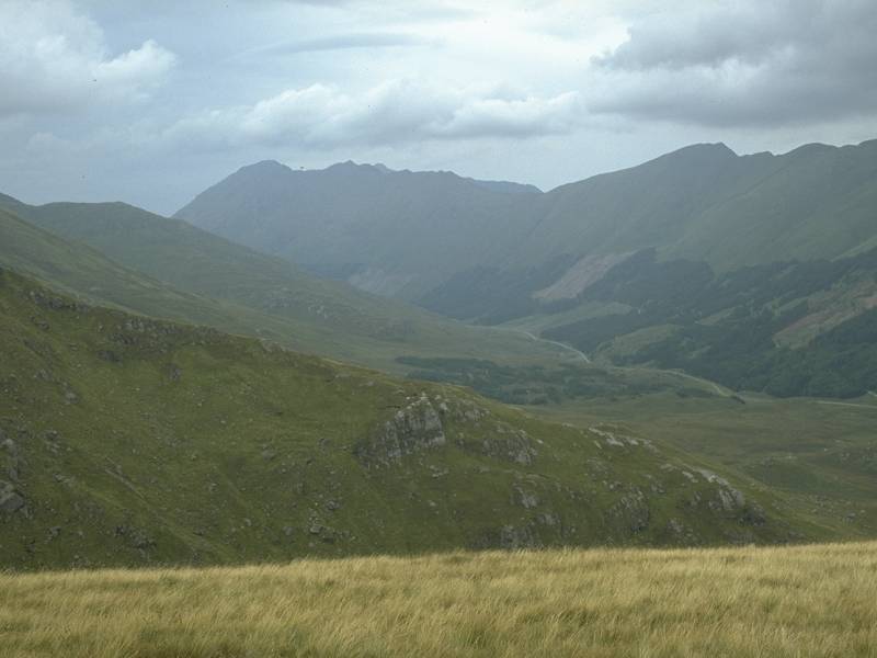
For the first time there's a decent view northwestwards along Glen Shiel itself. The Five Sisters of Kintail and the Saileag group dominate the north wall of the glen. |
 |
A look at the map confirms that there's rather a steep drop beyond Aonach air Chrith to the col. Beyond it, across the upper Quoich glen, looms Sgurr a Mhaoraich. |
 |
Moving off Aonach air Chrith to the west now, over very east terrain. Gleouriach looks magnificent across the glen to the south west. |
 |
The massive bowl of Coire nan Eirecheanach separates Aonach air Chrith from Maol Chinn Dearg. |
 |
The view of the narrowest part of the ridge from the top of that steep drop. |
 |
I didn't take any pictures during the descent to the col. It looked pretty steep and so it proved to be. For about four hundred meters west of the summit dome the ridge path is rough and slightly scrambly. Not actually difficult, and certainly not exposed, but it does require care. This is the view from the foot of the bouldery staircase, where things calm down once again. |
 |
The rest of the two kilometre ridge walk to Maol Chinn-Dearg is fine. There are a few minor tops on the way, which can be climbed or bypassed to the left according to taste. With a minimum of 350ft of reascent between me and the next Munro, however, I was inclined to leave the minor tops out. Even on a highly invigorating and relatively straightforward ridge walk such as this, you can only be prepared to expend so much effort. |
 |
Here's one of the minor tops, an apparently nameless summit of 892m elevation. |
 |
Loch Quoich is now coming into view to the right of Gleouriach. |
 |
Approaching the top of Maol Chinn Dearg, and looking southwest down to Loch Quoich. |
 |
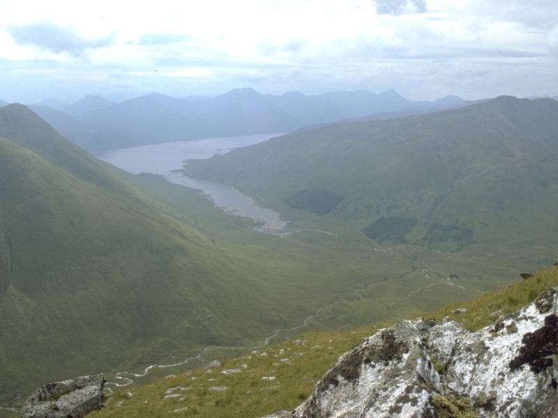
Looking out along the Coire nan Eirecheanach towards the Cluanie Inn. Is my bed made yet? |
 |
The same view, from the summit. |
 |
Looking back along the ridge from Maol Chinn-Dearg to Aonach air Chrith. |
 |
The summit cairn of Maol Chinn Dearg, 3218ft or 981m, and my nineteenth Munro. The view southwestwards over Loch Quoich, and a tantalising glimpse of Knoydart beyond. |
 |
The view westwards from Maol Chinn-Dearg. This is going to be my last Munro of the day, but had I chosen to go on this would have been the country I would have covered next. Past the minor summit of Sgurr Coire na Feinne is the next Munro of the ridge, Sgurr na Doire Leathain. |
 |
A retrospective view of Aonach air Chrith. |
 |
The northern ridge of Maol Chinn-Dearg. This is going to be my descent route back to Glen Shiel. And yes, the Cluanie Inn is still in view. |
 |
According to the guidebook, a path would be found once I had descended quite some way down this ridge. In fact there was a path, and a good one, virtually all the way. The ridge forms part of the main watershed; water falling to the east finds its way into Loch Cluanie, then via Glen Morriston to Loch Ness; water falling to the west runs down Glen Shiel to Loch Duich. |
 |
Like the path ascending Creag a Mhaim, this one is very reasonably graded and is equally easy on the feet. The ridge did not descend at a constant angle, but as a series of shoulders with linking ridges that were almost level in places. |
 |
The Five Sisters of Kintail seen from the descent. |
 |
Only in its lower stages did the path start to deteriorate. It described a series of zigzags down the last steep pitch, leaving only half a mile of drab moorland to cross to regain the main road. |
 |
A couple of hundred meters short of
the road,
the path joins a rather more well defined one coming down from Coire a
Chuil Droma Mor, used as an ascent route to the western half of the
ridge.
Some day I'll come back and walk the rest of it.
There was a walk of less than two miles back to the Cluanie Inn, and I was luxuriating under a welcome shower well before 5pm. |