 |
Wythop
valley
Starting out from Keswick, I've caught the Whitehaven bus and have alighted at Embleton then walked the short distance by road to Wythop Mill. From here a farm road goes up the north side of the valley of Wythop Beck towards Kelswick farm. This is a retrospective view along the farm track. |
 |
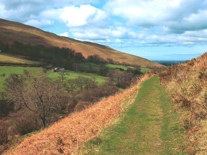
Wythop
valley (2)
Looking eastwards. There is an illusion that the valley sweeps upwards towards Skiddaw, though in reality the drop to Bassenthwaite Lake intervenes. Walking towards Kelswick here, with our first objective (Sale Fell) rising to the left). |
 |
Sale
Fell
From Kelswick a path rises across the fell towards a stone wall, from where there is a simple grassy ascent to the summit. |
 |
Sale
Fell (2)
The summit of Sale Fell, 1170ft above sea level. The walk has involved about 800ft of ascent from Embleton and has taken about 55 minutes. Here we're looking almost due east, towards the huge bulk of Skiddaw |
 |
Sale
Fell (3)
Looking down on Bassenthwaite. In view is the Pheasant Inn and the former Bassenthwaite Lake railway station. The lone fell of Binsey is about 4 miles away to the northeast. |
 |
Ling
Fell
To get to Ling Fell, my second objective, it was necessary to retrace my route most of the way to Wythop Mill before taking a side lane to Eskin farm, from where a short stretch of road gives access to the fellside. Like the ascent of Sale Fell, Ling Fell is ascended first by a grassy rake and then a direct climb up grassy slopes. This is Skiddaw from the 1224ft summit. |
 |
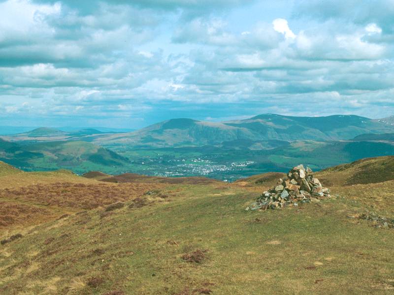
Ling
Fell (2)
The trig point on Ling Fell's summit. We're looking over the Vale of Lorton towards Cockermouth. |
 |
Darling
How
My next objective was the 1477ft height of Graystones, a rather isolated hill to the west of the group overlooking the Vale of Lorton. To get there I dropped off the summit to the south and found a way across Wythop Moss, climbing a fence corner to gain access to the slopes of Graystones (no photos of Graystones unfortunately). From there I dropped south again along a stone wall to come to the Darling How plantations in the valley of Aiken Beck, seen here. |
 |
Brown
How
A bit of zigzagging along forestry roads in the Aiken Beck valley was followed by a brief ascent through the trees and a climb over a stone wall to gain Brown How, the northwestern slopes of Whinlatter. This is the view westwards across the Vale of Lorton. |
 |
Whinlatter
The summit of Whinlatter, 1696 ft, the fourth, highest and last of the day's fells. |
 |
Whinlatter
(2)
The summit wind shelter and a view across the Vale of Lorton towards Cockermouth. |
 |
Whinlatter
(3)
Looking south across the Whinlatter Pass to Grizedale Pike. |
 |
Whinlatter
(4)
The Vale of Keswick from Whinlatter. Beyond the town are Walla Crag, Bleaberry Fell and High Seat. Over to the left are the isolated hills of Great Mell Fell and Little Mell Fell, with the line of the Pennines behind. Latrigg rises to the far left. |
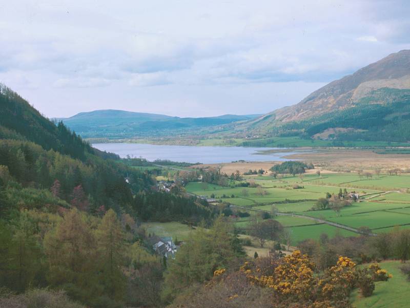 |
Whinlatter
Pass
From Whinlatter I took the path eastwards to the forest plantations then down through the rides to the Whinlatter visitor centre for a pot of tea. After that I walked down the road towards Braithwaite. Here's a view of Bassenthwaite from above the village. |
 |
Braithwaite
Braithwaite, at the end of the day's walk. |
 |
Braithwaite
(2)
Another scene in Braithwaite. |