 |
Stanger
Gill
One of the few lines of approach available is via Stanger Gill, accessed from Langstrath about a mile southeast of Stonethwaite. The climb is heart-stoppingly steep. This is a view back towards Stonethwaite from about 1300ft. |
 |
Rosthwaite
Fell
The rather "choppy" terrain at the top of Stanger Gill. It was such hard work ascending the gill that it took me two hours to reach the summit from Stonethwaite. |
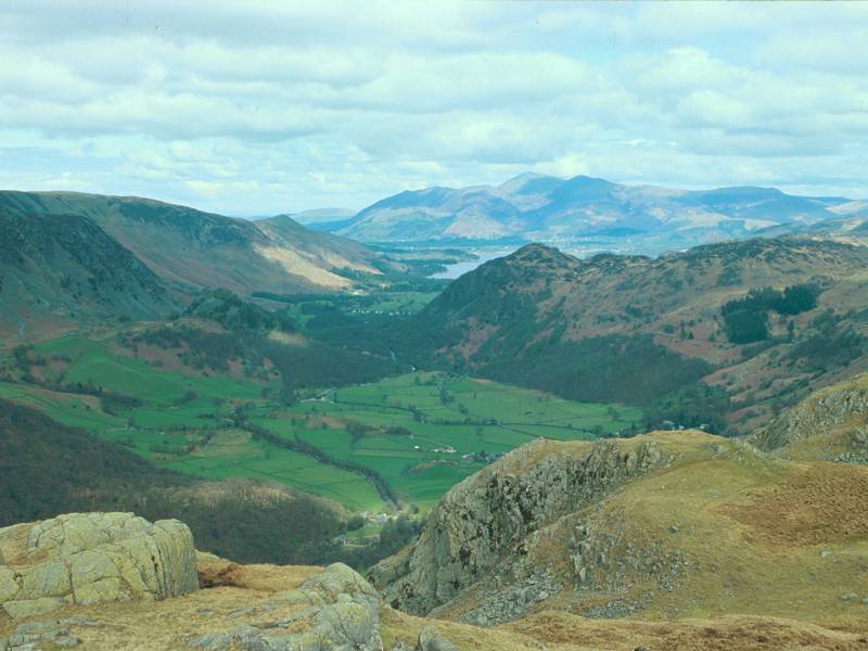 |
Borrowdale
Looking north into upper Borrowdale, with Skiddaw way beyond. |
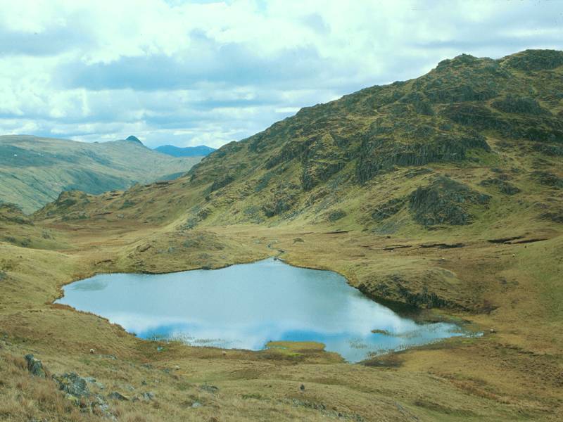 |
Tarn
at Leaves
South of Bessyboot is this body of water known as Tarn at Leaves, surely Lakeland's most poetic name. Beyond is Rosthwaite Cam, higher than Bessyboot and a "top" of Glaramara. |
 |
Bessyboot
The summit cairn. We're looking west of south. Glaramara is the main peak in view, with its satellite of Rosthwaite Cam to the left. |
 |
Bessyboot
(2)
Tarn at Leaves forms the foreground to this view into Langstrath. |
 |
Bessyboot
(3)
Looking just north of west to the double-winged shape of the High Stile group south of Buttermere. |
 |
Bessyboot
(4)
Looking due north towards Borrowdale and Skiddaw |
 |
Bessyboot
(5)
A telephoto shot from a rocky outcrop a little south of the summit, towards High Stile and its neighbours. Fleetwith Pike, with Honister Crag falling steeply to its right, looks quite dramatic from this angle. |
 |
Bessyboot
(6)
Rock outcrops at the summit. |
 |
Tarn
at Leaves (2)
No path to speak of, but I wanted to take a close up look at Tarn at Leaves. It proved possible to ford its outlet stream without mishap and I settled down for lunch in the lee of Rosthwaite Cam just beyond. |
 |
Dry
Gill
I had nothing more on the agenda for the day so I studied the map, looking for a possible alternative descent. The grassy slopes to the west were pathless but looked like an excellent way down, and so they proved. My route kept just south of Dry Gill. It was only when I studied the small print in Wainwright that I realised he'd also spotted this alternative descent. It leads in half a mile to Comb Gill and the main descent path from Glaramara. |
 |
Comb
Gill
It's an easy hop across Comb Gill to reach the path. This is a view southwards towards Glaramara. It remained only to walk down the path to Mountain View for the short stroll along the road to Seatoller, there to catch the bus back to Keswick. |
 |
Mountain
View
The lower end of the path from Glaramara back to Borrowdale |
 |
Mountain
View (2)
A retrospective view back up the path from Mountain View |
 |
Mountain
View (3)
Rosthwaite Fell seen in silhouette |
 |
Mountain
View (4)
The end of the path, at Mountain View cottages near Seatoller. |