 . . |
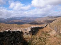
The Kentmere Horseshoe, June 1989
An introduction to part of this rewarding circular expedition from Kentmere, with a diversion to High Street. |
 |
Wansfell and Baystones, April 2006 A short walk from Ambleside. |
Sketch map will appear here
The Kentmere group forms the southern half of Wainwright's Far
Eastern
Fells. It includes the fells of the Kentmere horseshoe - the Ill Bell
ridge to the west of the Kent valley and the Mardale Ill Bell ridge to
the east - and extends north to include the group's parent fell of High
Street, west to the satellite ridge of Stony Cove Pike and its
neighbours, and southwest to include a handful of isolated lesser
heights down to the fringes of Windermere such as Wansfell and Sour
Howes.
It's lonely country. Long, grassy ridges connect the tops and the
group is very similar to the neighbouring Fairfield Horseshoe to the
west in that respect, but there are fewer villages and roads on the
periphery and access is consequently more awkward. Those who do walk
these fells are rewarded by a huge sense of freedom and space, and once
you get the initial climb under your belt you can stride out and wander
these ridges for hours. Kentmere is the best access point for the
horseshoe itself, Stony Cove Pike and its neighbours are best
approached from Patterdale or Brothers Water, while the lesser fells to
the southwest can be accessed from Ambleside, Troutbeck or Windermere.
To the east are the unfequented fells of Long Sleddale while to the
north, High Street connects with another complex series of ridges
laying between Haweswater and Ullswater.
 . . |
The Kentmere Horseshoe, June 1989
An introduction to part of this rewarding circular expedition from Kentmere, with a diversion to High Street. |
 |
Wansfell and Baystones, April 2006 A short walk from Ambleside. |
Back to Lake District index page
![]()