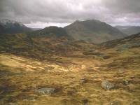
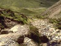
The Great Gable group
Sketch map will appear here
Great Gable is England's seventh highest
mountain.
From Wasdale, which it overlooks, it appears as a massive, unassailable
cone and doubtless this aspect of the mountain has given it its name.
From
other directions, however, it is revealed as a dome-shaped top
supported
by Green Gable, its lesser neighbour. Despite its elevation and its
somewhat
fearsome appearance, its ascent is straightforward and is one of
Lakeland's
most popular expeditions.
The fell occupies a strategic geographical
position in Lakeland, standing at the apex of two ridge systems; the
Pillar
group, laying between Wasdale and Ennerdale, and the High Stile group,
between Ennerdale and Wasdale. This section deals with Gable itself and
its immediate neighbours. In the Pillar direction Gable's principal
outlier
is Kirk Fell, bounded in the west by Black Sail pass. In the High Stile
direction Green Gable rises immediately beyond Windy Gap, then falls to
a wide col beyond which lie Brandreth and Grey Knotts, plus the
northeastern
offshoot of Base Brown. Brandreth itself forms an extensive plateau to
the west from which rise the headwaters of the river Cocker (which
flows
into Buttermere and then Crummock Water). The western edge of this
plateau
rises again to form two more summits; the rambling, intricate and
tarn-pocked
Haystacks, and quarry-riven Fleetwith Pike (seen as a steep cone from
Buttermere
below). In this direction the group is bounded by Scarth Gap pass. To
the
east, the group's boundary is marked by Sty Head pass, the walking
route
between Wasdale and Borrowdale.
Gallery Index
Back to Lake District index page
Last updated 7th May 2002


