 |
Coast-to-Coast, August 13th 1993From Black Sail to Ennerdale Bridge as part of the Coast-to-Coast Walk. |
 |
Ennerdale Water, 26th May 1986
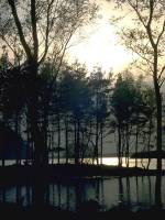
Five shots of Ennerdale Water near Bowness Point, in evening light. |
Sketch map will appear here
Every Lakeland valley has its unique feature. In the case of Ennerdale, the valley of the river Liza, that feature is remoteness. The valley has no public road along most of its length. To explore it you have to be prepared to walk, and walk long distances.
The lack of road is only part of the logistical problem. When Ennerdale does eventually reach tarmac roads and open out into the Cumbrian coastal plain, it meets a world of farms and pastures and tiny villages. Public transport is sparse and places to stay are a long way off - the nearest town worthy of the name is Cleator Moor, seven miles distant. There are routes into the head of the valley but they all involve crossing ridge lines (for instance, from Buttermere) - and once you've got into Ennerdale you have to get out again. For non drivers like me, expeditions within Ennerdale's confines are a considerable undertaking.
The valley lies in the heart of the hills that Wainwright designates as the Western Fells, sandwiched between the High Stile and Starling Dodd groups to the north, and the Pillar massif to the south. Ennerdale's lake, Ennerdale Water, occupies the lowest couple of miles of the valley. At the head of Ennerdale Water is the remote locality of Gillerthwaite, consisting of a couple of remote farmsteads and a youth hostel; then there are seven lonely miles of forest plantation before the track emerges at Black Sail youth hostel, strategically placed at the confluence of paths over to Buttermere, Wasdale and Borrowdale. Much has been written about the planting of Ennerdale's forest; older guidebook writers see the forest as something of an eyesore, a gross visual intrusion that has forever spoiled what was formerly a place of beauty. Looking down at Ennerdale from the surrounding fells it's easy to see their point for the foresters have done nothing whatsoever to soften the tree line. Forest, however, is the true natural vegetation in these part. Personally, I enjoy forest walking and I find Ennerdale's paths and rides are places of tranquility and great beauty.
This page also includes a small cluster of fells south of Ennerdale Water; the fells of Kinniside Common (Lank Rigg, Crag Fell, Grike and outliers such as Blakeley and Dent) are typically sprawling lumps of moorland and rough grassland ranging from 1000ft to 1500ft in altitude and largely unfrequented by walkers. The exception to this rule is Dent, which is crossed by the route of the Coast-to-Coast Walk. In fact this long distance route runs the whole length of Ennerdale and probably accounts for a significant proportion of its pedestrian traffic.
Ennerdale should not be confused in any way with Emmerdale, a fictitious setting for a countryside soap opera supposedly somewhere in the Yorkshire dales.
 |
Coast-to-Coast, August 13th 1993From Black Sail to Ennerdale Bridge as part of the Coast-to-Coast Walk. |
 |
Ennerdale Water, 26th May 1986
Five shots of Ennerdale Water near Bowness Point, in evening light. |
Back to Lake District index page
This page last updated 15th April 2001
![]()