 |
Dale Head - Catbells ridge, 30th April 2000A walk along the ridge that rises above Borrowdale to the west. |
 |
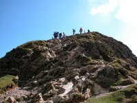
Catbells from
Brandlehow, 1st May 2005 A half day walk after a morning storm, and my
first ascent of Catbells in sunshine.
|
Sketch map will appear here
Dale Head is the central fell of a compact group of hills that sits immediately west of Borrowdale. Part of the area designated by Wainwright as the North Western Fells, this group is bounded by Borrowdale to the east, Honister Pass to the south, Buttermere to the southwest and Newlands Valley to the northwest. For the purposes of this web page the Dale Head group also includes Newlands and its offshoots.
The group comprises six fells. Dale Head itself sits at the southern end of the group, at a meeting place of ridges. The main ridge runs east then north and forms three more fells; High Spy, Maiden Moor and the delightful Catbells. To the west of Dale Head are two more fells, Hindscarth and Robinson. On the south side these fells form a continuous wall with Dale Head fronting Honister Pass, Gatescarth and Buttermere. To the north, however, they each send long ridges descending into Newlands.
Newlands itself is a delightful area of tiny, scattered farms and
clusters
of cottages. It includes the side valley of Keskadale (rising to
Newlands
hause) and the localities of Stair, Skelgill, Little Town and Rigg
Beck,
as well as the wooded knoll of Swinside. In times past Newlands was an
area of notable mining activity, yielding semi-precious ores such as
copper
and silver.
 |
Dale Head - Catbells ridge, 30th April 2000A walk along the ridge that rises above Borrowdale to the west. |
 |
Catbells from
Brandlehow, 1st May 2005 A half day walk after a morning storm, and my
first ascent of Catbells in sunshine.
|
Back to Lake District index page