 |
Ascent
of Dale Head
The easiest ascent of Dale Head is by its south ridge, from Honister Pass. There is some 1300ft of ascent and it takes about 45 minutes. Many fellwalkers regard Dale Head as the easiest of the bigger Lakeland fells; it's probably the hill with the greatest reward to effort ratio, in as far as these things can be measured at all. "Easy", of course, is a relative term. |
 |
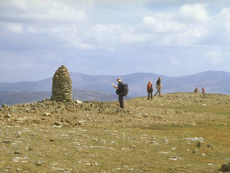
Dale
Head summit
The 2473 ft summit of Dale Head, and a cairn that has been rebuilt several times. |
 |
Hindscarth
from Dale Head
The westward view from the summit towards Hindscarth, with Robinson beyond and Grasmoor in the distance to the right. Buttermere lies in the dip to the left; Gavel Fell and Blake Fell appear on the skyline beyond. |
 |
Scope
End from Dale Head
Hindscarth Crags form the east wall of Scope End, Hindscarth's north ridge. Grasmoor, Eel Crag, Sail and Grizedale Pike ring the skyline. |
 |
Newlands
from Dale Head
The end-on view of the upper Newlands valley shows why Dale Head is so named. |
 |
Maiden
Moor and High Spy
A NNE view from the summit looks along the ridge I will be following; High Spy (near at hand, to the right) merges into Maiden Moor (further north) and eventually Catbells (not seen). Skiddaw and Blencathra dominate the skyline. |
 |
High
Spy from Dale Head
High Spy seen from Dale Head. Blencathra is 10 miles away on the skyline to the left, while Clough Head and Great Dodd appear to the right. The Central Fells ridge is in the middle distance. |
 |
Helvellyn
from Dale Head
Looking along Dale Head's east ridge towards Helvellyn and its neighbours |
 |
Bowfell
and Scafell from Dale Head
Bowfell, Esk Pike and the Scafells seen in this southeast view from Dale Head's summit. |
 |
High
Stile from Dale Head
High Stile is the hump to the right. High Crag is its outlier in the centre of shot. The mass of Pillar rises to the left, beyond Ennerdale. |
 |
Dale
Head summit (2)
Another view of Dale Head's summit cairn and a cluster of visitors. |
 |
East
ridge
The initial stage of the descent path eastwards to Dalehead Tarn. |
 |
Descent
to Dalehead Tarn
High Scawdel, Dale Head's southeastern shoulder, is seen here. Dalehead Tarn lies in the shallow col before High Scawdel, about 900ft below Dale Head's summit. |
 |
Descent
to Dalehead Tarn (2)
A view across to Eel Crags, on the western flanks of High Spy |
 |
Descent
to Dalehead Tarn (3)
It's a long stony descent to Dalehead Tarn but you can tackle the grassy slopes rather than the made path if you prefer. |
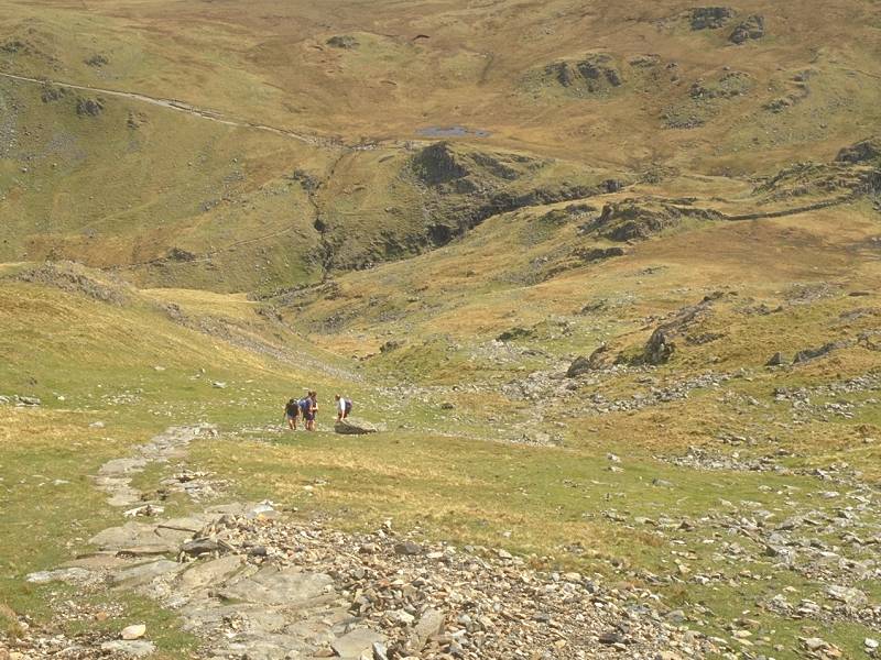 |
Descent
to Dalehead Tarn (4)
The tarn seems to take forever to reach. |
 |
Descent
to Dalehead Tarn (5)
About halfway down to the tarn. The gradient is fairly uniform. |
 |
Descent
to Dalehead Tarn (6)
Nearly there; the highest reaches of Newlands beck above the tarn. |
 |
Dalehead
Tarn
About 100 ft above the tarn. Standing at a height of just over 1700ft, it is a popular refreshment stop for walkers during the day and an equally popular wild campsite at night. |
 |
Dalehead
Tarn (2)
The environs of Dalehead Tarn. |
 |
Dalehead
Tarn (3)
Looking at the bulk of Dale Head from the little crag just east of the tarn. |
 |
Rigg
Head
Newlands Beck is forded just below the tarn, beyond which it forms this tiny but picturesque gorge. This locality is known as Rigg Head. |
 |
Rigg
Head (2)
From Rigg Head the path rises from the col towards High Spy. There's some 550ft of reascent. |
 |
Rigg
Head (3)
Looking back at Rigg Head from High Spy's south ridge |
 |
High
Spy
A retrospective view of High Spy's south ridge at about 1900ft. |
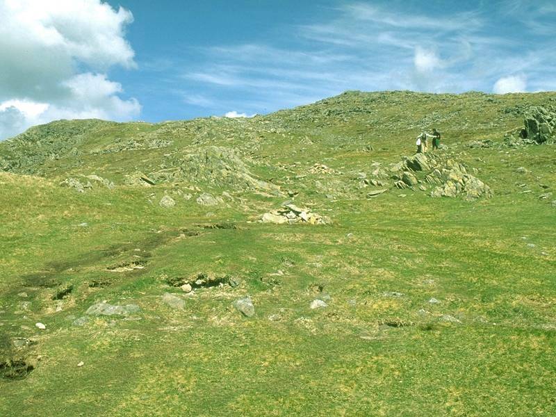 |
High
Spy (2)
Approaching the summit. |
 |
High
Spy (3)
Walkers ascending High Spy, at around 2000ft. |
 |
Dale
Head from High Spy
High Spy's summit is a fairly extensive plateau that falls gently away to the east but rather more dramatically to the west. Dale Head, seen across Newlands to the southwest. The Tongue Gill ravine is very prominent. |
 |
High
Spy (4)
The path wanders along the summit plateau. |
 |
High
Spy summit
The summit at last, perched high on the western edge of the plateau at a height of 2143ft. |
 |
Scope
End and Grasmoor
Scope End seen across the Newlands valley, with Grasmoor, Wandope and Eel Crag looming beyond. |
 |
Skiddaw
from High Spy
The summit plateau of High Spy continues northwards from the summit cairn for another half mile. Skiddaw comes into view. |
 |
View
NW from High Spy
The summit plateau narrows and eventually falls away over Blea Crag. I've deliberately wandered off the path to track eastwards for a look down the slopes above Borrowdale. Bleaberry Fell stands opposite; beyond it, across the dip of the unseen Thirlmere, are Clough Head and the Dodds. |
 |
Grasmoor
and Newlands
Some crags on the western flanks enliven the scene. The steep sides of Scope End rise on the other side of the Newlands valley, with Grasmoor, Wandope and Eel Crags beyond. |
 |
Derwentwater
from High Spy
The northern end of the summit plateau. Derwentwater comes into view. |
 |
High
Spy (5)
Looking directly along the ridge from the same point. Skiddaw appears in the distance to the right of the unseen Bassenthwaite. |
 |
High
Spy (6)
This little tarn doesn't even figure on the map. |
 |
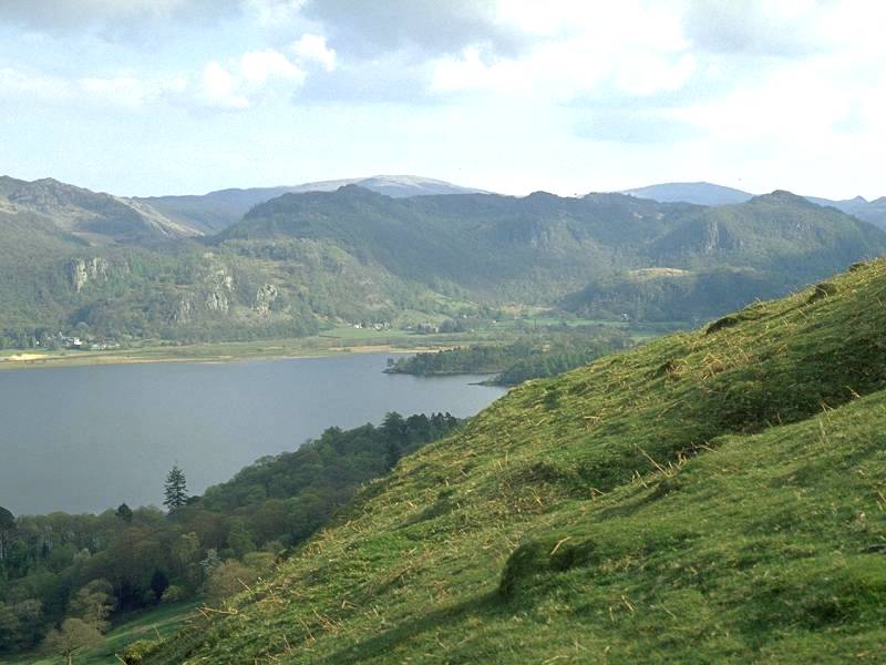
Borrowdale
from High Spy
Derwentwater and Rosthwaite seen from the side of Blea Crags |
 |
Maiden
Moor from High Spy
Maiden Moor (1887ft) is another fell with a big plateau-like summit. I waited nearly half an hour for a break in the clouds to grab this shot. |
 |
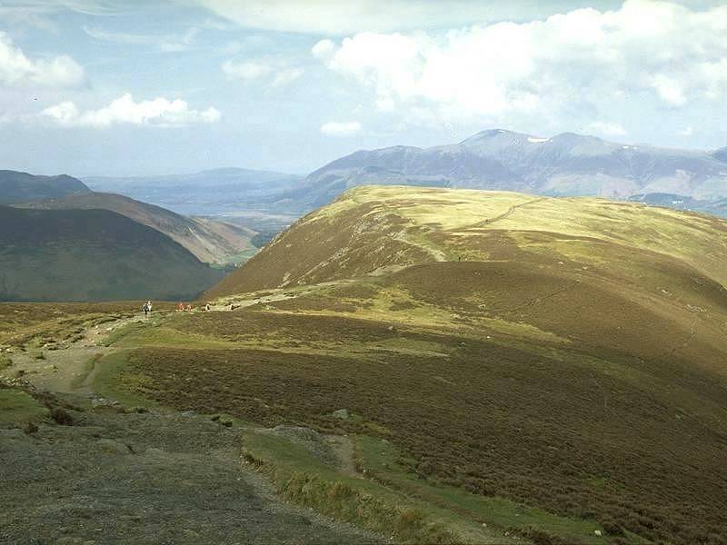
Hindscarth
and Newlands
Looking back along Newlands from the descent from High Spy to the Maiden Moor col. It was galling to see the sun shining on the valleys to either side. Despite another long wait Maiden Moor remained cloud covered and eventually I gave up and walked on to Catbells. |
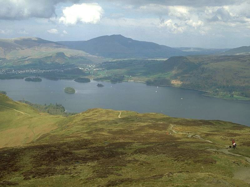 |
Derwentwater
from Catbells
A brief sunny interval enabled me to grab this shot from the vicinity of Hause Gate (the col between Maiden Moor and Catbells). |
 |
Skiddaw
and Keswick
...seen from Hause Gate. Nearer to is the shapely topknott of Catbells. |
 |
Derwentwater
from Catbells (2)
Catbells, elevation 1481ft, is without doubt the most popular fell in the Lakes. On fine days the summit sees hundreds of visitors. It's not a straightforward climb, though; its rocky topknott cannot be ascended with any degree of dignity and it's necessary to claw and clamber one's way to the top. Descents are equally tricky. This is a view southwards along Derwentwater from the north ridge. |
 |
Derwentwater
from Catbells (3)
A good path below the scrambly bit drops quickly towards Hawse End. |
 |
Descent
from Catbells
The path zigzags down the final shoulder of Catbells towards the road. |
 |
Descent
from Catbells (2)
Skelgill and the lower reaches of Newlands. Beyond the road, walkers in the know descend the little woodland path to the lakeshore to catch the Derwentwater ferry back to Keswick. The Lakeshore tearoom and its inquisitive birdlife provides a splendid finish to a day's fellwalk. |