| Porthpean to Fowey | Back to South Cornwall Coast Path index | Polperro to Looe |
Well he is, in a sense. The super-fit might well knock off the twelve miles between Fowey and Looe in one day but you and I, dear reader, are but ordinary mortals - and for us, believe me, the seven miles detailed below are enough for one day.
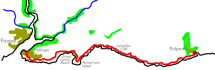
After yesterday's rather atypical stretch around Carlyon Bay and Par, we're back among the scenery today - back into the long, lonely miles of switchback path tending up and down gorse-covered slopes, with nothing in sight save pastures and fields to the left and the ever-present vista of sea to the right. This is glorious country. It's never ending. And it's tiring.
Tiring, yes, but tiresome, far from it.
There
is variety here, including the airy drop down into Great Lantic Beach
which
you might consider as a detour, and the glorious views from Pencarrow
Head
and Washing Rocks. To the seaward side of the path there is enough
first-class
rock scenery to keep you gasping, despite having walked past a hundred
miles' worth of it already. And last, but not least, this section links
two of the South Cornwall Coast's most agreeable settlements, Fowey and
Polperro; each a maze of impossibly narrow lanes with cottages
shoe-horned
among each other at crazy angles, and sometimes clinging to slopes that
would make a mountain goat think twice. Squeezing though Polperro's
back
lanes, almost certainly the narrowest residential roads in Britain, you
wonder how the residents ever get double beds or fridge freezers
delivered
without the aid of a Royal Navy helicopter. Both places invite you to
linger
and explore. Don't rush this section.
|
|
|
| Length: | 7.37 miles / 11.9 km |
| Total ascent: | 2537 ft / 773 m |
| Total descent: | 2552 ft / 778 m |
| Estimated time: | 3 hrs 25 mins |
Map: OS 1:25000 Explorer 107 (St Austell & Liskeard)
Click
on
any thumbnail image in this gallery to display the corresponding full
size
image. The images are access protected through a cgi script to prevent
hotlinking. If you encounter problems while trying to view the full
size
images, please read the access advice
page.


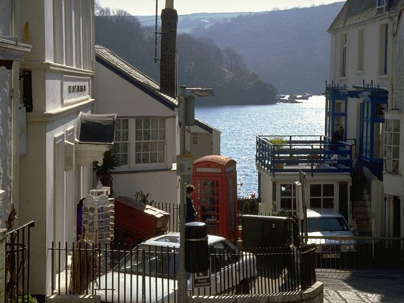
Fowey and its steep and narrow streets
![]() First
Western National service 24 - Truro - St Austell -
Par - Fowey
First
Western National service 24 - Truro - St Austell -
Par - Fowey
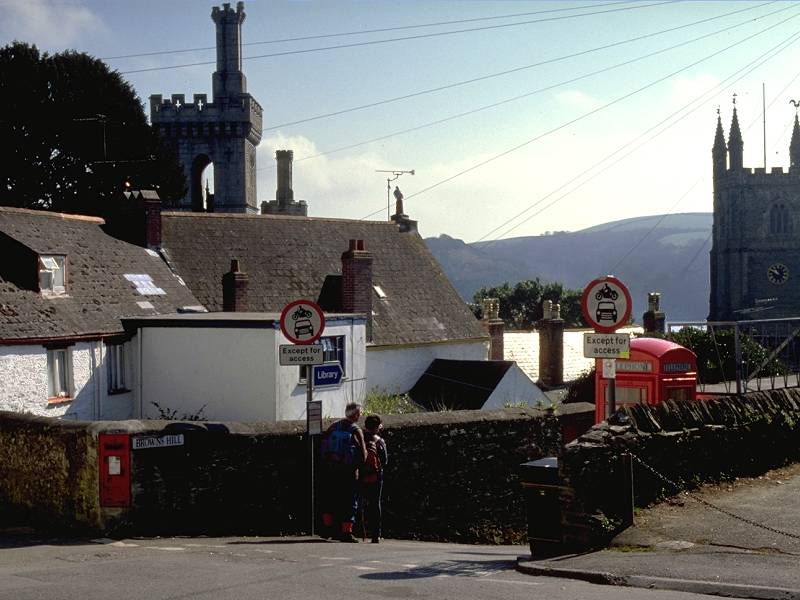
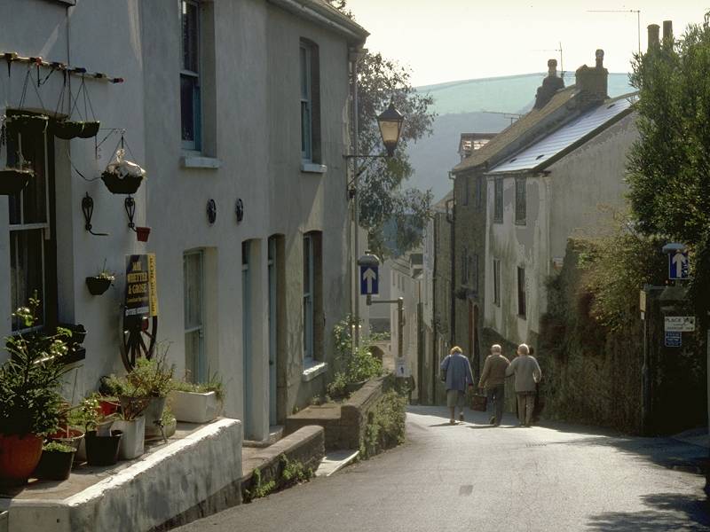
If you've not been staying in Fowey overnight you'll no doubt want to have a look around as soon as you arrive on the bus from St Austell or Par. Fowey is a fascinating little town of steep, narrow streets clustered around the harbour inlet. The town centre is almost impossibly cramped into an area about 400 meters square. Space is at a premium here; it only needs two cars to create a major traffic jam and it's surprising how many businesses have invested in sliding doors just to save a couple of square feet of floor space.

Fowey's main street

Town Quay and Fowey harbour


Fowey photo album
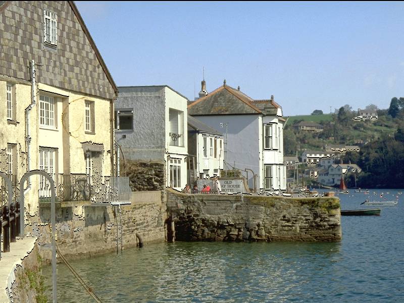
Having explored Fowey to your satisfaction your next task is to cross the narrow Fowey estuary to Polruan, opposite. In summer the passenger ferry leaves from a jetty a few hundred yards south of the town centre, back along the coast path to Gribbin; you will probably have passed it yesterday. It's signposted along a tiny alley between waterfront cottages.
Through much of the year, however, the ferry leaves from the town quay immediately adjacent to the town centre. There is no information posted at the summer jetty warning you when the ferry is running from the town quay instead; you could wait there for a considerable time before you realise that nothing is going to come. It's also depressingly easy to miss the town quay and end up instead at the car ferry a quarter of a mile to the north.


Arrival in Polruan


Polruan
As you cross to Polruan you also leave the district of Restormel and enter that of Caradon, which covers the whole of south-east Cornwall.
Initially, Polruan is almost a mirror image of Fowey; you immediately find yourself in a similar little maze of steep and narrow streets. The coast path, however, is well signed and leads initially along West St and then along Battery Lane. You pass a coastguard station and then, higher up, a separate coastguard lookout. This series of lanes delivers you to the highest part of the village, which becomes surprisingly urban for a short distance. The coast path dodges through a gap in a wall near the coastguard lookout and a car park, and passes through a small recreation area; on the seaward side there is a splendid view over the entrance to the Fowey estuary and the so-called Washing Rocks.


The path keeps to the seaward side of the upper reaches of Polruan, which turns out to be far more extensive than Fowey itself. Every time you think you've left Polruan behind you cross another pasture only to find you're approaching another limb of the village; it manages to play this trick by hiding behind the convex slope of the pastures across which the coast path runs. Eventually, however, you leave the last cottage behind and find yourself running into an area of scrubby slope below Blackbottle Rock.


Retrospective view of Polruan; the Coast path below Blackbottle Rock.
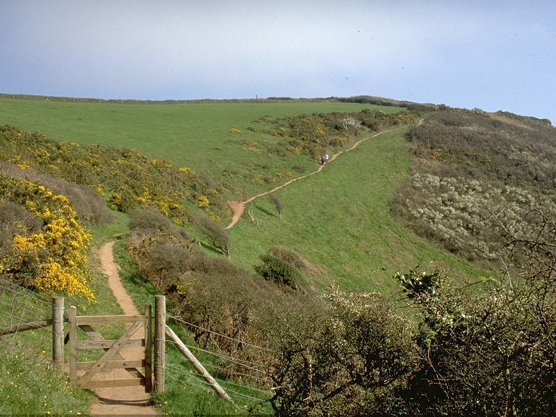
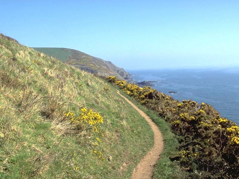
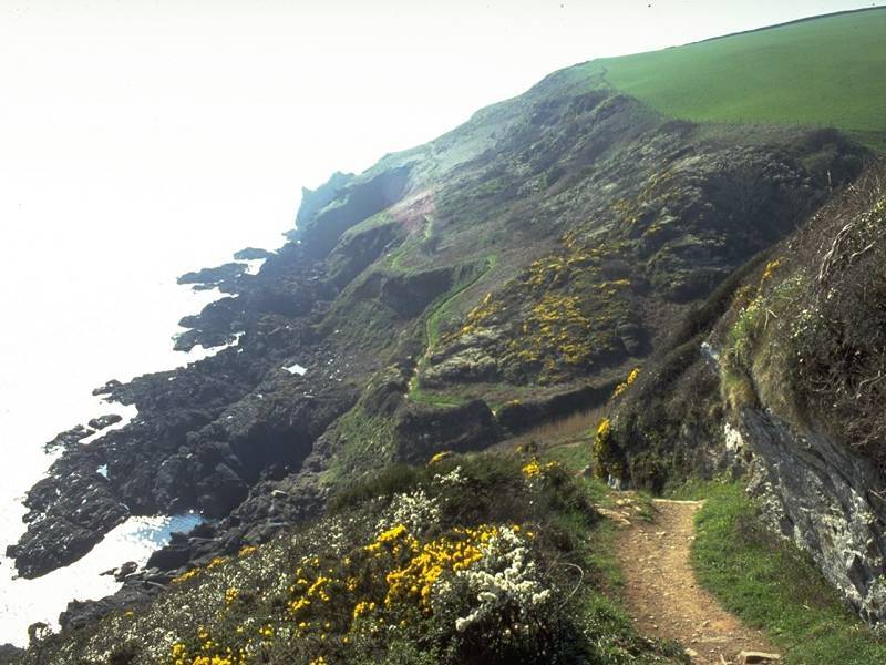
Blackbottle Rock rears high above you as you traverse the slope. It doesn't look far from Polruan on the map, and there is the distinct feeling that you have already walked much further than the map suggests that you have. Your modest progress is revealed, however, once you round a curve of gorse-flecked pasture to see Lantic Bay ahead.


The approach to Lantic Bay
Lantic Bay is graced by two tiny and remote beaches - Great Lantic Beach and Little Lantic Beach. Great Lantic beach is by far the larger of the two and there is a steep descent to it from the coast path. Little Lantic Beach would appear to be impossible to reach. Great Lantic Beach gets it fair share of trippers - the road to Polruan passes within five hundred meters and there is a car park close by.


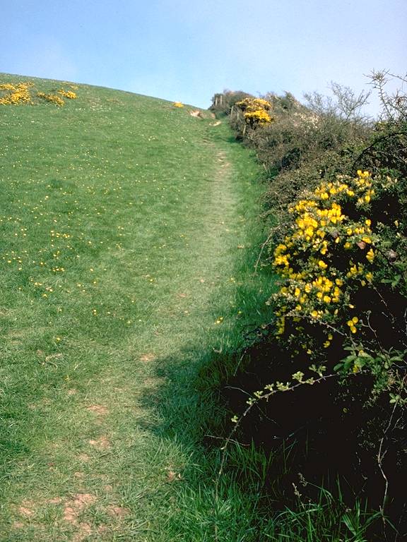
The coast path above Lantic Bay
The rise and fall of the path in the vicinity of Lantic Bay will bring tears to the eyes of fatigued hikers. The path gains a good deal of height to reach a field corner just northeast of the apex of Great Lantic Beach, only to lose it all again moments later as the path descends to the gorse-covered headland of Pencarrow Head, beyond.


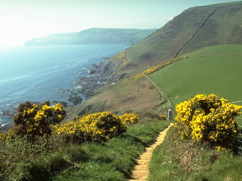
Pencarrow Head juts some 700 meters south of the general line of the coast hereabouts and thus forms a rather good viewpoint. To the west Fowey is hidden but you should see back to the Gribbin, and beyond that to Chapel Point and Dodman on the far side of St Austell bay. To the east, however, the view is daunting. Rame Head may be in view, now 27km away in a straight line, but directly ahead of you is one of the loneliest parts of the entire South Cornwall coast path. Polperro lies four and a half miles away and you can see all but the last of those four and a half miles from Pencarrow. And there's not a single feature save the dip of Lansallos Cove and the stark white pillar of the Lizzen Cliff daymark.


Down to the cove; stiles and footbridges; looking back at the way in
With the exception of the steep path down to Porthcurno from the Minack Theatre back on day one, the drop into Lansallos Cove is the steepest descent along the entire coast path. Lansallos itself is little but a green pasture, and from here a public path leads inland up West Coombe to Lansallos village inland, where there is a campsite.

It's necessary to walk to the northeastern corner of this little pasture and pass through a gate to reach the continuation of the coast path, which doglegs back to the south and ascends fairly steeply to Lansallos cliff.


The official guidebook to the coastal path hasn't much to say about the next section. "There are no route finding problems," it intones, "but there are severe gradients". This is perhaps larding it a bit - the gradients are not impossibly steep and you've already experienced the worst just behind you at Lansallos Cove. But there are a great many of them and the cumulative effect is very tiring.


The coast path winding along the scrubby slopes of Lansallos Cliff


Approaching East Coombe
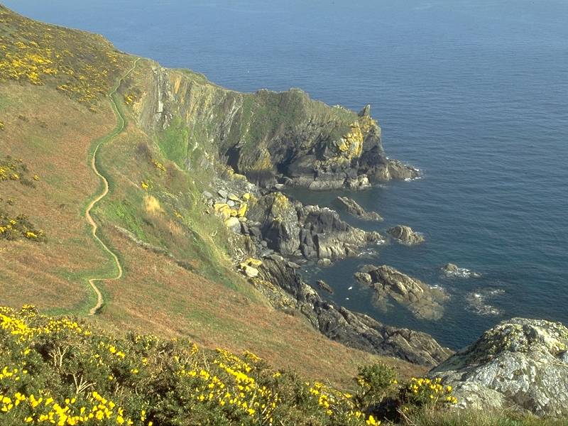
There isn't actually much of a dip at East Coombe but thereafter the path piles on the contours as Lansallos cliff gives way to Lizzen cliff. The scenery is rockier now as the scrub begins to give way to proper cliffs.


East Coombe
As the coast path draws level with the unseen locality of Great Lizzen just inland, the path dips to a little col and then climbs very steeply up a stepped path, passing the white daymark that was first glimpsed back at Pencarrow. The daymark is complemented by a bell buoy out to sea, which tolls a baleful note warning shipping of dangerous rocks just offshore.


Passing the Lizzen daymark.

Nealand Point
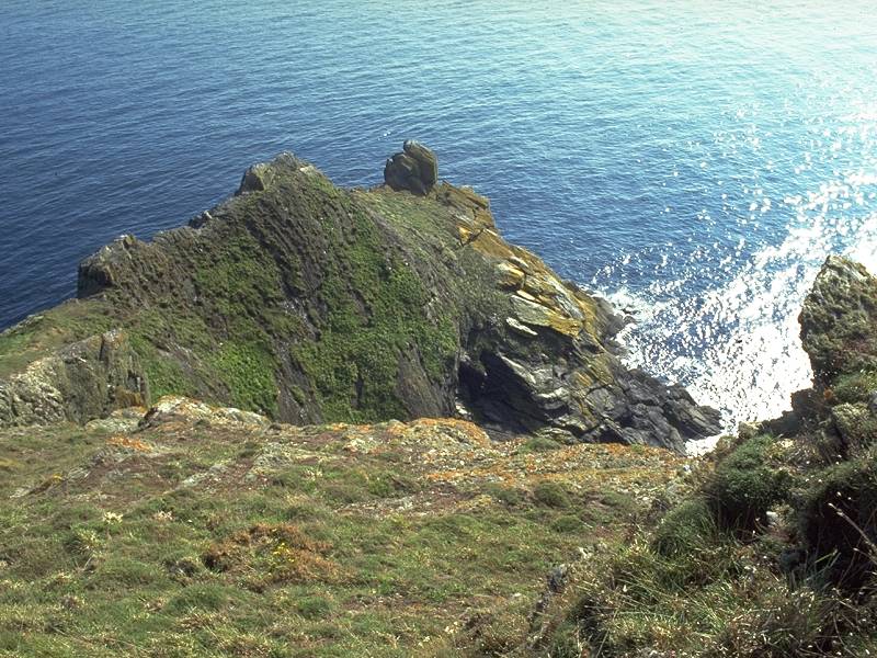
Lizzen Cliff gives way, imperceptibly, to Raphael Cliff. There's some fairly dramatic scenery hereabouts, not least the rocky baylet apparently gouged out of the coast between Blackybale Point and Nealand Point. The rises and falls of the path are at their most stamina-sapping hereabouts, bringing back memories of the stretches between Mevagissey and Porthpean.


The rollercoaster path at Raphael Cliff


Gradients, gullies, coves and rock formations at Raphael
The course of the path along here can only be described as relentless. Rise and fall, rise and fall, while to your right are rock formations, coves, inlets, headlands and gullies too numerous to deserve names on the map. There is a gradual tendency for the path to curve gradually leftwards, which unfortunately denies you any long views either forwards or back. You feel you've expended enough energy to have reached Polperro at least an hour ago, but there is no sign of any respite. It might be around that next headland. Or it might be miles away yet. Rise and fall. Rise and fall.


Yet more rocky scenery at Raphael Cliff
Somewhere around mile 122 the path bifurcates to give a choice of upper and lower routes. There really is nothing in it, as both routes plough ever onwards across the same gorse-cloaked slopes. The bifurcation is easily missed, in any case.


The view back to Raphael Cliff; still no respite; there it is at last!
Raphael Cliff becomes Chapel Cliff. At last the gradient settles down somewhat, though you may notice that there are now three alternative routes. After expending so much energy, however, there is a natural inclination to save effort by staying on the level. You may pass increasing pedestrian traffic along here; you've passed the strolling limit from Polperro even though the village remains tantalisingly out of sight almost until the last moment. Three cottages peep out a few hundred yards ahead, and then suddenly you round a bluff and see - Polperro!


Polperro from the Coast Path
Polperro gives the appearance of being packed very tightly into a sinewy, wooded ravine. This appearance is not a false one. If you think Fowey was an interesting exercise in three dimensional topology, then you ain't seen nothing yet.

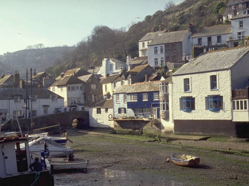
Polperro harbour
The coast path runs behind the village for a short distance then descends steeply and without dignity down rock slopes and flights of steps to disgorge you through a narrow alley just inland from the tiny stone harbour. The harbour is built pretty much in the same fashion as those at Mousehole and Porthleven, but here the houses crowd round as though they're jostling to be first to jump in.


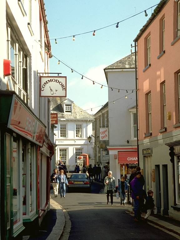
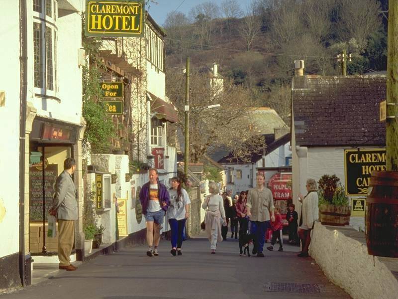
The streets of Polperro
You may like Polperro or you may loathe it, but you can't ignore it. Here is Cornish quart-into-a-pint-pot architecture at its most sublime. The streets (well lanes, really) are so narrow that motor traffic is strictly controlled; tourists must park a kilometre up from the harbour at Crumpelhorn and either walk in or take a horse-drawn taxi. In some streets in the most crowded part of the village, around the harbour, it's possible to spread your arms out and touch the buildings on both sides of the road simultaneously. One corner is so narrow that those of very large stature could actually get stuck.


The narrowest residential streets in Britain?
It's perhaps unsurprising that Polperro targets the tourist quite ruthlessly, but remember that it isn't Disneyland. It wasn't deliberately built to look quaint, it is a Cornish solution to a severe lack of space. People do live and work here (though heaven knows how they get their furniture shifted if ever they move). But the place certainly invites exploration. Visit the curiosities such as Britain's Smallest Shop, of course, but wander also through its back lanes (assuming you're slim enough!) and admire the colourwashed houses and the complex of alleys and staircases and the sheer inventiveness of those who managed to shoehorn yet another cottage into yet another tiny plot of land, at such a crazy angle, and on such a steep slope!


Polperro village

Higher Polperro


Crumpelhorn Inn and the top of the village
Polperro is at the western limit of bus services from Plymouth, and there is a regular service to that fair city via Looe. Not surprisingly, buses are not allowed into the village; walk up away from the harbour, through the wider and roomier upper village, to the road end at the Crumpelhorn Inn; the bus stop is just around the corner to the left.
![]() Service
72, Polperro - Looe - Saltash - Plymouth,
Mon
- Sat, mid-July to late Aug (summer 2002 timetable)
Service
72, Polperro - Looe - Saltash - Plymouth,
Mon
- Sat, mid-July to late Aug (summer 2002 timetable)
| Porthpean to Fowey | Back to South Cornwall Coast Path index | Polperro to Looe |
This page last updated 24th February 2008
![]()