The Walk
The crossing of Bleaklow is a relatively short walk, but it is not one
to be undertaken lightly. This is rough, tough terrain. Bleaklow is a
vast sprawl of moorland wilderness, roughly 130 square kilometres of
peat bog, heather and rough grasses. If you've already crossed Kinder
you know roughly what to expect, but there's rather more of it. The few
paths that exist in this
morass largely follow stream beds and, as such, tend to be either
stony, muddy, or both. Away from the stream beds Bleaklow is a
difficult
and endless void of peaty hummocks and dark, sinewy channels, looking
exactly the same in every direction. The ground is saturated. Progress
is slow, and navigation
can be difficult. This is not a place to be in bad weather and not a
place to come unprepared. One sentence in Wainwright's guide should be
warning enough - "lives", he says, "have been lost on Bleaklow". If the
pictures below fill you with horror and revulsion then all well and
good. I might
have saved the mountain rescue boys a needless outing.
Having said that, there are plenty who enjoy Bleaklow, and its crossing
is an excellent day out for the experienced walker. Sections of the
path have been "tamed", laid with flagstones to prevent erosion and to
give dry and safe passage. The mile south of Bleaklow Head itself
has been rerouted from the original path, nowadays following the bed of
Hern Clough rather than the exposed and relatively boggy route via Hern
Stones. Gradients on Bleaklow are gentle while the summit is relatively
firm terrain, a wide area of rock and
silt giving improved walking, and once you find the path heading off
along the developing stream of Wildboar Grain, navigation becomes
easier
(though the terrain becomes rougher and stonier). The final two miles
of the route follow a rocky path high above the deep ravine of Torside
Clough, arguably the scenic highlight of the day's walk, with views
opening up down to Longendale and Torside Reservoir. Youth hostellers
will be heading for Crowden, a couple of miles to the right on the far
bank of the reservoir, while the day trippers are faced with a three
mile walk back to Glossop or Hadfield (except on Sundays, when buses
run).
|
Walk Statistics:
|
| Length: |
5.67 miles / 9.13
km |
| Total ascent: |
545 ft / 166 m |
| Total descent: |
1514 ft / 462 m |
| Estimated time: |
2 hrs 33 mins |
Map: OS 1:25000 Outdoor Leisure 1
(Dark
Peak)
Click
on
any thumbnail image in this gallery to display the corresponding full
size
image. The images are access protected through a cgi script to prevent
hotlinking. If you encounter problems while trying to view the full
size
images, please read the access advice
page.
Snake Pass
The beginning of the Bleaklow section is the summit of the A57 Snake
Pass, the main road between Sheffield and Glossop. Bus services on this
road are skeletal, with just one bus each way on Saturday mornings and
three or four services a day on Sundays. Unless you want to tackle the
four and a half mile ascent from Glossop on foot your best bet is to
take a taxi from the rank outside Glossop station.
 First
Pennine
service 373, Manchester/Glossop to Castleton (weekends only)
First
Pennine
service 373, Manchester/Glossop to Castleton (weekends only)
Stagecoach
service 275, Sheffield to Glossop (one journey only, Saturday
morning)
Stagecoach
service 473, Glossop to Baslow (one journey only, Sunday morning)
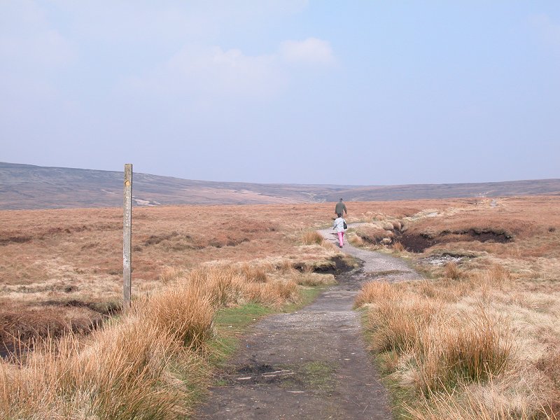
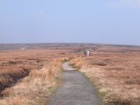
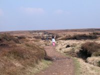
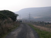
An obvious gravel path leads away from the road heading slightly east
of north, seemingly disappearing into nowhere.
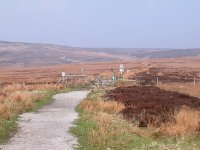

The Pennie Way leaving Snake Pass for Bleaklow
Doctors Gate
A few hundred metres after leaving Snake Pass the Way crosses the
road's
predecessor, an ancient right of way known as Doctors Gate, and
apparently based on a Roman road. It is believed to have
been named after Dr John Taylor of Glossop, who trod it regularly in
the sixteenth
century. Beyond Doctors Gate the Way continues along a pretty straight
line to approach the watercourse of Devil's Dyke.
 Doctors Gate looking west and east, and the approach to Devil's Dyke
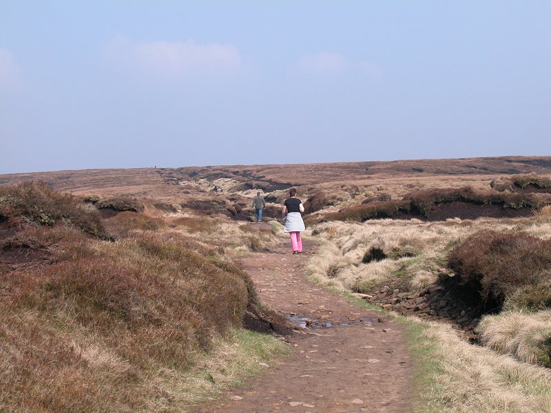
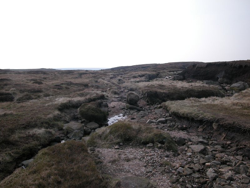
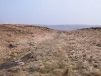
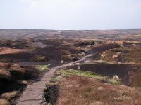
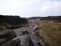
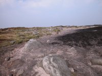
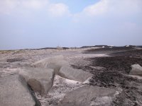
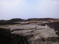
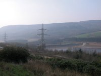
Devil's Dyke
 Typical Bleaklow scenery
Devil's Dyke is a long, straight watercourse running
roughly
northeastwards for about a kilometre. The Pennine Way runs alongside
the streambed, partly on flagstones but mostly on a more natural
surface of silt and stone.
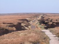
 Devil's Dyke
The name is a little fanciful. A glance at the map,
and in particular at the drainage system either side, shows that the
Dyke is artificial. A watercourse this straight, and in this position,
doesn't add up. It's pretty much following the line of the watershed
for one thing, and a glance either side shows a maze channels of
glutinous black peat, all of them tending slightly downhill away from
the dyke. None of the guidebook writers have mentioned this, let alone
followed
it up, so no clues are offered as to who constructed the dyke or why.
The Pennine Way used to follow the left bank but it seems that walkers
preferred the solid, silty bed in the same way that the river Kinder
became the preferred route on Kinder Scout. Even Devil's Dyke has been
tamed, for what you see nowadays is a new path laid along the left-hand
side of the channel, the watercouse itself having been confined to a
ditch on the right. Devil's Dyke is about six to eight feet deep on
average, which means that you don't get much of a view to either side
except at the openings of side channels. Way over to your left is
Higher Shelf Stones, a "top" of Bleaklow on the edge of the higher
level of the moor.

 The higher reaches of Devil's Dyke
The route of the Way along the Dyke gains height,
almost imperceptibly. The Dyke becomes shallower in its upper reaches
as it approaches the minor swell of Alport Low.
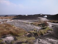
Alport Low
 Devil's Dyke petering out at Alport Low
The Dyke peters out and now you see Bleaklow in all
its glory, a wasteland of peat bog, of soil so sour and acidic that it
will support little apart from heather and the roughest of grasses.
It's too poor even to function as rough pasture and no sheep graze
here, but the one species that seems to love this terrain is grouse.
Grouse is a relative of the pheasant, a ground-nesting bird found in
temperate to cold regions of the Northern hemisphere, and in Britain
it's hunted as game. Having been deliberately maintained as a habitat
for game for sereval hundred years, these moors are now an ecological
disaster area, the soil too wet and too acidic even to grow trees any
more. You'll see this effect at its worst tomorrow on the summit of
Black
Hill, on which a large area is completely devoid of vegetation and now
exists as a desert of naked peat.


 Alport Low
The Pennine Way reaches the rise of Alport Low. The
watershed now turns northwest, and the parish boundary between Hope
Woodlands and Charlesworth follows it. The boundary used to be marked
by a line of wooden posts and early Pennine Wayfarers were known to
mistake these for route markers. However, the posts no longer seem to
be in situ, perhaps having been lifted, or more likely having rotted or
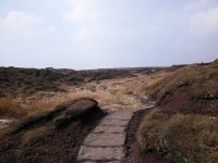
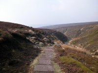
sunk. The Pennine Way wanders a little uncertainly between the peaty
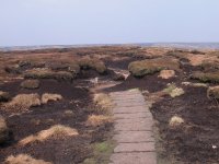
hummocks of Alport, the worst stretches having been provided with
flagstones. The terrain to either side looks positively alien and does
not invite exploration except after prolonged drought. The flagstones
detract from the true "wilderness" feeling of Bleaklow but you only
need to glance to either side to realise what it would be like up here
without them.

 Alport Low, and a flagstone path
The Pennine Way now curves gradually to the left and
begins to descend to the watercourse of Hern Clough.
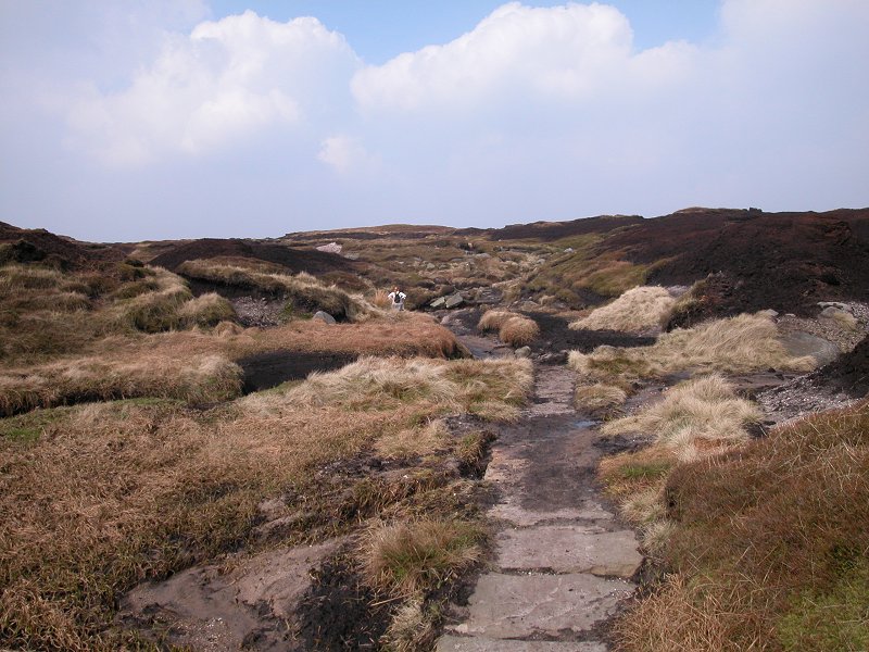
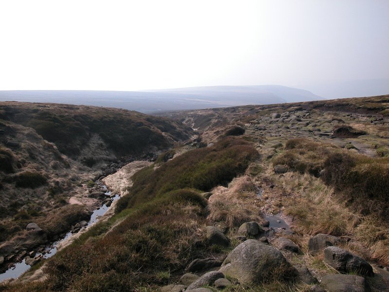
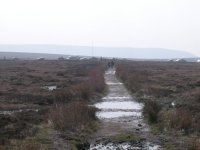
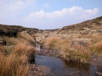
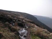
Hern Clough

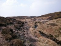
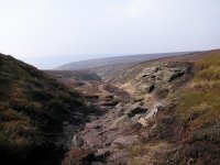
 A first view of Hern Clough, and the path descending into the
watercourse
A first view of Hern Clough, and the path descending into the
watercourse
The Pennine Way now descends slightly to approach the
watercourse of Hern Clough, one of the more substantial of the many
streams that drain Bleaklow to the southeast. You first catch sight of
it as it falls to the east, where it has carved itself a small but
impressive little ravine in the steepest part of the slope (first
picture above). The path curves to the left and approaches the
streambed on the diagonal as it descends from Alport Low. After a very
short distance the path reaches the streambed, more or less at a
significant bend at which the water channel turns more to the north.
Depending on the recent weather conditions this can be a most agreeable
spot, and I remember halting here for my morning refreshment break when
I first walked over Bleaklow in 1989.
Hern Clough runs out to the east and south, eventually finding its way
into the river Ashop somewhere near Hope Woodlands, bound eventually
for the North Sea. Just a hundred metres to the west, however, the
similar declivity of Crooked Clough turns southwest to run alongside
Doctors Gate, eventually finding its way into the suburbs of Glossop
and heading ultimately for the west coast.

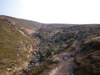
 The upper reaches of Hern Clough
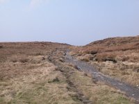
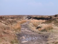
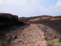
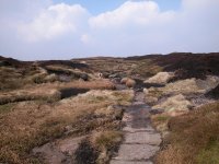
Our route now follows the course of the stream
uphill. The path is patchy and rough, switching from side to side
according to where hikers can find the best walking surface. More often
than not the bed of the stream itself provides the best going, though
parts of it are unpleasantly rough. A glance at Wainwright's guidebook
tells you that the original course of the Way crossed Hern Clough at
the bend to track over the moor a hundred metres or so to the west,
more or less on the watershed. That particular route option had already
fallen into disuse when I first came here in '89, walkers obviously
preferring to stick to the course of the stream.

 The Pennine Way following the route of Hern Clough
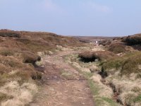
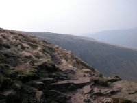
Continue to make your way along the course of Hern
Clough. Its course is never in doubt and in one or two places it gets a
bit steeper, but the going is rough and just about every footstep
requires care. As you progress further upstream more stretches of
flagstones appear.
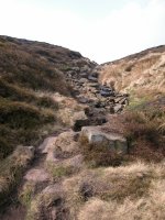
 Hern Clough
About six hundred metres along the course of the
stream, at grid reference 094952, you reach the point at which the
original route of the PW has been abandoned in favour of a new course,
sticking to the streambed right up to its source. The occasional stone
pillar marked with an arrow and the acorn symbol of the PW keeps you
going in the right direction, as Hern Clough is now tending to break up
into tributaries. The original path may still be followed in dry
weather - it runs via two natural rock sculptures, Hern Stones (two
boulders apparently shaped into a pair of heads kissing each other) and
Wain Stones, which could almost be a partially collapsed stone circle.
If you stick to the new route via the stream bed then Wain Stones is
still visible from the path, only a couple of hundred metres up to the
left.

The top of Hern Clough on the approach to
Bleaklow Head
Dowstone Clough
The gradient eases now as you approach the broad top of Bleaklow. The
terrain becomes firmer too, and if you wish you can explore a little
without fear of mishap. On my recent walk in April 2005 I chose to walk
a hundred metres to the west to find Dowstone Clough, the original
route of the Pennine Way beyond Wain Stones. I halted for lunch here,
in reasonably agreeable scenery and in complete privacy, even though
the voices of many walkers could be heard as they passed by not far to
my right.
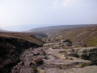
Bleaklow Head
 Bleaklow Head
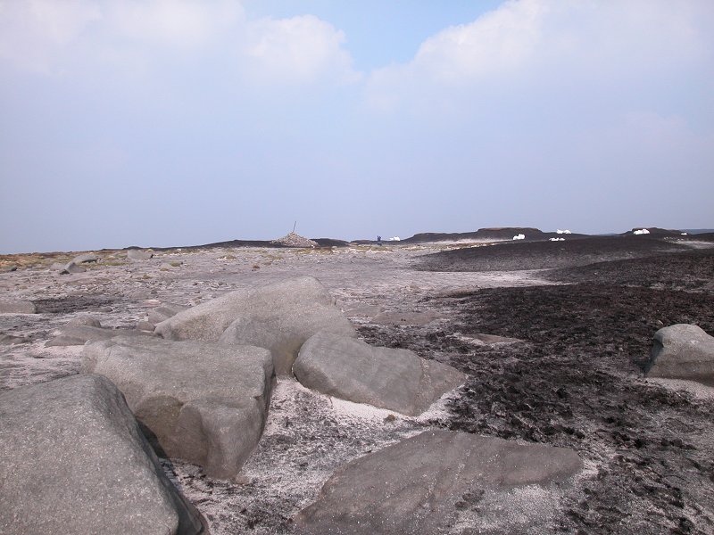
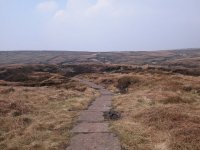
And so you come to Bleaklow Head. The terrain is
mixed here at the summit, the peaty hummocks and channels interspersed
with quite large areas of rock, gravel and silt. Walking is easy here.
The nominal summit of Bleaklow is marked by a tall stake around which a
large cairn has been built, though curiously it's not actually at the
highest point, a peaty hummock some ten feet higher about fifty metres
to the east. Bleaklow's top is broad and largely flat and there is no
view to speak of, just the far off lines of similar moorland heights to
the north and south. Behind you is the vast sprawl of Kinder, seen for
the last time, and ahead of you to the north is the equally featureless
skyline of Black Hill. On clear days you may catch a glimpse of the
Holme Moss radio mast to the northeast. In the days of 405-line
television this same mast broadcast BBC TV to the whole of the north of
England, serving roughly half of Britain's population.
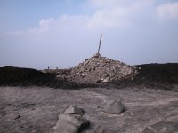

 Bleaklow's summit
The trick now is to find your way off. When I first
came here in 1989 the path was obvious, but conditions change and now
you have to hunt a little. If the day is cloudy you might well want to
dig out your compass for a bearing, for the top of Bleaklow looks
pretty much the same in every direction. You need to head north (or
very slightly west of north) off the summit, choosing whichever
depression among the peaty hummocks most takes your fancy. You can't
really go wrong as just about all these channels find their way into
the developing runnell of Wildboar Grain, and this watercourse makes a
wide loop around the north of the summit area to head off eventually to
the northwest. It will look pretty nondescript and tentative as a path
at first but it soon becomes obvious, and it will begin to curve around
to the left. You're on your way down to Longendale.

Leaving the summit area for the source of
Wildboar Grain
Wildboar Grain
It's a while before Wildboar Grain gets it act together and begins to
look like it knows where it's going, but eventually it settles down and
becomes a significant watercourse. The long, gradual curve runs out and
you find yourself heading pretty much due west. The old path used to
run along the south side of the stream but a more prominent, and rather
easier, route has come into being on the north bank (or the right hand
side as you progress). You can still see traces of the old route on the
other side of the stream.
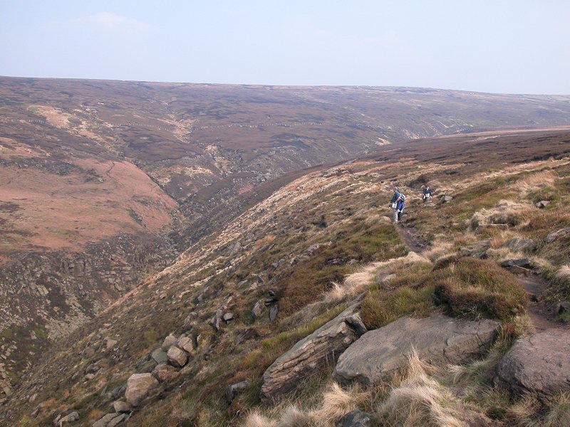
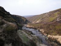
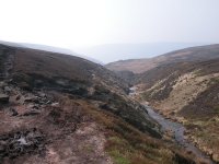
Torside Clough
Cross to the opposite (southwest) corner of the confluence and take the
steep path up the south bank of Torside Clough. Within a very short
distance Torside Clough develops into an impressive ravine, both deep
and steep sided. The route of the Pennine Way chooses to keep high
above the ravine to the south, and the scenery improves dramatically.
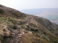
 The path climbing above Torside Clough
You need fewer directions and less narrative now, for
the route is straightforward from here on and the scenery speaks for
itself. The ravine first heads northwest but, like Wildboar Grain
before it, it also curves gradually around to the left and ultimately
heads due west. As the ravine deepens the edge of the clough actually
begins to rise and the path runs gently uphill once more.
 The Pennine Way, Torside Clough
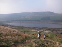
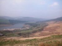
Some pretty impressive rock scenery begins to appear,
and one kilometre out from the watersmeet you get your first view of
Torside Reservoir down in Longendale. Don't forget to stoip every now
and then to cast a glance behind you, for the views into the upper
reaches of the Clough are rather good. Ahead of you the ravine curves
gracefully to the right to open out into Longendale, while Torside Edge
rises substantially above it. That's out route, and it looks like quite
a climb from here.
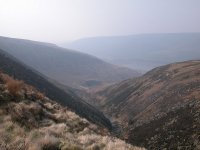

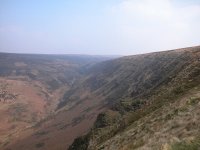
 Torside Clough
Your gaze will naturally be attracted towards the
continually unfolding view of Torside Reservoir, but take care and
watch where you're putting your feet. This is rough terrain and Torside
Clough is not a place to sprain an ankle.


Expanding views of Longendale
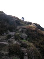
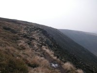
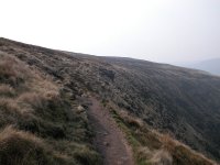
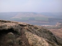
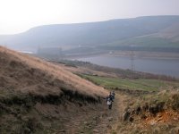
Torside Edge
 Torside Edge, looking forwards and back
The walk is perfectly straightforward from here on
but this is arguably the day's hight point. As Torside Clough itself
carves an ever deeper channel through the edge of the moor, the edge of
the ravine actually gains height, reaching its greatest elevation
immediately before the clough curves around to the north to enter
Longendale itself. From the crest, then, one gets a glorious view down
into the lower reaches of the ravine, of Torside Reservoir in
Longendale, and of the rising swell of Black Hill beyond.

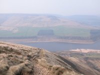
 Torside Edge
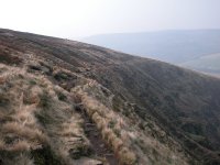
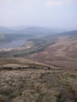
 Views of, and from, Torside Edge
The terrain is a good deal firmer and dryer than most
of the Bleaklow massif, but it's still rough and stony and requires
care. Apart from the views into Longendale there's a fair number rock
formations along the edge to provide visual interest. Immediately after
the crest the path starts to curve around to the right, or north, as it
follows the ravine edge. The views back along Tordide Clough from
here are beautiful.
 The curve, and the view back along the clough
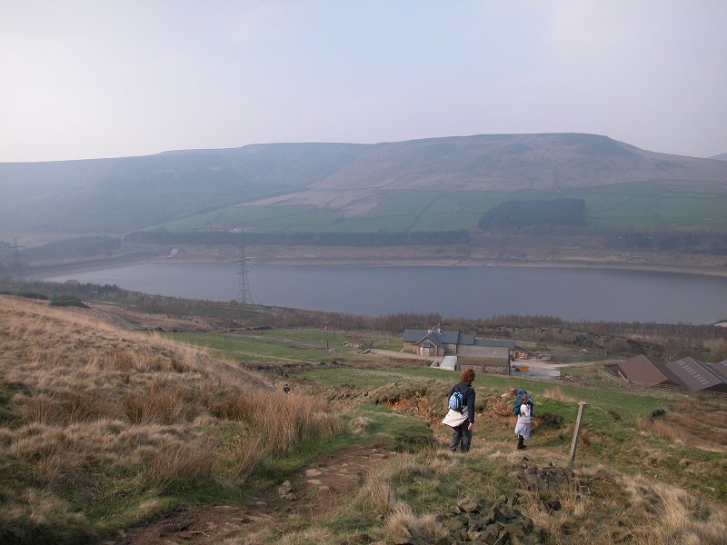
The path starts to drop now, quite steeply, towards
Reaps Farm and Torside Reservoir. As you descend the views of
Longendale expand rapidly, and the extent of Black Hill beyond starts
to reveal itself. That's for tomorrow.
 The descent to Reaps Farm
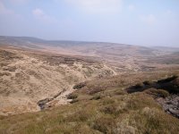
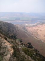
Longendale
 A view of Longendale to the east
And so the path comes down into Longendale. This is
the Pennine Way's first major descent and it's where a good many
inexperienced walkers discover an unpleasant truth - that going
downhill can be just as much an effort as going up. Muscles and tendons
not normally expected to carry loads are suddenly called upon to put in
a lot of effort, and they complain. The ankles and the backs of the
knees are normally the worst hit, and the root cause is that, as you
descend, your feet invariably have to point forwards and down. This is
where blisters start to make themselves felt, this is where you really
discover if your boots fit properly (continual jarring of your toenails
against the internal surfaces of your boots are a bad sign), and this
is where the majority of falls and slips occur. Take your time. If you
really stiffen up badly, try the trick of turning around and descending
backwards. It might look silly but it works, as it transfers the load
back again to the muscles and tendons that are used to it.
 Approaching Longendale
The terrain changes a couple of times as you descend
towards Reaps farm. The natural surface of rock and compacted soil is
succeeded, about a third of the way down, by cobbles. These have been
laid in order to prevent erosion but they are particularly hard on the
knees and will jar alarmingly. Wherever possible try to place your feet
heel downmost as you descend. And do keep watching where you tread, at
all times. If you want to look at the scenery, stop.

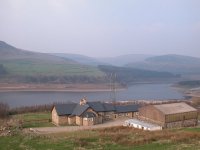 Arrival at Reaps farm
Below the cobbles the steepest section of the descent
is mitigated by a wide zigzag across the grass, at the apex of which a
stile has to be crossed. Below this you're on grass for a bit, until
you reach the environs of Reaps Farm. The farm would appear to have
been spruced up, or even rebuilt, as it looks a good deal more handsome
than I remember from my earlier journeys here a few years back. The
path now enters a sizeable little gully with a firm stony bed, though
doubtless it also doubles as a watercourse during and after rain. The
gully converges with the driveway of Reaps Farm, from where it's a
simple downhill walk over gravel to the gate and the road.

 Longendale, and Torside Dam
Wainwright is pretty scathing about Longendale. Here,
he says, are the first trappings of civilisation since leaving Edale,
and he reckons that they are not a pretty sight - roads, railway,
reservoirs and power lines all crowded into one narrow ribbon of hectic
activity. Heretical as it may seem, I largely disagree with him. Times
have changed, of course. The railway has gone - it closed in 1980, the
only electrified line in the UK ever to be abandoned, and the old
trackbed is now a path and cycleway that provides a convenient and
level route into Hadfield two and a half miles to the west. The road on
the south side of Longendale is the quieter of the two, the vast bulk
of the traffic confined to the main road on the north side. But for the
power lines, which are admittedly a visual intrusion, Longendale is
actually quite charming and the string of reservoirs that occupy it are
probably its best visual feature.
Day trippers will be bound for Hadfield along the old railway track,
which is preferable to the direct road walk into Glossop - not only
will the traffic be unpleasant but the road also climbs a fair bit.
Hostellers bound for Crowden still have a bitl to do. Walk along the
road to the right (east ) for a hundred yards or so then cross it, and
cross the old railway track in turn, to gain the side road going down
to the dam across Torside reservoir. Cross the dam to gain the main
road. Crowden Youth Hostel is not quite two miles to the east, and the
main road can be avoided by a path a little way down the bank and along
the shore. The official route of the Pennine Way follows this for about
six hundred meters then crosses the main road to take a track a little
way up the hill and behind a wood. It's up to you which option you take.
 Crowden
Youth Hostel
Crowden
Youth Hostel
 Derbyshire County
Council's Peak
District
website
Derbyshire County
Council's Peak
District
website
Now
available on
CD - the high resolution (2560 x 1920 pixel) originals of the images
on this gallery. 111 images, 153MB of data.
(includes some images not
selected
for the website).
£5.00
inclusive
of postage / packing.
Note:
Payment
by credit card is handled by Pay Pal. If you are not already a member,
their validation of your account can take up to 4 weeks.
|
This page last updated 9th April 2005