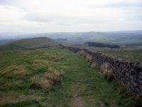
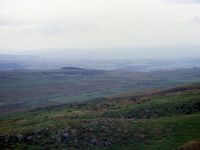
Walltown
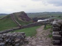
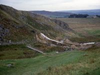
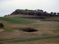 Walltown quarry and crags
After roughy half a mile of
walking alongside the north side of the wall you come out onto a road,
and opposite is the former Walltown quarry. When I came this way in
1989 the quarry was in the process of being landscaped by the national
park authority and a tree planting scheme had begun. The place probably
looks quite handsome by now. The official route of the Pennine Way
skirts the quarry ground to the south but an alternative route through
the grounds of the quarry should be possible.
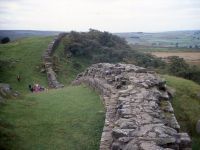
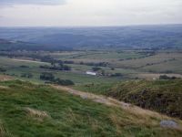
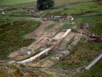
 The Wall met for the first time; the east quarry and Walltown Crags; scene at Alloe Lea
Beyond Walltown Quarry the
first section of genuie Hadrian's Wall is met. "This," says Wainwright,
"is EXCITING!". Getting to it might prove a little frustrating; the
route around the south side of the quarry runs along a minor road for
about 400 meters before doglegging hard left to climb back through the
adjacent pasture. A fresh visit will be necessary to determine whether
there's a practical alternative; but for now just follow the crowds or
the waymarks. The wall, when you first meet it, looks nothing out of
the ordinary apart from its width. Then, of course, you realise that
you're standing beside the remnant of a huge civil engineering project,
conceived and built almost two thousand years ago. The sheer audacity
of such a plan would raise eyebrows if it was mooted even today, so one
can scarcely imagine what a leap of imagination it must have been back
then, fifteen hundred years before the age of industry and
mechanisation.
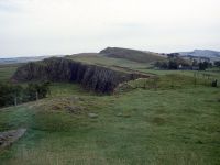
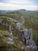
Walk along the southern side of the wall. It drops down into a dip. A
second, smaller, quarry lays north of the wall. Beyond here you climb
to Walltown Crags, where the wall's advantage as a viewpoint across the
empty country to the north becomes obvious. The Wall has largely
diappeared just here and you have some three miles to walk before you
reach the next well-preserved section at Cawfield Crags. Beyond
Walltown Crags is a dip and the tiny locality of Walltown lays to your
right. It's barely big enough to be a hamlet and the "town" suffix does
seem a little fanciful. Perhaps it had some historical importance. The
map notes the antiquity of King Arthur's Well just here but it seems
unregarded and forgotten - all Wainwright says is that the well is
unromantically fenced off and covered over. Head ever eatwards, across
undulating pastures with the lonely farm of Alloa Lea to the right.
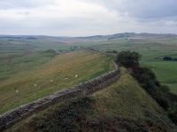
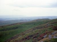
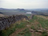
Cockmount Hill
Cawfield Crags
There's another
disused quarry here at hole gap, apparently nameless, but another that
has been reclaimed and landscaped. It features a sizeable area of
water, plus a picnic area. It makes a pretty good lunch stop in fact.
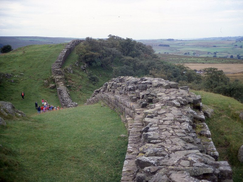
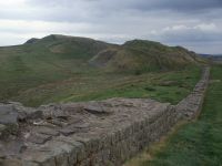
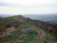
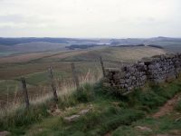
 Milecastle 42 and Cawfield Crags
Beyond the quarry a short
and steep ascent takes you up to the lip of Cawfield Crags, and here
you find your second section of proper Roman wall. It seems that this
section might have been rebuilt for, unlike the first back at Walltown,
it gives the impression of havong been laid dry. As you progress along
the line of Cawfield Crags the style of wall building chops and
changes; it reverts to English drystone, then becomes a standard
drystone wall laid on top of three courses of Roman foundation (obvious
because of its greater width). There has been some significant
restoration work around here within the last 50 years or so.
The Wall and Way now descend
together to Caw Gap, which is crossed by a motor road
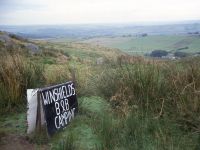
Winshields
 Winshields Crag from Turret 40B; view NW from the same point; looking back to the west
Beyond Caw gap the wall
reverts to common drystone
again. The land rises in the first of three waves as it approaches the
highest altitude of the day's hike, the 1230 ft summit of Winshields
Crag. This
three-pitch ascent is gradual, spread out along a further mile, during
which
the wall changes nature several times between English drystone,
drystone using
Roman masonry, Roman wall rebuilt dry, and Roman wall built (or
rebuilt) with
mortar. Towards the top, at a little col a side path goes off to
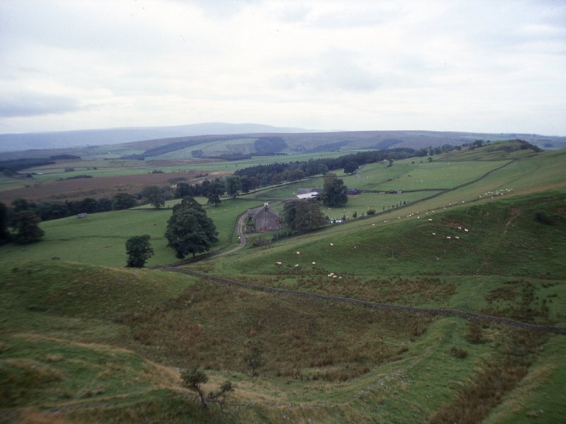
Winshields Farm about half a mile to the southeast, The summit, when
you eventually reach it, proves
to be a superb viewpoint.
 Footpath to Winshields Farm; the crest of Winshields Crag; loking back to Wain Rigg
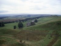
Looking back to the west you can see all of the day's hike so far, and much of yesterday's walk in
addition. The profile of Wain Rigg is prominent,with
the obvious pimple of Highside standing out on the skyline. It's still just possible to make
out the trig pillar on its summit, and this is at a distance of nine
miles. Behind the Rigg and slightly to the left is the
vaster and higher sprawl of Cold Fell, and the line of the high
Pennines can be clearly seen stretching away southwards. Cross Fell itself is
vaguely visible in a dip in the skyline slightly west of south.
To the east you can see the
remainder of the day's
walk, notably the rippled profiles of Peel Crag and Housteads Crag, and
three bodies of water (Crag Lough, Broomlee Lough and Greenlee Lough.
To the southeast, about a mile off, is the lone building of Once Brewed
youth hostel, standing by a crossroads.
 The Tyne valley fron Winshields Crag; Once Brewed youth hostel; Crag Lough in the distance
Beyond the top of
Winshields Crag there's a descent of about half a mile until you reach
the road at Peel Gap The youth hostel is not far down the road to the
right, but the chances are that you will get here too early; normal
practice for hostellers, it seems, is to press on to Housteads and then
come back later.
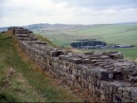
Peel Crags
 Peel Crags and restoration works at Milecastle 39
A swift rise and fall after
Peel Gap gets you to the site of what is apparently an extra turret
between 39B and 39A, laying in a dip adjacent to Peel farm. A steep
rise immediately afterwards gets you to Peel Crags, where another
section of Roman wall is encountered. Some five hundred metres further
on another sharp dip brings you to the site of Milecastle 39, and a
jarringly steep ascent proves to be the first of three craggy outcrops
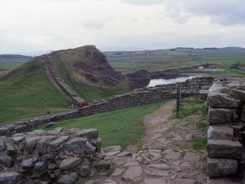
known as Castle Nick. This section can be rather tiring. Castle Nick is
succeeded by Highshield Crag, where remarkably precipitous cliffs to
your left drop sheer into Crag Lough. It's a dramatic place. It's also
a mite dangerous so don't let children muck about and keep your dog on
a lead.
 Highshield Crag
The path down from
Highshields Crag descends through a wood to reach Hotbank farm and the
site of Milecastle 38. There are just two ascents left now until you
reach Housteads, one to reach Hotbank Crags and then the final rise to
Housteads Crag. The ascent to Hotbank Crafg is relatively gentle and is
accompanied by patches of woodland on both flanks. The view from
Hotbank Crag is a fine one, with Wain Rigg still visible eleven miles
to the west and Housteads Crag immediately ahead. Greenlee Lough lays a
mile to your left with the neighbouring Broomlee Lough a mile to the
east. A minimal descent beyond Hotbank Crags gets you to the shallow
col of Rapishaw Gap, and it's here that tomorrow's route strikes off to
the north east, the PW heading resoluteky for the gap between the two
lakes to the north. The walk out to Housteads and back from this point
is a spur and could be missed out, but few Pennine Wayfareres do
so. Come on, it's only another mile.
Housteads
 Housteads Roman fort
The ascent on the far side
of Rapishaw Gap is a gentle one. Cuddy's Crag is encountered first,
where you walk beside one of the better preserved sections of Hadrian's
Wall. There's a small dip, the site of Milecastle 37, and then the
final rise to Housteads Crag. Here the Wall is hemmed in by trees on
both sides and, uniquely, the Pennine Way follows the top of Hadrian's
Wall itself. It's a fascinating experience at first, but then it dawns
on you that the one place from which you can't admire the Wall is the
top of the Wall itself. The walk along Housteads Crag is a short one,
roughly 400 metres in length, after which you descend to Housteads Fort
itself.
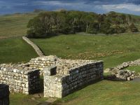
Housteads, or Vercovicum (its proper Latin name) is by far the best
preserved of all the forts along the Wall. It is administered by the
National Trust, who charge a small entry fee. Housteads is extensive
and fascinating. The layout and foundations of all the buildings are
still intact, as are pretty much all the walls up to a height of
between two and four feet. The buildings are identified; most were
barrack blocks of course but you will also find structures such as the
granary and the hospital, and the intricate drainage and underfloor
heating arrangements are beautifully preserved.
The fort has a small National Trust shop and a refreshment room.
There's apparently a Hadrian's Wall bus that runs during the summer
months; otherwise you have a walk of some two and a half miles to get
to Once Brewed youth hostel or three and a half miles to Bardon Mill
for the train or regular bus service between Carlisle and Hexham.
Links
 Once Brewed Youth Hostel
Hadrian's Wall Country
National Trust - Housteads Fort
Once Brewed Youth Hostel
Hadrian's Wall Country
National Trust - Housteads Fort