| Winchcombe to Broadway | Back to Cotswold Way index | Chipping Campden to Bidford on Avon |
| Winchcombe to Broadway | Back to Cotswold Way index | Chipping Campden to Bidford on Avon |
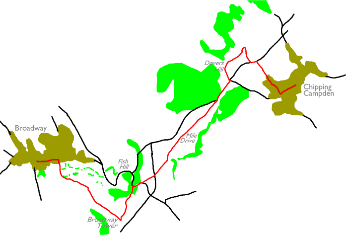
Broadway Tower is also on the route, and also repays a visit. This classic folly, which has seen a variety of occupiers and uses, is now the centre of a country park and is essentially a museum / exhibition venue in the hands of a private trust. Much of the walk itself lays along the top of the Cotswold scarp straddling the Worcestershire / Gloucestershire boundary, and is partially wooded. A final viewpoint is provided at Dovers Hill, just short of Chipping Campden itself.
|
|
|
| Length: | 5.68 miles / 9.15 km |
| Total ascent: | 860 ft / 262 m |
| Total descent: | 689 ft / 210 m |
| Estimated time: | 2 hrs 5 mins |
Click
on
any thumbnail image in this gallery to display the corresponding full
size
image. The images are access protected through a cgi script to prevent
hotlinking. If you encounter problems while trying to view the full
size
images, please read the access advice
page.

Pastures south of Broadway
![]() First
Midland Red service 21/22, Moreton-in-Marsh
- Broadway - Chipping Campden - Stratford-on-Avon
First
Midland Red service 21/22, Moreton-in-Marsh
- Broadway - Chipping Campden - Stratford-on-Avon
(.pdf document)
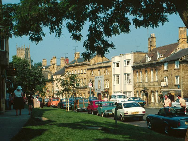
Broadway is a show village, a beautiful place of Cotswold stone cottages, shops and inns of superb character. Its wide, handsome high street is lined with trees and is dominated by the Lygon Arms, one of England's most famous coaching inns and nowadays an ultra-exclusive five-star hotel. It's a massive, rambling structure, parts of which date from the fourteenth century, and has several major historical associations. Broadway has traditionally attracted writers, artists and craftsmen and it tends to attract the discerning visitor - it has to, really, for a substantial majority of the village's businesses are art galleries, craft shops and estate agencies. If you're looking for a pint of milk or a newspaper you're in for a fairly hard search.
![]() Cotswold Marketing's Broadway
page
Cotswold Marketing's Broadway
page
![]() This is the Cotswolds - Broadway
This is the Cotswolds - Broadway
![]() The
Broadway Directory
The
Broadway Directory
The Cotswold Way leaves the town by a footpath turning right off the Stow road about 200m east of the road junction in the middle of the village, though a quick study of the map will reveal two other local footpaths turning off into the pastures to the south of the high street. It matters little which one you choose, and I plumped for the one leading past the sports ground. All three variations turn left after about 400m to join a path that heads initially east, but then curves to the southeast and heads steeply and directly up the Cotswold scarp towards Broadway Tower, about a mile southeast of the village.


Looking back at Broadway; climbing the scarp


Approaching Broadway tower
Broadway Tower is a classic folly, the sort of structure that used to be erected by aristocrats and rich landowners a couple of centuries back simply because it pleased them to do so. The tower was built in 1707 by the then Earl of Coventry for his wife and was designed James Wyatt, a prominent architect of the age. Strangely, none of the information available on the tower gives its height, which must be around 60ft, but what's not in doubt is the elevation of its site - Broadway Hill, at 1024ft, is one of the highest points of the Cotswolds. It's said that fourteen counties are visible from the top. The tower has had a variety of occupants, including the nineteenth century artist William Morris. Nowadays it's in the hands of a private trust, is open to the public as a museum, and is the centrepiece of Broadway Country Park - an area of family attractions that include animal enclosures, play areas and short nature rambles.
![]() Broadway
Tower and Country Park
Broadway
Tower and Country Park
![]() Follies
- Broadway Tower
Follies
- Broadway Tower
![]() Cotswolds
Calling - Broadway Tower
Cotswolds
Calling - Broadway Tower
![]() This
is the Cotswolds - Broadway
Tower
This
is the Cotswolds - Broadway
Tower
From Broadway Tower turn left, to take the path along the edge of the scarp northeastwards as far as the road at Fish Hill.

A look back at the tower
The Way follows the horrendously busy A44 Evesham - Chipping Norton road eastwards around a bend and then strikes off northeastwards across a virtually flat tableland. As you leave the road at the top of Fish Hill the Cotswold Way's short excursion through Worcestershire is over, and the remainder of the Way is back in Gloucestershire again. Fifty yards away from the road a copse of trees almost hides a topograph. This instrument doesn't really help much; it's too far from the top of the scarp to afford a decent view and functions more as a You Are Here map than anything else. Around its circumference are plotted the directions and distances to various prominent towns; Cheltenham, Stratford, Tewkesbury, Cirencester, Stowe. It then gets silly and includes Bath, Cardiff and Birmingham; from the sublime to the ridiculous it then goes on to give the distances to London, Edinburgh, Paris, Rome, Sydney and New York.


The Cotswold Way, Long Hill
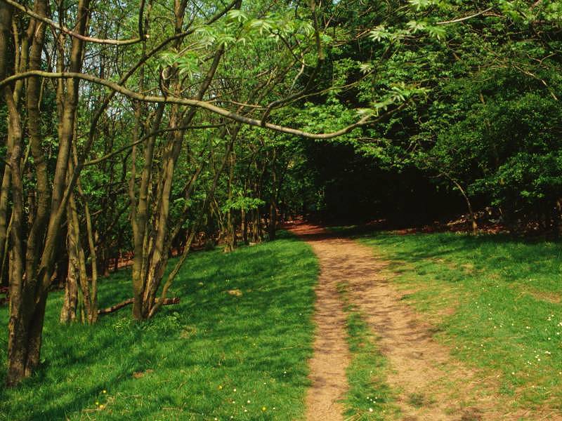
Now that we're back in Gloucestershire the Cotswold Way gives the walker a taste of the Midlands by charging straight across a field of growing corn. The path crosses a minor road and continues across a second field, and then a third. At the subsequent field boundary the path passes through a small copse of trees and merges with a farm track called the Mile Drive.

The Mile Drive
The Mile Drive runs, oddly enough, for about a mile. The surrounding scene is one of mixed farmland and woodland. The drive merges at its northeastern end with a minor road, that from Chipping Campden to Fish Hill. On the left side of the road is the extensive wood of Weston Park, while the valley of the Cam is beginning to open out to the right. After some 400 metres you come to a lonely crossroads at which the Cotswold Way turns left for the viewpoint of Dover Hill.
At the far side of the extensive hilltop pasture a stile gives access to a little track heading sharp right back down to the road. Go left along the road for 100m and then turn right and continue along another track, which begins to head downhill. In about 400m the track passes a farm building and then comes to the first houses in Chipping Campden.


A Chipping Campden portfolio
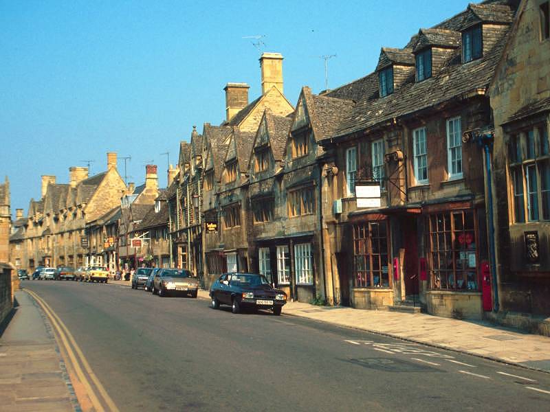
Chipping Campden is beautiful. An old wool town, its curved high street is lined with buildings of great character, just about all of them in Cotswold stone and many dating from the seventeenth century or even earlier. The Woolstaplers Hall dates from the fourteenth century. The town's side streets and residential roads, too, are invariably of charming Cotswold Stone cottages, some thatched, and invariably featuring lovingly tended gardens. In pride of place in the market square at the centre of town is the Market Hall, a structure consisting of arched walls and a roof that would originally have provided shelter for market stalls selling perishables. A discrete sign beside the market hall marks the end of the Cotswold Way. At the same point, the Heart of England Way begins its 85-mile journey around the eastern edge of the Birmingham conurbation.
![]() Chipping Campden's website
Chipping Campden's website
![]() First
Midland Red service 21/22, Moreton-in-Marsh
- Broadway - Chipping Campden - Stratford-on-Avon
First
Midland Red service 21/22, Moreton-in-Marsh
- Broadway - Chipping Campden - Stratford-on-Avon
(.pdf document)
| Winchcombe to Broadway | Back to Cotswold Way index | Chipping Campden to Bidford on Avon |
This page last updated 15th February 2004
![]()